Bullitt County is a county located in the north central portion of the U.S. state of Kentucky. As of the 2020 census, the population was 82,217. Its county seat is Shepherdsville. The county was founded in 1796. Located just south of the city of Louisville, Bullitt County is included in the Louisville/Jefferson County, KY-IN Metropolitan Statistical Area, commonly known as Kentuckiana. The western fifth of the county is part of the United States Army post of Fort Knox and is reserved for military training.
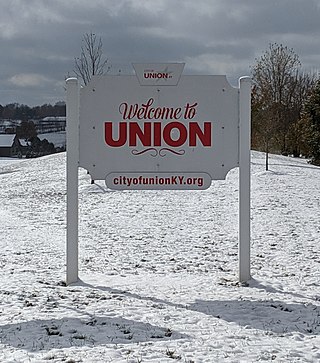
Union is a home rule-class city in Boone County, Kentucky, United States. The population was 7,416 as of the 2020 United States Census. The area was rural until residential growth in the 1990s and 2000s. Union is located 17 miles (27 km) southwest of Cincinnati, Ohio.
Annville is an unincorporated community, a census-designated place (CDP), and the largest community in Jackson County, KY. As of the 2020 census, the population was 1,102. The community was established in 1878 and named for local resident Nancy Ann Johnson. The community offers a few services such as a post office, grocery store, gas station, medical clinic, nursing home, restaurants, and other locally owned businesses.

Kentucky Route 80 (KY 80) is a 483.55-mile-long (778.20 km) state highway in the southern part of the U.S. state of Kentucky. The route originates on the state's western border at Columbus in Hickman County and stretches across the southern portion of the state, terminating southeast of Elkhorn City on the Virginia state line. It is the longest Kentucky State Highway, though the official distance as listed in route logs is much less due to multiple concurrencies with U.S. Route 68 (US 68) and US 23.

Kentucky Route 100 is a state highway in south-central Kentucky. It originates at a junction with U.S. Highway 79 in Russellville in Logan County. The route continues through Simpson, Allen and Monroe Counties to terminate at a junction with KY 90 near Waterview in Cumberland County.

Tyner is a small, unincorporated community in southeastern Jackson County, KY. The town is located at the junction of U.S. Route 421, KY Route 30 and KY Route 3630. Tyner Elementary School (K-5) is located in the community and is operated by the Jackson County Public School system. The community offers a few services such as a post office, grocery store, and gas station.
Parksville is a small unincorporated community on the Chaplin River in south central Boyle County, Kentucky, United States. It is located at the eastern end of Ky Route 300, where it intersects with Ky Route 34, near the US Post Office. The global position of Parksville is 37.597N latitude and -84.891W longitude. Elevation is 1,083 feet (330 m) above sea level. Current population is approximately 900 people. The ZIP Code for Parksville is 40464.

Kentucky Route 70 (KY 70) is a long east-east state highway that originates at a junction with U.S. Route 60 (US 60) in Smithland in Livingston County, just east of the Ohio River. The route continues through the counties of Crittenden, Caldwell, Hopkins, Muhlenberg, Butler, Edmonson, Barren, Barren, Metcalfe, Green, Taylor, Casey, Pulaski, Lincoln and back into Pulaski again to terminate at a junction with US 150 near Maretburg in Rockcastle.
Kentucky Correctional Institution for Women (KCIW) is a prison located in unincorporated Shelby County, Kentucky, near Pewee Valley, Kentucky, operated by the Kentucky Department of Corrections. Male and female inmates prior to 1937 had been housed at the Kentucky State Penitentiary in Frankfort
The Elizabethtown–Fort Knox Metropolitan Statistical Area, as defined by the United States Census Bureau, is an area consisting of two counties in Kentucky, anchored by the city of Elizabethtown and the nearby Fort Knox Army post. As of the 2020 census, the MSA had a population of 155,572.

This is a list of the National Register of Historic Places listings in Clark County, Indiana.
Centerfield is an unincorporated community in Oldham County, Kentucky, United States. It is a small suburban community that lies approximately 4 miles northeast of Crestwood on KY Highway 22 and approximately 6.5 miles southwest of La Grange.

Flaherty, an unincorporated community in Meade County, Kentucky, United States, is located 13 miles/21 km south of Brandenburg on KY 144, at its intersection with KY 1600 and KY 1816. While predominantly a rural agricultural community; Flaherty has a modest business district consisting of a Dollar General store, car wash, banks, and a gas station. Notable locations also include: Flaherty Elementary & Primary School, Saint Martin of Tours Catholic Church, Flaherty Ball Park, and Flaherty Fire Department. Clarkson House is also in Flaherty.
West Paducah is an unincorporated community in McCracken County, Kentucky, United States. Its elevation is 361 feet.
Windyville is an unincorporated community located in Edmonson County, Kentucky, United States.

Kentucky Route 14 is a 17.209-mile-long (27.695 km) state highway in Kentucky that runs from U.S. Route 42 and US 127 in rural Boone County to KY 177 in the unincorporated community of Morning View.

Kentucky Route 1508 is a state highway located in northwestern Kentucky. The route starts at KY 109, west of Sturgis. It travels westward to unincorporated area of Caseyville, and turns north near the Ohio River. KY 1508 then travels through the community of Dekoven, before ending at KY 109, northwest of its southern terminus. The route was designated around 1967, after the KY 130 designation was removed from the section in Caseyville, which was connected to the community since 1939.

Kentucky Route 105 (KY 105) is an 18.345-mile-long (29.523 km) state highway in Breckinridge County, Kentucky.