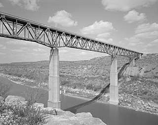
Presidio County is a county located in the U.S. state of Texas. As of the 2020 census, its population was 6,131. Its county seat is Marfa. The county was created in 1850 and later organized in 1875. Presidio County is in the Trans-Pecos region of West Texas and is named for the border settlement of Presidio del Norte. It is on the Rio Grande, which forms the Mexican border.

Kinney County is a county located in the U.S. state of Texas. As of the 2020 census, its population was 3,129. Its county seat is Brackettville. The county was created in 1850 and later organized in 1874. It is named for Henry Lawrence Kinney, an early settler.

Hudspeth County is a county located in the U.S. state of Texas. As of the 2020 census, the population was 3,202. Its county seat is Sierra Blanca, and the largest community is Fort Hancock. The county is named for Claude Benton Hudspeth, a state senator and United States Representative from El Paso. It is northeast of the Mexico–U.S. border.

Brewster County is a county located in the U.S. state of Texas. It is in West Texas and its county seat is Alpine. It is one of the nine counties that comprise the Trans-Pecos region, and borders Mexico. Brewster County is the largest county by area in the state - at 6,192 square miles (16,040 km2) it is over three times the size of the state of Delaware, and more than 500 square miles (1,300 km2) bigger than Connecticut.

The Pecos River originates in north-central New Mexico and flows into Texas, emptying into the Rio Grande. Its headwaters are on the eastern slope of the Sangre de Cristo mountain range in Mora County north of Pecos, New Mexico, at an elevation of over 12,000 feet (3,700 m). The river flows for 926 miles (1,490 km) before reaching the Rio Grande near Del Rio. Its drainage basin encompasses about 44,300 square miles (115,000 km2).

Big Bend National Park is an American national park located in West Texas, bordering Mexico. The park has national significance as the largest protected area of Chihuahuan Desert topography and ecology in the United States, and was named after a large bend in the Rio Grande/Río Bravo. The park protects more than 1,200 species of plants, more than 450 species of birds, 56 species of reptiles, and 75 species of mammals. Additional park activities include scenic drives, programs led by Big Bend park rangers, and stargazing.

Guadalupe Mountains National Park is an American national park in the Guadalupe Mountains, east of El Paso, Texas. The mountain range includes Guadalupe Peak, the highest point in Texas at 8,751 feet (2,667 m), and El Capitan used as a landmark by travelers on the route later followed by the Butterfield Overland Mail stagecoach line. The ruins of a stagecoach station stand near the Pine Springs visitor center. The restored Frijole Ranch contains a small museum of local history and is the trailhead for Smith Spring. The park covers 86,367 acres in the same mountain range as Carlsbad Caverns National Park, about 25 miles (40 km) to the north in New Mexico. The Guadalupe Peak Trail winds through pinyon pine and Douglas-fir forests as it ascends over 3,000 feet (910 m) to the summit of Guadalupe Peak, with views of El Capitan and the Chihuahuan Desert.

Mescalero or Mescalero Apache is an Apache tribe of Southern Athabaskan–speaking Native Americans. The tribe is federally recognized as the Mescalero Apache Tribe of the Mescalero Apache Reservation, located in south-central New Mexico.

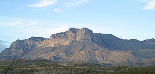
El Capitan is a peak in Culberson County, Texas, located within Guadalupe Mountains National Park. The 10th-highest peak in Texas at 8,085 ft, El Capitan is part of the Guadalupe Mountains, an exposed portion of a Permian period reef uplifted and exposed by tectonic activity during the late Cretaceous period. The southern terminus of the Guadalupe Mountains, El Capitan looms over U.S. 62/180, where its imposing height and stark outline have made it one of the iconic images of the Trans-Pecos to generations of travelers.

The Estrella Mountains or The Sierra Estrella is a mountain range located southwest of Phoenix, Arizona. Much of the range falls within the Gila River Indian Reservation, but 14,400 acres (5,800 ha) of BLM land is protected as the Sierra Estrella Wilderness.

The Guadalupe Mountains are a mountain range located in West Texas and southeastern New Mexico. The range includes the highest summit in Texas, Guadalupe Peak, 8,751 ft (2,667 m), and the "signature peak" of West Texas, El Capitan, both of which are located within Guadalupe Mountains National Park. The Guadalupe Mountains are bordered by the Pecos River valley and Llano Estacado to the east and north, Delaware Mountains to the south, and Sacramento Mountains to the west. One of the clearest exposures of a prehistoric reef is preserved in the mountain range's bedrock geology. Bedrock contains fossils of reef-dwelling organisms from the Permian period, and the geology is widely studied, mostly by stratigraphers, paleontologists, and Paleoecologists.

Blanca Peak is the fourth highest summit of the Rocky Mountains of North America and the U.S. state of Colorado. The ultra-prominent 14,351-foot (4,374 m) peak is the highest summit of the Sierra Blanca Massif, the Sangre de Cristo Range, and the Sangre de Cristo Mountains. The fourteener is located 9.6 miles (15.5 km) north by east of the Town of Blanca, on the drainage divide separating Rio Grande National Forest and Alamosa County from the Sangre de Cristo Land Grant and Costilla County. The summit is the highest point of both counties and the entire drainage basin of the Rio Grande. Below the steep North Face of Blanca Peak two live Glaciers once developed, until extinction sometime after 1903. North & South Blanca Glaciers were located at 37° 35N.,longitude 105° 28W. Blanca Peak is higher than any point in the United States east of its longitude.

The Chisos Mountains, also known as the Chisos, are a mountain range located in the Big Bend area of the Trans-Pecos region of Texas, United States. The mountain system covers 40 square miles and is contained entirely within the boundaries of Big Bend National Park, making it the only mountain range in the United States fully contained within a national park. The Chisos Mountains are the southernmost mountain range in the mainland United States.

The Sierra Blanca is an ultra-prominent range of volcanic mountains in Lincoln and Otero counties in the south-central part of the U.S. state of New Mexico. The range is about 40 miles (64 km) from north to south and 20 miles (32 km) wide.

Franklin Mountains State Park is a Texas state park in El Paso, Texas, that protects the Franklin Mountains. Park headquarters are located at an elevation of 5,426 feet (1,654 m) with the highest peak, North Franklin Mountain, reaching 7,192 feet (2,192 m). It is one of the largest urban parks in the nation lying completely within city limits, covering 24,247.56 acres (9,813 ha). Franklin Mountains State Park is open year-round for recreational hiking, mountain biking, picnicking and scenic driving and vistas.

The Franklin Mountains of Texas are a small range 23 miles (37 km) long, 3 miles (5 km) wide that extend from El Paso, Texas, north into New Mexico. The Franklins were formed due to crustal extension related to the Cenozoic Rio Grande rift. Although the present topography of the range and adjoining basins is controlled by extension during rifting in the last 10 million years, faults within the range also record deformation during the Laramide orogeny, between 85 and 45 million years ago.

Lincoln National Forest is a unit of the U.S. Forest Service located in southern New Mexico. The Lincoln National Forest covers an extensive 1.1 million acres in southeastern New Mexico. Established by Presidential Proclamation in 1902 as the Lincoln Forest Reserve, the 1,103,897 acres (4,467.31 km2) forest begins near the Texas border and contains lands in parts of Chaves, Eddy, Lincoln, and Otero counties. The Lincoln National Forest is home to three major mountain ranges: Sacramento, Guadalupe and Capitan. The three Ranger Districts within the forest contain all or part of a total of four mountain ranges, and include a variety of different environmental areas, from desert to heavily forested mountains and sub-alpine grasslands. Clean air, water, and soil are necessary elements that the National Forests contribute to the environment. Established to balance conservation, resource management, and recreation, the lands of the Lincoln National Forest include important local timber resources, protected wilderness areas, and popular recreation and winter sports areas. The forest headquarters is located in Alamogordo, N.M. with local offices in Carlsbad, Cloudcroft, and Ruidoso.

The Chinati Mountains of Texas are a small range in the high desert of far West Texas near the city of Presidio. There is a pass through the mountains on Ranch to Market Road 2810, also known as Pinto Canyon Road, which connects to Farm to Market Road 170 at Ruidosa, Texas. Some believe the range derives its name from the Apache word ch'íná'itíh, which means gate or mountain pass.
Prehistory of Colorado provides an overview of the activities that occurred prior to Colorado's recorded history. Colorado experienced cataclysmic geological events over billions of years, which shaped the land and resulted in diverse ecosystems. The ecosystems included several ice ages, tropical oceans, and a massive volcanic eruption. Then, ancient layers of earth rose to become the Rocky Mountains.

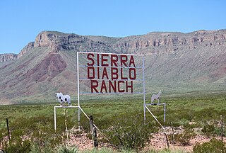
The Sierra Diablo is a small mountain range in the US state of Texas, extending north and south along the border between Hudspeth and Culberson counties. It is in the Chihuahuan Desert, and is near Van Horn, Texas.


