
California is a U.S. state on the western coast of North America. Covering an area of 163,696 sq mi (423,970 km2), California is among the most geographically diverse states. The Sierra Nevada, the fertile farmlands of the Central Valley, and the arid Mojave Desert of the south are some of the geographic features of this U.S. state. It is home to some of the world's most exceptional trees: the tallest, most massive, and oldest. It is also home to both the highest and lowest points in the 48 contiguous states.

Van Horn is a town in and the seat of Culberson County, Texas, United States. According to the 2010 census, Van Horn had a population of 2,063, down from 2,435 at the 2000 census. The 2020 census results detailed a decline in population to 1,941. Van Horn's official newspaper is The Van Horn Advocate. The town is the westernmost incorporated community in the United States that uses the Central Time Zone, located on the same line of longitude as Cheyenne, Wyoming, and Colorado Springs, Colorado. Its earliest sunset in the beginning of December is the latest among incorporated towns in the United States, occurring no earlier than 5:56 pm.

Guadalupe Mountains National Park is a national park of the United States in the Guadalupe Mountains, east of El Paso, Texas. The mountain range includes Guadalupe Peak, the highest point in Texas at 8,751 feet (2,667 m), and El Capitan used as a landmark by travelers on the route later followed by the Butterfield Overland Mail stagecoach line. The ruins of a stagecoach station stand near the Pine Springs visitor center. The restored Frijole Ranch contains a small museum of local history and is the trailhead for Smith Spring. The park covers 86,367 acres in the same mountain range as Carlsbad Caverns National Park, about 25 miles (40 km) to the north in New Mexico. The Guadalupe Peak Trail winds through pinyon pine and Douglas-fir forests as it ascends over 3,000 feet (910 m) to the summit of Guadalupe Peak, with views of El Capitan and the Chihuahuan Desert.

The Transverse Ranges are a group of mountain ranges of southern California, in the Pacific Coast Ranges physiographic region in North America. The Transverse Ranges begin at the southern end of the California Coast Ranges and lie within Santa Barbara, Ventura, Los Angeles, San Bernardino, Riverside and Kern counties. The Peninsular Ranges lie to the south. The name is due to the ranges' east–west orientation, making them transverse to the general northwest–southeast orientation of most of California's coastal mountains.

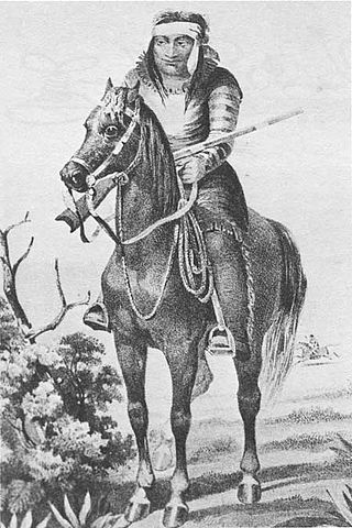
Victorio was a warrior and chief of the Warm Springs band of the Tchihendeh division of the central Apaches in what is now the American states of Texas, New Mexico, Arizona, and the Mexican states of Sonora and Chihuahua.

Mescalero or Mescalero Apache is an Apache tribe of Southern Athabaskan–speaking Native Americans. The tribe is federally recognized as the Mescalero Apache Tribe of the Mescalero Apache Reservation, located in south-central New Mexico.

The Western Apache are a subgroup of the Apache Native American people, who live primarily in east central Arizona, in the United States and north of Mexico in the states of Sonora and Chihuahua. Most live within reservations. The Fort Apache Indian Reservation, San Carlos Apache Indian Reservation, Yavapai-Apache Nation, Tonto Apache, and the Fort McDowell Yavapai Nation are home to the majority of Western Apache and are the bases of their federally recognized tribes. In addition, there are numerous bands. The Western Apache bands call themselves Ndee (Indé). Because of dialectical differences, the Pinaleño/Pinal and Arivaipa/Aravaipa bands of the San Carlos Apache pronounce the word as Innee or Nnēē:.

The Guadalupe Mountains are a mountain range located in West Texas and southeastern New Mexico. The range includes the highest summit in Texas, Guadalupe Peak, 8,751 ft (2,667 m), and the "signature peak" of West Texas, El Capitan, both of which are located within Guadalupe Mountains National Park. The Guadalupe Mountains are bordered by the Pecos River valley and Llano Estacado to the east and north, Delaware Mountains to the south, and Sacramento Mountains to the west. One of the clearest exposures of a prehistoric reef is preserved in the mountain range's bedrock geology. Bedrock contains fossils of reef-dwelling organisms from the Permian period, and the geology is widely studied, mostly by stratigraphers, paleontologists, and Paleoecologists.

The Cibola National Forest is a 1,633,783 acre United States National Forest in New Mexico, US. The name Cibola is thought to be the original Zuni Indian name for their pueblos or tribal lands. The name was later interpreted by the Spanish to mean "buffalo". The forest is disjointed with lands spread across central and northern New Mexico, west Texas and Oklahoma. The Cibola National Forest is divided into four Ranger Districts: the Sandia, Mountainair, Mt. Taylor, and Magdalena. The Forest includes the San Mateo, Magdalena, Datil, Bear, Gallina, Manzano, Sandia, Mt. Taylor, and Zuni Mountains of west-central New Mexico. The Forest also manages four National Grasslands that stretch from northeastern New Mexico eastward into the Texas Panhandle and western Oklahoma. The Cibola National Forest and Grassland is administered by Region 3 of the United States Forest Service from offices in Albuquerque, New Mexico. Elevation ranges from 5,000 ft to 11,301 ft. The descending order of Cibola National Forest acres by county are: Socorro, Cibola, McKinley, Catron, Torrance, Bernalillo, Sandoval County, New Mexico, Lincoln, Sierra, and Valencia counties in New Mexico. The Cibola National Forest currently has 137,701 acres designated as Wilderness. In addition to these acres, it has 246,000 acres classified as Inventoried Roadless Areas pursuant to the Roadless Area Conservation Rule.
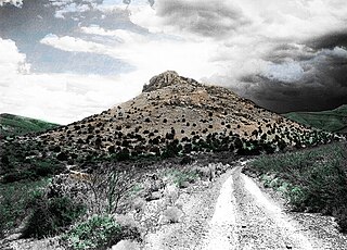
Victorio Peak is a high rocky outcropping in the Hembrillo Basin in southern New Mexico. This was one of Chief Victorio's hideouts, and was the site of a battle in 1880 between Victorio's Apaches and the U.S. Army Ninth Cavalry "Buffalo Soldiers." Additionally, an American gold prospector claimed to have found hidden treasure inside the Mountains in the late 1930s.

The Sierra Blanca is an ultra-prominent range of volcanic mountains in Lincoln and Otero counties in the south-central part of the U.S. state of New Mexico. The range is about 40 miles (64 km) from north to south and 20 miles (32 km) wide.
The Cabeza Prieta Mountains are a mountain range in the northwestern Sonoran Desert of southwest Arizona. It is located in southern Yuma County, Arizona.
The Sierra Pinta or Sierra Pintas are a narrow remote block faulted northwest-southeast trending mountain range, about 22 miles (35 km) long located in southwestern Arizona in the arid northwestern Sonoran Desert, just north of the Pinacate Reserve of northern Sonora, Mexico. The mountains derive their name from visitor descriptions of its multicolored hues when viewed at sunrise and sunset.

Arizona is a landlocked state situated in the southwestern region of the United States of America. It has a vast and diverse geography famous for its deep canyons, high- and low-elevation deserts, numerous natural rock formations, and volcanic mountain ranges. Arizona shares land borders with Utah to the north, the Mexican state of Sonora to the south, New Mexico to the east, and Nevada to the northwest, as well as water borders with California and the Mexican state of Baja California to the southwest along the Colorado River. Arizona is also one of the Four Corners states and is diagonally adjacent to Colorado.

The Coyote Mountains are a small mountain range in San Diego and Imperial County in Southern California. The Coyotes form a narrow ESE trending 2 mi (3.2 km) wide range with a length of about 12 mi (19 km). The southeast end turns and forms a 2 mi (3.2 km) north trending "hook". The highest point is Carrizo Mountain on the northeast end with an elevation of 2,408 feet (734 m). Mine Peak at the northwest end of the range has an elevation of 1,850 ft (560 m). Coyote Wash along Interstate 8 along the southeast margin of the range is 100 to 300 feet in elevation. Plaster City lies in the Yuha Desert about 5.5 mi (8.9 km) east of the east end of the range.

The Chinati Mountains of Texas are a small range in the high desert of far West Texas near the city of Presidio. There is a pass through the mountains on Ranch to Market Road 2810, also known as Pinto Canyon Road, which connects to Farm to Market Road 170 at Ruidosa, Texas. Some believe the range derives its name from the Apache word ch'íná'itíh, which means gate or mountain pass.
The Battle of the Diablo Mountains was an October 1854 engagement between the U.S. Army and the Lipan Apache. A small force of Mounted Rifles attacked a much larger force of Lipan Apaches at the base of the Diablo Mountains in Texas.
The Figure 2 Ranch is located in present-day Culberson County, Texas, founded in 1890 by James Monroe Daugherty, a cattle rancher who owned ranches in several states prior to this date. The site was the scene of one of the last battles between the Texas Rangers and the Apache Indians. Daugherty, a former express rider for the Confederate Army in the American Civil War and a founding member of the Texas and Southwestern Cattle Raisers Association lived on the ranch by 1905 and would later serve on the local county commission for Culberson County after its founding in 1911. At the age of 83, Daugherty sold the ranch to ranching, timber, and oil tycoon James Marion West, Sr. in 1933. West never lived on the ranch, but his son James Jr. maintained a home there which he used as one of his many residences. The ranch remained in the West family until 1992. The Figure 2 Ranch Airport is located on the property. At its height, the ranch encompassed some 175,000 acres. The Figure 2 Ranch is now owned by Jeff Bezos, who is building a 10,000 year clock in part of the Sierra Diablo Mountains that lie on the ranch property. Part of the Figure 2 Ranch property serves as a Blue Origin test and launch facility.
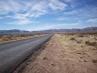
The Sierra Vieja is a small mountain range in the Trans-Pecos region of West Texas, 42 miles northwest of the city of Marfa in far western Jeff Davis County and northwestern Presidio County. The range extends 16 miles south, from just east of the Van Horn Mountains. Locally known as the Candelaria Rim Rock, the Sierra Vieja comprise the southernmost tip of the Southern Rocky Mountains in North America. Sierra Vieja is Spanish for "old mountains."

The Beach Mountains are located on privately owned land roughly 3 miles (5 km) north of Van Horn in southwestern Culberson County, Texas. The maximum elevation reached is 5,827 feet (1,776 m) above sea level. The Beach Mountains occupy a roughly circular area with a diameter of approximately 8 kilometres (5.0 mi), rising 550 metres (1,800 ft) above the surrounding desert. Narrow passes separate the Beach Mountains from the Baylor Mountains to the north and the much larger Sierra Diablo range to the northwest.

