Siruma

Last updated
Siruma
Municipality of Siruma
Siruma, Camarines Sur, Philippines.jpg
View from Siruma View Deck
Flag of Siruma, Camarines Sur.png
Ph locator camarines sur siruma.png
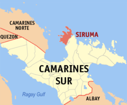
Map of Camarines Sur with Siruma highlighted
OpenStreetMap
Siruma
Philippines location map (square).svg
Red pog.svg
Siruma
Location within the Philippines
Coordinates: 14°01′19″N123°15′32″E / 14.0219°N 123.2589°E / 14.0219; 123.2589
Country Philippines
Region Bicol Region
Province Camarines Sur
District 4th district
Barangays 22 (see Barangays)
Government
[1]
  Type Sangguniang Bayan
   Mayor Carina R. Polinga
   Vice Mayor Sandy S. Ondis
   Representative Arnulf Bryan B. Fuentebella
   Municipal Council
Members
  • Henry G. Galan
  • Dorna T. Borlado
  • Roselo C. Abad
  • Florissa A. Antivola
  • Lizlie R. Aniete
  • Sheila Marie S. Borja
  • Eugene Vincent G. Camacho
  • Marietta R. Peralta
   Electorate 14,979 voters (2025)
Area
[2]
  Total
141.27 km2 (54.54 sq mi)
Elevation
11 m (36 ft)
Highest elevation
134 m (440 ft)
Lowest elevation
−1 m (−3.3 ft)
Population
 (2024 census) [3]
  Total
19,168
  Density135.68/km2 (351.42/sq mi)
   Households
4,262
Economy
   Income class 4th municipal income class
   Poverty incidence
49.7
% (2021) [4]
   Revenue 145 million (2022)
   Assets 199.5 million (2022)
   Expenditure 111.1 million (2022)
   Liabilities 9.931 million (2022)
Service provider
  ElectricityCamarines Sur 2 Electric Cooperative (CASURECO 2)
Time zone UTC+8 (PST)
ZIP code
4427
PSGC
IDD : area code +63(0)54
Native languages Central Bikol
Tagalog
Crime index 0
Website crohan.wix.com/sirlgu

Siruma, officially the Municipality of Siruma (Central Bikol : Banwaan kan Siruma; Tagalog : Bayan ng Siruma), is a municipality in the province of Camarines Sur, Philippines. According to the 2020 census, it has a population of 19,419 people. [5]

Contents

History

Siruma was under the jurisdiction of Quipayo, considered to be one of the oldest parishes in the Archdiocese of Nueva Caceres. Now, Quipayo is a barangay of Calabanga.

On October 19, 1846, a decree was implemented by Governor General Narciso Claveria which restructured the territorial domain of the province. It was during this time that Siruma was ceded to Camarines Norte.

It was said that the town's name was derived from the name of an island called "Matandang Siruma". The word "siruma" comes from the local vernacular sirum which is a "small, red ant". A myth was told that a certain capitan encountered a swarm of small red ants during his overnight stay in one of the places in Siruma, thus, calling the place as "masirum".

Geography

Barangays

Siruma is politically subdivided into 22 barangays. Each barangay consists of puroks and some have sitios.

  • Bagong Sirang
  • Bahao
  • Boboan
  • Butawanan
  • Cabugao
  • Fundado
  • Homestead
  • La Purisima
  • Mabuhay
  • Malaconini
  • Matandang Siruma
  • Nalayahan
  • Pinitan
  • Poblacion
  • Pamintan-Bantilan
  • Salvacion
  • San Andres
  • San Ramon (Daldagon)
  • Sulpa
  • Tandoc
  • Tongo-Bantigue
  • Vito

Climate

Climate data for Siruma, Camarines Sur
MonthJanFebMarAprMayJunJulAugSepOctNovDecYear
Mean daily maximum °C (°F)31
(88)
30
(86)
33
(91)
35
(95)
36
(97)
36
(97)
35
(95)
34
(93)
35
(95)
33
(91)
32
(90)
31
(88)
33
(92)
Mean daily minimum °C (°F)27
(81)
27
(81)
28
(82)
30
(86)
31
(88)
31
(88)
30
(86)
30
(86)
30
(86)
29
(84)
28
(82)
28
(82)
29
(84)
Average precipitation mm (inches)62.63
(2.47)
114.71
(4.52)
41.44
(1.63)
56.32
(2.22)
105.22
(4.14)
175.86
(6.92)
192.89
(7.59)
110.61
(4.35)
130.78
(5.15)
546.13
(21.50)
232.9
(9.17)
462
(18.2)
2,231.49
(87.86)
Average rainy days212514172329312327292931299
Source: World Weather Online (modeled/calculated data, not measured locally) [6]

Demographics

Population census of Siruma
YearPop.±% p.a.
1903 1,321    
1918 1,194−0.67%
1939 5,851+7.86%
1948 5,245−1.21%
1960 9,307+4.89%
1970 9,373+0.07%
1975 10,435+2.18%
1980 11,613+2.16%
YearPop.±% p.a.
1990 13,103+1.21%
1995 13,870+1.07%
2000 16,339+3.57%
2007 17,035+0.58%
2010 17,050+0.03%
2015 17,764+0.78%
2020 19,419+1.89%
2024 19,168−0.31%
Source: Philippine Statistics Authority [7] [8] [9] [10] [11]
Siruma beach Siruma beach during lowtide, 2021.jpg
Siruma beach

In the 2020 census, the population of Siruma was 19,419 people, [12] with a density of 140 inhabitants per square kilometre or 360 inhabitants per square mile.

Economy

Poverty incidence of Siruma

10
20
30
40
50
60
2000
58.76
2003
55.97
2006
56.30
2009
58.10
2012
58.06
2015
59.18
2018
37.77
2021
49.70

Source: Philippine Statistics Authority [13] [14] [15] [16] [17] [18] [19] [20]

Education

The Siruma Schools District Office governs all educational institutions within the municipality. It oversees the management and operations of all private and public, from primary to secondary schools. [21]

Primary and elementary schools

  • Bagong Sirang Elementary School
  • Bahao Elementary School
  • Boboan Elementary School
  • Butawanan Elementary School
  • Cabugao Elementary School
  • Daldagon Elementary School
  • Elon Elementary School
  • Fundado Elementary School
  • Mabuhay Elementary School
  • Nalayahan Elementary School
  • Penitan Elementary School
  • Salvacion Elementary School
  • San Andres Elementary School
  • Siruma Central School
  • Sulpa Elementary School
  • Tandoc Elementary School
  • Vito Elementary School

Secondary schools

  • Siruma High School (Fundado High School Annex)
  • Siruma National High School
  • Tandoc National High School
  • Vito National High School

References

  1. Municipality of Siruma | (DILG)
  2. "2015 Census of Population, Report No. 3 – Population, Land Area, and Population Density" (PDF). Philippine Statistics Authority. Quezon City, Philippines. August 2016. ISSN   0117-1453. Archived (PDF) from the original on May 25, 2021. Retrieved July 16, 2021.
  3. "2024 Census of Population (POPCEN) Population Counts Declared Official by the President". Philippine Statistics Authority. 17 July 2025. Retrieved 18 July 2025.
  4. "PSA Releases the 2021 City and Municipal Level Poverty Estimates". Philippine Statistics Authority. 2 April 2024. Retrieved 28 April 2024.
  5. "2024 Census of Population (POPCEN) Population Counts Declared Official by the President". Philippine Statistics Authority. 17 July 2025. Retrieved 18 July 2025.
  6. "Siruma, Camarines Sur: Average Temperatures and Rainfall". World Weather Online. Retrieved 29 October 2017.
  7. "2024 Census of Population (POPCEN) Population Counts Declared Official by the President". Philippine Statistics Authority. 17 July 2025. Retrieved 18 July 2025.
  8. Census of Population (2015). "Region V (Bicol Region)". Total Population by Province, City, Municipality and Barangay. Philippine Statistics Authority . Retrieved 20 June 2016.
  9. Census of Population and Housing (2010). "Region V (Bicol Region)" (PDF). Total Population by Province, City, Municipality and Barangay. National Statistics Office . Retrieved 29 June 2016.
  10. Censuses of Population (1903–2007). "Region V (Bicol Region)". Table 1. Population Enumerated in Various Censuses by Province/Highly Urbanized City: 1903 to 2007. National Statistics Office.
  11. "Province of". Municipality Population Data. Local Water Utilities Administration Research Division. Retrieved 17 December 2016.
  12. "2024 Census of Population (POPCEN) Population Counts Declared Official by the President". Philippine Statistics Authority. 17 July 2025. Retrieved 18 July 2025.
  13. "Poverty incidence (PI):". Philippine Statistics Authority. Retrieved December 28, 2020.
  14. "Estimation of Local Poverty in the Philippines" (PDF). Philippine Statistics Authority. 29 November 2005.
  15. "2003 City and Municipal Level Poverty Estimates" (PDF). Philippine Statistics Authority. 23 March 2009.
  16. "City and Municipal Level Poverty Estimates; 2006 and 2009" (PDF). Philippine Statistics Authority. 3 August 2012.
  17. "2012 Municipal and City Level Poverty Estimates" (PDF). Philippine Statistics Authority. 31 May 2016.
  18. "Municipal and City Level Small Area Poverty Estimates; 2009, 2012 and 2015". Philippine Statistics Authority. 10 July 2019.
  19. "PSA Releases the 2018 Municipal and City Level Poverty Estimates". Philippine Statistics Authority. 15 December 2021. Retrieved 22 January 2022.
  20. "PSA Releases the 2021 City and Municipal Level Poverty Estimates". Philippine Statistics Authority. 2 April 2024. Retrieved 28 April 2024.
  21. "Masterlist of Schools" (PDF). Department of Education. January 15, 2021. Retrieved November 6, 2025.