Pasacao

Last updated
Pasacao
Municipality of Pasacao
Pasacao Aerial.JPG
Aerial shot of Pasacao with its port and oil depot
Flag of Pasacao, Camarines Sur.png
Pasacao Official Sel.png
Nickname: 
Summer Capital of Camarines Sur
Motto: 
Matatag [lower-alpha 1] na Bayan ng Pasacao
Ph locator camarines sur pasacao.png
Map of Camarines Sur with Pasacao highlighted
OpenStreetMap
Pasacao
Philippines location map (square).svg
Red pog.svg
Pasacao
Location within the Philippines
Coordinates: 13°30′37″N123°02′31″E / 13.5103°N 123.0419°E / 13.5103; 123.0419
Country Philippines
Region Bicol Region
Province Camarines Sur
District 2nd district
Founded 1872
Barangays 19 (see Barangays)
Government
[1]
  Type Sangguniang Bayan
   Mayor Jorge R. Bengua
   Vice Mayor Maryol O. Tayco
   Representative Luis Raymund F. Villafuerte Jr.
   Municipal Council
Members
   Electorate 31,618 voters (2022)
Area
[2]
  Total149.54 km2 (57.74 sq mi)
Elevation
36 m (118 ft)
Highest elevation756 m (2,480 ft)
Lowest elevation0 m (0 ft)
Population
 (2020 census) [3]
  Total53,461
  Density360/km2 (930/sq mi)
   Households
11,971
Demonym Pasaqueño (Masculine) Pasaqueña (Feminine)
Economy
   Income class 3rd income class municipality
   Poverty incidence 41.62% (2015) [4]
   Revenue ₱197,378,822.82
   Assets 528.4 million (2020)
   Expenditure 137.2 million (2020)
   Liabilities 168.3 million (2020)
Service provider
  ElectricityCamarines Sur 1 Electric Cooperative (CASURECO 1)
  WaterPasacao Water District (PAWADI)
Time zone UTC+8 (PST)
ZIP code
4417
PSGC
IDD : area code +63(0)54
Native languages Central Bikol
Tagalog
Major religions Roman Catholicism
Feast dateAugust 30
Catholic diocese Diocese of Libmanan
Patron saint Saint Rose of Lima
Websitepasacao.gov.ph

Pasacao, officially the Municipality of Pasacao (Central Bikol : Banwaan kan Pasacao; Tagalog : Bayan ng Pasacao), is a 2nd class municipality in the province of Camarines Sur, Philippines. According to the 2020 census, it has a population of 53,461 people. [3]

Contents

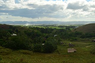
It is famed for its stretch of brownish sand beaches, earning it the title "Summer Capital of Camarines Sur". [5] The municipality's landmarks include the town's symbol, Daruanak Island, and the Port of Pasacao.

During the Spanish colonization in the 16th century, Pasacao was one of the embarkation points in Camarines Sur and was the only sea transportation link to Manila. It played a vital role in the development of commerce and trade in the province. [6]

The town was formed in 1872, according to records from the Archdiocese of Cáceres. [6]

Etymology

The town's name is derived from the Spanish-Tagalog portmanteau Pasa-Ikaw (English: Pass it on). This is because dock guards stationed at the Pasacao Port would regularly issue directions to passengers by shouting "Pasa ikaw, Pasa ikaw." Passengers mistook the phrase for the town's name, Pasacao. [6]

History

Spanish colonization

From 1585 to the 19th century, Pasacao served as a crucial defense port against Moro pirate incursions. The raid in Caranan on October 4, 1779, is an example. Pasacao and 9 other towns and two missions were entirely destroyed; ten churches were robbed and torched; 8,000 residents were captured or slain; one priest was killed, two were captured; and Caceres, the capital, was placed on high alert one night. [7] In 1823, the town had an estimated population of only 200 people due to frequent attacks. [6]

To defend Pasacao against these raids, Alcalde Jacinto Rodriguez Morales contributed material for a balwark. He also gave watchmen rations. The fortification of Pasacao in 1848, which included Cabusao in Camarines Sur, Pantao (now Libon), and Donsol in Sorsogon, was motivated by these attacks. [6]

Between 1609 and 1616, during the governor generalship of Juan de Silva, two galleons, the Nuestra Seora de Guadalupe and Angel dela Guardia, were built in Barangay Dalupaon, as well as the Astillero de Dalupaon (English: Dalupaon Shipyard). Guadalupe was vital in the galleon commerce between Manila and Acapulco, as well as the defense of the Philippines against the Dutch at the Battle of Playa Honda. [6]

Japanese occupation

When World War II broke out on December 8, 1941, Juan Q. Miranda and Elias Madrid, both from Canaman and Leon Sa. Aureus from Libmanan founded the Tangcong Vaca Guerilla Unit  [ bcl ]. It was the province's first big guerilla unit, established on March 18, 1942. The TVGU took its name from Mount Bernacci, where they set up camp. Miranda commanded 67 men from multiple guerrilla squads in a two-and-a-half-hour convoy ambush near Taguild, Pamplona, on November 8, 1942. Colonel Susumo Takechi (the Japanese commander in Naga), two captains, two lieutenants, and 168 to 200 enlisted men were killed. [8] Other significant historical events in Pasacao also left their mark. When the Japanese ships docked at Pasacao Pier, it was bombed. Until today, some Japanese ships have been visible in clear waters. [6]

The Six Daughters of Charity landed on Pasacao's shore to establish Naga City's first regular girls' school, Universidad de Santa Isabel. [6]

Geography

Daruanak Island Pasacao 2.jpg
Daruanak Island

Pasacao is situated on the northwest coast of the Camarines Sur. The town is bordered by Mount Bernacci that it shares a border with Libmanan in the northwest, San Fernando in the east, and Pamplona in the north..

The total land area of Pasacao is approximately 149.54 square kilometres (57.74 sq mi), with much of the terrain consisting of rolling hills and mountains. The town's topography is characterized by steep slopes, with elevations ranging from sea level to over 400 metres (1,300 ft) above sea level. The highest point in the town is Mount Bernacci, which stands at 756 metres (2,480 ft) above sea level.

Pasacao is also home to several rivers and creeks, including the Itulan River and Tinalmud River, which flows into Ragay Gulf. Other rivers and creeks in the town include the Caranan River and Dalupaon River.

Pasacao is also known for its rich natural resources, particularly its abundant fishery and marine life. The town has a sanctuary and a marine protected area, the Stampa Beach, which are home to a wide variety of marine species including fish, corals, and sea turtles.

The town has a long coastline stretching for about 22 kilometres (14 mi), making it a popular destination for beach lovers. Pasacao's beaches are known for their fine brown sand and crystal-clear waters, and they offer a variety of water activities such as swimming, snorkeling, and fishing. The most popular beach in Pasacao is Balogo Beach, where the Daruanak Island is situated, which is a favorite spot for locals and tourists alike.

In summary, Pasacao is a municipality characterized by a rugged terrain, a long coastline, and a tropical climate. Its natural features make it an attractive destination for tourists seeking outdoor adventures and relaxation by the beach.

Barangays

Pasacao is politically subdivided into 19 barangays. Each barangay consists of puroks and some have sitios.   Poblacion

Barangays [9] Population (2020)Feast Date Political Zones
Antipolo1.78%953May 246
Bagong Silang1.03%550April 287
Bahay3.56%1,905October 256
Balogo10.82%5,785July 167
Caranan19.57%10,460June 1314
Cuco3.75%2,004October 157
Dalupaon7.44%3,977June 2414
Hubo1.46%780May 227
Itulan2.29%1,226October 45
Macad [lower-alpha 2] 3.41%1,823February 117
Odicon5.69%3,043May 167
Quitang5.59%2,991July 257
Salvacion1.86%995April 25
San Antonio1.15%613May 127
San Cirilo9.97%5,53May 18
Santa Rosa Del Norte7.74%4,136October 248
Santa Rosa Del Sur6.60%3,527January 197
Tilnac1.73%927January 287
Tinalmud4.55%2,435
Total100%53,461

Climate

Climate data for Pasacao
MonthJanFebMarAprMayJunJulAugSepOctNovDecYear
Mean maximum °F (°C)82
(28)
84
(29)
86
(30)
88
(31)
90
(32)
90
(32)
86
(30)
88
(31)
88
(31)
86
(30)
84
(29)
84
(29)
90
(32)
Mean minimum °F (°C)75
(24)
73
(23)
75
(24)
75
(24)
79
(26)
79
(26)
79
(26)
79
(26)
77
(25)
77
(25)
77
(25)
77
(25)
73
(23)
Average precipitation inches (mm)5.82
(147.9)
3.56
(90.5)
3.06
(77.8)
3.08
(78.2)
5.66
(143.8)
8.31
(211.1)
12.46
(316.4)
10.05
(255.3)
11.96
(303.9)
10.10
(256.6)
5.81
(147.7)
8.85
(224.7)
88.72
(2,253.9)
Average rainy days64549121813141178111
Average ultraviolet index 6667766666666
Source: World Weather Online (modeled/calculated data, not measured locally) [10]

According to the Köppen climate classification system, Pasacao has a tropical rainforest climate. The north-east monsoon dominates the area; therefore, rainfall is evenly spread throughout the year. From October to January, the wind blows from north to east, from east to southeast from February to April, and from May to September, it blows from east to southeast. From December to May, the area is rather dry, and the rest of the year is wet. The town is occasionally affected by typhoons during the wet season, which can cause flooding and landslides in some areas.

Pasacao experiences a hot and dry season from February to May. Most visitors and tourists come to Pasacao to relax during these months. Most resorts and beaches are packed with people on Easter Sunday, especially from local communities and other parts of the country.

Demographics

Pasacao municipal hall An munisipyo Pasacao.jpg
Pasacao municipal hall

In the 2020 census, the population of Pasacao was 53,461 people, [3] with a density of 360 inhabitants per square kilometre or 930 inhabitants per square mile.

Population census of Pasacao
YearPop.±% p.a.
1903 2,431    
1918 2,308−0.35%
1939 5,594+4.31%
1948 8,128+4.24%
1960 14,327+4.84%
YearPop.±% p.a.
1970 19,355+3.05%
1975 21,809+2.42%
1980 25,303+3.02%
1990 31,960+2.36%
1995 36,070+2.29%
YearPop.±% p.a.
2000 38,423+1.36%
2007 41,533+1.08%
2010 45,946+3.74%
2015 49,035+1.25%
2020 53,461+1.71%
Source: Philippine Statistics Authority [11] [12] [13] [14]

Language

The primary language spoken in Pasacao is Bikol, specifically the Central Bikol dialect. However, many residents also speak Tagalog and English, which are the official languages of the Philippines.

Religion

Despite the presence of a single church, Saint Rose of Lima Parish, and a few chapels, Roman Catholicism is the dominant religion in the municipality. The Church of Jesus Christ of Latter-day Saints, Iglesia ni Kristo, Born Again denominations, Jehovah's Witnesses, and other Christian denominations are also present across the municipality.

Economy

The economy of Pasacao is largely based on agriculture and fishing, with rice, corn, and coconut being the main crops grown in the area. Fishing is also an important industry, with the town's coastal location providing abundant fishing grounds. Many schools and a growing number of local businesses give additional work opportunities for people. Other locals work at the oil depots in Barangay Sta. Rosa Del Sur (the area is also claimed by Barangay Caranan), as well as some labor in Naga and the Metropolitan Manila area. In recent years, there has been a growing interest in eco-tourism, with the municipality's pristine beaches and scenic spots attracting both local and foreign visitors.

Culture

Town Fiesta and Pasa-Pasa Ikaw Festival

August 29-30, the town celebrates its fiesta as well as the Pasa-Pasa Ikaw Festival. The festival is held in honor of Saint. Rose of Lima, the town's patroness. The municipal government organizes an annual calendar of events that includes pageant competitions, civic and military parades, and other activities.

Overall, the town fiesta and Pasa-Pasa Ikaw Festival are significant events in Pasacao's cultural calendar. These festivals showcase the town's rich cultural heritage and provide a platform for residents to celebrate and express themselves. They also attract visitors from neighboring towns and cities, boosting the town's tourism industry and promoting local businesses.

Daruanak Summer Festival

TBE

Attractions

Signature Park
(stylized as Sig [lower-alpha 3] NATURE Park) is an 1,145 square metres (12,320 sq ft) reclaimed property owned by the Pasacao - Local Government Unit. It's located along Acacia Drive, Zone 1B, Barangay Sta. Rose Del Norte-Balogo Junction. The park serves as both a recreational space and a civic center, which makes it a hub for community activities and events. One of the buildings in the complex is StrEat Park, which is a food park and an outdoor dining area.
The CBD (Central Business District) Complex is another part of Signature Park, and it houses several important offices and facilities. The Central Business District Terminal, a transportation hub for the area, providing easy access to Naga City. The Tourism office could offer information about local attractions and events, while the PSO and PNP substation provide public safety and police services. The Pasalubong Center is a place where visitors can purchase souvenirs and local products, which can help support the local economy.
The DRRM Complex is another notable feature of Pasacao Signature Park, which includes a covered court and the MDDRMC Office. The MDDRMC Office is responsible for managing disaster risk reduction and management in the area. The park also features an Eco-park Complex, which offers green spaces and features such as an eco-park and plaza. Visitors can relax and unwind in the serene environment of the Eco-park Complex, which also houses the Municipal Police Office Station, serving as a local police station for the area.
Pasacao Boulevard
is a waterfront road located in barangay San Cirilo. It is part of the Circumferential Road and Proposed Esplanade that connects San Cirilo to Santa Rosa del Norte and Balogo Road.

Infrastructure

Pasacao Port Pasacao Port in Pasacao, Camarines Sur.jpg
Pasacao Port

Ports

Pasacao Seaport, also known as the Port of Pasacao, locally known as Pier, is a fishing, passenger, and cargo port in Camarines Sur. It is situated in Barangay Sta. Rose del Sur. The port serves passengers traveling from Pasacao to Burias in Masbate Province.

The nearby smaller Pasacao Fishport is primarily utilized for fishing and unloading fish, as well as pump boats and fastcrafts for short trips.

Pasacao-Balatan Tourism Coastal Highway

The Pasacao-Balatan Tourism Coastal Highway is a 40.69 kilometres (25.28 mi) project of the National Economic and Development Authority (NEDA) and the Build, Build, Build program. It connects the municipalities of Pasacao, San Fernando, Minalabac, Bula, and Balatan, as well as 15 barangays within the aforementioned towns, with the goal of promoting ecotourism in Camarines Sur. There are 13 bridges in the network of roads, as well as intersections, service roads, and other infrastructure. [22]

Education

The town has several schools and educational institutions that offer quality education to its residents.

At the elementary level, there are 16 public elementary schools and 2 private schools that cater to the educational needs of children in Pasacao. The public elementary schools are operated by the Department of Education (DepEd) and offer the government's K-12 program. At the secondary level, there are 6 public high schools and 2 private schools in Pasacao. Students who complete high school can pursue higher education in colleges and universities in nearby cities such as Naga and Legazpi.

One notable educational institution in Pasacao is the Central Bicol State University of Agriculture (CBSUA) - Pasacao Campus. It was established in 1982 and is one of the satellite campuses of CBSUA in the province. The Pasacao Campus offers undergraduate course in education.

Aside from formal education, Pasacao also promotes non-formal education through the Alternative Learning System (ALS). The ALS is a program offered by the DepEd that provides out-of-school youth and adults an opportunity to complete their elementary or high school education through flexible learning modes such as distance learning, modular learning, and face-to-face classes.

In addition, Pasacao also supports technical and vocational education and training (TVET) through the Camarines Sur Institute of Fisheries and Marine Sciences (CASIFMAS). CASFIMAS offers various vocational courses in fields such as automotive, welding, food and beverage, and electronics, among others. These courses provide residents of Pasacao with the necessary skills to pursue employment opportunities or start their own businesses

Below is the list of the tertiary and secondary level existing schools on the municipality.

Tertiary
Secondary

Notes

    • Malinig (English: Clean)
    • Asensado (English: Prosperous)
    • Trangkilo (English: Peaceful)
    • Areglado (English: Organized)
    • Tarabangan para sa aktibong pag gobernar (English: Cooperated for an active governance)
  1. Formerly Hebrio Lourdes
    • Seat
    • of
    • Inclusive 
    • Government

Related Research Articles

<span class="mw-page-title-main">Tiwi, Albay</span> Municipality in Albay, Philippines

Tiwi, officially the Municipality of Tiwi is a 1st class municipality in the Province of Albay, Philippines. According to the 2020 census, it has a population of 56,444 people.

<span class="mw-page-title-main">Baao</span> Municipality in Camarines Sur, Philippines

Baao, officially the Municipality of Baao is 1st class municipality in the province of Camarines Sur, Philippines. According to the 2020 census, it has a population of 61,493 people.

<span class="mw-page-title-main">Bato, Camarines Sur</span> Municipality in Camarines Sur, Philippines

Bato, officially the Municipality of Bato, is a 3rd class municipality in the province of Camarines Sur, Philippines. According to the 2020 census, it has a population of 52,155 people.

<span class="mw-page-title-main">Bombon, Camarines Sur</span> Municipality in Camarines Sur, Philippines

Bombon, officially the Municipality of Bombon, is a 4th class municipality in the province of Camarines Sur, Philippines. According to the 2020 census, it has a population of 17,995 people.

<span class="mw-page-title-main">Bula, Camarines Sur</span> Municipality in Camarines Sur, Philippines

Bula, officially the Municipality of Bula, is a 1st class municipality in the province of Camarines Sur, Philippines. According to the 2020 census, it had a population of 73,143 people.

<span class="mw-page-title-main">Canaman</span> Municipality in Camarines Sur, Philippines

Canaman, officially the Municipality of Canaman is a 3rd class municipality in the province of Camarines Sur, Philippines. According to the 2020 census, it has a population of 36,205 people. Canaman is known for its upscale shopping, heritage which dates back to Spanish era, and its new first class housings.

<span class="mw-page-title-main">Caramoan</span> Municipality in Camarines Sur, Philippines

Caramoan, officially the Municipality of Caramoan, is a 2nd class municipality in the province of Camarines Sur, Philippines. According to the 2020 census, it has a population of 51,728 people.

<span class="mw-page-title-main">Del Gallego</span> Municipality in Camarines Sur, Philippines

Del Gallego, officially the Municipality of Del Gallego, is a 4th class municipality in the province of Camarines Sur, Philippines. According to the 2020 census, it has a population of 26,403 people.

<span class="mw-page-title-main">Gainza</span> Municipality in Camarines Sur, Philippines

Gainza, officially the Municipality of Gainza, is a 5th class municipality in the province of Camarines Sur, Philippines. According to the 2020 census, it has a population of 11,584 people.

<span class="mw-page-title-main">Garchitorena</span> Municipality in Camarines Sur, Philippines

Garchitorena, officially the Municipality of Garchitorena, is a 4th class municipality in the province of Camarines Sur, Philippines. According to the 2020 census, it has a population of 29,436 people.

<span class="mw-page-title-main">Lupi, Camarines Sur</span> Municipality in Camarines Sur, Philippines

Lupi, officially the Municipality of Lupi, is a 3rd class municipality in the province of Camarines Sur, Philippines. According to the 2020 census, it has a population of 33,897 people.

<span class="mw-page-title-main">Magarao</span> Municipality in Camarines Sur, Philippines

Magarao, officially the Municipality of Magarao, is a 3rd class municipality in the province of Camarines Sur, Philippines. According to the 2020 census, it has a population of 26,742 people.

<span class="mw-page-title-main">Milaor</span> Municipality in Camarines Sur, Philippines

Milaor, officially the Municipality of Milaor, is a 3rd class municipality in the province of Camarines Sur, Philippines. According to the 2020 census, it has a population of 33,963 people.

<span class="mw-page-title-main">Minalabac</span> Municipality in Camarines Sur, Philippines

Minalabac, officially the Municipality of Minalabac, is a 2nd class municipality in the province of Camarines Sur, Philippines. According to the 2020 census, it has a population of 53,981 people.

<span class="mw-page-title-main">Ocampo, Camarines Sur</span> Municipality in Camarines Sur, Philippines

Ocampo, officially the Municipality of Ocampo, is a 1st class municipality in the province of Camarines Sur, Philippines. According to the 2020 census, it has a population of 51,073 people.

<span class="mw-page-title-main">Pamplona, Camarines Sur</span> Municipality in Camarines Sur, Philippines

Pamplona, officially the Municipality of Pamplona, is a 3rd class municipality in the province of Camarines Sur, Philippines. According to the 2020 census, it has a population of 39,333 people.

<span class="mw-page-title-main">Pili, Camarines Sur</span> Capital of Camarines Sur, Philippines

Pili, officially the Municipality of Pili is a 1st class municipality and capital of the province of Camarines Sur, Philippines. According to the 2020 census, it has a population of 99,196 people.

<span class="mw-page-title-main">Ragay</span> Municipality in Camarines Sur, Philippines

Ragay, officially the Municipality of Ragay, is a 1st class municipality in the province of Camarines Sur, Philippines. According to the 2020 census, it has a population of 59,770 people.

<span class="mw-page-title-main">Sagñay</span> Municipality in Camarines Sur, Philippines

Sagñay,, officially the Municipality of Sagñay, is a 4th class municipality in the province of Camarines Sur in the Philippines. According to the 2020 census, it has a population of 36,841 people.

<span class="mw-page-title-main">Sipocot</span> Municipality in Camarines Sur, Philippines

Sipocot, officially the Municipality of Sipocot, is a 1st class municipality in the province of Camarines Sur, Philippines. According to the 2020 census, it has a population of 68,169 people.

References

  1. Municipality of Pasacao | (DILG)
  2. "2015 Census of Population, Report No. 3 – Population, Land Area, and Population Density" (PDF). Philippine Statistics Authority. Quezon City, Philippines. August 2016. ISSN   0117-1453. Archived (PDF) from the original on May 25, 2021. Retrieved July 16, 2021.
  3. 1 2 3 Census of Population (2020). "Region V (Bicol Region)". Total Population by Province, City, Municipality and Barangay. Philippine Statistics Authority . Retrieved 8 July 2021.{{cite encyclopedia}}: CS1 maint: numeric names: authors list (link)
  4. "PSA releases the 2015 Municipal and City Level Poverty Estimates". Quezon City, Philippines. Retrieved 1 January 2020.
  5. Barrameda, Shiena M. (2013-06-12). "Saving Pasacao as summer capital". INQUIRER.net. Retrieved 2022-05-15.
  6. 1 2 3 4 5 6 7 8 "History of Pasacao | LGU Pasacao Official Website" . Retrieved 2022-05-13.
  7. Abella, Domingo (1954). Bikol annals: A Collection of Vignettes of Philippine History.  [ bcl ]. Manila.{{cite book}}: CS1 maint: location missing publisher (link)
  8. Barrameda. pp. 43–44.
  9. "Barangays | LGU Pasacao Official Website" . Retrieved 2022-05-15.
  10. "Pasacao Climate Weather Averages" . Retrieved May 13, 2022.
  11. Census of Population (2015). "Region V (Bicol Region)". Total Population by Province, City, Municipality and Barangay. Philippine Statistics Authority . Retrieved 20 June 2016.{{cite encyclopedia}}: CS1 maint: numeric names: authors list (link)
  12. Census of Population and Housing (2010). "Region V (Bicol Region)" (PDF). Total Population by Province, City, Municipality and Barangay. National Statistics Office . Retrieved 29 June 2016.{{cite encyclopedia}}: CS1 maint: numeric names: authors list (link)
  13. Censuses of Population (1903–2007). "Region V (Bicol Region)". Table 1. Population Enumerated in Various Censuses by Province/Highly Urbanized City: 1903 to 2007. National Statistics Office.{{cite encyclopedia}}: CS1 maint: numeric names: authors list (link)
  14. "Province of Camarines Sur". Municipality Population Data. Local Water Utilities Administration Research Division. Retrieved 17 December 2016.
  15. "Poverty incidence (PI):". Philippine Statistics Authority. Retrieved December 28, 2020.
  16. "Estimation of Local Poverty in the Philippines" (PDF). Philippine Statistics Authority. 29 November 2005.
  17. "2003 City and Municipal Level Poverty Estimates" (PDF). Philippine Statistics Authority. 23 March 2009.
  18. "City and Municipal Level Poverty Estimates; 2006 and 2009" (PDF). Philippine Statistics Authority. 3 August 2012.
  19. "2012 Municipal and City Level Poverty Estimates" (PDF). Philippine Statistics Authority. 31 May 2016.
  20. "Municipal and City Level Small Area Poverty Estimates; 2009, 2012 and 2015". Philippine Statistics Authority. 10 July 2019.
  21. "PSA Releases the 2018 Municipal and City Level Poverty Estimates". Philippine Statistics Authority. 15 December 2021. Retrieved 22 January 2022.
  22. "Groundworks for Pasacao-Balatan Tourism Coastal Highway now underway". ph.news.yahoo.com. Retrieved 2022-12-27.