Garchitorena

Last updated
Garchitorena
Municipality of Garchitorena
Flag of Garchitorena, Camarines Sur.png
Ph locator camarines sur garchitorena.png
Map of Camarines Sur with Garchitorena highlighted
OpenStreetMap
Garchitorena
Philippines location map (square).svg
Red pog.svg
Garchitorena
Location within the Philippines
Coordinates: 13°53′N123°42′E / 13.88°N 123.7°E / 13.88; 123.7
Country Philippines
Region Bicol Region
Province Camarines Sur
District 4th district
Named for Andres Garchitorena
Barangays 23 (see Barangays)
Government
[1]
  Type Sangguniang Bayan
   Mayor Leda S. San Luis
   Vice Mayor Marcelo S. Aragdon
   Representative Arnulf Bryan B. Fuentebella
   Municipal Council
Members
   Electorate 18,388 voters (2022)
Area
[2]
  Total243.80 km2 (94.13 sq mi)
Elevation
30 m (100 ft)
Highest elevation
317 m (1,040 ft)
Lowest elevation
0 m (0 ft)
Population
 (2020 census) [3]
  Total29,436
  Density120/km2 (310/sq mi)
   Households
6,013
Economy
   Income class 4th municipal income class
   Poverty incidence
41.16
% (2018) [4]
   Revenue 169.4 million (2020)
   Assets 394.4 million (2020)
   Expenditure 131.8 million (2020)
   Liabilities 77.27 million (2020)
Service provider
  ElectricityCamarines Sur 4 Electric Cooperative (CASURECO 4)
Time zone UTC+8 (PST)
ZIP code
4428
PSGC
IDD : area code +63(0)54
Native languages Central Bikol
Tagalog

Garchitorena, officially the Municipality of Garchitorena (Central Bikol : Banwaan kan Garchitorena; Tagalog : Bayan ng Garchitorena), is a 4th class municipality in the province of Camarines Sur, Philippines. According to the 2020 census, it has a population of 29,436 people. [3]

Contents

Its territory includes the islands of Quinalasag, Lamit, and Malabungot, also known as Mahad.

History

The original location of Garchitorena is said to be found at the mouth of the Pambuhan River but it was later transferred to Binanwahan primarily because of frequent attacks of the Moros.

Soon, a rich man by the name of Don Andres Garchitorena, who hailed from Tigaon town and owned in this place a vast portion of the land area, persuaded the townspeople to plant abaca. He later established an abaca processing plant which started the establishment of this coastal settlement.

The municipality was established on March 4, 1949, through Executive Order No. 205 signed by President Elpidio Quirino. It was originally named the municipality of Anderson. [5] The municipality was then renamed after its founder and discoverer, Don Andres Garchitorena. He came from Tigaon. He was a member of Emilio Aguinaldo's Hong Kong Junta during the Spanish–American War. He became the governor of then Ambos Camarines in 1919. He is the father of Don Mariano Garchitorena, Secretary of Agriculture and Commerce and also Governor of Camarines Sur.
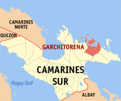
Geography

Barangays

Garchitorena is politically subdivided into 23 barangays. Each barangay consists of puroks and some have sitios.

  • Ason (Anson)
  • Bahi
  • Binagasbasan
  • Burabod
  • Cagamutan
  • Cagnipa
  • Canlong
  • Dangla
  • Del Pilar
  • Denrica
  • Harrison
  • Mansangat
  • Pambuhan
  • Barangay I (Poblacion)
  • Barangay II (Poblacion)
  • Barangay III (Poblacion)
  • Barangay IV (Poblacion)
  • Sagrada
  • Salvacion
  • San Vicente
  • Sumaoy
  • Tamiawon
  • Toytoy

Climate

Climate data for Garchitorena, Camarines Sur
MonthJanFebMarAprMayJunJulAugSepOctNovDecYear
Mean daily maximum °C (°F)30
(86)
30
(86)
32
(90)
33
(91)
35
(95)
35
(95)
35
(95)
34
(93)
35
(95)
33
(91)
31
(88)
31
(88)
33
(91)
Mean daily minimum °C (°F)27
(81)
27
(81)
28
(82)
30
(86)
31
(88)
31
(88)
31
(88)
30
(86)
30
(86)
29
(84)
28
(82)
28
(82)
29
(85)
Average precipitation mm (inches)151.1
(5.95)
198.89
(7.83)
106.28
(4.18)
60.08
(2.37)
63.62
(2.50)
85.76
(3.38)
117.53
(4.63)
46.99
(1.85)
52.23
(2.06)
740.22
(29.14)
522.7
(20.58)
618.0
(24.33)
2,763.4
(108.8)
Average rainy days242818232325292126282931305
Source: World Weather Online [6]

Demographics

Population census of Garchitorena
YearPop.±% p.a.
1960 10,191    
1970 15,890+4.54%
1975 16,438+0.68%
1980 16,877+0.53%
1990 19,439+1.42%
1995 19,481+0.04%
2000 23,021+3.64%
2007 24,825+1.05%
2010 25,204+0.55%
2015 27,010+1.33%
2020 29,436+1.71%
Source: Philippine Statistics Authority [7] [8] [9] [10]

In the 2020 census, the population of Garchitorena was 29,436 people, [3] with a density of 120 inhabitants per square kilometre or 310 inhabitants per square mile.

Bikol is the predominant language spoken.

Economy

Local agricultural products in the town includes abaca, coconut, and palay. Electrical power is supplied by CASURECO (Camarines Sur Electric Cooperative).

Related Research Articles

<span class="mw-page-title-main">Mercedes, Camarines Norte</span> Municipality in Camarines Norte, Philippines

Mercedes, officially the Municipality of Mercedes, is a 2nd class municipality in the province of Camarines Norte, Philippines. According to the 2020 census, it has a population of 55,334 people.

<span class="mw-page-title-main">Baao</span> Municipality in Camarines Sur, Philippines

Baao, officially the Municipality of Baao is 1st class municipality in the province of Camarines Sur, Philippines. According to the 2020 census, it has a population of 61,493 people.

<span class="mw-page-title-main">Balatan</span> Municipality in Camarines Sur, Philippines

Balatan, officially the Municipality of Balatan, is a 4th class municipality in the province of Camarines Sur, Philippines. According to the 2020 census, it has a population of 30,669 people.

<span class="mw-page-title-main">Bato, Camarines Sur</span> Municipality in Camarines Sur, Philippines

Bato, officially the Municipality of Bato, is a 3rd class municipality in the province of Camarines Sur, Philippines. According to the 2020 census, it has a population of 52,155 people.

<span class="mw-page-title-main">Bula, Camarines Sur</span> Municipality in Camarines Sur, Philippines

Bula, officially the Municipality of Bula, is a 1st class municipality in the province of Camarines Sur, Philippines. According to the 2020 census, it had a population of 73,143 people.

<span class="mw-page-title-main">Caramoan</span> Municipality in Camarines Sur, Philippines

Caramoan, officially the Municipality of Caramoan, is a 2nd class municipality in the province of Camarines Sur, Philippines. According to the 2020 census, it has a population of 51,728 people.

<span class="mw-page-title-main">Del Gallego</span> Municipality in Camarines Sur, Philippines

Del Gallego, officially the Municipality of Del Gallego, is a 4th class municipality in the province of Camarines Sur, Philippines. According to the 2020 census, it has a population of 26,403 people.

<span class="mw-page-title-main">Gainza</span> Municipality in Camarines Sur, Philippines

Gainza, officially the Municipality of Gainza, is a 5th class municipality in the province of Camarines Sur, Philippines. According to the 2020 census, it has a population of 11,584 people.

<span class="mw-page-title-main">Lagonoy</span> Municipality in Camarines Sur, Philippines

Lagonoy, officially the Municipality of Lagonoy, is a 2nd class municipality in the province of Camarines Sur, Philippines. According to the 2020 census, it has a population of 56,714 people.

<span class="mw-page-title-main">Magarao</span> Municipality in Camarines Sur, Philippines

Magarao, officially the Municipality of Magarao, is a 3rd class municipality in the province of Camarines Sur, Philippines. According to the 2020 census, it has a population of 26,742 people.

<span class="mw-page-title-main">Minalabac</span> Municipality in Camarines Sur, Philippines

Minalabac, officially the Municipality of Minalabac, is a 2nd class municipality in the province of Camarines Sur, Philippines. According to the 2020 census, it has a population of 53,981 people.

<span class="mw-page-title-main">Ocampo, Camarines Sur</span> Municipality in Camarines Sur, Philippines

Ocampo, officially the Municipality of Ocampo, is a 1st class municipality in the province of Camarines Sur, Philippines. According to the 2020 census, it has a population of 51,073 people.

<span class="mw-page-title-main">Pamplona, Camarines Sur</span> Municipality in Camarines Sur, Philippines

Pamplona, officially the Municipality of Pamplona, is a 3rd class municipality in the province of Camarines Sur, Philippines. According to the 2020 census, it has a population of 39,333 people.

<span class="mw-page-title-main">Presentacion</span> Municipality in Camarines Sur, Philippines

Presentacion, officially the Municipality of Presentacion, is a 4th class municipality in the province of Camarines Sur, Philippines. According to the 2020 census, it has a population of 22,591 people.

<span class="mw-page-title-main">Ragay</span> Municipality in Camarines Sur, Philippines

Ragay, officially the Municipality of Ragay, is a 1st class municipality in the province of Camarines Sur, Philippines. According to the 2020 census, it has a population of 59,770 people.

<span class="mw-page-title-main">Sagñay</span> Municipality in Camarines Sur, Philippines

Sagñay,, officially the Municipality of Sagñay, is a 4th class municipality in the province of Camarines Sur in the Philippines. According to the 2020 census, it has a population of 36,841 people.

<span class="mw-page-title-main">San Fernando, Camarines Sur</span> Municipality in Camarines Sur, Philippines

San Fernando, officially the Municipality of San Fernando, is a 2nd class municipality in the province of Camarines Sur, Philippines. According to the 2020 census, it has a population of 38,626 people.

<span class="mw-page-title-main">Siruma</span> Municipality in Camarines Sur, Philippines

Siruma, officially the Municipality of Siruma, is a 4th class municipality in the province of Camarines Sur, Philippines. According to the 2020 census, it has a population of 19,419 people.

<span class="mw-page-title-main">Tigaon, Camarines Sur</span> Municipality in Camarines Sur, Philippines

Tigaon, officially the Municipality of Tigaon, is a 2nd class municipality in the province of Camarines Sur, Philippines. According to the 2020 census, it has a population of 60,524 people.

<span class="mw-page-title-main">Tinambac</span> Municipality in Camarines Sur, Philippines

Tinambac, officially the Municipality of Tinambac, is a 1st class municipality in the province of Camarines Sur, Philippines. According to the 2020 census, it has a population of 70,176 people.

References

  1. Municipality of Garchitorena | (DILG)
  2. "2015 Census of Population, Report No. 3 – Population, Land Area, and Population Density" (PDF). Philippine Statistics Authority. Quezon City, Philippines. August 2016. ISSN   0117-1453. Archived (PDF) from the original on May 25, 2021. Retrieved July 16, 2021.
  3. 1 2 3 Census of Population (2020). "Region V (Bicol Region)". Total Population by Province, City, Municipality and Barangay. Philippine Statistics Authority . Retrieved 8 July 2021.
  4. "PSA Releases the 2018 Municipal and City Level Poverty Estimates". Philippine Statistics Authority. 15 December 2021. Retrieved 22 January 2022.
  5. "Executive Order No. 205, s. 1949". Official Gazette of the Republic of the Philippines. 4 March 1949. Retrieved 12 November 2015.
  6. "Garchitorena, Camarines Sur: Average Temperatures and Rainfall". World Weather Online. Retrieved 29 October 2017.
  7. Census of Population (2015). "Region V (Bicol Region)". Total Population by Province, City, Municipality and Barangay. Philippine Statistics Authority . Retrieved 20 June 2016.
  8. Census of Population and Housing (2010). "Region V (Bicol Region)" (PDF). Total Population by Province, City, Municipality and Barangay. National Statistics Office . Retrieved 29 June 2016.
  9. Censuses of Population (1903–2007). "Region V (Bicol Region)". Table 1. Population Enumerated in Various Censuses by Province/Highly Urbanized City: 1903 to 2007. National Statistics Office.{{cite encyclopedia}}: CS1 maint: numeric names: authors list (link)
  10. "Province of Camarines Sur". Municipality Population Data. Local Water Utilities Administration Research Division. Retrieved 17 December 2016.
  11. "Poverty incidence (PI):". Philippine Statistics Authority. Retrieved December 28, 2020.
  12. "Estimation of Local Poverty in the Philippines" (PDF). Philippine Statistics Authority. 29 November 2005.
  13. "2003 City and Municipal Level Poverty Estimates" (PDF). Philippine Statistics Authority. 23 March 2009.
  14. "City and Municipal Level Poverty Estimates; 2006 and 2009" (PDF). Philippine Statistics Authority. 3 August 2012.
  15. "2012 Municipal and City Level Poverty Estimates" (PDF). Philippine Statistics Authority. 31 May 2016.
  16. "Municipal and City Level Small Area Poverty Estimates; 2009, 2012 and 2015". Philippine Statistics Authority. 10 July 2019.
  17. "PSA Releases the 2018 Municipal and City Level Poverty Estimates". Philippine Statistics Authority. 15 December 2021. Retrieved 22 January 2022.