Balatan

Last updated • 3 min readFrom Wikipedia, The Free Encyclopedia
Balatan
Municipality of Balatan
Balatan Road Street Lights.JPG
Street in Balatan
Flag of Balatan, Camarines Sur.png
Balatan Camarines Sur.png
Motto(s): 
Balateño, Oragon!
Ph locator camarines sur balatan.png
Map of Camarines Sur with Balatan highlighted
OpenStreetMap
Balatan
Philippines location map (square).svg
Red pog.svg
Balatan
Location within the Philippines
Coordinates: 13°19′N123°14′E / 13.32°N 123.23°E / 13.32; 123.23
Country Philippines
Region Bicol Region
Province Camarines Sur
District 5th district
Founded 1951
Barangays 17 (see Barangays)
Government
[1]
  Type Sangguniang Bayan
   Mayor Nena B. Bagasbas
   Vice Mayor Ma. Cecelia C. Cuarto
   Representative Miguel Luis R. Villafuerte
   Municipal Council
Members
   Electorate 20,655 voters (2022)
Area
[2]
  Total
93.09 km2 (35.94 sq mi)
Elevation
71 m (233 ft)
Highest elevation
415 m (1,362 ft)
Lowest elevation
0 m (0 ft)
Population
 (2020 census) [3]
  Total
30,669
  Density330/km2 (850/sq mi)
   Households
6,464
Economy
   Income class 4th municipal income class
   Poverty incidence
48.76
% (2021) [4]
   Revenue 167.2 million (2022)
   Assets 528 million (2022)
   Expenditure 132.7 million (2022)
   Liabilities 95.67 million (2022)
Service provider
  ElectricityCamarines Sur 3 Electric Cooperative (CASURECO 3)
Time zone UTC+8 (PST)
ZIP code
4436
PSGC
IDD : area code +63(0)54
Native languages Rinconada Bikol
Central Bikol
Tagalog

Balatan, officially the Municipality of Balatan (Rinconada Bikol: Banwaān ka Balatan; Tagalog: Bayan ng Balatan), is a municipality in the province of Camarines Sur, Philippines. According to the 2020 census, it has a population of 30,669 people. [3]

Contents

Balatan was founded by Don Gregorio Balatan, also its first mayor and founder of the municipality's first school, the Balatan Institute Memorial High School (formerly Balatan Institute). The current and the 6th mayor is Ernesto "Bares" Arillas Bagasbas.

The town's economy is supported by people from the Burias Island of Masbate province who are mostly trading their products in this small municipality. Balatan celebrates the Pintakasi and Pagkamundag Festivals annually on February 18 and December 1–3 respectively.

History

Balatan was once a sitio known as Siramag which belonged to the town of Nabua.

In 1951, Camarines Sur Provincial Board Member Gregorio O. Balatan Sr. proposed a resolution to divide Nabua into two municipalities: Nabua and Balatan. Balatan then was separated from its mother town and became independent on December 3, 1951, under Executive Order (EO) No. 485 of then President Elpidio Quirino. It was named after Don Rufino Balatan which is the father of Board Member Gregorio O. Balatan Sr.

Geography

This town bounded by the municipalities of Bula, Bato, and Nabua, as well as Ragay Gulf.

Animasola Island is part of this municipality's territory.

Barangays

Balatan is politically subdivided into 17 barangays. Each barangay consists of puroks and some have sitios.

  • Cabanbanan
  • Cabungan
  • Camangahan
  • Cayogcog
  • Coguit
  • Duran
  • Laganac
  • Luluasan
  • Montenegro (formerly Maguiron, renamed in honor of Mayor Candido Montenegro)
  • Pararao (Parao)
  • Siramag (Poblacion)
  • Pulang Daga
  • Sagrada Nacacale
  • San Francisco
  • Santiago Nacacale
  • Tapayas
  • Tomatarayo

Climate

Climate data for Balatan, Camarines Sur
MonthJanFebMarAprMayJunJulAugSepOctNovDecYear
Mean daily maximum °C (°F)33
(91)
32
(90)
36
(97)
37
(99)
38
(100)
37
(99)
35
(95)
33
(91)
33
(91)
34
(93)
33
(91)
32
(90)
34
(94)
Mean daily minimum °C (°F)27
(81)
27
(81)
29
(84)
31
(88)
32
(90)
32
(90)
31
(88)
29
(84)
30
(86)
29
(84)
28
(82)
28
(82)
29
(85)
Average precipitation mm (inches)36.63
(1.44)
49.6
(1.95)
46.66
(1.84)
78.81
(3.10)
93.81
(3.69)
135.51
(5.34)
326.31
(12.85)
406.10
(15.99)
214.85
(8.46)
313.98
(12.36)
76.2
(3.00)
262
(10.3)
2,040.46
(80.32)
Average rainy days192317192327312927292429297
Source: World Weather Online [5]

Demographics

Population census of Balatan
YearPop.±% p.a.
1960 11,189    
1970 12,146+0.82%
1975 13,159+1.62%
1980 15,191+2.91%
1990 19,324+2.44%
1995 21,075+1.64%
2000 22,537+1.45%
2007 25,982+1.98%
2010 28,699+3.69%
2015 30,922+1.43%
2020 30,669−0.16%
Source: Philippine Statistics Authority [6] [7] [8] [9]

In the 2020 census, the population of Balatan, Camarines Sur, was 30,669 people, [3] with a density of 330 inhabitants per square kilometre or 850 inhabitants per square mile.

Rinconada Bikol is the mother tongue spoken by 96.67% of the population.

In the period 1960 to 1997, there was an average of 97.60% of total housing units in the municipality that were occupied while only 3.40% were vacant.

Literacy Rate
Religious affiliation

Economy

Poverty incidence of Balatan

10
20
30
40
50
60
70
2000
63.26
2003
60.96
2006
50.60
2009
49.98
2012
51.50
2015
51.68
2018
38.39
2021
48.76

Source: Philippine Statistics Authority [10] [11] [12] [13] [14] [15] [16] [17]

Balatan Public Market Balatan Market.JPG
Balatan Public Market

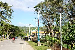
Minor central business district consists of public market, grocery, sari-sari stores, welding and vulcanizing shop, calling office, fish dealer, bakery, barber shop, beauty parlor, billiard hall, coco lumber dealer, junk shop and cable network. Neighborhood centers consists of sari-sari stores, bakery, videoke/bar, mini-sound system, repair shops, piggery, cockpit, bakery, furniture shop, fish dealer, repair and welding shops, copra dealer, among others.

The only industrial business is a mini-containerized ice plant which caters to the needs of rich-fishing activities, and a few rice mills. There are six beach resorts catering to domestic tourism.

Agriculture sector

Infrastructure

Transportation

Balatan bus terminal Balatan Terminal WTR.JPG
Balatan bus terminal

Land transportation refers to the present road circulation system as well as bus, van, and jeepney terminal. Marine transportation facility operates through the existing Balatan Municipal Port of Ragay Gulf.

Utilities

Water supply is distributed under Level III and Level I water systems: Level III is operated by the Balatan Water District; Level I water supply system consisting of either shallow wells, deep wells or improved spring provides alternative water supply source.

Power and electricity:

Communication facilities include the postal services, telegraph and telegraphic transfer service facilities, and telephone services.

Public services

Health

Protective

Facilities for protective services include the police headquarters, police substation, fire station, municipal jail, and Coast Guard.

Social welfare

Existing social welfare organizations or institutions include CVRD'S People Organization, KALIPI (Women) PYM, Federation of Day Care Workers, 4Ps, RincoMESA (Rinconada Movement for Environment and Sustainable Agriculture) and Kalahi-CIDDS.

Education

Don Gregorio Balatan Memorial Institute Don Gregorio Balatan Institute 4.JPG
Don Gregorio Balatan Memorial Institute

References

  1. Municipality of Balatan | (DILG)
  2. "2015 Census of Population, Report No. 3 – Population, Land Area, and Population Density" (PDF). Philippine Statistics Authority. Quezon City, Philippines. August 2016. ISSN   0117-1453. Archived (PDF) from the original on May 25, 2021. Retrieved July 16, 2021.
  3. 1 2 3 Census of Population (2020). "Region V (Bicol Region)". Total Population by Province, City, Municipality and Barangay. Philippine Statistics Authority . Retrieved 8 July 2021.
  4. "PSA Releases the 2021 City and Municipal Level Poverty Estimates". Philippine Statistics Authority. 2 April 2024. Retrieved 28 April 2024.
  5. "Balatan, Camarines Sur: Average Temperatures and Rainfall". World Weather Online. Retrieved 29 October 2017.
  6. Census of Population (2015). "Region V (Bicol Region)". Total Population by Province, City, Municipality and Barangay. Philippine Statistics Authority . Retrieved 20 June 2016.
  7. Census of Population and Housing (2010). "Region V (Bicol Region)" (PDF). Total Population by Province, City, Municipality and Barangay. National Statistics Office . Retrieved 29 June 2016.
  8. Censuses of Population (1903–2007). "Region V (Bicol Region)". Table 1. Population Enumerated in Various Censuses by Province/Highly Urbanized City: 1903 to 2007. National Statistics Office.
  9. "Province of Camarines Sur". Municipality Population Data. Local Water Utilities Administration Research Division. Retrieved 17 December 2016.
  10. "Poverty incidence (PI):". Philippine Statistics Authority. Retrieved December 28, 2020.
  11. "Estimation of Local Poverty in the Philippines" (PDF). Philippine Statistics Authority. 29 November 2005.
  12. "2003 City and Municipal Level Poverty Estimates" (PDF). Philippine Statistics Authority. 23 March 2009.
  13. "City and Municipal Level Poverty Estimates; 2006 and 2009" (PDF). Philippine Statistics Authority. 3 August 2012.
  14. "2012 Municipal and City Level Poverty Estimates" (PDF). Philippine Statistics Authority. 31 May 2016.
  15. "Municipal and City Level Small Area Poverty Estimates; 2009, 2012 and 2015". Philippine Statistics Authority. 10 July 2019.
  16. "PSA Releases the 2018 Municipal and City Level Poverty Estimates". Philippine Statistics Authority. 15 December 2021. Retrieved 22 January 2022.
  17. "PSA Releases the 2021 City and Municipal Level Poverty Estimates". Philippine Statistics Authority. 2 April 2024. Retrieved 28 April 2024.