| Skalkaho Pass | |
|---|---|
Skalkaho Falls near the head of the pass. | |
| Elevation | 7,258 ft (2,212 m) |
| Traversed by | |
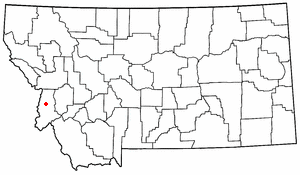
| Location | Ravalli County, Montana, United States |
| Range | Sapphire Mountains |
| Coordinates | 46°14′45″N113°46′24″W / 46.2457°N 113.7734°W Coordinates: 46°14′45″N113°46′24″W / 46.2457°N 113.7734°W |
| Topo map | USGS Skalkaho Pass |

The Skalkaho Pass (Salish: Sq̓x̣q̓x̣ó, "many trails" [1] ), 7,258 feet (2,212 m) above sea level, [2] is a pass in the Sapphire Mountains in southwest Montana traversed by Montana Highway 38. [3]

A mountain pass is a navigable route through a mountain range or over a ridge. Since many of the world's mountain ranges have presented formidable barriers to travel, passes have played a key role in trade, war, and both human and animal migration throughout Earth's history. At lower elevations it may be called a hill pass. The highest vehicle-accessible pass in the world appears to be Mana Pass, located in the Himalayas on the border between India and Tibet, China.

The Sapphire Mountains are a range of mountains located in southwestern Montana in the northwestern United States. From a point near the Clark Fork River and the city of Missoula, they run in a southerly direction for a distance of approximately 60 miles (100 km), making up much of the border between Ravalli County and Granite County. To the west is the Bitterroot Valley, and to the east is Rock Creek. The southern end of the range meets the larger Anaconda Range at West Pintler Peak.
Montana Highway 38, also known as Skalkaho Road or Skalkaho Highway is a state highway in the US state of Montana approximately 53.8 miles (86.6 km) long. It provides seasonal direct land connections between the communities of Hamilton on the west and Phillipsburg and Anaconda on the east via Skalkaho Pass.
Contents
The road over the pass connects the towns of Hamilton in the Bitterroot Valley and Philipsburg in Flint Creek Valley and remains the only direct route between these two important agricultural areas. Originally an Indian route, Highway 38 was built in 1924 to link mountainous mining areas with the agricultural settlements in the valleys. [3] [4] The route is closed during winter due to heavy snowfall.

Hamilton is a city in and the county seat of Ravalli County, Montana, United States. The population was 4,348 at the 2010 census. Significant outlying population growth is shown in the area; the ZIP Code Tabulation Area for Hamilton's ZIP Code, 59840, had a population of 12,979 at the United States Census Bureau 2013 estimate. If the city of Hamilton annexed all the area in its zipcode it would be the 8th largest city in Montana.
The Bitterroot Valley is located in southwestern Montana, along the Bitterroot River between the Bitterroot Range and Sapphire Mountains, in the Northwestern United States.

Philipsburg is a town in and the county seat of Granite County, Montana, United States. The population was 820 at the 2010 census. The town was named after the famous mining engineer Philip Deidesheimer, who designed and supervised the construction of the ore smelter around which the town originally formed.
Skalkaho Falls ( 46°15′28″N113°49′36″W / 46.2577°N 113.8268°W ) is near the top of the pass.