Sentinel Peak is a 8,266-foot (2,519-metre) mountain located in the Glacier Peak Wilderness of Washington's North Cascades. The summit is part of the Ptarmigan Traverse. The mountain is situated on the crest of the Cascade Range, on the shared border of Snohomish County and Chelan County, also straddling the boundary between the Mount Baker-Snoqualmie National Forest and the Wenatchee National Forest. The South Cascade Glacier lies below its western slope, and the LeConte Glacier lies on the northeast slope. Its nearest higher peak is Spire Point, 3.03 mi (4.88 km) to the south-southwest.
Gunn Peak is a 6,244-foot (1,903-metre) mountain summit in Snohomish County, Washington, United States.

Chikamin Peak is a 6,994-foot (2,132-metre) mountain summit located in the Cascade Range, in Kittitas County of Washington state. It is situated within the Alpine Lakes Wilderness on land managed by the Okanogan–Wenatchee National Forest. The mountain's name "Chikamin" derives from Chinook Jargon meaning "money" or "metal", and was submitted by Edmond S. Meany, president of The Mountaineers. This name was officially adopted in 1916 by the U.S. Board on Geographic Names. Chikamin Peak is the highest point of Chikamin Ridge, six miles (9.7 km) northeast of Snoqualmie Pass. Other notable peaks on Chikamin Ridge include Four Brothers and Three Queens. Precipitation runoff from this mountain drains into tributaries of the Yakima River. The Pacific Crest Trail traverses the southwest slope of Chikamin Ridge, and from the trail a scramble up a gully leads to the summit and several alpine lakes including Chikamin Lake and Spectacle Lake.

Indian Head Peak is a prominent 7,448-foot (2,270-metre) mountain summit located in the Glacier Peak Wilderness, in the North Cascades of Washington state. The mountain is situated in Chelan County, on land managed by the Okanogan–Wenatchee National Forest. Its nearest higher neighbor is Kololo Peaks, 3.29 mi (5.29 km) to the north. Indian Head Peak is the second-highest point on Wenatchee Ridge, a subrange which also includes Mount Saul, Whittier Peak, and Mount David. Precipitation runoff from the peak drains into Indian Creek and White River which are tributaries of the Wenatchee River.
Kololo Peaks is an 8,200+ ft mountain located in the Glacier Peak Wilderness of the North Cascades in Washington state. The mountain is situated on the crest of the Cascade Range, on the shared border of Snohomish County and Chelan County, and also straddling the boundary between Mount Baker-Snoqualmie National Forest and Wenatchee National Forest. The nearest higher peak is Glacier Peak, 3.29 mi (5.29 km) to the north. Precipitation runoff and meltwater from the White River Glacier on the southeast slope drains into White River. On the west slope, the White Chuck Glacier drains into the White Chuck River, and the Suiattle Glacier and Honeycomb Glacier on the north and east sides drain into the Suiattle River. Surrounded by these glaciers, Fred Beckey in his Cascade Alpine Guide describes the mountain as being almost a nunatak.
Whittier Peak is a 7,281-foot (2,219-metre) mountain summit located in the Glacier Peak Wilderness of the North Cascades in Washington state. The mountain is situated in Chelan County, in the Wenatchee National Forest. Its nearest higher neighbor is Mount David, 2.26 mi (3.64 km) to the northeast, and Indian Head Peak is 5.2 mi (8.4 km) to the northwest. Precipitation runoff from Whittier Peak drains into tributaries of the Wenatchee River. The peak was named for poet John Greenleaf Whittier by Albert Hale Sylvester, pioneer surveyor, explorer, topographer, and forest supervisor in the Cascades who named thousands of natural features. Other peaks in the immediate vicinity named by Sylvester after poets include Irving Peak, Poe Mountain, Longfellow Mountain, and Bryant Peak.

White Mountain is a 7,043-foot (2,147-metre) mountain located in the Glacier Peak Wilderness of the North Cascades in Washington state. The mountain is situated on the crest of the Cascade Range, on the shared border of Snohomish County and Chelan County, and also straddling the boundary between Mount Baker-Snoqualmie National Forest and Wenatchee National Forest. White Mountain is located 3.04 mi (4.89 km) to the west-southwest of Kololo Peaks, and immediately north of White Pass. The Pacific Crest Trail traverses the south slope of the peak. Precipitation runoff from the peak drains into the White River, White Chuck River, and Sauk River. The mountain's name was suggested by The Mountaineers, and officially adopted in 1918 by the United States Board on Geographic Names.

Luahna Peak is an 8,445-foot (2,574-metre) double summit mountain located in the Glacier Peak Wilderness of the North Cascades in Washington state. The true summit is 8,445 feet in elevation, and the northwest subpeak is 8,369 feet. The mountain is situated in Chelan County, in the Wenatchee National Forest. Luahna Peak is the second highest in the Dakobed Range after Clark Mountain which is 1.04 mi (1.67 km) to the southeast, and Luahna lies 6.95 mi (11.18 km) southeast of Glacier Peak. The Richardson Glacier lies to the southeast of the summit, with the Pilz Glacier and Butterfly Glacier stretching across the northern slope. Precipitation runoff from the peak drains into the White River and Napeequa River, both tributaries of the Wenatchee River. The first ascent of the summit was made on August 13, 1911, by Rodney Glisan, H.H. Prouty, Winthrop Stone, C.W. Whittlesey, all of whom were members of the Mazamas.

Napeequa Peak is an 8,073-foot (2,461-metre) pyramidal mountain summit located in the Glacier Peak Wilderness of the North Cascades in Washington state. The mountain is situated on the crest of the Cascade Range, on the shared border of Snohomish County and Chelan County, also straddling the boundary between the Mount Baker-Snoqualmie National Forest and the Wenatchee National Forest. Its nearest neighbor is Cirque Mountain, 0.3 mi (0.48 km) to the north, and the nearest higher peak is Buck Mountain, 2.56 mi (4.12 km) to the east-southeast. Precipitation runoff from the peak drains east to the headwaters of Napeequa River; or west into the Suiattle River. The mountain's name is taken from the river's name, which was applied by Albert Hale Sylvester (1871-1944), a pioneer surveyor, explorer, topographer, and forest supervisor in the Cascades.

Brahma Peak is a remote 8,079-foot (2,462-metre) mountain summit located on Chiwawa Ridge in the North Cascades, in Chelan County of Washington state. The mountain is situated in the Glacier Peak Wilderness, on land managed by the Wenatchee National Forest. The nearest higher neighbor is Buck Mountain, 1.8 mi (2.9 km) to the north. Brahma and Buck are set on Chiwawa Ridge, and other notable peaks on this ridge include Fortress Mountain, Cirque Mountain, Napeequa Peak, Mount Berge, Bandit Peak, and Chiwawa Mountain. Precipitation runoff from Brahma and meltwater from its glacier remnants drains into Chiwawa River and Napeequa River, both tributaries of the Wenatchee River. Topographic relief is significant since the southwest lavender-colored schist cliffs of this peak rise nearly 4,000 feet above the Napeequa River Valley in approximately one mile.

Cirque Mountain is a 7,966-foot (2,428-metre) mountain summit located in the Glacier Peak Wilderness of the North Cascades in Washington state. The mountain is situated on the crest of the Cascade Range, on the shared border of Snohomish County and Chelan County, also straddling the boundary between the Mount Baker-Snoqualmie National Forest and the Wenatchee National Forest. Its nearest higher peak is Napeequa Peak, 0.3 mi (0.48 km) to the south. The peak is set on Chiwawa Ridge with Napeequa, and other notable peaks on this ridge include Fortress Mountain, Buck Mountain, Brahma Peak, Mount Berge, and Chiwawa Mountain. Topographic relief is significant since the western aspect of the mountain rises 4,000 feet above the Suiattle Valley in approximately 1.5 mi (2.4 km). This mountain has small, unnamed, hanging glaciers in cirques surrounding the summit. Precipitation runoff from the peak and meltwater from the glaciers drains east to the headwaters of Napeequa River; or west into the Suiattle River.

Tenpeak Mountain is an 8,312-foot (2,533-metre) mountain summit located in the Glacier Peak Wilderness of the North Cascades in Washington state. Tenpeak is situated on the crest of the Cascade Range, on the shared border of Snohomish County and Chelan County, also straddling the boundary between the Mount Baker-Snoqualmie National Forest and the Wenatchee National Forest. Its nearest higher neighbor is Luahna Peak, 2.5 mi (4.0 km) to the southeast. Topographic relief is significant since the northern aspect of the mountain rises 4,200 feet above the Suiattle Valley in approximately 1.5 mi (2.4 km). This mountain has small, unnamed, hanging glaciers in cirques surrounding the summit, and the terminus of the Honeycomb Glacier lies below the western base of the mountain. Precipitation runoff from the mountain and meltwater from the glaciers drains south into White River; or north into the Suiattle River. This mountain's descriptive name was suggested by The Mountaineers, and was officially adopted in 1918 by the U.S. Board on Geographic Names. The first ascent was made September 21, 1940, by Lloyd Anderson and Tom Campbell.

Mount Berge is a 7,951-foot (2,423-metre) double-summit granitic mountain located in the Glacier Peak Wilderness of the North Cascades, in Chelan County of Washington state. The mountain is situated along the crest of the Cascade Range, on land managed by the Okanogan–Wenatchee National Forest. Its nearest higher neighbor is Napeequa Peak, 1.2 mi (1.9 km) to the west, and Buck Mountain is 1.7 mi (2.7 km) to the east-southeast. Berge is positioned on Chiwawa Ridge with Buck and Napeequa, and other notable peaks on this ridge include Fortress Mountain, Brahma Peak, Cirque Mountain, Helmet Butte, and Chiwawa Mountain. Precipitation runoff from Berge drains to the headwaters of Napeequa River; or east into tributaries of the Chiwawa River.

Ice Box is an 8,112-foot (2,473-metre) mountain summit located in the Entiat Mountains, a sub-range of the North Cascades, in Chelan County of Washington state. Ice Box ranks as ninth-highest in the Entiat Mountains, and 147th of Washington's highest 200 peaks. Its nearest higher neighbor is Mount Maude, 1.8 miles (2.9 km) to the north, Spectacle Buttes are set 1.9 miles (3.1 km) to the northeast, and Chilly Peak is 1.3 miles (2.1 km) to the southeast. Ice Box is situated 1.25 miles (2.01 km) south of Ice Lakes in the Okanogan-Wenatchee National Forest. Precipitation runoff from the mountain drains east into Ice Creek, or west into Box Creek. This peak is positioned between these two creeks, hence its name.

Bandit Peak is a 7,625-foot (2,324-metre) double-summit granitic mountain located in the Glacier Peak Wilderness of the North Cascades, in Chelan County of Washington state. The mountain is situated east of the crest of the Cascade Range, on land managed by the Okanogan–Wenatchee National Forest. Its nearest higher neighbor is Brahma Peak, 5.9 mi (9.5 km) to the north. Bandit Peak is the ninth-highest peak on Chiwawa Ridge, and other notable peaks on this ridge include Mount Berge, Buck Mountain, Cirque Mountain, Napeequa Peak, Helmet Butte, and Chiwawa Mountain. Precipitation runoff from Bandit Peak drains west into Napeequa River; or east into the Chiwawa River.

Surprise Mountain is a 6,330-foot (1,929-metre) mountain summit located above the southern end of Glacier Lake, in eastern King County of Washington state. It is part of the Wenatchee Mountains, which are a subset of the Cascade Range, and is situated in the Alpine Lakes Wilderness, on land managed by Mount Baker-Snoqualmie National Forest. Precipitation runoff from the mountain drains into Surprise Creek and Deception Creek, both tributaries of the Skykomish River. The nearest higher neighbor is Thunder Mountain, 0.88 mi (1.42 km) to the northeast, and Terrace Mountain is set three miles (4.8 km) to the southwest. The Pacific Crest Trail skirts this peak as it passes through Surprise Gap.

Spark Plug Mountain is a 6,320-foot (1,926-metre) mountain summit located above the western shore of Glacier Lake, in eastern King County of Washington state. It's part of the Wenatchee Mountains, which are a subset of the Cascade Range, and is situated in the Alpine Lakes Wilderness, on land managed by Mount Baker-Snoqualmie National Forest. The nearest higher neighbor is Surprise Mountain, 1.0 mi (1.6 km) to the southeast, and Thunder Mountain is set above the eastern shore of Glacier Lake. The Pacific Crest Trail skirts this lake as it passes between Spark Plug and Thunder. Spark Plug Lake, elevation 5,587-ft, lies immediately below the north aspect of the mountain, and Little Spark Plug is the 6,016-ft peak on the north side of this lake. Precipitation runoff from the mountain drains into Surprise Creek and Deception Creek, both tributaries of the Skykomish River.

Jove Peak is a 6,007 ft (1,830 m) mountain summit located 5 mi (8.0 km) north of Stevens Pass on the common border of Snohomish County with Chelan County in Washington state. This peak is situated 12 mi (19 km) west of Lake Wenatchee, in the Henry M. Jackson Wilderness, on land managed by Mount Baker-Snoqualmie National Forest and Okanogan-Wenatchee National Forest. Jove Peak was named by Albert Hale Sylvester for Jove in association with the mythology-theme of nearby Minotaur and Theseus Lakes which are near Labyrinth Mountain, 2.5 mi (4.0 km) to the northeast. Precipitation runoff from the peak drains west into headwaters of Rapid River, or east into Rainy Creek which is a tributary of the Little Wenatchee River.

Fifth of July Mountain is a 7,696 ft (2,350 m) mountain summit located in the Entiat Mountains, a sub-range of the North Cascades, in Chelan County of Washington state. Fifth of July Mountain is situated in the Glacier Peak Wilderness, on land managed by the Okanogan–Wenatchee National Forest. Its nearest higher neighbor is Chilly Peak, 3.8 miles (6.1 km) to the north-northwest, and Carne Mountain is set 4 miles (6.4 km) to the northwest. Precipitation runoff from the mountain drains west into Rock Creek which is a tributary of the Chiwawa River, or east into Cow Creek, a tributary of the Entiat River. This geographical feature was named by surveyor Albert Hale Sylvester for the day he visited it.

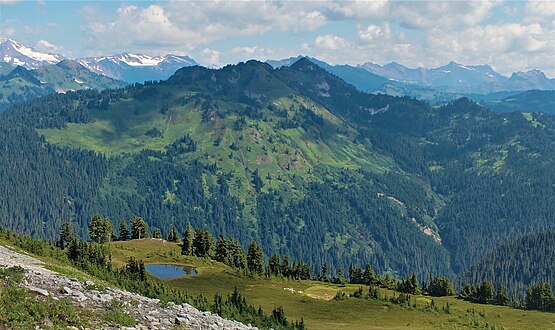
Kodak Peak is a 6,132-foot-elevation (1,869-meter) summit on the border shared by Chelan and Snohomish counties in Washington, United States.