
North Lanarkshire is one of the 32 council areas of Scotland. It borders the north-east of the Glasgow City council area and contains many of Glasgow's suburbs, commuter towns, and villages. It also borders East Dunbartonshire, Falkirk, Stirling, South Lanarkshire, and West Lothian. The council area covers parts of the historic counties of Dunbartonshire, Lanarkshire, and Stirlingshire. The council is based in Motherwell.

Lanarkshire, also called the County of Lanark, is a historic county, lieutenancy area and registration county in the Central Lowlands of Scotland. The county is no longer used for local government purposes, but gives its name to the two modern council areas of North Lanarkshire and South Lanarkshire.

Motherwell is a town and former burgh in North Lanarkshire, Scotland, United Kingdom, south east of Glasgow. It has a population of around 32,120. Historically in the parish of Dalziel and part of Lanarkshire, Motherwell is the headquarters for North Lanarkshire Council. Geographically the River Clyde separates Motherwell from Hamilton to the west whereas the South Calder Water separates Motherwell from Carfin to the north-east and New Stevenston and Bellshill towards the north.
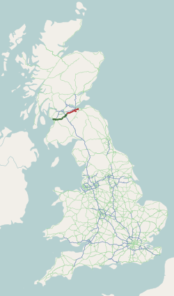
The A71 is a major road in Scotland linking Edinburgh with Lanarkshire and Ayrshire. It adjoins the Livingston Bypass A899.

The Rotten Calder is a river to the east of East Kilbride, South Lanarkshire, Scotland and along with the Rotten Burn it forms the southern and western boundaries of Blantyre.

Wishaw is a large town in North Lanarkshire, Scotland, on the edge of the Clyde Valley, 15 miles (24 km) south-east of Glasgow city centre. The Burgh of Wishaw was formed in 1855 within Lanarkshire. it formed a joint large burgh with its neighbour Motherwell from 1920 until its dissolution when Scottish local authorities were restructured in 1975, and was then in Motherwell district within the Strathclyde region until 1996. The town is part of the Motherwell and Wishaw constituency. It has the postal code of ML2 and the dialling code 01698.

Cleland is a village near Motherwell and Wishaw in North Lanarkshire, Scotland. As of 2018, it has a population of about 3,000. The village has a strong coal mining heritage, and is a typical example of a working class village in North Lanarkshire and the Glasgow area. Due to its location, despite being at the heart of North Lanarkshire, the village is isolated, geographically and culturally, from surrounding towns such as Motherwell, Shotts and Wishaw.

Wishaw Football Club is a Scottish football club based in the town of Wishaw, North Lanarkshire. The club currently competes in the West of Scotland League Second Division.
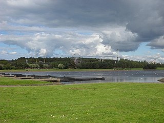
Strathclyde Country Park is a country park located on the outskirts of Motherwell in North Lanarkshire, Scotland, named after the former Strathclyde region of Scotland. It is often commonly referred to as Strathclyde, or simply Strathy.
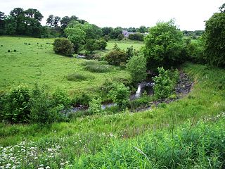
The North Calder Water is a river in North Lanarkshire, Scotland. It flows for 12 miles (19 km) from the Black Loch via the Hillend Reservoir, Caldercruix, Plains, Airdrie, Calderbank, Carnbroe and Viewpark to the River Clyde at Daldowie, south-east of Glasgow. For the last two miles of its course, it forms part of the boundary between North Lanarkshire and Glasgow. The name Calder is thought to be Brythonic and to mean 'hard cold flowing' water.

Ravenscraig is a village and new town, located in North Lanarkshire, Scotland, around 1½ miles east of Motherwell. Ravenscraig was formerly the site of Ravenscraig steelworks; once the largest hot strip steel mill in western Europe, the steelworks closed in 1992, and is now almost totally demolished.

McKindless was a Scottish bus operator, operating a number of bus routes throughout Greater Glasgow, Scotland. The company was based in Newmains and had a depot in Parkhead.

Newmains is a village and former mining community on the eastern edge of Wishaw, North Lanarkshire, Scotland, 18 miles (29 km) south-east of Glasgow. Although it is considered by the local authority to have a town centre in its own right.
Bothwellhaugh was a Scottish coal mining village housing Hamilton Palace Colliery workers and their families. Locals referred to the village as The Pailis. It was located near to the towns of Motherwell, Bellshill and Hamilton in Lanarkshire, being occupied from the mid-1880s until it was demolished in 1965.

Bothwellhaugh Roman Fort is a site now located within Strathclyde Country Park in North Lanarkshire, Scotland. It is east of where the South Calder Water flows into Strathclyde Loch. The fort is a scheduled monument.

Morningside is a small village in North Lanarkshire, Scotland. It is located around 3⁄4 mile (1.2 km) south of Newmains, and 2+1⁄4 miles (3.6 km) east of Wishaw. Morningside's population is 1,090 people. It is a former coal mining village, and formerly had two railway stations. Today, Morningside mainly consists of a modern housing estate with more older houses along the main road.
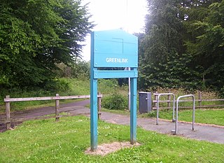
The Greenlink Cycle Path is a cycle path in North Lanarkshire that is a direct route running from Strathclyde Country Park to Motherwell Town Centre. The path is 7 kilometres in length. The Greenlink project was established in 2005, and was part of a 3-year partnership between many organisations, such as North Lanarkshire Council, Scottish Natural Heritage and Forestry Commission Scotland.
The Caledonian Railway branches in North Lanarkshire built on the Caledonian Railway main line, which opened in 1848. In the following years the considerable increase of iron production and coal extraction in North Lanarkshire led to a progressive expansion of branch lines in the area between the eastern margin of Glasgow and Bellside in the east, and between Coatbridge, Airdrie and Motherwell. Mineral traffic was dominant and for some years passenger operation followed the construction of some of the mineral connections. In 1861 the Rutherglen and Coatbridge line was opened, extended later to Airdrie, rivalling the established Monkland Railways route. In 1869 the connection from Cleland to Midcalder was opened, connecting mineral sites but also forming a new passenger route to Edinburgh.
 ,
,