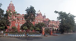
The Eastern Railway is among the 19 zones of the Indian Railways. Its headquarters is at Fairley Place, Kolkata and comprises four divisions: Howrah, Malda, Sealdah, and Asansol. Each division is headed by a Divisional Railway Manager (DRM). The name of the division denotes the name of the city where the divisional headquarters is located. Eastern Railway oversees the largest and second largest rail complexes in the country, Howrah Junction and Sealdah railway station, and also contains the highest number of A1 and A Category Stations like Howrah, Malda Town, Sealdah, Asansol, Kolkata, Durgapur, Barddhaman, Rampurhat Junction, Bhagalpur,Jamalpur, Jasidih, Bandel and Naihati. Eastern Railways operates India's oldest train, Kalka Mail.
The South Eastern Railway is one of the 19 railway zones in India. It is headquartered at Garden Reach, Kolkata, West Bengal, India. It comprises Adra railway division, Chakradharpur railway division, Kharagpur railway division and Ranchi railway division.
Kolkata the Capital of the Indian state of West Bengal has a good transportation system. Kolkata's transport system is diverse, with a mix of modern and traditional modes of transport catering to the city's large population.

Chitpur is a neighbourhood in North Kolkata in Kolkata district in the Indian state of West Bengal. Sometimes, the entire area along Chitpur Road is referred to as Chitpur, although the various localities have distinctive names.
Hindmotor is a neighbourhood in Uttarpara of Hooghly district in the Indian state of West Bengal. It is a part of the area covered by Kolkata Metropolitan Development Authority (KMDA).

Ultadanga is one of the most crowded junctions in North Kolkata. The place is located at the north-eastern fringe of the city and marks the limit of Kolkata district. Prominent places in Ultadanga are Telenga Bagan and Muchi Bazar.

Liluah is a neighbourhood in Howrah of Howrah district in the Indian state of West Bengal. It is a part of the area covered by Kolkata Metropolitan Development Authority (KMDA). Liluah has a railway junction, which is the first station after Howrah station under the Eastern Railway (India). Its history dates back to the British era when the Liluah Carriage and wagon Workshop was set up to release pressure off Howrah.

Garfa is a neighborhood of Jadavpur in South 24 Parganas district in West Bengal,India. This area is surrounded by Haltu, Nandi bagan, Jadavpur and Kalikapur. Starting as a refugee colony within Jadavpur, Garfa is now primarily a residential area within Kolkata.

Picnic Garden is a neighbourhood of East Kolkata in the Indian state of West Bengal.

Tiljala is a neighbourhood of East Kolkata, in West Bengal, India.

Garden Reach is a neighbourhood of Kolkata in West Bengal, India. It is situated in the south-western part of Kolkata on the eastern banks of the Hooghly River. Localities within Garden Reach include Metiabruz, BNR Colony, Bandhabartala, Bartala, Badartala, Rajabagan and Santoshpur.

Badartala is a suburb locality of Kolkata in West Bengal, India. It is situated in the south-western fringes of Kolkata near the bank of Hooghly River. Adjoined neighbourhoods are Rajabagan (east), Metiabruz and Akra Phatak (south). Ayub Nagar Basti, Kanchantala, Bagdipara, Nadial, Birjunala, Jeliapara, Kachari Bari, Waris Nagar, are some sub localities of the neighborhood.

Bartala is a locality of Kolkata in West Bengal, India. It is situated in the south-western part of Kolkata near to Metiabruz and Garden Reach on the east and Akra Phatak on the west. The area is populated with mainly Muslims. It has a post office named Bartala Post office with PIN 700018.

Rajabagan is a locality and a dockyard in the Garden Reach neighbourhood of Kolkata in West Bengal, India. It is situated in the south-western part of Kolkata near the bank of the Hooghly river and is situated between Metiabruz (east) and Badartala (west).
Ward No. 80, Kolkata Municipal Corporation is an administrative division of Kolkata Municipal Corporation in Borough No. 9, covering parts of Kidderpore, Garden Reach, Tikiapara, Alipore Mint Colony, Brace Bridge, Taratala neighbourhoods in South Kolkata, in the Indian state of West Bengal.
Ward No. 138, Kolkata Municipal Corporation is an administrative division of Kolkata Municipal Corporation in Borough No. 15, covering parts of Metiabruz (Panchpara-Kashyappara-Jabarhat) in Garden Reach neighbourhood in the Indian state of West Bengal.
Ward No. 141, Kolkata Municipal Corporation is an administrative division of Kolkata Municipal Corporation in Borough No. 15, covering parts of Badartala and Rajabagan in Garden Reach neighbourhood in the Indian state of West Bengal.

Haridevpur is a neighborhood in Tollygunge area of Southern Kolkata in West Bengal, India. The area is situated off the Mahatma Gandhi Road and is a part of Behala Purba and Tollygunge assembly constituency.

Dum Dum Park is a neighbourhood in South Dumdum of North 24 Parganas district in the Indian state of West Bengal. It is a part of the area covered by Kolkata Metropolitan Development Authority (KMDA).

The Nature Park of India is a reserved area administered by the Government of India. It is located in the Garden Reach area of Kolkata.