
Year 1287 (MCCLXXXVII) was a common year starting on Wednesday of the Julian calendar.

The confederation of Cinque Ports is a historic group of coastal towns in south-east England – predominantly in Kent and Sussex, with one outlier (Brightlingsea) in Essex. The name is Old French, meaning "five harbours", and alludes to the original five members. At its peak in the Late Middle Ages, the confederation included over 40 members. There are now a total of 14 members: five "head ports", two "ancient towns" and seven "limbs".

Romney Marsh is a sparsely populated wetland area in the counties of Kent and East Sussex in the south-east of England. It covers about 100 square miles (260 km2). The Marsh has been in use for centuries, though its inhabitants commonly suffered from malaria until the 18th century. Due to its location, geography and isolation, it was a smuggler's paradise between the 1600s and 1800s. The area has long been used for sheep pasture: Romney Marsh sheep are considered one of the most successful and important sheep breeds. Criss-crossed with numerous waterways, and with some areas lying below sea level, the Marsh has over time sustained a gradual level of reclamation, both through natural causes and by human intervention.

The River Brede is an English river in East Sussex. It flows into the Rock Channel and then onto the River Rother at Rye, Sussex. It takes its name from the village of Brede, which lies between Hastings and Tenterden.

The River Rother flows for 35 miles (56 km) through the English counties of East Sussex and Kent. Its source is near Rotherfield in East Sussex, and its mouth is on Rye Bay, part of the English Channel. Prior to 1287, its mouth was further to the east at New Romney, but it changed its course after a great storm blocked its exit to the sea. It was known as the Limen until the sixteenth century. For the final 14 miles (23 km), the river bed is below the high tide level, and Scots Float sluice is used to control levels. It prevents salt water entering the river system at high tides, and retains water in the river during the summer months to ensure the health of the surrounding marsh habitat. Below the sluice, the river is tidal for 3.7 miles (6.0 km).

New Romney is a market town in Kent, England, on the edge of Romney Marsh, an area of flat, rich agricultural land reclaimed from the sea after the harbour began to silt up. New Romney, one of the original Cinque Ports, was once a sea port, with the harbour adjacent to the church, but is now more than a mile from the sea. A mooring ring can still be seen in front of the church. It is the headquarters of the Romney, Hythe and Dymchurch Railway.

Rye is a town and civil parish in the Rother district of East Sussex, England, two miles from the sea at the confluence of three rivers: the Rother, the Tillingham and the Brede. An important member of the mediaeval Cinque Ports confederation, it was at the head of an embayment of the English Channel, and almost entirely surrounded by the sea.

Winchelsea is a town in the county of East Sussex, England, located between the High Weald and the Romney Marsh, approximately 2 miles (3.2 km) south west of Rye and 7 miles (11 km) north east of Hastings. The current town, which was founded in 1288, replaced an earlier town of the same name, known as Old Winchelsea, that was lost to coastal erosion in the late medieval period. Winchelsea is part of the civil parish of Icklesham.
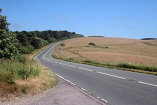
The A259 is a road on the south coast of England passing through Hampshire, West Sussex, East Sussex, and Kent, and is the longest Zone 2 A road in Great Britain. The main part of the road connects Brighton, Eastbourne, Hastings, Rye, and Folkestone.
Appledore is a village and civil parish in the Ashford District of Kent, England. The village centre is on the northern edge of the Romney Marsh, 12 miles (19 km) south-west of Ashford town. The northerly part of this village is Appledore Heath.
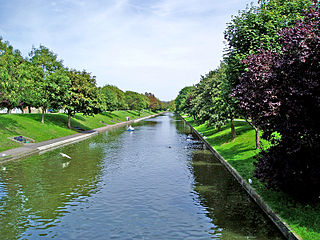
The Royal Military Canal is a canal running for 28 miles (45 km) between Seabrook near Folkestone and Cliff End near Hastings, following the old cliff line bordering Romney Marsh, which was constructed as a defence against the possible invasion of England during the Napoleonic Wars.
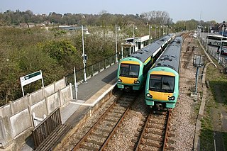
The Marshlink line is a railway line in South East England. It runs from Ashford, Kent via Romney Marsh, Rye and the Ore Tunnel to Hastings where it connects to the East Coastway line towards Eastbourne. Services are provided by Southern.

Hastings and Rye is a constituency in East Sussex represented in the House of Commons of the UK Parliament since 2019 by Sally-Ann Hart of the Conservative Party. From 2010 until 2019, it was represented by Amber Rudd, who served as Secretary of State for Energy and Climate Change, Minister for Women and Equalities, Secretary of State for the Home Department and Secretary of State for Work and Pensions under the governments of David Cameron, Theresa May and Boris Johnson.

Fairlight is a village in East Sussex, England within Rother district, three miles (5 km) to the east of Hastings. Fairlight is also the name of the civil parish forming part of the Rother district which includes the villages of Fairlight and Fairlight Cove. The village of Fairlight lies on a minor road between Ore, Pett and Winchelsea.
Icklesham is a village and civil parish in the Rother district of East Sussex, England. The village is located about six miles (10 km) east of Hastings, on the main A259 Hastings to Rye road. The surrounding countryside is a made up of fields, hills, woods, orchards and vineyards.

Camber is a village and civil parish in the Rother district of East Sussex, England, 3 miles (4.8 km) south-east of Rye. The village is located behind the sand dunes that occupy the estuary of the River Rother, where the seaside settlement of Camber Sands is situated.

The Saxon Shore Way is a long-distance footpath in England. It starts at Gravesend, Kent, and traces the coast of South-East England as it was in Roman times as far as Hastings, East Sussex, 163 miles (262 km) in total. This means that around Romney Marsh the route runs significantly inland from the modern coastline.
Winchelsea Beach is a seaside village in the parish of Icklesham in the Rother district of East Sussex, England. The village is located about ten miles (15 km) east of Hastings, and about 1.5 miles (2 km) south east of Winchelsea.

The River Tillingham flows through the English county of East Sussex. It meets the River Brede and the eastern River Rother near the town of Rye. A navigable sluice controlled the entrance to the river between 1786 and 1928, when it was replaced by a vertical lifting gate which was not navigable. The river provided water power to operate the bellows of an iron works at Beckley Furnace, used to make cannons for the Royal Navy between 1578 and 1770, when it became uneconomic, and a water mill which replaced it, until that burnt down in 1909. The lower reaches supported a thriving shipbuilding industry from the early nineteenth century onwards, and although on a smaller scale, was still doing so in 2000.
Events from the 1280s in England.
