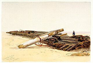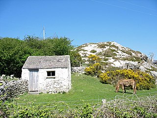
HMS Conway was a naval training school or "school ship", founded in 1859 and housed for most of her life aboard a 19th-century wooden ship of the line. The ship was originally stationed on the Mersey near Liverpool, then moved to the Menai Strait during World War II. While being towed back to Birkenhead for a refit in 1953, she ran aground and was wrecked, and later burned. The school moved to purpose-built premises on Anglesey where it continued for another twenty years.

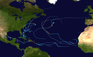
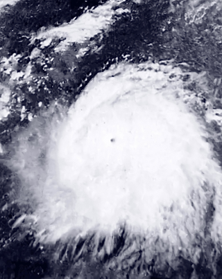
The 1967 Atlantic hurricane season was the first Atlantic hurricane season to be part of the modern-day satellite era. With 13 named storms, it was an above average season in terms of named storms, slightly above average in terms of hurricanes (6), and below average in terms of major hurricanes, with only one; Beulah. The season began on June 1, 1967, and ended on November 30, 1967, which delimits the time boundaries when tropical cyclones in the North Atlantic Ocean typically form. The first depression originated on June 10, and the final storm – Heidi – lost tropical characteristics on October 31.

Hurricane Donna, known in Puerto Rico as Hurricane San Lorenzo, was the strongest hurricane of the 1960 Atlantic hurricane season, and caused severe damage to the Lesser Antilles, the Greater Antilles, and the East Coast of the United States, especially Florida, in August–September. The fifth tropical cyclone, third hurricane, and first major hurricane of the season, Donna developed south of Cape Verde on August 29, spawned by a tropical wave to which 63 deaths from a plane crash in Senegal were attributed. The depression strengthened into Tropical Storm Donna by the following day. Donna moved west-northwestward at roughly 20 mph (32 km/h) and by September 1, it reached hurricane status. Over the next three days, Donna deepened significantly and reached maximum sustained winds of 130 mph (210 km/h) on September 4. Thereafter, it maintained intensity as it struck the Lesser Antilles later that day. On Sint Maarten, the storm left a quarter of the island's population homeless and killed seven people. An additional five deaths were reported in Anguilla, and there were seven other fatalities throughout the Virgin Islands. In Puerto Rico, severe flash flooding led to 107 fatalities, 85 of them in Humacao alone.

Hurricane Hattie was the strongest and deadliest tropical cyclone of the 1961 Atlantic hurricane season, reaching peak intensity as a Category 5 hurricane. The ninth tropical storm, seventh hurricane, fifth major hurricane, and second Category 5 of the season, Hattie originated from an area of low pressure that strengthened into a tropical storm over the southwestern Caribbean Sea on October 27. Moving generally northward, the storm quickly became a hurricane and later major hurricane the following day. Hattie then turned westward west of Jamaica and strengthened into a Category 5 hurricane, with maximum sustained winds of 165 mph (270 km/h). It weakened to Category 4 before making landfall south of Belize City on October 31. The storm turned southwestward and weakened rapidly over the mountainous terrain of Central America, dissipating on November 1.

The 1952 Atlantic hurricane season was the last Atlantic hurricane season in which tropical cyclones were named using the Joint Army/Navy Phonetic Alphabet. It was a near normal Atlantic hurricane season, although it was the least active since 1946. The season officially started on June 15; however, a pre-season unnamed storm formed on Groundhog Day, becoming the only storm on record in the month of February. The other six tropical cyclones were named using the Joint Army/Navy Phonetic Alphabet, the first of which formed on August 18. The final storm of the season dissipated on October 28, two and a half weeks before the season officially ended on November 15.
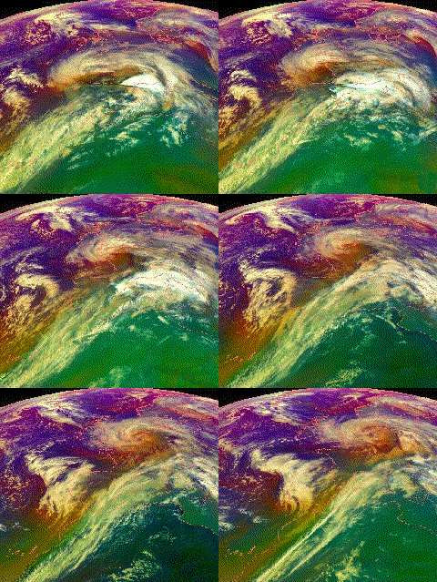
The Great Gale of 1880 was an intense extratropical cyclone that impacted the Northwest United States on January 9, 1880.
The greatest snowstorm, and perhaps overall worst storm in SW Washington and NW Oregon history, was that dubbed the ‘Storm King’ event of January 9, 1880.... Little data is available for the so-called ‘Storm King’ of January 1880, but it appears the storm center came ashore just south of Astoria, Oregon, on January 9th when a barometric pressure of 28.45” was registered in the town. Portland bottomed out at 28.56.

The Royal Charter was a steam clipper which was wrecked off the beach of Porth Helaeth in Dulas Bay on the northeast coast of Anglesey, Wales on 26 October 1859. About 450 lives were lost, the highest death toll of any shipwreck on the Welsh coast. The precise number of dead is uncertain as the complete passenger list was lost in the wreck, although an incomplete list is retained in the Victorian Archives Centre in Victoria, Australia. The Royal Charter was the most prominent among about 200 ships wrecked by the Royal Charter Storm.
The Rothsay Castle was a paddle steamer built in 1816 for service on the River Clyde, Scotland, and was later transferred to Liverpool, England, where she was used for day trips along the coast of North Wales. She was shipwrecked on the Lavan Sands at the eastern end of the Menai Strait, North Wales, in 1831, with the loss of 130 lives.

Lligwy Bay is a bay of the Welsh island of Anglesey.

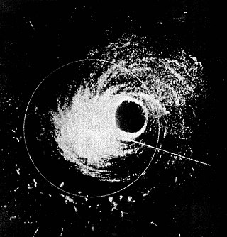
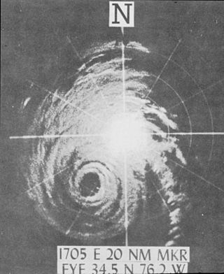
Hurricane Helene was the most intense tropical cyclone of the 1958 Atlantic hurricane season. The eighth tropical storm and fourth hurricane of the year, Helene was formed from a tropical wave east of the Lesser Antilles on September 21, 1958. Moving steadily westward, the storm slowly intensified, attaining hurricane strength on September 24. As conditions became increasingly favorable for tropical cyclone development, Helene began to rapidly intensify. Nearing the United States East Coast, the hurricane quickly attained Category 4 intensity on September 26, before it subsequently reached its peak intensity with maximum sustained winds of 150 mph (240 km/h) and a minimum barometric pressure of 930 mbar. The intense hurricane came within 10 mi (16 km) of Cape Fear, North Carolina before recurving out to sea. Accelerating northward, Helene gradually weakened, and transitioned into an extratropical cyclone as it passed over Newfoundland on September 29. Helene's extratropical remnants traversed eastwards across the Atlantic Ocean before dissipating near Great Britain on October 4.
The Uncommercial Traveller is a collection of literary sketches and reminiscences written by Charles Dickens, published in 1860–1861.

European windstorms are powerful extratropical cyclones which form as cyclonic windstorms associated with areas of low atmospheric pressure. They can occur throughout the year, but are most frequent between October and March, with peak intensity in the winter months. Deep areas of low pressure are common over the North Atlantic, and occasionally start as nor'easters off the New England coast. They frequently track across the North Atlantic Ocean towards the north of Scotland and into the Norwegian Sea, which generally minimizes the impact to inland areas; however, if the track is further south, it may cause adverse weather conditions across Central Europe, Northern Europe and especially Western Europe. The countries most commonly affected include the United Kingdom, Ireland, the Netherlands, Norway, Germany, the Faroe Islands and Iceland.

The 1933 Tampico hurricane was a deadly tropical cyclone late in the 1933 Atlantic hurricane season. It was the second system of the season to reach Category 5‑equivalent intensity on the Saffir–Simpson Hurricane Scale. It developed on September 16 near the Lesser Antilles, and slowly intensified while moving across the Caribbean Sea. Becoming a hurricane on September 19, its strengthening rate increased while passing south of Jamaica. Two days later, the hurricane reached peak winds, estimated at 160 mph (260 km/h). After weakening, it made landfall on the Yucatán Peninsula, destroying several houses. One person was killed offshore Progreso, Yucatán during the storm.

Ellen Southard was an American full-rigged merchant ship from Bath, Maine that was built in 1863 by prominent shipbuilder T.J. Southard. She plied international trade routes for twelve years, calling at ports as far away as Sydney.

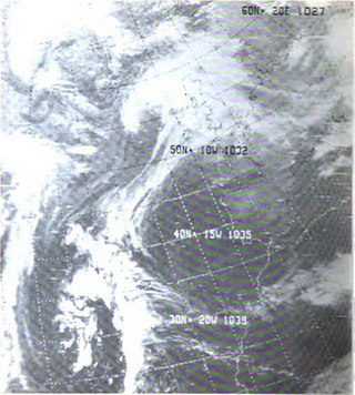
The Gale of January 1976, widely known as the "Capella" storm in Germany and the Ruisbroek flood in Belgium, was one in a series of extratropical cyclones and storm surges, which occurred over January 1976. The gale of 2–5 January 1976 resulted in severe wind damage across western and central Europe and coastal flooding around the southern North Sea coasts. At the time, this was the most severe storm of the century over the British Isles. Total fatalities reached 82 across Europe, although a figure of 100 is given by the World Meteorological Organization. Of these 24 were reported in Britain and 4 in Ireland. Overall losses of US$1.3 billion were incurred, with insured losses standing at US$500 million (1976).

The 1926 Louisiana hurricane caused widespread devastation to the United States Gulf Coast, particularly in Louisiana. The third tropical cyclone and hurricane of the 1926 Atlantic hurricane season, it formed from a broad area of low pressure in the central Caribbean Sea on August 20. Moving to the northwest, the storm slowly intensified, reaching tropical storm strength on August 21 and subsequently attaining hurricane strength after passing through the Yucatán Channel. The hurricane steadily intensified as it recurved northwards in the Gulf of Mexico, before reaching peak intensity just prior to landfall near Houma, Louisiana on August 25 with winds of 115 mph (185 km/h). After moving inland, the tropical cyclone moved to the west and quickly weakened, before dissipating on August 27.

Llanddyfnan is a village and community in Anglesey, Wales, located 3.5 miles (5.6 km) north east of Llangefni, 6.6 miles (10.6 km) north west of Menai Bridge and 7.1 miles (11.4 km) west of Beaumaris.

Typhoon Rita, known in the Philippines as Typhoon Kading, was the most powerful tropical cyclone during the 1978 Pacific typhoon season and one of the most intense tropical cyclones on record. A long-lived and destructive tropical cyclone, Rita began its journey east of the Marshall Islands and rapidly moved westwards, becoming a typhoon on October 20. Rita continued rapid intensification and attained super typhoon status and later an atmospheric pressure of 878 mbar (25.9 inHg) on October 25. Rita struck the Philippines overnight on October 26 and entered the South China Sea as a minimal typhoon. Rita caused extreme damage and more than 300 deaths.

The 1935 Jérémie hurricane, commonly referred to as the 1935 Haiti hurricane, was a highly destructive and catastrophic tropical cyclone that impacted the Greater Antilles and Honduras in October 1935, killing well over 2,000 people. Developing on October 18 over the southwestern Caribbean Sea, the storm proceeded to strike eastern Jamaica and southeastern Cuba while overwhelming southwestern Haiti in a deluge of rain. The hurricane—a Category 1 at its peak—completed an unusual reversal of its path on October 23, heading southwestward toward Central America. Weakened by its interaction with Cuba, the storm soon regained strength and made its final landfall near Cabo Gracias a Dios in Honduras on October 25. The cyclone weakened upon moving inland and dissipated two days later.

Typhoon Dot was a strong tropical cyclone that made landfalls on Luzon and near Hong Kong in October 1964. It was the fifth typhoon to impact Hong Kong during the active 1964 Pacific typhoon season, and prompted the issuance of the No. 10 typhoon signal from the Royal Observatory in Hong Kong—the highest warning possible. The storm's precursor disturbance formed west of Pohnpei on October 3 and tracked towards the west, becoming a tropical storm by October 6. Gradually strengthening, Dot moved towards the west-northwest, northwest, and then curved west, leading to a landfall at typhoon intensity on Luzon on October 9. A freighter with 32 crewmembers went missing west of the island after passing through the typhoon and was never recovered.


