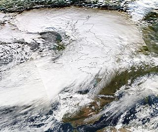
The United Kingdom straddles the higher mid-latitudes between 49°and 61°N on the western seaboard of Europe. Since the UK is always in or close to the path of the polar front jet stream,frequent changes in pressure and unsettled weather are typical. Many types of weather can be experienced in a single day. The basic climate of the UK annually is wet and cool in winter,spring,and autumn with frequent cloudy skies,and drier and cool to mild in summer.

Weather and climate in the country of Scotland is mostly temperate and oceanic,and tends to be very changeable,but rarely extreme. The country is warmed by the Gulf Stream from the Atlantic,and given its northerly latitude it is much warmer than areas on similar latitudes,for example Kamchatka in Russia or Labrador in Canada,or Fort McMurray,Canada. Scots sometimes describe weather which is grey and gloomy using the Scots language word dreich.

Hurricane Charley was the second hurricane to threaten the East Coast of the United States within a year's timeframe,after Hurricane Gloria of 1985. The third tropical storm and second hurricane of the season,Charley formed as a subtropical low on August 13 along the Florida panhandle. After moving off the coast of South Carolina,the system transitioned into a tropical cyclone and intensified into a tropical storm on August 15. Charley later attained hurricane status before moving across eastern North Carolina. It gradually weakened over the north Atlantic Ocean before transitioning into an extratropical cyclone on August 20. Charley's remnants remained identifiable for over a week,until after crossing Ireland and Great Britain they dissipated on August 30.
Floods in the United States are generally caused by excessive rainfall,excessive snowmelt,and dam failure. Below is a list of flood events that were of significant impact to the country during the 20th century,from 1900 through 1999,inclusive.

The British Isles are an archipelago off the northwest coast of Europe,consisting of the islands of Great Britain and Ireland along with smaller surrounding ones. Its position allows dry continental air from Eurasia to meet wetter air from the Atlantic Ocean,which causes the weather to be highly variable,often changing many times during the day. It is defined as a temperate oceanic climate,or Cfb on the Köppen climate classification system. It is significantly warmer than other regions on the same latitude generally thought to be due to the warmth provided by the Gulf Stream;however there is an alternative hypothesis that it is caused by the Rocky Mountains and the heat storing capabilities of the North Atlantic Ocean. Temperatures do not often switch between great extremes,with warm summers and mild winters.

The global weather activity of 2010 includes major meteorological events in the Earth's atmosphere during the year,including winter storms,hailstorms,out of season monsoon rain storms,extratropical cyclones,gales,microbursts,flooding,rainstorms,tropical cyclones,and other severe weather events.

The Autumn of 2000 was the wettest recorded in the United Kingdom since records began in 1766. Several regions of Atlantic Europe from France to Norway received double their average rainfall and there were severe floods and landslides in the southern Alps. In October and November 2000 a successive series of extratropical cyclones caused severe flooding across the UK.

The 2012 Great Britain and Ireland floods were a series of weather events that affected parts of Great Britain and Ireland periodically during the course of 2012 and on through the winter into 2013. The beginning of 2012 saw much of the United Kingdom experiencing droughts and a heat wave in March. A series of low pressure systems steered by the jet stream brought the wettest April in 100 years,and flooding across Britain and Ireland. Continuing through May and leading to the wettest beginning to June in 150 years,with flooding and extreme events occurring periodically throughout Britain and parts of Atlantic Europe.

The Spanish Plume is a weather pattern in which a plume of warm air moves from the Iberian plateau or the Sahara to northwestern Europe,causing thunderstorms. This meteorological pattern can lead to extreme high temperatures and intense rainfall during the summer months,with potential for flash flooding,damaging hail,and tornado formation. Some of these intense thunderstorms are formed from thermal lows,which are also known as heat lows. Thermal lows can be semipermanent features around some parts of Europe,particularly in the summer season. These thermal lows can be developed or created around Spain,Portugal,France,etc.,during the summer season because of the intense heat. Thermal low pressure can be located around the world,particularly in the summer or in tropical regions.

Cyclone Dirk was a large and deep European windstorm that affected Western Europe from the Iberian Peninsula to Iceland from 22 December 2013.

Storm Desmond was an extratropical cyclone and fourth named storm of the 2015–16 UK and Ireland windstorm season,notable for directing a plume of moist air,known as an atmospheric river,which brought record amounts of orographic rainfall to upland areas of northern Atlantic Europe and subsequent major floods.

The 2015–2016 Great Britain and Ireland floods were a series of heavy rainfall events which led to flooding during the winter of late 2015 and early 2016. 11 named storms produced record level rainfall from November 2015 - March 2016 in both monthly and seasonal accumulation records.

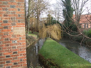
The 1920 Louth flood was a severe flash flooding event in the Lincolnshire market town of Louth which occurred 29 May 1920,resulting in 23 fatalities in 20 minutes. It has been described as one of the most significant flood disasters in Britain and Ireland during the 20th century.

Chew Stoke Flood was a heavy rain event and severe flash flood which occurred on 10 July 1968,affecting Somerset and Southwest England in particular the Chew Valley and some areas of Bristol,notably Bedminster. The River Chew suffered a major flood in 1968 with serious damage to towns and villages along its route,including sweeping away the bridge at Pensford.
The 2018–2019 European windstorm season was the fourth instance of seasonal European windstorm naming in Europe. Most storms form between September and March. The first named storm,Ali,affected primarily the United Kingdom and Ireland on 19 September 2018.

The July 1968 United Kingdom thunderstorms were the most severe dust fall thunderstorms in the British Isles for over 200 years. A layer of mineral dust blowing north from the Sahara met cold,wet air over the British Isles,resulting in thick,dense clouds and severe thunderstorms across most of England and Wales. These clouds completely blotted out the light in some areas and the rain and hail resulted in property damage and flooding,and at least four people were killed. During the storm,Leeming Bar in North Yorkshire saw 35.7 millimetres (1.41 in) of rain in under 10 minutes –a UK record until 2003.

Storm Dennis was a European windstorm which,in February 2020,became one of the most intense extratropical cyclones ever recorded,reaching a minimum central pressure of 920 millibars. The thirteenth named storm of the 2019–20 European windstorm season,Dennis affected the Republic of Ireland and the United Kingdom less than a week after Storm Ciara,exacerbating the impacts from that storm amidst ongoing flooding in the latter country.

Storm Alex was a powerful early-season extratropical cyclone that was particularly notable for its extreme flooding around the Mediterranean. Alex caused widespread wind and flooding damage across Europe,and at least 16 fatalities,with one more person missing. Alex was the first named storm in the 2020–21 European windstorm season.
The 2024–2025 European windstorm season is the tenth and current season. It comprises a year,from 1 September to 31 August,except shifted a month later in the Eastern Mediterranean Group. The storm names were announced four days before the start of the season on 28 August 2024. This was the sixth season in which the Netherlands participated alongside the United Kingdom's Met Office and Ireland's Met Éireann in the western group. The Portuguese,Spanish,French and Belgian meteorological agencies collaborated for the eighth time,joined by Luxembourg's agency. This is the fourth season of the Eastern Mediterranean and Central Mediterranean groups,in which they comprised respectively:Greece,Israel and Cyprus;and Italy,Slovenia,Croatia,Montenegro,North Macedonia and Malta.


