Spiritwood is a town in the boreal forest of central Saskatchewan, Canada with a population of approximately 1,000. Its location is 125 km west of Prince Albert and about 110 km northeast of North Battleford at the junction of Highway 3, Highway 24 and Highway 376. As the largest community in the region, the community functions as the major supply, service, and administrative headquarters for the trading area population which includes several First Nation reserves including Witchekan Lake, Big River and Pelican Lake.
Arcola Airport is located adjacent to Arcola, Saskatchewan, Canada. Burton Ag Air Ltd. operates a fixed base at the airport.
Canora Airport is located adjacent to Canora, Saskatchewan, Canada.
Cudworth Municipal Airport is located adjacent to Cudworth, Saskatchewan, Canada.
Cut Knife Airport, formerly TC LID: CKU4, was located adjacent to Cut Knife, Saskatchewan, Canada.
Davin Lake Airport, formerly TC LID: CKW6, was located adjacent to Davin Lake Lodge, a fly-in fishing lodge in northern Saskatchewan, Canada.
Estevan (South) Airport TC LID: CKK4 was a registered aerodrome located 5 nautical miles south of Estevan, Saskatchewan, Canada.
Key Lake Airport is a regional airport near the Key Lake mine in Saskatchewan, Canada.
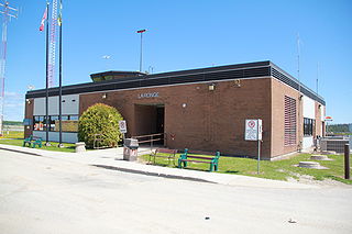
La Ronge Airport is located 2 nautical miles north-east of La Ronge, Saskatchewan, Canada.
Points North Landing Airport is a regional airport adjacent to Points North Landing in Saskatchewan, Canada.
Wollaston Lake Airport is located adjacent to Wollaston Lake, Saskatchewan, Canada on the Hatchet Lake Dene Nation.
Yorkton Municipal Airport is located 2.8 nautical miles north of Yorkton, Saskatchewan, Canada.
Highway 995, also known as Welcome Street, is a provincial highway in the far north region of the Canadian province of Saskatchewan. It is one of the few highways in Saskatchewan that is completely isolated from the other highways. Seasonal access is provided to Highway 905 by way of the Wollaston Lake Barge.
Highway 954 is a provincial highway in the Canadian province of Saskatchewan. It runs from Highway 26 on the north side of Goodsoil to a dead end at Northern Cross Resort on Lac des Îles within Meadow Lake Provincial Park. At the eastern end of the highway is the Goodsoil Airport. It is about 12.9 kilometres (8.0 mi) long.
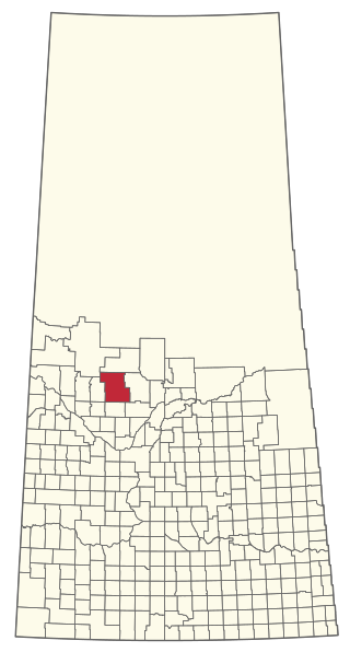
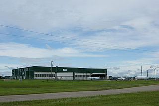
The Rural Municipality of Spiritwood No. 496 is a rural municipality (RM) in the Canadian province of Saskatchewan within Census Division No. 16 and SARM Division No. 6. Located in the north-central portion of the province, it is west of the City of Prince Albert.

The Rural Municipality of Arborfield No. 456 is a rural municipality (RM) in the Canadian province of Saskatchewan within Census Division No. 14 and SARM Division No. 4.
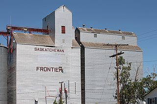
Frontier is a village in the Canadian province of Saskatchewan within the Rural Municipality of Frontier No. 19 and Census Division No. 4. Frontier is on Highway 18 and is served by the Frontier Airport located (3.7 km) south of the village.
Leoville is a village in the Canadian province of Saskatchewan within the Rural Municipality of Spiritwood No. 496 and Census Division No. 16. The village is located along Highway 24. Highway 946 begins in the village and proceeds north. Leoville is home to the administrative centre of the Pelican Lake First Nation band government.
Spiritwood/H & M Fast Farms Aerodrome is located 5.8 nautical miles south-southwest of Spiritwood, Saskatchewan, Canada.

