Spot Mountain

Last updated
Spot Mountain
Spot Mountain, Glacier National Park.jpg
East aspect
Highest point
Elevation 7,831 ft (2,387 m) [1]
Prominence 111 ft (34 m) [1]
Parent peak Peak 8140 [2]
Isolation 0.94 mi (1.51 km) [2]
Coordinates 48°32′01″N113°21′21″W / 48.53366694°N 113.35574999°W / 48.53366694; -113.35574999 Coordinates: 48°32′01″N113°21′21″W / 48.53366694°N 113.35574999°W / 48.53366694; -113.35574999 [3]
Geography
USA Montana relief location map.jpg
Red triangle with thick white border.svg
Spot Mountain
Location in Montana
Usa edcp relief location map.png
Red triangle with thick white border.svg
Spot Mountain
Location in the United States
Location Glacier National Park
Glacier County, Montana, U.S.
Parent range Lewis Range
Rocky Mountains
Topo map USGS Kiowa

Spot Mountain is a 7,831-foot-elevation (2,387-meter) mountain summit located in the Two Medicine area of Glacier National Park, in Glacier County, Montana, United States. [3] It is situated in the Lewis Range, nine miles northwest of East Glacier Park Village, and approximately five miles east of the Continental Divide. Precipitation runoff from the mountain drains into tributaries of Cut Bank Creek and Two Medicine River, which merge to form the Marias River. Topographic relief is significant as the south aspect rises nearly 3,000 feet (910 meters) above Lower Two Medicine Lake in two miles. The mountain's name was officially adopted in 1929 by the United States Board on Geographic Names. [3]

Contents

Geology

The mountains in Glacier National Park are composed of sedimentary rock laid down during the Precambrian to Jurassic periods. Formed in shallow seas, this sedimentary rock was initially uplifted beginning 170 million years ago when the Lewis Overthrust fault pushed an enormous slab of precambrian rocks 3 mi (4.8 km) thick, 50 miles (80 km) wide and 160 miles (260 km) long over younger rock of the cretaceous period. [4]

Climate

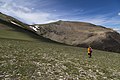
According to the Köppen climate classification system, Spot Mountain is located in an alpine subarctic climate zone with long, cold, snowy winters, and cool to warm summers. [5] Winter temperatures can drop below −10 °F with wind chill factors below −30 °F. Due to its altitude, it receives precipitation all year, as snow in winter, and as thunderstorms in summer.

See also

Related Research Articles

<span class="mw-page-title-main">Heavens Peak</span> Mountain in Montana, United States

Heavens Peak is located in the Livingston Range, Glacier National Park in the U.S. state of Montana. Heavens Peak is a little more than 1 mile (1.6 km) north of McPartland Mountain. The mountain's descriptive name first appeared on a map prepared by Lt. George P. Ahern, from 1888-1890 reconnaissance maps prepared by him. This geographical feature's name was officially adopted in 1929 by the United States Board on Geographic Names.

<span class="mw-page-title-main">Rising Wolf Mountain</span> American mountain

Rising Wolf Mountain is located in the Lewis Range, Glacier National Park in the U.S. state of Montana. The peak is in the southeastern section of the park and rises dramatically above the Two Medicine region and more than 4,450 ft (1,360 m) above Two Medicine Lake immediately to the south. The Blackfeet consider the Two Medicine region of the park to be sacred ground and their name for the peak, "Mahkuyi-opuahsin", meaning, The way the wolf gets up, was later translated to the current name of the mountain.

<span class="mw-page-title-main">Goat Mountain (Glacier County, Montana)</span>

Goat Mountain is located in the Lewis Range, Glacier National Park in the U.S. state of Montana. Goat Mountain rises above Otokomi Lake and Goat Lake in the east central section of Glacier National Park.

<span class="mw-page-title-main">Lone Walker Mountain</span>

Lone Walker Mountain is located in the Lewis Range, Glacier National Park in the U.S. state of Montana. Lone Walker Mountain is situated immediately southwest of Upper Two Medicine Lake along the Continental Divide.

<span class="mw-page-title-main">Mount Helen (Montana)</span> Mountain in United States of America

Mount Helen is located in the Lewis Range, Glacier National Park in the U.S. state of Montana. Mount Helen rises immediately to the northwest roughly 3,100 feet (940 m) above Upper Two Medicine Lake in the southeastern part of Glacier National Park. The Continental Divide of the Americas passes over the summit of Mount Helen.

<span class="mw-page-title-main">Piegan Mountain</span>

Piegan Mountain is located in the Lewis Range, Glacier National Park in the U.S. state of Montana. Piegan Glacier is located in a cirque immediately southeast of the summit.

<span class="mw-page-title-main">Red Mountain (Glacier County, Montana)</span>

Red Mountain is located in the Lewis Range, Glacier National Park in the U.S. state of Montana. Red Mountain is 2.75 miles (4.43 km) north of Rising Wolf Mountain.

<span class="mw-page-title-main">Boulder Peak</span>

Boulder Peak is located in the Livingston Range, Glacier National Park in the U.S. state of Montana. The remnant Boulder Glacier is situated on the northern slopes of the mountain.

<span class="mw-page-title-main">Heavy Runner Mountain</span>

Heavy Runner Mountain is located in the Lewis Range, Glacier National Park in the U.S. state of Montana. The summit is a little over a mile east-northeast of Reynolds Mountain and is easily seen from the Going-to-the-Sun Road as well as Logan Pass. The mountain is named for the Blackfeet Indian Chief, Heavy Runner, who was massacred along with most of his encampment by Col. Eugene M. Baker's detachment on the Marias River on January 23, 1870.

<span class="mw-page-title-main">Olson Mountain</span> Mountain in Glacier National Park, US

Olson Mountain, also known as Mount Olson, is a 7,913-foot-elevation mountain summit located in the Livingston Range, of Glacier National Park in the U.S. state of Montana. Olson Mountain rises more than 3,700 feet (1,100 m) above the western shore of Waterton Lake. The mountain was named for a surveyor on the International Boundary Survey, with the name officially adopted in 1929. The nearest higher peak is Campbell Mountain, 1.13 miles (1.82 km) to the north, and Citadel Peaks is two miles to the south. Precipitation runoff from the mountain drains into Olson Creek before it empties to Waterton Lake.

<span class="mw-page-title-main">Stanton Mountain</span> Mountain summit in the Livingston Range

Stanton Mountain is a 7,750 feet (2,360 m) mountain summit located in the Livingston Range, of Glacier National Park in the U.S. state of Montana. Stanton Mountain rises more than 4,500 feet (1,400 m) above the northern shore of Lake McDonald. The mountain's name refers to Mrs. Lottie Stanton who lived near the west side of the park in the late 1800s, and with her husband operated a livery stable in historic Demersville. She was a pioneering woman who followed the construction camps during the railroad building days. The mountain's name was officially adopted in 1929. In the late 1800s it was known as Mt. Lottie Stanton. The nearest higher peak is Mount Vaught, 1.38 miles (2.22 km) to the northeast. Precipitation runoff from the mountain drains into tributaries of the Flathead River.

<span class="mw-page-title-main">Calf Robe Mountain</span>

Calf Robe Mountain is a 7,948-foot-elevation (2,423-meter) mountain summit located in Glacier National Park in the U.S. state of Montana. It is situated on the Continental Divide in the Lewis Range, and can be seen from Highway 2 midway between Marias Pass and East Glacier Park. The summit is set on the border shared by Flathead County and Glacier County. Topographic relief is significant as the east aspect rises 2,500 feet in one mile. The immediate area between the mountain and highway is known for its aspen and beaver dams.

<span class="mw-page-title-main">Red Crow Mountain</span>

Red Crow Mountain is a 7,891-foot-elevation (2,405-meter) mountain summit located in Glacier National Park in the U.S. state of Montana. The summit is set on the border shared by Flathead County and Glacier County. It is situated on the Continental Divide so precipitation runoff from the east side of the mountain drains into Railroad Creek which is part of the Two Medicine River watershed, and the west side drains to Ole Creek, which is a tributary of Middle Fork Flathead River. It is set in the Lewis Range, 6.5 miles southwest of East Glacier Park Village. Topographic relief is significant as the east aspect rises approximately 2,000 feet in one mile. The nearest higher neighbor is Calf Robe Mountain 1.2 mile to the southeast, with Firebrand Pass forming the saddle between these two peaks.

<span class="mw-page-title-main">Clyde Peak</span>

Clyde Peak is an 8,610-foot-elevation (2,620-meter) mountain summit located in Glacier National Park in the U.S. state of Montana. The mountain straddles the border shared by Flathead County and Glacier County. It is situated on the Continental Divide so precipitation runoff from the west side of the mountain drains into Thompson Creek which is part of the Middle Fork Flathead River watershed, and the east side drains into headwaters of Red Eagle Creek, which flows to Red Eagle Lake, thence Saint Mary Lake. It is set in the Lewis Range, and the nearest higher neighbor is Mount Logan 1.44 mile to the northwest. Topographic relief is significant as the southwest aspect rises approximately 4,000 feet in one mile.

<span class="mw-page-title-main">Scenic Point</span>

Scenic Point is a 7,522-foot-elevation (2,293-meter) mountain summit located in the Two Medicine area of Glacier National Park, in Glacier County, Montana, United States. It is situated in the Lewis Range, six miles northwest of East Glacier Park Village, and approximately seven miles east of the Continental Divide, with precipitation runoff from the mountain draining into the Two Medicine River watershed. Topographic relief is significant as the north aspect rises over 2,600 feet above Lower Two Medicine Lake in one mile. Access to the summit is via the Continental Divide National Scenic Trail which traverses the upper slopes of this mountain. The trail to Scenic Point was constructed by the Great Northern Railway, and the summit once hosted a locomotive bell, a Swiss Alps tradition. The mountain's name was officially adopted in 1929 by the United States Board on Geographic Names.

<span class="mw-page-title-main">Porcupine Ridge</span> Mountain ridge in Montana, US

Porcupine Ridge is a prominent mountain ridge located in the Goat Haunt area of Glacier National Park, in Glacier County of the U.S. state of Montana. This mountain is part of the Livingston Range, and is situated 1.5 mile east of the Continental Divide. Topographic relief is significant as the summit rises approximately 3,900 feet above Lake Frances in one mile, and nearly 5,000 feet above Waterton Lake in five miles. Precipitation runoff from the mountain drains to the Waterton River via Olson and Valentine Creeks. This geographical feature's name was officially adopted in 1911 by the United States Board on Geographic Names.

<span class="mw-page-title-main">Crypt Peak</span> Mountain summit in Glacier National Park

Crypt Peak is an 8,579-foot (2,615 m) mountain summit located in Glacier National Park, in Glacier County of the U.S. state of Montana. It is situated along the Canada–United States border, above Crypt Lake, and is partially within Waterton Lakes National Park. Crypt Peak is part of the Lewis Range, and is approximately three miles east of Waterton Lake. Topographic relief is significant as Crypt Peak rises over 2,100 feet above Crypt Lake in approximately one-half mile (1.6 km), and 4,400 ft (1,340 m) above Waterton Lake in three miles (4.8 km). Precipitation runoff from the mountain drains west to Waterton Lake, and east to Belly River. This geographical feature's name has not yet been officially adopted by the United States Board on Geographic Names.

<span class="mw-page-title-main">Pentagon Mountain</span>

Pentagon Mountain is an 8,873-foot (2,704-metre) mountain summit located in Flathead County of the U.S. state of Montana.

<span class="mw-page-title-main">Capitol Mountain</span>

Capitol Mountain is a 7,868-foot (2,398-metre) summit located in Flathead County of the U.S. state of Montana.

<span class="mw-page-title-main">Sentinel Mountain (Montana)</span>

Sentinel Mountain is an 8,245-foot-elevation (2,513 meter) summit in Glacier County, Montana, United States.

References

  1. 1 2 "Spot Mountain, Montana". Peakbagger.com. Retrieved 2021-09-29.
  2. 1 2 "Spot Mountain - 7,831' MT". listsofjohn.com. Retrieved 2021-09-29.
  3. 1 2 3 "Spot Mountain". Geographic Names Information System . United States Geological Survey, United States Department of the Interior . Retrieved 2021-09-29.
  4. Gadd, Ben (2008). "Geology of the Rocky Mountains and Columbias".{{cite journal}}: Cite journal requires |journal= (help)
  5. Peel, M. C.; Finlayson, B. L.; McMahon, T. A. (2007). "Updated world map of the Köppen−Geiger climate classification". Hydrol. Earth Syst. Sci. 11 (5): 1633. Bibcode:2007HESS...11.1633P. doi: 10.5194/hess-11-1633-2007 . ISSN   1027-5606. S2CID   9654551.