Mount St. Helens is an active stratovolcano located in Skamania County, Washington, in the Pacific Northwest region of the United States. It lies 52 miles (83 km) northeast of Portland, Oregon, and 98 miles (158 km) south of Seattle. Mount St. Helens takes its English name from that of the British diplomat Alleyne Fitzherbert, 1st Baron St Helens, a friend of explorer George Vancouver who surveyed the area in the late 18th century. The volcano is part of the Cascade Volcanic Arc, a segment of the Pacific Ring of Fire.

Milk River is a tributary of the Missouri River, 729 miles (1,173 km) long, in the U.S. state of Montana and the Canadian province of Alberta. Rising in the Rocky Mountains, the river drains a sparsely populated, semi-arid watershed of 23,800 square miles (62,000 km2), ending just east of Fort Peck, Montana.

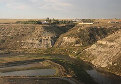
Cut Bank is a city in and the county seat of Glacier County, Montana, United States, located just east of the "cut bank" (gorge) along Cut Bank Creek. The population was 3,056 at the 2020 census, The town began in 1891 with the arrival of the Great Northern Railway.
Landforms are categorized by characteristic physical attributes such as their creating process, shape, elevation, slope, orientation, rock exposure, and soil type.

The Marias River is a tributary of the Missouri River, approximately 210 mi (338 km) long, in the U.S. state of Montana. It is formed in Glacier County, in northwestern Montana, by the confluence of the Cut Bank Creek and the Two Medicine River. It flows east, through Lake Elwell, formed by the Tiber Dam, then southeast, receiving the Teton River at Loma, 2 mi. (3.2 km) above its confluence with the Missouri.

The Two Medicine River is a tributary of the Marias River, approximately 60 mi (97 km) long, in northwestern Montana in the United States.

The Teton River is located in northwestern Montana, in the Western United States The ~ 150 miles (240 km) long river is a tributary of the Marias River. Its watershed is within Teton County and Chouteau County, Montana.

The Clarks Fork of the Yellowstone River is a tributary of the Yellowstone River, 150 mi (241 km) long in the U.S. states of Montana and Wyoming.
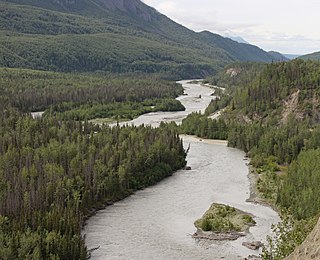
The Matanuska River (Dena'ina: Ch'atanhtnu; Ahtna: Ts'itonhna’) is a 75-mile (121 km) long river in Southcentral Alaska, United States. The river drains a broad valley south of the Alaska Range eponymously known as the Matanuska Valley.
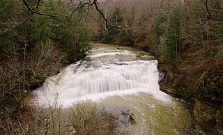
The Falling Water River is a 46.8-mile-long (75.3 km) stream in the east-central portion of Middle Tennessee in the United States. It rises just west of Monterey at the edge of the Cumberland Plateau, and traverses the Eastern Highland Rim before dropping off to the Nashville Basin and emptying into Center Hill Lake along the Caney Fork. The river is noted for the 136-foot (41 m) Burgess Falls, which it spills over near the end of its course.

Mount Stimson is the second highest peak in Glacier National Park, located in Montana, United States. It is part of the Lewis Range, which spans much of the park. It is located in the remote southwestern portion of the park, approximately 5 miles (8.0 km) west of the Continental Divide and 12 miles (19 km) southeast of Lake McDonald. It is drained by Pinchot Creek and Nyack Creek, both of which flow into the Middle Fork of the Flathead River. The mountain is named for Henry L. Stimson (1867–1950), former U.S. Secretary of State and twice Secretary of War, who hiked and assisted George Bird Grinnell survey the area in and around Glacier National Park in the 1890s, and supported efforts to establish the national park.
The Mud Creek Glacier is the southernmost glacier on Mount Shasta in the U.S. state of California. It lies to the east of Sargents Ridge on Shastarama point near 10,915 feet (3,327 m) above sea level. The glacier is smaller than the northern ones on Mount Shasta such as Whitney, Hotlum, Bolam, and Wintun Glaciers. There are approximately 80 glaciers in California and unlike the glaciers in Alaska, Colorado and Montana. California’s existing current glaciers are not remnants of the Pleistocene, but instead relatively young approximately 1,000 years in age. The Mud Creek Glacier is one of at least 7 recognized glaciers on Mt. Shasta by the United States Geological Survey (USGS) the rest being: Whitney, Hotlum, Bolam, Wintun, Konwakiton, and Watkins.

The Geology of Pennsylvania consists of six distinct physiographic provinces, three of which are subdivided into different sections. Each province has its own economic advantages and geologic hazards and plays an important role in shaping everyday life in the state. From the southeast corner to the northwest corner of the state, the include: the Atlantic Plain Province province, the Piedmont Province, the New England Province, the Ridge and Valley Province, the Appalachain Province, and the Central Lowlands Province.

Camp Disappointment is the northernmost campsite of the Lewis and Clark Expedition, on its return trip from the Pacific Northwest. The site is on private land within the Blackfeet Indian Reservation in Glacier County, Montana. It is located along the south bank of Cut Bank Creek and 12 miles (19 km) northeast of Browning, Montana. Glacier National Park can be seen in the distance.

The Gardner River is a tributary of the Yellowstone River, approximately 25 miles (40 km) long, in northwestern Wyoming and south central Montana in the United States. The entire river is located within Yellowstone National Park. It rises on the slope of Joseph Peak, Gallatin Range in the northwestern part of the park, and winds southeast through Gardner's Hole, a broad subalpine basin which is a popular trout fishing location. The Gardner falls within the Native Trout Conservation Area and anglers are allowed to take an unlimited number of brown and rainbow trout. Mountain whitefish and Yellowstone cutthroat trout must be released. Angling on the Gardner is governed by Yellowstone National Park fishing regulations. After merging with Panther Creek, Indian Creek and Obsidian Creek, it then turns north and flows through a steep canyon where it cuts through a basaltic flow from approximately 500,000 years ago known as Sheepeater Cliffs. Below Sheepeater, Glen Creek out of Golden Gate Canyon and Lava Creek out of Lava Creek Canyon join the Gardner near Mammoth Hot Springs. The river crosses the 45th parallel in Gardner Canyon and is also home to a popular hot spring known as The Boiling River. The river continues north through Gardner Canyon and empties into the Yellowstone near Gardiner, Montana.

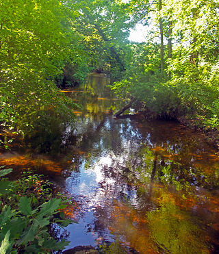
The Poesten Kill is a 26.2-mile-long (42.2 km) creek in Rensselaer County, Upstate New York. It flows westerly from its source at Dyken Pond in the town of Berlin to its mouth at the Hudson River in the city of Troy. The creek was used historically as a source of water for the local inhabitants and farmers. During the Industrial Revolution, it became an important source of water power, and many mills and factories sprung up along its banks.
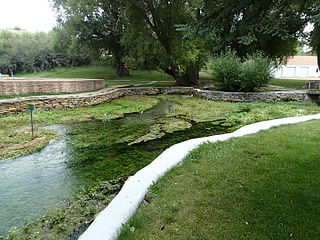
Big Spring Creek is a tributary of the Judith River in Fergus County, Montana near Lewistown, Montana. The creek originates from a first magnitude artesian spring approximately 6 miles (9.7 km) south of Lewistown and flows north, northwest for 30 miles (48 km) to its confluence with the Judith River. The spring is one of the largest in the world flowing at approximately 50,000 to 64,000 US gallons per minute out of the Madison-Limestone formation in the foothills of the Big Snowy Mountains. The creek flows through and under the town of Lewistown. For three blocks spanning Main Street, the creek runs underneath the town in a man-made channel that was created as the town was built over the creek. The spring provides Lewistown's water supply, which requires no treatment for use by consumers.
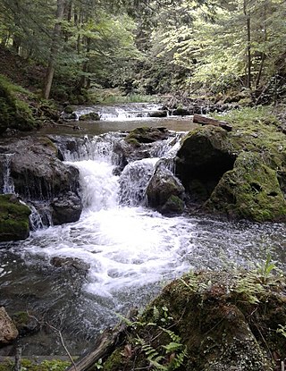
The Verkeerder Kill, sometimes Verkeerderkill and locally shortened to Kaidy Kill is an 8-mile-long (13 km) stream in Ulster County, New York, United States. It rises on the Shawangunk Ridge, in the town of Wawarsing, and flows southwards through the town of Shawangunk, toward the Shawangunk Kill, itself a major tributary of the Wallkill River. Ultimately it is a part of the Hudson River's watershed.
Otsquago Creek is a river that enters the Mohawk River in Fort Plain, New York. Otsquago is a Mohawk Indian word meaning 'under the bridge,' probably referring to an early bridge of felled trees along the creek, a way of making small bridges. It is also referred to as Otsquage on old maps, which is an Indian word for 'healing waters'.

Lake Cut Bank was a glacial lake formed during the late Pleistocene along the Missouri and Sun Rivers. After the Laurentide Ice Sheet retreated, water melting off the glacier accumulated between the Rocky Mountinas and the ice sheet. The lake drained along the front of the ice sheet, eastward towards the Judith River and the Missouri River.