Stainton, South Lakeland

Last updated

Stainton
Stainton Cross - geograph.org.uk - 483284.jpg
Stainton cross
Location map United Kingdom South Lakeland.svg
Red pog.svg
Stainton
Location in South Lakeland
Cumbria UK location map.svg
Red pog.svg
Stainton
Location within Cumbria
Population313 (2011 Census) [1]
OS grid reference SD522859
Civil parish
  • Stainton
District
Shire county
Region
Country England
Sovereign state United Kingdom
Post town KENDAL
Postcode district LA8
Dialling code 015395
Police Cumbria
Fire Cumbria
Ambulance North West
UK Parliament
List of places
UK
England
Cumbria
54°15′59″N2°43′57″W / 54.2664°N 2.7325°W / 54.2664; -2.7325 Coordinates: 54°15′59″N2°43′57″W / 54.2664°N 2.7325°W / 54.2664; -2.7325

Stainton is a village and a civil parish in the South Lakeland district, in the county of Cumbria, England, situated near the village of Sedgwick and the town of Kendal. It is near the main A590 road. Killington reservoir runs alongside the parish of Stainton.

Contents

In the 19th century John Bartholomew described Stainton as follows:

"Stainton, township and vil., Heversham par., Westmorland, in S. of co.- township, 1735 ac., pop. 388; vil., 4 miles S. of Kendal; P.O." [2]

The village of Stainton

20th century map of Stainton, South Lakeland received from the Vision of Britain Website. Map of Stainton in the 20th Century.PNG
20th century map of Stainton, South Lakeland received from the Vision of Britain Website.

History

The name Stainton derives from the old English meaning of stoney farm/settlement. Stān, meaning "a stone, stone, rock" and tūn meaning "an enclosure, a farmstead, a village, an estate." [3] Stainton used to be the site of an old Roman settlement and is built on limestone. [4] It is situated south east of the lake district national park, 5.3 miles south of the town of Kendal. The Lancaster Canal runs close to Stainton approximately 1 km south of the village. [5] The village is home to a small chapel, post office and 128 houses. [6] The chapel, which was "erected in 1698" is no longer used for religious reasons. In 2003 work started to convert it into a village hall and, ten years later, it was handed on 22 November 2013 to the charity that had funded this project. [7]

Historical monuments

The rich history of the area can be observed by monuments which include a series of bridges across Stainton Beck (Stainton bridge, a packhorse bridge and an aqueduct carrying the Lancaster Canal), Selet Hall and the parish church (St Thomas' Church in the neighbouring village of Crosscrake). [8]

Viaduct Stainton Beck - geograph.org.uk - 142366 Aqueduct over Stainton Beck - geograph.org.uk - 142366.jpg
Viaduct Stainton Beck – geograph.org.uk – 142366

Wainwright wrote about the history stating that "it is a place of great antiquity" and also about how pleasant the parish was. [9] The historical monuments could provide key data about the parish itself. What it was like in the past and also possibly what it will be like in the future, along with giving the parish character, pleasant surroundings and attractions.

Population over time

Population of Stainton from 1881-2011 using census data Stainton map 20th century.jpg
Population of Stainton from 1881–2011 using census data

This is a chart showing the population statistics for Stainton between 1881 and 2011 received from census data. In 1941, there was no census so no recorded data. Over time, there have not been any substantial fluctuations in the data and the population seems to have kept at a steady rate. In 1881 the recorded population was 388 and the most recent record was 313. [10] [1] [11] The lack of major fluctuations could suggest that the boundary of the parish hasn't moved over the years and there have been no major inputs and outputs into the village. Peter Wood states that in the past "people rarely moved far away and were often related to each other" [12] which could be the reason for such a stable trend.

1881 Occupation Roles

Bar chart showing the occupation statistics of Stainton in 1881 1881 bar chart paint.jpg
Bar chart showing the occupation statistics of Stainton in 1881

This table shows the occupation roles of the population of Stainton in the year 1881. It also splits the occupations into males (blue) and females (orange). As this data from the vision of Britain shows, other than the unidentified jobs there was a high proportion of workers in the agricultural and animals sector. [13] However these were all males which shows it was possibly a very labour-intensive job but it also suggests the surroundings of the parish were mostly countryside. This was confirmed in the book about the history and topography of Westmoreland when T.F.Bulmer stated that " a large portion of the township is laid down in meadow and pasture." [14] Peter Wood also backs it up by stating that a hundred years ago farms were distributed across the parish mainly run by a husband and wife with one or two children. [12]

The second largest sector is domestic which is dominated by females at 23, compared to only two males. [15] This could suggest that it was a traditional village in those times whereby the men went out and worked and the women stayed at home and took on domestic jobs. Over time, however, the occupation roles seem to have shifted around. In 1881, there were only 4 professionals compared to 51 in 2011 as the graph below shows. [1] This may be simply to the fact that there is more opportunity nowadays to take on a higher ranked job than it was previously and there is also a higher demand for disposable income.

2011 Occupation Roles

Graph showing the occupation statistics of Stainton in 2011 2011 Occupation roles in Stainton.jpg
Graph showing the occupation statistics of Stainton in 2011

In the 2011 census the recorded number of economically active people in the parish was 226 and of those, 146 were economically active. [1] With this table it is possible to compare the 1881 occupation statistics with those of 2011. As the 1881 graph shows the most significant occupations other than the unknown ones were agriculture and domestic. [15] In 1881 it is highly likely the parish would have been surrounded by farmland and there may not have been as many opportunities available as there would have been in 2011. The largest sector in 2011 was professionals and associate professionals which compared to only 4 in 1881 is a large expansion. [15] [1] This shows that over 130 years the dominant occupation roles have shifted from agriculture to professionals and also managers and directors. This might be due to improved transport links to larger cities and the demand for higher wages and a decrease in family run farms for a source of income. From studying the 2011 occupation statistics they suggest Stainton may have a slightly wealthy domain about it and also more of a middle aged to older aged population. The smallest sectors in 2011 were sales and administrative jobs, [1] for example shop work or office work. This may be due to one person in a household earning a higher income so the other takes a more relaxed job role or because these types of jobs tend to have more flexible hours making it more suitable to fit around family life.

Education

A graph showing the qualifications gained by residents in Stainton using 2011 census data Quaification of Stainton members in 2011.jpg
A graph showing the qualifications gained by residents in Stainton using 2011 census data

In the Parish of Stainton there are 255 members who are 16 and over. [1] As the Graph shows 219 of these have qualifications between level one and the highest level of qualification including apprenticeships. As the graph shows, 105 people who live in the village have gained a level four qualification which is the greatest percentage at 41.2% of the total number. This shows that some members of the village whether they are retired or not may have or had reasonable occupations due to their level of education. This can be backed up by looking at the occupation statistics in 2011 as 51.8% of the parish were managers/directors or in the professional sector. [1] Out of 255 people, 36 in the parish have no qualifications [1] which could suggest that they didn't attend school or they didn't complete it. However it could also suggest that they may have lived their whole lives on a family run farm and taken over from previous generations.

School

There is a school at Crosscrake situated approximately one kilometre from Stainton [16] which could be occupied by some of the parishes younger residents. 58 members of Stainton are under the age of 16 [1] meaning that they may be in primary education as they are too young to be classed as economically active. In the book written by Peter Wood he states that some of the children who go to Crosscrake are from neighbouring parishes [17] possibly implying Stainton as one of these. If the younger population of Stainton attend this school to gain an education it may increase their chances of a better occupation in the future.

Households

Total number of households in the parish of Stainton, South Lakeland between the years of 1881 and 2011 received from census data Amount of Households in Stainton Between 1881 and 2011.jpg
Total number of households in the parish of Stainton, South Lakeland between the years of 1881 and 2011 received from census data

In the year 1881 the number of households in the parish of Stainton was 78. The graph took slight decrease up until 1931 where after this the number of households increased and in 2011 it stood at 128. [18] [1] [11] As you can see the first half of the household graph up until the year 1931 is similar to the population trend with a slight decrease in both. This would be expected as a decrease in population would cause a decrease in households. However, after 1931 households increased whereas the population stayed steady. This may be due to people buying second homes or housing for single people.

HOUSEHOLD TYPES

These two graphs show the number of people who live in each household in Stainton and also the type of households that dominate the parish of Stainton. The graph on the left concentrates on the number of people who occupy households in the parish. As the data shows two person households dominate the parish with 46.75% (56) houses. [1] Owing to this dataset it could potentially mean that the houses are occupied by married couples without dependent children or even retired couples who have chosen to live in the parish. The graph also shows that there are not many houses occupied by larger families as only eight houses have five people or more in them. These few houses could be families who have dependent children, although it does not seem that there are many households of this composition so it may not entice families looking to move to live in the Stainton. The pie chart on the right shows the type of households which are in the Parish. The majority of the homes are detached or bungalows, followed by semi-detached homes. [1] Due to over half of the homes being detached it shows that it is unlikely that there is a street lined with houses along them. These homes may be occupied my small families, married couples or retired workers.

A Graph showing the number of people in households using 2011 census data Amount of people in houeholds in 2011.jpg
A Graph showing the number of people in households using 2011 census data
The type of accommodation in Stainton in 2011 using Census data Accommodation Type.jpg
The type of accommodation in Stainton in 2011 using Census data

Economic activity

According to the 2011 census in the village there are 226 residents who are aged between 16 and 64 and 146 of these people are economically active whether it is part-time work, full-time work or self-employed. Of these 226 only one of them is unemployed and seven of them are full-time students. This is another factor that shows that it is unlikely for members of the village to be on job seekers allowance or on a relatively low income. The total number of economically inactive people stands at a total of 80 however 56 are retired and the remaining are either students or suffer from an illness. [1] This could reinforce the suggestion that some members of the village are retirees who chose to live in the parish for a relaxing retirement with peaceful surroundings.

See also

Related Research Articles

<span class="mw-page-title-main">Sutton, Peterborough</span> Human settlement in England

Sutton is a small village and civil parish in the Peterborough district, in the north-west of Cambridgeshire, England. Situated about 5.7 miles from Peterborough and approximately half a mile south of the A47 road.

<span class="mw-page-title-main">Blindbothel</span> Human settlement in England

Blindbothel is a village and civil parish in the Allerdale district of Cumbria, England. It is on the edge of the Lake District National Park, and is a couple of miles south of Cockermouth. It had a population of 174 according to the 2011 census. Blindbothel has an area of around 500 hectares On the East of Blindbothel is the River Cocker which flows to Cockermouth.

<span class="mw-page-title-main">Darenth</span> Human settlement in England

Darenth is a village and civil parish in the Borough of Dartford, Kent, England. It is located 3.4 miles south east of Dartford and 4.6 miles north east of Swanley.

<span class="mw-page-title-main">Docker, Cumbria</span> Human settlement in England

Docker is a civil parish in the South Lakeland district of the English county of Cumbria. Docker is 4.3 miles north east of the market town of Kendal. At the 2011 census Docker was grouped with Lambrigg giving a total population of 260.

<span class="mw-page-title-main">Tingrith</span> Human settlement in England

Tingrith is a small village and civil parish in Bedfordshire, England. It is located adjacent to the M1 motorway near the large village of Toddington. The nearest major town is Luton, located about 10 miles (16 km) to the southeast. The parish church of St Nicholas dates back to the 13th century and has Tingrith's only cemetery. The church can seat up to 200 people.

<span class="mw-page-title-main">Bransford</span> Human settlement in England

Bransford is a village and civil parish in the Malvern Hills district of the county of Worcestershire, England. It is situated close to the River Teme and the village of Leigh. It is on the primary route between Worcester and Hereford, the A4103 that runs through the centre of the village. According to the 2011 census, Bransford has a population of 389. The parish shares its parish council with Leigh.

<span class="mw-page-title-main">Hartley, Cumbria</span> Human settlement in England


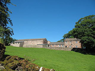
Hartley is a village and civil parish in the Eden district of Cumbria, England. It is about 0.5 miles (0.8 km) east of Kirkby Stephen. The area has many old lead and copper mines that are now abandoned as well as having a large quantity of iron haematite, ironstone and ore. At the highest peak in Hartley stand nine obelisks referred to as "Nine Standards". Nobody knows the true purpose of the "Nine Standards" although some believe that they were used to create a sense of a forthcoming army to scare the enemy forces. However, it is believed more heavily that they were placed as geographical aid to help outline the borders between the two neighbouring counties, Westmorland and Yorkshire. Hartley also is home to Hartley Castle. It was originally built as a "tower house circa 1353 and extended circa 1600" and then re- developed in the 18th century. The Castle was built at the southern point of Hartley.

<span class="mw-page-title-main">Stansfield</span> Human settlement in England

Stansfield is a village and civil parish in the West Suffolk district of Suffolk in eastern England. Located seven miles south-west of Bury St Edmunds, in 2011 its population was 221. The village has an Anglican church dedicated to All Saints. In 1870, John Marius Wilson's Imperial Gazetteer of England and Wales described Stansfield as

<span class="mw-page-title-main">Ousden</span> Human settlement in England

Ousden is a village and civil parish in the West Suffolk district of Suffolk in eastern England. It is located around six miles west of Bury St Edmunds and 72 miles north of London, and as of 2011, its population is 266. The village has an Anglican church of St Peter's and a chapel in the cemetery dedicated to St Barnabas.

<span class="mw-page-title-main">Roudham and Larling</span> Human settlement in England

Roudham and Larling is a civil parish in the English county of Norfolk. It includes the villages of Roudham and Larling. It covers an area of 15.20 km2 (5.87 sq mi) and had a population of 278 in 119 households at the 2001 census, increasing to a population of 301 in 119 households at the 2011 Census. For the purposes of local government, it falls within the district of Breckland. River Thet flows next to Roudham and Larling.

<span class="mw-page-title-main">Great Tey</span> Human settlement in England

Great Tey is a village and civil parish near the villages of Marks Tey and Little Tey in the Colchester borough of Essex, England, located approximately six miles west of Colchester.

<span class="mw-page-title-main">Long Marton</span> Human settlement in England

Long Marton is a village and civil parish in the Eden District of the English county of Cumbria. In 2011 the population was 827.

<span class="mw-page-title-main">Lamarsh</span> Human settlement in England

Lamarsh is a village and a civil parish in the Braintree District, in the county of Essex, England. It is near the large village of Bures and the village of Alphamstone. The village is west of the River Stour. It has a pub, a village hall and a church called The Friends of Holy Innocents Church. The civil parish's name, Lamarsh, comes from the phrase "Loamy marsh". This is derived from the Old English terms lām and mersc, which translate into loam or clay and a marsh respectively.

<span class="mw-page-title-main">Haile, Cumbria</span> Human settlement in England

Haile is a small village and civil parish in Copeland district, in the county of Cumbria, England. It had a population of 617 at the 2011 Census.

<span class="mw-page-title-main">Huntingfield, Suffolk</span> Human settlement in England

Huntingfield is a village near the B1117 road, in the East Suffolk district, in the county of Suffolk, England. The village is close to the source of the River Blyth and the parish is 12 miles from the seaside town of Southwold. Nearby settlements include the town of Halesworth and the villages of Walpole, Heveningham, Cookley and Laxfield.

<span class="mw-page-title-main">Ponsonby, Cumbria</span> Human settlement in England

Ponsonby is a village and civil parish in the Borough of Copeland of the county of Cumbria, England. Ponsonby has a church which was constructed in 1840 and had further additions in 1874. Ponsonby is located along and just off the A595. It has a population of 205 according to the 2011 Census Data.

<span class="mw-page-title-main">Stapleford, Hertfordshire</span> Human settlement in England

Stapleford is a village and civil parish of 134 acres (54 ha) on the A119 road, in the East Hertfordshire district, in the county of Hertfordshire, England. Stapleford is located between Waterford and Watton-at-Stone in the Beane valley; the little river was forded at this point, giving rise to the village. Stapleford's parish church is St Mary's Church. Beane is a hamlet of Stapleford.

<span class="mw-page-title-main">Hugill</span> Human settlement in England

Hugill is a civil parish in the South Lakeland district of the English county of Cumbria. Hugill includes the village of Ings and the hamlets of Grassgarth, and Reston plus a large part of the village of Staveley and the west bank of the River Kent north of Barley Bridge. It was formerly a part of the Barony of Kendal. In the 2001 census the parish had a population of 416, increasing at the 2011 census to 446. Approximately 60% of the population live in Staveley or the Kent valley.

<span class="mw-page-title-main">Skelsmergh</span> Human settlement in England

Skelsmergh is a small village and former civil parish, now in the parish of Skelsmergh and Scalthwaiterigg, in South Lakeland in rural Cumbria, England, about 4 miles (6.4 km) north of Kendal, on the A6 road.

<span class="mw-page-title-main">Shobrooke</span> Village in Devon, England

Shobrooke is a village, parish and former manor in Devon, England. The village is situated about 1 1/2 miles north-east of Crediton. It is located close to Shobrooke park. The river Shobrooke Lake flows through the village. It had a population of 537 according to the 2011 census. The name Shobrooke is derived from the old English words of succa and brōc, and translates as goblin brook.

References

  1. 1 2 3 4 5 6 7 8 9 10 11 12 13 14 UK Census (2011). "Local Area Report – Stainton Parish (E04002650)". Nomis. Office for National Statistics . Retrieved 13 May 2021.
  2. Bartholomew, John (1887). Gazetteer of the British Isles. Stainton: Bartholomew. Retrieved 27 January 2015.
  3. "Meaning of Stainton". Key to English Placenames. The institute for name-studies/University of Nottingham. 2015. Retrieved 2 March 2015.
  4. The Cumbria Village Book. Countryside Books Newbry, CCFWI, Carslile, CWFWI, Kendal. 1991. pp. 222–223.
  5. "Bing Maps". Bing. Retrieved 24 February 2015.
  6. "Stainton, Westmorland". A Vision of Britain through time. GBH GIS Project/University Portsmouth. Retrieved 27 February 2015.
  7. "History of the Chapel". Stainton Institute. Retrieved 24 February 2015.
  8. Royal Commission on Historical Monuments (1936). An Inventory of the Historical Monuments in Westmorland (First ed.). London: His Majesty's Stationery Office. p. 217.
  9. Wainwright, Alfred (1975). Westmorland Heritage. Kendal: Westmoreland Gazette. p. 412.
  10. "Stainton Ch/CP through time, Population Statistics, Total Population". A Vision of Britain through Time. GB Historical GIS / University of Portsmouth. Retrieved 2 March 2015.
  11. 1 2 UK Census (2001). "Local Area Report – Stainton Parish (16UG067)". Nomis. Office for National Statistics . Retrieved 13 May 2021.
  12. 1 2 Wood, Peter (2003). Stainton An Old Westmorland Parish: Reminiscences of a local farmer. Helm Press.
  13. "Stainton Ch/CP through time, Industry Statistics". A Vision of Britain Through Time. GB Historical GIS / University of Portsmouth. Retrieved 20 March 2015.
  14. Bulmer, T.F (1885). History, Topography, and Directory of Westmoreland. Manchester: T.Bulmer. p. 435.
  15. 1 2 3 "Stainton Ch/CP through time Industry Statistics". A Vision of Britain Through Time. GB Historical GIS / University of Portsmouth. Retrieved 20 March 2015.
  16. "Crosscake School". Google Maps. Retrieved 27 March 2015.
  17. Wood, Peter (2003). Stainton, an old Westmoreland parish, Reminiscences of a local farmer. Helm Press. p. 36.
  18. "Stainton Ch/CP through time, Housing Statistics, Total Houses". A Vision of Britain Through Time. GB Historical GIS / University of Portsmouth. Retrieved 24 March 2015.


Commons-logo.svg Media related to Stainton at Wikimedia Commons