
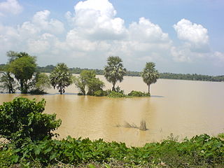
Ketugram I is a community development block that forms an administrative division in Katwa subdivision of Purba Bardhaman district in the Indian state of West Bengal.

Berhampore is a community development block that forms an administrative division in the Berhampore subdivision of Murshidabad district in the Indian state of West Bengal.
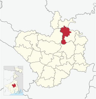
Manbazar is a census town in Manbazar I CD block in Manbazar subdivision of Purulia district in the state of West Bengal, India. The headquarters of Manbazar subdivision are located in Manbazar.

Burdwan I is a community development block that forms an administrative division in Bardhaman Sadar North subdivision of Purba Bardhaman district in the Indian state of West Bengal.
Burdwan II is a community development block that forms an administrative division in Bardhaman Sadar North subdivision of Purba Bardhaman district in the Indian state of West Bengal.

Memari I is a community development block that forms an administrative division in Bardhaman Sadar South subdivision of Purba Bardhaman district in the Indian state of West Bengal.
Katwa I is a community development block that forms an administrative division in Katwa subdivision of Purba Bardhaman district in the Indian state of West Bengal.
State Highway 8 (West Bengal) is a state highway in West Bengal, India.
State Highway 9 (West Bengal) is a state highway in West Bengal, India.
State Highway 2 is a state highway in West Bengal, India.

State Highway 4 is a state highway in West Bengal, India.

State Highway 5 (West Bengal) is a state highway in West Bengal, India.
State Highway 1 (West Bengal) is a state highway in West Bengal, India.
State Highway 3 (West Bengal) is a state highway in West Bengal, India.
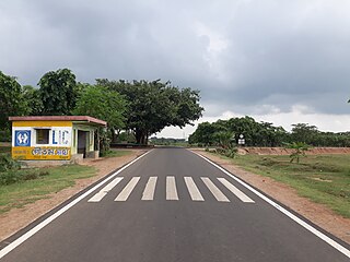
State Highway 6 (West Bengal) is a state highway in West Bengal, India.
State Highway 7 (West Bengal) is a state highway in West Bengal, India.
State Highway 14 (West Bengal) is a state highway in West Bengal, India.
State Highway 13 (West Bengal) is a state highway in West Bengal, India.

State Highway 15 (West Bengal), is a state highway in West Bengal, India.

State Highway 11 (West Bengal) is a state highway in West Bengal, India.
