Bankura is a city and a municipality in the state of West Bengal, India. It is the headquarters of the Bankura district.Bankura was described as Suhmobhumi. The word larh or rarh was introduced after 6th century A.D. It comes from the old Austric word ráŕhá or ráŕho which means “land of red soil”. 2-n ancient times "China called Ráŕh by the name of 'Láti'". 3-n Santali, lar means thread, rarh means tune and larh means snake. 4-.Perhaps the Jain and Greek scholars used this original Austric word larh to indicate this dry forest region which was very difficult. The popularity of Manasa Puja, the worship of Snake-Goddess Manasa, shows this opinion might have some relevance. According to Nilkantha, a commentator of the Mahabharata, the words suhmo [bhumi] and Rarh are synonymous.

Nayagram is a community development block that forms an administrative division in Jhargram subdivision of Jhargram district in the Indian state of West Bengal.

Raipur is a community development block that forms an administrative division in the Khatra subdivision of the Bankura district in the Indian state of West Bengal.
Jhilimili is a tourist centre in the Ranibandh CD block in the Khatra subdivision of the Bankura district in the Indian state of West Bengal.

Ranibandh is a community development block that forms an administrative division in Khatra subdivision of Bankura district in the Indian state of West Bengal.
Raipur, referred to in census reports as Raipur Bazar, is a census town in the Raipur CD block in the Khatra subdivision of the Bankura district in the state of West Bengal, India.
Binpur is a village in the Binpur I CD block in the Jhargram subdivision of the Jhargram district in the state of West Bengal, India.
Binpur II is a community development block that forms an administrative division in Jhargram subdivision of Jhargram district in the Indian state of West Bengal.
Jamboni is a community development block that forms an administrative division in Jhargram subdivision of Jhargram district in the Indian state of West Bengal.

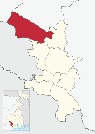
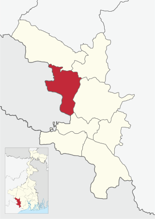
Jhargram is a community development block that forms an administrative division in Jhargram subdivision of Jhargram district in the Indian state of West Bengal.

Gopiballavpur I is a community development block that forms an administrative division in Jhargram subdivision of Jhargram district in the Indian state of West Bengal.
Belpahari is a village in the Binpur II CD block in the Jhargram subdivision of the Jhargram district in West Bengal, India.
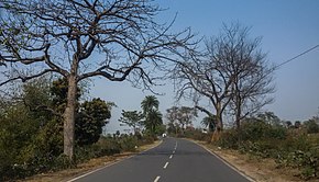
State Highway 8 (West Bengal) is a state highway in West Bengal, India.
State Highway 9 (West Bengal) is a state highway in West Bengal, India.
State Highway 2 is a state highway in West Bengal, India.

State Highway 4 is a state highway in West Bengal, India.
Lodhasuli is a village in the Jhargram CD block in the Jhargram subdivision of Jhargram district in the state of West Bengal, India.
Dhaneswarpur is a village, in the Dantan II CD block in the Kharagpur subdivision of the Paschim Medinipur district in the state of West Bengal, India.
State Highway 7 (West Bengal) is a state highway in West Bengal, India.

State Highway 15 (West Bengal), is a state highway in West Bengal, India.