State Highway 7 (West Bengal)

Last updated

WB SH7-IND.png
State Highway 7
Route information
Length289 km (180 mi)
Major junctions
From Rajgram
Major intersections NH 14 from Nalhati to Morgram
SH 11 at Kuli
SH 6 at Kurmodanga
SH 14 at Muratipur
Guskara Road at Obaidullah Market near Chandipur
Katwa-Bardhaman Road at Narja Chati
SH 8 from Mirzapur to Bankura Morh
NH 114/GT Road from Mehedi Bagan to Perbhirhata
NH 19 flyover near Sripally
SH 2 at Arambagh
SH 4 from Khirpai to Chandrakona
Keshpur-Daspur Road at Keshpur
To Midnapore – Junction with NH 14
Location
Country India
State West Bengal
Districts Birbhum, Purba Bardhaman, Hooghly and Howrah
Highway system
State Highways in West Bengal

State Highway 7 (West Bengal) is a state highway in West Bengal, India.

Contents

Route

SH 7 originates from Rajgram (the road extends up to Kanupur on NH 12) and passes through Murarai, Nalhati, Lohapur (it is a little off the highway), Morgram, Khargram, Nagar, Burwan, Nutanhat, Mongalkote, Mirzapur, Bardhaman, Sagrai, Badulia, Seharabazar, Arambag, Kamarpukur, Gar Mandaran, Khirpai, Chandrakona, Keshpur and terminates in junction with NH 14 at Midnapore. [1]

The total length of SH 7 is 289 km. [2]

Districts traversed by SH 7 are: [3]
Birbhum district (0 – 31 km)
Murshiadabad (31-100)
Purba Bardhaman district (100 – 196) km
Hooghly district (196 – 226 km)
Paschim Medinipur district (226-289)

Road sections

It is divided into different sections as follows: [2] [4] [5] [6] [7] [8]

Road SectionDistrictCD BlockLength (km)
Rajgram-NalhatiBirbhum Murarai I, Nalhati I 31
Nalhati-Morgram via NH 14Birbhum Nalhati II -
Morgram-AlinagarMurshidabad Sagardighi, Nabagram 20
Alinagar-KuleeMurshidabad Khargram 20
Kulee-RamjibanpurMurshidabad Burwan 29
Ramjibanpur-Palita-Palitapur-NatunhatPurba Bardhaman Ketugram I, Mongolkote 29
Natunhat-Muraripur-KarjonaPurba Bardhaman Bhatar 19
Karjona-BardhamanPurba Bardhaman Burdwan I, Burdwan II 15
Bardhaman-Arambagh (Purba Bardhaman portion)Purba Bardhaman Khandaghosh, Raina I, Raina II 33
Bardhaman-Arambagh (Hooghly portion)Hooghly Arambagh 9
Arambagh-Goghat-RamjibanpurHooghly Goghat I, Goghat II 21
Ramjibanpur-KhirpaiPaschim Medinipur Chandrakona I 18
Chandrakona-KeshpurPaschim Medinipur Chandrakona II, Keshpur 21
Keshpur-MidnaporePaschim Medinipur Midnapore Sadar 24

See also

Related Research Articles

Bankura is a city and a municipality in the state of West Bengal, India. It is the headquarters of the Bankura district.Bankura was described as Suhmobhumi. The word larh or rarh was introduced after 6th century A.D. It comes from the old Austric word ráŕhá or ráŕho which means “land of red soil”. 2-n ancient times "China called Ráŕh by the name of 'Láti'". 3-n Santali, lar means thread, rarh means tune and larh means snake. 4-.Perhaps the Jain and Greek scholars used this original Austric word larh to indicate this dry forest region which was very difficult. The popularity of Manasa Puja, the worship of Snake-Goddess Manasa, shows this opinion might have some relevance. According to Nilkantha, a commentator of the Mahabharata, the words suhmo [bhumi] and Rarh are synonymous.

<span class="mw-page-title-main">Nayagram (community development block)</span> Community development block in West Bengal, India

Nayagram is a community development block that forms an administrative division in Jhargram subdivision of Jhargram district in the Indian state of West Bengal.

<span class="mw-page-title-main">Raipur, Bankura (community development block)</span> Community development block in West Bengal, India

Raipur is a community development block that forms an administrative division in the Khatra subdivision of the Bankura district in the Indian state of West Bengal.

<span class="mw-page-title-main">Ranibandh (community development block)</span> Community development block in West Bengal, India

Ranibandh is a community development block that forms an administrative division in Khatra subdivision of Bankura district in the Indian state of West Bengal.

<span class="mw-page-title-main">Gopiballavpur I</span> Community development block in West Bengal, India

Gopiballavpur I is a community development block that forms an administrative division in Jhargram subdivision of Jhargram district in the Indian state of West Bengal.

<span class="mw-page-title-main">Burdwan I</span> Community development block in West Bengal, India

Burdwan I is a community development block that forms an administrative division in Bardhaman Sadar North subdivision of Purba Bardhaman district in the Indian state of West Bengal.
<span class="mw-page-title-main">National Highway 14 (India)</span> National highway in India

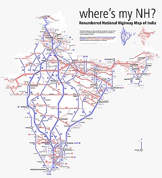
National Highway 14 is a National Highway in India. It runs from Morgram to Kharagpur in the Indian state of West Bengal.

State Highway 8 (West Bengal) is a state highway in West Bengal, India.

State Highway 9 (West Bengal) is a state highway in West Bengal, India.

State Highway 2 is a state highway in West Bengal, India.

<span class="mw-page-title-main">State Highway 4 (West Bengal)</span>

State Highway 4 is a state highway in West Bengal, India.

<span class="mw-page-title-main">State Highway 5 (West Bengal)</span>

State Highway 5 (West Bengal) is a state highway in West Bengal, India.

Dhaneswarpur is a village, in the Dantan II CD block in the Kharagpur subdivision of the Paschim Medinipur district in the state of West Bengal, India.
<span class="mw-page-title-main">State Highway 6 (West Bengal)</span> State highway in West Bengal

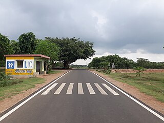
State Highway 6 (West Bengal) is a state highway in West Bengal, India.

State Highway 14 (West Bengal) is a state highway in West Bengal, India.

State Highway 13 (West Bengal) is a state highway in West Bengal, India.

<span class="mw-page-title-main">State Highway 15 (West Bengal)</span> Road in West Bengal, India

State Highway 15 (West Bengal), is a state highway in West Bengal, India.

Mirzapur is a census town in Burdwan I CD Block in Bardhaman Sadar North subdivision of Purba Bardhaman district in the state of West Bengal, India.

<span class="mw-page-title-main">State Highway 11 (West Bengal)</span> State highway in West Bengal

State Highway 11 (West Bengal) is a state highway in West Bengal, India.

Mohammad Bazar is a census town in Mohammad Bazar CD Block in Suri Sadar subdivision of Birbhum district in the Indian state of West Bengal.

References

  1. Google maps
  2. 1 2 "List of State Highways in West Bengal". West Bengal Traffic Police. Retrieved 5 November 2016.
  3. "Road - Highway". Public Works Department, Government of West Bengal. Retrieved 30 November 2016.
  4. "Birbhum Tehsil/ CD Block Map". Maps of India. Retrieved 30 November 2016.
  5. "Murshidabad Tehsil/ CD Block Map". Maps of India. Retrieved 30 November 2016.
  6. "Bardhaman Tehsil/ CD Block Map". Maps of India. Retrieved 30 November 2016.
  7. "Hugli Tehsil/ CD Block Map". Maps of India. Retrieved 30 November 2016.
  8. "Paschim Medinipur Tehsil/ CD Block Map". Maps of India. Retrieved 30 November 2016.