State Line, California

Last updated

State Line is a former settlement in Mono County, California. [1] It was located on the Nevada state line 6 miles (10 km) north-northeast of Benton. [1]

Mono County, California County in California, United States

Mono County (MOH-noh) is a county located in the east central portion of the U.S. state of California. As of the 2010 census, the population was 14,202. making it the fifth-least populous county in California. The county seat is Bridgeport. The county is located east of the Sierra Nevada between Yosemite National Park and Nevada.

California State of the United States of America

California is a state in the Pacific Region of the United States. With 39.6 million residents, California is the most populous U.S. state and the third-largest by area. The state capital is Sacramento. The Greater Los Angeles Area and the San Francisco Bay Area are the nation's second and fifth most populous urban regions, with 18.7 million and 8.8 million residents respectively. Los Angeles is California's most populous city, and the country's second most populous, after New York. California also has the nation's most populous county, Los Angeles County, and its largest county by area, San Bernardino County. The City and County of San Francisco is both the country's second-most densely populated major city after New York and the fifth-most densely populated county, behind only four of the five New York City boroughs.
Nevada State of the United States of America

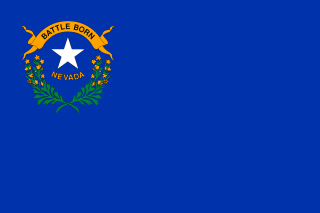
Nevada is a state in the Western United States. It is bordered by Oregon to the northwest, Idaho to the northeast, California to the west, Arizona to the southeast and Utah to the east. Nevada is the 7th most extensive, the 34th most populous, but the 9th least densely populated of the U.S. states. Nearly three-quarters of Nevada's people live in Clark County, which contains the Las Vegas–Paradise metropolitan area where three of the state's four largest incorporated cities are located. Nevada's capital, however, is Carson City.

Related Research Articles

Coast Line (UP) railroad line in California along the Pacific coast

The Coast Line is a railroad line between Burbank, California and the San Francisco Bay Area, roughly along the Pacific Coast. It is the shortest rail route from Los Angeles to the Bay Area.

Luebbering, Missouri unincorporated community in Missouri

Luebbering is an unincorporated community in eastern Franklin County, Missouri, United States. It is located on Missouri Route FF, approximately ten miles southeast of St. Clair and about 2.5 miles south of Lonedell.

McGirk, Missouri unincorporated community in Missouri

McGirk is an unincorporated community in eastern Moniteau County, Missouri, United States. It is located approximately five miles east of California on old U.S. Route 50.

South Center, Indiana Unincorporated community in Indiana, United States

South Center is an unincorporated community in Union Township, LaPorte County, Indiana.

Fraziers Landing, California Unincorporated community in California, United States

Fraziers Landing is an unincorporated community in Colusa County, California. It lies at an elevation of 43 feet.

Aspendell, California Unincorporated community in California, United States

Aspendell is an unincorporated community in Inyo County, California. It lies at an elevation of 8409 feet. Aspendell is located at 37°14′17″N118°35′54″W.

Nolia is a former community in eastern Pushmataha County, Oklahoma, five miles east of Nashoba, Oklahoma. Nolia is located at 34°28′35″N95°09′06″W.

Mid-Peninsula High School (Mid-Pen) is an independent non-profit and non-sectarian coeducational college preparatory high school located in Menlo Park, California. The school offers a flexible and personalized academic program, small class sizes and accommodations for learning differences. The school has a reputation for inclusiveness, according to a San Francisco Chronicle article about helping young people cope with cliques. Mid-Pen's colors are maroon and gray and its school nickname is the dragons.

Gospel Grove, Indiana Unincorporated community in Indiana, United States

Gospel Grove is an unincorporated community in central Lost Creek Township, Vigo County, in the U.S. state of Indiana.

Fine Creek Mills is an unincorporated community in Powhatan County, in the U.S. state of Virginia.

Timiryazevsky District District in Moscow, Russia

Timiryazevsky District is an administrative district (raion) of Northern Administrative Okrug, and one of the 125 raions of Moscow, Russia. The district is known for its public parks - Timiryazavsky Park and the Dubki Park - and the Timiryazev Agricultural Academy. The total area of the district is 10.43 square kilometers (4.03 sq mi). Population: 82,800

Devon, Kansas Unincorporated community in Kansas, United States

Devon is an unincorporated community in Bourbon County, Kansas, United States.

Ninetynine Oaks is an unincorporated community in Los Angeles County, California, in the United States.

Audubon is an unincorporated community in Gordon County, in the U.S. state of Georgia. The community lies about 10 miles (16 km) northeast of the county seat at Calhoun.

Starbucktown is an unincorporated community in Clinton County, in the U.S. state of Ohio.

Fawn is an unincorporated community in Dent County, in the U.S. state of Missouri.

Halcyon is an extinct town in Dent County, in the U.S. state of Missouri.

Sidney is an unincorporated community in Putnam County, in the U.S. state of Missouri.

Henley Hollow is a valley in Warren County in the U.S. state of Missouri. The intermittent stream in Henley Hollow is a tributary to Little Lost Creek in the Little Lost Creek State Forest.

Pine Valley, Indiana Unincorporated community in Indiana, United States

Pine Valley is an unincorporated community in Southeast Township, Orange County, in the U.S. state of Indiana.

References

  1. 1 2 Durham, David L. (1998). California's Geographic Names: A Gazetteer of Historic and Modern Names of the State. Clovis, Calif.: Word Dancer Press. p. 1146. ISBN   1-884995-14-4.

Coordinates: 37°49′9″N118°28′35″W / 37.81917°N 118.47639°W / 37.81917; -118.47639

Geographic coordinate system Coordinate system

A geographic coordinate system is a coordinate system that enables every location on Earth to be specified by a set of numbers, letters or symbols. The coordinates are often chosen such that one of the numbers represents a vertical position and two or three of the numbers represent a horizontal position; alternatively, a geographic position may be expressed in a combined three-dimensional Cartesian vector. A common choice of coordinates is latitude, longitude and elevation. To specify a location on a plane requires a map projection.