
The Milk River is a tributary of the Missouri River, 729 mi (1,173 km) long, in the U.S. state of Montana and the Canadian province of Alberta. Rising in the Rocky Mountains, the river drains a sparsely populated, semi-arid watershed of 23,800 sq mi (61,642 km2), ending just east of Fort Peck, Montana.

Flathead County is in the U.S. state of Montana. At the 2020 United States Census, its population was 104,357, making it the state's fourth most populous county. Its county seat is Kalispell. Its numerical designation is 7. Its northern border is on the state's north border, making it contiguous with the Canada–US border, facing British Columbia.

Bigfork is a census-designated place (CDP) in Flathead County, Montana, United States. It is within Montana's Rocky Mountains. The population was 4,270 at the 2010 census, up from 1,421 in 2000.
Columbia Falls is a city along the Flathead River in Flathead County, Montana, United States. The population was 5,308 at the 2020 census. Columbia Falls has been ranked as one of the best and safest places to live in Montana.
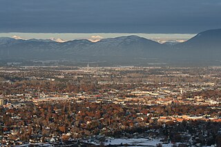
Kalispell is a city in, and the county seat of, Flathead County, Montana, United States. The 2020 census put Kalispell's population at 24,558. In Montana's northwest region, it is the largest city, and the commercial center, of the Kalispell Micropolitan Statistical Area. The name Kalispell is a Salish word meaning "flat land above the lake".

Whitefish is a town in Flathead County, Montana, United States. According to the 2020 United States Census, there were 7,751 people in the town.

U.S. Route 93 (US 93) is a major north–south United States highway in the western United States. The southern terminus is at US 60 in Wickenburg, Arizona. The northern terminus is at the Canada–US border north of Eureka in Lincoln County, Montana, where the roadway continues into Roosville, British Columbia, as Highway 93. Major cities that US 93 travels through include: Kingman, Arizona; Las Vegas, Nevada; Twin Falls, Idaho; and Missoula, Montana.
The Bighorn River is a tributary of the Yellowstone, approximately 461 miles (742 km) long, in the states of Wyoming and Montana in the western United States. The river was named in 1805 by fur trader François Larocque for the bighorn sheep he saw along its banks as he explored the Yellowstone.

The Little Missouri River is a tributary of the Missouri River, 560 miles (901 km) long, in the northern Great Plains of the United States. Rising in northeastern Wyoming, in western Crook County about 15 miles (24 km) west of Devils Tower, it flows northeastward, across a corner of southeastern Montana, and into South Dakota. In South Dakota, it flows northward through the Badlands into North Dakota, crossing the Little Missouri National Grassland and both units of Theodore Roosevelt National Park. In the north unit of the park, it turns eastward and flows into the Missouri in Dunn County at Lake Sakakawea, where it forms an arm of the reservoir 30 miles (48 km) long called Little Missouri Bay and joins the main channel of the Missouri about 25 miles (40 km) northeast of Killdeer.

The Stillwater River is a tributary of the Yellowstone River. Approximately 70 miles (113 km) long, it runs through southern Montana in the United States. The Stillwater River has also been known as: the Itchkeppearja River, Rose River, Rosebud River and Stillwater Creek.

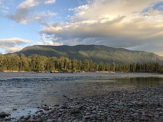
The Flathead River, in the northwestern part of the U.S. state of Montana, originates in the Canadian Rockies to the north of Glacier National Park and flows southwest into Flathead Lake, then after a journey of 158 miles (254 km), empties into the Clark Fork. The river is part of the Columbia River drainage basin, as the Clark Fork is a tributary of the Pend Oreille River, a Columbia River tributary. With a drainage basin extending over 8,795 square miles (22,780 km2) and an average discharge of 11,380 cubic feet per second (322 m3/s), the Flathead is the largest tributary of the Clark Fork and constitutes over half of its flow.

The Flathead National Forest is a national forest in the western part of the U.S. state of Montana. The forest lies primarily in Flathead County, south of Glacier National Park. The forest covers 2,404,935 acres of which about 1 million acres (4,000 km2) is designated wilderness. It is named after the Flathead Native Americans who live in the area.
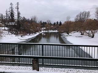
The Whitefish River is a 24.8-mile-long (39.9 km) southward-flowing stream originating at the outlet of Whitefish Lake. The river is a tributary of the Stillwater River just before it reaches the Flathead River in Flathead County, in the U.S. state of Montana. The Whitefish River is part of the Columbia River basin, as the Flathead River is a tributary of Clark Fork, which is tributary to the Pend Oreille River, which is tributary to the Columbia River.

Stryker is an unincorporated community and census-designated place (CDP) in Lincoln County, Montana, United States. As of the 2010 census it had a population of 26. Stryker has the 59933 ZIP code.

The Regional designations of Montana vary widely within the U.S state of Montana. The state is a large geographical area that is split by the Continental Divide, resulting in watersheds draining into the Pacific Ocean, Gulf of Mexico and Hudson's Bay. The state is approximately 545 miles (877 km) east to west along the Canada–United States border and 320 miles (510 km) north to south. The fourth largest state in land area, it has been divided up in official and unofficial ways into a variety of regions. Additionally, Montana is part of a number of larger federal government administrative regions.
Salmon Lake State Park is a public recreation area located approximately 32 miles (51 km) northeast of Missoula, Montana. The state park occupies 42 acres (17 ha) on the eastern side of Salmon Lake in the Clearwater River chain between the Mission and Swan mountain ranges.
U.S. Highway 93 is a north–south United States Numbered Highway in the state of Montana.

Whitefish Lake ; is a natural oligotrophic freshwater lake in Flathead County, Montana, United States.

