A request that this article title be changed to Sunderland Bay is under discussion . Please do not move this article until the discussion is closed. |
Sunderland Bay | |
|---|---|
 Sunderland Bay | |
| Coordinates: 38°30′19″S145°16′41″E / 38.50528°S 145.27806°E | |
| Country | Australia |
| State | Victoria |
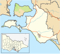
| LGA | |
| Government | |
| • State electorate | |
| • Federal division | |
| Population | |
| • Total | 234 (2016 census) [1] |
| Postcode | 3922 |
Sunderland Bay is a quiet coastal locality on Phillip Island in Victoria, Australia, positioned between Surf Beach and Smiths Beach. Characterised by its rugged natural scenery, Sunderland Bay overlooks Bass Strait, featuring rocky outcrops, cliffs, and secluded sandy beaches. The area is popular among surfers due to consistent swell conditions, and it attracts visitors seeking coastal walks, nature observation, and peaceful relaxation. Predominantly residential, Sunderland Bay consists of a mix of permanent homes and holiday residences, reflecting its appeal as both a retreat and community. Its central location offers convenient access to key Phillip Island attractions, including the Grand Prix Circuit, Penguin Parade, and Phillip Island Nature Parks.