Survey, Kansas | |
|---|---|
 | |
 Survey  Survey | |
| Coordinates: 39°22′50″N99°08′21″W / 39.38056°N 99.13917°W | |
| Country | United States |
| State | Kansas |
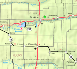
| County | Rooks |
| Elevation | 1,831 ft (558 m) |
| Population | |
• Total | 0 |
| Time zone | UTC-6 (CST) |
| • Summer (DST) | UTC-5 (CDT) |
| Area code | 785 |
Survey is a ghost town in Medicine Township, Rooks County, Kansas, United States.
