Swanscombe and Greenhithe

Last updated

Swanscombe and Greenhithe
Kent UK location map.svg
Red pog.svg
Swanscombe and Greenhithe
Location within Kent
Population14,128 (2011) [1]
OS grid reference TQ604749
Civil parish
  • Swanscombe and Greenhithe
District
Shire county
Region
Country England
Sovereign state United Kingdom
Post town GREENHITHE, SWANSCOMBE, GRAVESEND
Postcode district DA9, DA10, DA11
Dialling code 01322, 01987
Police Kent
Fire Kent
Ambulance South East Coast
Website Swanscombe and Greenhithe Town Council
List of places
UK
England
Kent

51°27′00″N0°18′32″E / 51.4500°N 0.3090°E / 51.4500; 0.3090

Contents

Swanscombe and Greenhithe

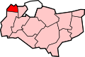
Swanscombe and Greenhithe is a civil parish in the Borough of Dartford in Kent, England. Swanscombe and Greenhithe is a recent renaming of the ancient parish of Swanscombe, covering Swanscombe and Greenhithe. The parish included much of the Ebbsfleet Valley new town development until 2019. The local council is Swanscombe and Greenhithe Town Council.

History

Swanscombe was an ancient parish in the Axstane Hundred of Kent. In 1894 it became part of Dartford Rural District and Swanscombe Parish Council was formed. In 1926 it was removed from the rural district and became a separate urban district [2] When the urban district was abolished in 1974 the parish council was formed again as the successor parish to Swanscombe Urban District. In 1981 Swanscombe Parish Council resolved to become a town council and was renamed Swanscombe and Greenhithe, thus electing its own mayor for the first time. [3]

Governance

The local council is Swanscombe and Greenhithe Town Council.

Geography

The two villages which give the parish its name are both located on the south bank of the River Thames, approximately midway between Dartford town and Gravesend. At the 2011 Census the population of the civil parish was 14,128. [4] Swanscombe village is an ancient one. Greenhithe railway station also serves the Bluewater shopping centre.

Until 2019 the parish included much of the Ebbsfleet Valley area which is undergoing regeneration from industry (cement works at one time dominated it) to housing and lighter industrial use. The Ebbsfleet area was removed from the parish on 2 May 2019 to become an unparished area. [5]

Related Research Articles

<span class="mw-page-title-main">London Borough of Bexley</span> London borough in United Kingdom

The London Borough of Bexley is a London borough in south-east London, forming part of Outer London. It has a population of 248,287. The main settlements are Sidcup, Erith, Bexleyheath, Crayford, Welling and Old Bexley. The London Borough of Bexley is within the Thames Gateway, an area designated as a national priority for urban regeneration. The local authority is Bexley London Borough Council.

<span class="mw-page-title-main">Borough of Dartford</span> Borough & Non-metropolitan district in England

The Borough of Dartford is a local government district in the north-west of the county of Kent, England. Its council is based in the town of Dartford. It is part of the contiguous London urban area. It borders the borough of Gravesham to the east, Sevenoaks District to the south, the London Borough of Bexley to the west, and the Thurrock unitary authority in Essex to the north, across the River Thames. The borough was formed on 1 April 1974 by the merger of the Municipal Borough of Dartford, the Swanscombe Urban District, and part of the Dartford Rural District. The 2011 Census had a population of 97,365 which increased to 116,800 in the 2021 census.

<span class="mw-page-title-main">City of Milton Keynes</span> Unitary authority area in England

The City of Milton Keynes is a unitary authority area with both borough and city status, in Buckinghamshire. It is the northernmost district of the South East England Region. The borough abuts Bedfordshire, Northamptonshire and the remainder of Buckinghamshire.

<span class="mw-page-title-main">Sevenoaks District</span> Non-metropolitan district in England

Sevenoaks is a local government district in west Kent, England. Its council is based in the town of Sevenoaks.

<span class="mw-page-title-main">Dartford railway station</span> Railway station in Kent, England

Dartford railway station serves the town of Dartford in Kent, England. It is 17 miles 12 chains (27.6 km) down the line from London Charing Cross. Train services from the station are operated by Southeastern and Thameslink. Southeastern also manages the station. Dartford is a major interchange station in the North Kent region of the Southeastern network. Ticket barriers control access to the platforms.

<span class="mw-page-title-main">Swanscombe</span> Human settlement in England

Swanscombe /ˈswɒnzkəm/ is a village in the Borough of Dartford in Kent, England, and the civil parish of Swanscombe and Greenhithe. It is 4.4 miles west of Gravesend and 4.8 miles east of Dartford.

<span class="mw-page-title-main">Stone, Kent</span> Human settlement in England

Stone is a village and civil parish in the Borough of Dartford in Kent, England. It is located 2.5 miles east of Dartford. In 2011 the parish had a population of 10,778.

<span class="mw-page-title-main">Greenhithe, Kent</span> Village in the Borough of Dartford, Kent, England

Greenhithe is a village in the Borough of Dartford in Kent, England, and the civil parish of Swanscombe and Greenhithe. It is located 4 miles east of Dartford and 5 miles west of Gravesend.

<span class="mw-page-title-main">Sutton-at-Hone and Hawley</span> Human settlement in England

Sutton-at-Hone and Hawley is a civil parish within the Borough of Dartford in Kent, England. It lies to the south of the urban part of the Borough, and consists of the two settlements named, both to the west of the River Darent, one of the parish boundaries. The M25 motorway divides them. It has a population of 4,133, increasing to 4,230 at the 2011 Census.

<span class="mw-page-title-main">Wrotham</span> Village in Kent, England

Wrotham is a village on the Pilgrims' Way in Kent, England, at the foot of the North Downs. It is 1 mile (1.6 km) north of Borough Green and approximately 5 miles (8 km) east of Sevenoaks. It is between the M20 and M26 motorways.

<span class="mw-page-title-main">Chepping Wycombe</span> Human settlement in England

Chepping Wycombe is a civil parish in the ceremonial county of Buckinghamshire, England. The parish includes the three large villages of Tylers Green, Loudwater, and Flackwell Heath. The central part of the parish comprises extensive business and industrial development lying adjacent and underneath an elevated section of the M40 in the valley of the River Wye.

<span class="mw-page-title-main">Dartford (UK Parliament constituency)</span> UK Parliament constituency since 1885

Dartford is a constituency in Kent represented in the House of Commons of the UK Parliament since 2010 by Gareth Johnson of the Conservative Party. It is the longest bellwether constituency in the country: the party of the winning candidate has gone on to form the government at every UK general election since 1964. Candidates for the largest two parties nationally have polled first and second since 1923 in Dartford.

<span class="mw-page-title-main">Arriva Southern Counties</span> Bus operator in East Sussex, Kent and Essex

Arriva Southern Counties Limited, trading as Arriva Southern Counties, is a bus operator in Kent, Essex, Hemel Hempstead, and Watford in England. It is a subsidiary of Arriva UK Bus.

<span class="mw-page-title-main">Ebbsfleet International railway station</span> Railway station in Kent, England

Ebbsfleet International railway station is in Ebbsfleet Valley, Kent, 10 miles east of London, England, near Dartford and the Bluewater shopping centre to the west and Gravesend to the east. The station, part of the Thames Gateway urban regeneration project, is on the High Speed 1 (HS1) rail line, 400 metres south-west of Northfleet railway station, off the A2 trunk road, 5 mi (8.0 km) from its junction with the M25 motorway. It served as a primary park-and-rail service for the London 2012 Olympics.

Dartford Borough Council is the local authority for the Borough of Dartford in Kent, England. The council is elected every four years.

Successor parishes are civil parishes with a parish council, created in England in 1974. They replaced, with the same boundaries, a selected group of urban districts and municipal boroughs: a total of 300 successor parishes were formed from the former areas of 78 municipal boroughs and 221 urban districts.

<span class="mw-page-title-main">A226 road</span> Road in southeast England

The A226 road travels in a west–east direction in southeast London and north Kent, from Crayford in the London Borough of Bexley, through Dartford, Gravesend to Strood. It is about 15.7 miles in length.

Dartford Rural District was a rural district with an area of 34,037 acres (138 km2) in the county of Kent, England. In 1971 it had a population of 64,561 and an electorate of 43,911. At dissolution it was the most populous rural district council in Kent, but had once been larger, having lost territory when Crayford Urban District was created in 1920, and Swanscombe Urban District in 1926.

Ebbsfleet Valley is a new town and redevelopment area in Kent, South East England, and part of the Thames Gateway, southwest of Gravesend. Development is coordinated by the Ebbsfleet Development Corporation.

References

  1. Key Figures for 2011 Census: Key Statistics
  2. See www.visionofbritain.org.uk Swanscombe UD article, retrieved Jan. 2016
  3. See http://swanscombe.com/newsevents/history.asp retrieved Jan 2016, article by Christoph Bull the former Reference and Information Librarian at Dartford Central Library
  4. "Civil Parish population 2011". Neighbourhood Statistics. Office for National Statistics. Archived from the original on 20 October 2016. Retrieved 11 September 2016.
  5. "The Dartford Borough Council (Reorganisation of Community Governance) Order 2018". Dartford Borough Council. 30 November 2018. Retrieved 4 January 2024.