Tōhō, Fukuoka

Last updated • 2 min readFrom Wikipedia, The Free Encyclopedia
Tōhō
東峰村
Iwaya-jinja Honden 01.jpg
Iwaya Shrine
Flag of Toho Fukuoka.svg
Emblem of Toho, Fukuoka.svg
Toho, Fukuoka
Location of Tōhō in Fukuoka Prefecture
Toho in Fukuoka Prefecture Ja.svg
Japan location map with side map of the Ryukyu Islands.svg
Red pog.svg
Tōhō
Location in Japan
Coordinates: 33°23′50″N130°52′12″E / 33.39722°N 130.87000°E / 33.39722; 130.87000
CountryJapan
Region Kyushu
Prefecture Fukuoka
District Asakura
Area
  Total
51.97 km2 (20.07 sq mi)
Population
 (December 31, 2023)
  Total
1,842
  Density35/km2 (92/sq mi)
Time zone UTC+09:00 (JST)
City hall address6425 Hōshuyama, Tōhō-mura, Asakura-gun, Fukuoka-ken 838-1792
Website Official website
Toho Village Hall Toho village office.jpg
Tōhō Village Hall
Traditional Industry Hall of Koishiwara Pottery Traditional Industry Hall of Koishiwara Pottery.jpg
Traditional Industry Hall of Koishiwara Pottery

Tōhō (東峰村, Tōhō-mura) is a village located in Asakura District, Fukuoka Prefecture, Japan. [1] As of 31 March 2023, the village had an estimated population of 1842 in 811 households, and a population density of 35 persons per km². [2] The total area of the village is 51.97 km2 (20.07 sq mi).

Contents

Geography

Tōhō is located in the southeastern part of Fukuoka Prefecture and borders Hita City in Oita Prefecture. Most of the village area is mountainous, and a small portion is agricultural.

Neighboring municipalities

Fukuoka Prefecture

Ōita Prefecture

Demographics

Per Japanese census data, the population of Tōhō is as shown below

Historical population
YearPop.±%
1940 7,425    
1950 8,666+16.7%
1960 6,352−26.7%
1970 4,190−34.0%
1980 3,594−14.2%
1990 3,371−6.2%
2000 2,948−12.5%
2010 2,433−17.5%
2020 1,899−21.9%

Climate

Tōhō has a humid subtropical climate (Köppen Cfa) characterized by warm summers and cool winters with light to no snowfall. The average annual temperature in Tōhō is 15.2 °C. The average annual rainfall is 1532 mm with September as the wettest month. The temperatures are highest on average in August, at around 26.3 °C, and lowest in January, at around 4.2 °C. [3]

History

The area of Tōhō was part of ancient Chikuzen Province, but was on the border of Buzen and Bungo Provinces. During the Edo Period, the area was part of the holdings of Fukuoka Domain. The villages of Koishiwara and Hōshuyama in Asakura District were established on May 1, 1889 with the creation of the modern municipalities system. The two villages merged on March 28, 2005 to form the village of Tōhō.

Government

Tōhō has a mayor-council form of government with a directly elected mayor and a unicameral village council of ten members. Tōhō, collectively with the city of Asakura and town of Chikuzen contributes two members to the Fukuoka Prefectural Assembly. In terms of national politics, the village is part of the Fukuoka 5th district of the lower house of the Diet of Japan.

Economy

Tōhō has a mainly rural economy based on agriculture. The village is also a production centre of Koishiwara ware. [4] [5]

Education

Tōhō has one public combined elementary/junior high school operated by the village government. The village does not have a high school.

Transportation

Railways

Tōhō ceased to have passenger railway service when the lines of the JR Kyushu Hitahikosan Line suffered severe damage due to torrential rains in July 2017. The former rail service has been replaced by a Bus Rapid Transit (BRT) operation.

JR logo (west).svg JR Kyushu - Hitahikosan Line

Highways

Related Research Articles

<span class="mw-page-title-main">Fukuoka Prefecture</span> Prefecture of Japan

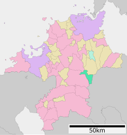
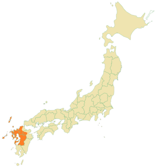
Fukuoka Prefecture is a prefecture of Japan located on the island of Kyūshū. Fukuoka Prefecture has a population of 5,109,323 and has a geographic area of 4,986 km2. Fukuoka Prefecture borders Saga Prefecture to the southwest, Kumamoto Prefecture to the south, and Ōita Prefecture to the southeast.

<span class="mw-page-title-main">Hita, Ōita</span> City in Kyushu, Japan

Hita is a city located in Ōita Prefecture, Japan. As of 30 November 2023, the city had an estimated population of 61,148 in 27556 households, and a population density of 96 persons per km2. The total area of the city is 666.03 km2 (257.16 sq mi).

<span class="mw-page-title-main">Tsuno, Miyazaki</span> Town in Kyushu, Japan

Tsuno is a town located in Koyu District, Miyazaki Prefecture, Japan. As of 1 October 2023, the town has an estimated population of 9,577 in 3997 households, and a population density of 94 persons per km². The total area of the town is 145.96 square kilometres (56.36 sq mi).

<span class="mw-page-title-main">Asakura, Fukuoka</span> City in Kyushu, Japan

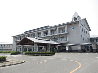
Asakura is a city located in south central Fukuoka Prefecture, Japan. As of 31 January 2024, the city had an estimated population of 50,488 in 22168 households, and a population density of 200 persons per km². The total area of the city is 246.71 km2 (95.26 sq mi).

Koishiwara was a village located in Asakura District, Fukuoka Prefecture, Japan.

Hōshuyama was a village located in Asakura District, Fukuoka Prefecture, Japan.

<span class="mw-page-title-main">Ukiha, Fukuoka</span> City in Kyushu, Japan

Ukiha is a city located in Fukuoka Prefecture, Japan. As of 31 January 2024, the city had an estimated population of 27,723 in 11449 households, and a population density of 240 persons per km2. The total area of the city is 117.46 km2 (45.35 sq mi).

<span class="mw-page-title-main">Soeda, Fukuoka</span> Town in Kyushu, Japan

Soeda is a town located in Tagawa District, Fukuoka Prefecture, Japan. As of 31 March 2023, the town had an estimated population of 8725 in 4496 households, and a population density of 66 persons per km2. The total area of the town is 132.20 km2 (51.04 sq mi).

<span class="mw-page-title-main">Chikuzen, Fukuoka</span> Town in Kyushu, Japan

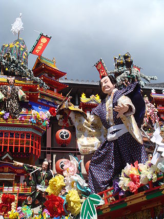
Chikuzen is a town located in Asakura District, Fukuoka Prefecture, Japan. As of 31 January 2024, the town had an estimated population of 30,470 in 12358 households, and a population density of 450 persons per km2. The total area of the town is 67.10 km2 (25.91 sq mi).

<span class="mw-page-title-main">Kama, Fukuoka</span> City in Kyushu, Japan

Kama is a city located in Fukuoka Prefecture, Japan. is a city located in Fukuoka Prefecture, Japan. As of 29 February 2024, the city had an estimated population of 34,800 in 18035 households, and a population density of 260 persons per km². The total area of the city is 135.11 km2 (52.17 sq mi).

<span class="mw-page-title-main">Hitahikosan Line</span> Railway line in Kyushu, Japan

The Hitahikosan Line is a railway line in Japan, operated by Kyushu Railway Company. It connects Jōno Station in Kitakyushu, Fukuoka Prefecture with Yoake Station in Hita, Ōita Prefecture and features the 4380 m Shakadake Tunnel between Chikuzen Iwaya and Hikosan station, where a fatal tunnel collapse occurred during construction in 1953, killing 21 construction workers. The line is named after Hita and Mount Hiko.

<span class="mw-page-title-main">Hita Station</span> Railway station in Hita, Ōita Prefecture, Japan

Hita Station is a railway station on the Kyūdai Main Line operated by JR Kyushu in Hita, Ōita Prefecture, Japan.

<span class="mw-page-title-main">Hikosan Station</span> Railway station in Japan

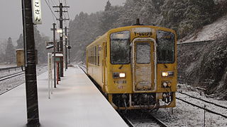
Hikosan Station was a passenger railway station located in the town of Soeda, Fukuoka Prefecture, Japan. It is operated by JR Kyushu.

<span class="mw-page-title-main">Yoake Station</span> Railway station in Hita, Ōita Prefecture, Japan

Yoake Station is a passenger railway station operated by JR Kyushu in the city of Hita, Ōita Prefecture, Japan. It was formerly the junction between the Kyudai Main Line and the Hitahikosan Line.

<span class="mw-page-title-main">Teruoka Station</span> Railway station in Hita, Ōita Prefecture, Japan

Teruoka Station is a passenger railway station on the Kyūdai Main Line operated by JR Kyushu in Hita, Ōita Prefecture, Japan.

<span class="mw-page-title-main">Itoshima, Fukuoka</span> City in Kyushu, Japan

Itoshima is a city located in western Fukuoka Prefecture, Japan. As of 31 March 2024, the city had an estimated population of 103,655 in 46,192 households, and a population density of 480 persons per km². The total area of the city is 215.69 km2 (83.28 sq mi).

<span class="mw-page-title-main">Hōshuyama Station</span> Railway station in Tōhō, Fukuoka Prefecture, Japan

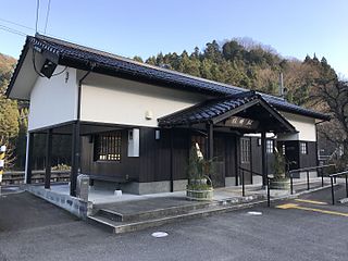
Hōshuyama Station is a railway station on the Hitahikosan Line in Tōhō, Fukuoka, Japan, operated by Kyushu Railway Company.

<span class="mw-page-title-main">Ōtsuru Station</span> Railway station in Hita, Ōita Prefecture, Japan

Ōtsuru Station is a railway station on the Hitahikosan Line in Hita, Ōita Prefecture, Japan. It is operated by JR Kyushu and is on the Hitahikosan Line.

<span class="mw-page-title-main">Imayama Station</span> Railway station in Hita, Ōita Prefecture, Japan

Imayama Station is a railway station on the Hitahikosan Line in Hita, Ōita Prefecture, Japan. It is operated by JR Kyushu and is on the Hitahikosan Line.

<span class="mw-page-title-main">Hichiku dialect</span> Japanese dialects of western Kyūshū, Japan

The Hichiku dialectHichiku hōgen (肥筑方言) is a group of the Japanese dialects spoken in western Kyushu. The name Hichiku (肥筑) is constructed by extracting a representative kanji from Hizen (前), Higo (後), Chikuzen (前) and Chikugo (後), the names of old provinces.

References

  1. 日経ビジネス電子版. "「バス以上鉄道未満」のBRT 線路跡の専用道にこだわる愚". 日経ビジネス電子版 (in Japanese). Retrieved 2022-10-21.
  2. "Tōhō Village official statistics" (in Japanese). Japan.
  3. Tōhō climate: Average Temperature, weather by month
  4. Gordenker, Alice (2019-06-21). "Pottery island: A three-day tour through Kyushu's ceramics villages". The Japan Times. Retrieved 2022-10-21.
  5. "Koishiwara ware (Toho Village) | Kyushu Tourism Promotion Organization". www.visit-kyushu.com. Retrieved 2022-10-21.