Nakagawa, Fukuoka

Last updated • 3 min readFrom Wikipedia, The Free Encyclopedia
Nakagawa
那珂川市
Nakagawa town hall.JPG
Nakagawa city hall
Flag of Nakagawa Fukuoka.svg
Emblem of Nakagawa, Fukuoka.svg
Nakagawa, Fukuoka
Location of Nakagawa in Fukuoka Prefecture
Nakagawa in Fukuoka Prefecture Ja.svg
Japan location map with side map of the Ryukyu Islands.svg
Red pog.svg
Nakagawa
Location in Japan
Coordinates: 33°29′58″N130°25′20″E / 33.49944°N 130.42222°E / 33.49944; 130.42222
CountryJapan
Region Kyushu
Prefecture Fukuoka
Area
  Total74.95 km2 (28.94 sq mi)
Population
 (March 31, 2024)
  Total49,400
  Density660/km2 (1,700/sq mi)
Time zone UTC+09:00 (JST)
City hall address1-1-1 Nishikuma, Nakagawa-shi, Fukuoka-ken 811-1292
Website Official website
Symbols
Bird Common kingfisher
Flower Rhododendron subg. Hymenanthes
Tree Myrica rubra
:Nakagawa River from Shironohashi Bridge Nakagawa River from Shironohashi Bridge (south) 2.jpg
:Nakagawa River from Shironohashi Bridge

Nakagawa (那珂川市, Nakagawa-shi) is a city located in Fukuoka Prefecture, Japan. [1] [2] The city was founded on October 1, 2018, making it the newest city in Japan. As of 31 March 2024, the city had an estimated population of 49,400 in 21613 households, and a population density of 660 persons per km². [3] The total area is 74.95 km2 (28.94 sq mi). [4]

Contents

Geography

Nakagawa is adjacent to the south side of Fukuoka City and the west side of Kasuga City, and forms part of the Fukuoka metropolitan area. The flatland area in the northern part of the city, centered around Hakata-Minami Station near Fukuoka City has developed as a commuter town, but other areas are farmland and mountainous, with areas such as Minamihata Dam and Gokayama Dam.

Neighboring municipalities

Fukuoka Prefecture

Saga Prefecture

Climate

Nakagawa has a humid subtropical climate (Köppen Cfa) characterized by warm summers and cool winters with light to no snowfall. The average annual temperature in Nakagawa is 14.8 °C (58.6 °F). The average annual rainfall is 1766 mm with September as the wettest month. The temperatures are highest on average in August, at around 26.2 °C (79.2 °F), and lowest in January, at around 4.1 °C (39.4 °F). [5]

Demographics

Per Japanese census data, the population of Nakagawa is as shown below. When looking at the city as a whole, the population is steadily increasing, but while the population is increasing in some areas in the north due to urbanization, other areas, which make up the majority of the area, are experiencing serious depopulation and aging.

Historical population
YearPop.±%
1940 6,868    
1950 8,621+25.5%
1960 8,458−1.9%
1970 11,245+33.0%
1980 24,840+120.9%
1990 36,576+47.2%
2000 45,548+24.5%
2010 49,785+9.3%
2020 50,112+0.7%

History

The area of Nakagawa is believed to be the part of the Yayoi period, Nakoku, mentioned in ancient Chinese documents. It was later part of ancient Chikuzen Province. During the Edo Period, the area was under the control of Fukuoka Domain. After the Meiji restoration, the villages of Andoku, Iwato, and Minamihata were established with the creation of the modern municipalities system on April 1, 1889.These three villages merged on April 1, 1956 to form the town of Nakagawa. It was raised to city status on October 1, 2018.

Government

Nakagawa has a mayor-council form of government with a directly elected mayor and a unicameral city council of 17 members. Nakagawa contributes one member to the Fukuoka Prefectural Assembly. In terms of national politics, the city is part of the Fukuoka 5th district of the lower house of the Diet of Japan.

Economy

Nakagawa is a regional commercial center, and is largely a commuter town for neighboring Fukuoka.The central and southern parts of Nakagawa City are mainly rice paddies, but due to recent acreage reduction policies, an increasing number of farmers are turning to upland farming, and are focusing on cultivating a root vegetable called yacon.

Education

Nakagawa has seven public elementary schools and three public junior high schools and one public high school operated by the Fukuoka Prefectural Board of Education.

Transportation

Railways

Nagakawa has no passenger railway service. The JR West Hakata-Minami Station is located on the border between Kasuga and Nakagawa, but the station and its platform are within the Kasuga area. The station building, rotary, and bus terminal are located in Nakagawa City, and the area around the station is more urbanized on the Nakagawa side than on the Kasuga side. In addition, although the Kyushu Shinkansen passes through Nakagawa, and the Sanyo Shinkansen Hakata General Vehicle Depot (commonly known as "Hakuso") straddles border between Kasuga and Nakagawa, there is no Shinkansen station within Nakagawa city borders.

Highways

Local attractions

Related Research Articles

<span class="mw-page-title-main">Fukuoka</span> Designated city in Kyushu, Japan

Fukuoka is the sixth-largest city in Japan and the capital city of Fukuoka Prefecture, Japan. The city is built along the shores of Hakata Bay, and has been a center of international commerce since ancient times. The area has long been considered the gateway to the country, as it is the nearest point among Japan's main islands to the Asian mainland. Although humans occupied the area since the Jomon period, some of the earliest settlers of the Yayoi period arrived in the Fukuoka area. The city rose to prominence during the Yamato period. Because of the cross-cultural exposure, and the relatively great distance from the social and political centers of Kyoto, Osaka, and later, Edo (Tokyo), Fukuoka gained a distinctive local culture and dialect that has persisted to the present.

<span class="mw-page-title-main">Fukuoka Prefecture</span> Prefecture of Japan

Fukuoka Prefecture is a prefecture of Japan located on the island of Kyūshū. Fukuoka Prefecture has a population of 5,109,323 and has a geographic area of 4,986 km2. Fukuoka Prefecture borders Saga Prefecture to the southwest, Kumamoto Prefecture to the south, and Ōita Prefecture to the southeast.

<span class="mw-page-title-main">Hakata-ku, Fukuoka</span> Ward in Kyushu, Japan

Hakata-ku (博多区) is a ward of the city of Fukuoka in Fukuoka Prefecture, Japan.

<span class="mw-page-title-main">Ōkawa, Fukuoka</span> City in Kyushu, Japan

Ōkawa is a city located in Fukuoka Prefecture, Japan. As of 1 February 2024, the city had an estimated population of 31,605 in 13984 households, and a population density of 940 persons per km². The total area of the city is 33.62 km2 (12.98 sq mi).

<span class="mw-page-title-main">Ogōri, Fukuoka</span> City in Kyushu, Japan

Ogōri is a city located in Fukuoka Prefecture, Japan. As of 1 February 2024, the city had an estimated population of 59,590 in 25998 households, and a population density of 1309 persons per km². The total area of the city is 45.51 km2 (17.57 sq mi).

<span class="mw-page-title-main">Chikushino, Fukuoka</span> City in Kyushu, Japan

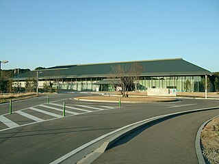
Chikushino is a city in Fukuoka Prefecture, Japan. As of 29 February 2024, the city had an estimated population of 106,513 in 48029 households, and a population density of 1200 persons per km2. The total area of the city is 87.73 km2 (33.87 sq mi).

<span class="mw-page-title-main">Kasuga, Fukuoka</span> City in Kyushu, Japan

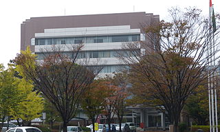
Kasuga is a city located in Fukuoka Prefecture, Japan. As of 31 March 2024, the city had an estimated population of 111,840 in 50874 households, and a population density of 260 persons per km². The total area of the city is 14.145 km2 (5.461 sq mi).

<span class="mw-page-title-main">Koga, Fukuoka</span> City in Kyushu, Japan

Koga is a city located in Fukuoka Prefecture, Japan. As of 29 February 2024, the city had an estimated population of 59,282 in 26981 households, and a population density of 1400 persons per km². The total area of the city is 42.07 km2 (16.24 sq mi).

<span class="mw-page-title-main">Hakata Station</span> Major railway and metro station in Fukuoka, Japan

Hakata Station is a major railway station in Hakata-ku, Fukuoka, Japan. It is the largest and busiest railway terminal in Kyushu, and is a gateway to other cities in Kyushu for travelers coming from Honshu by rail travel. The San'yō Shinkansen from Osaka ends at this station.

<span class="mw-page-title-main">Hakata-Minami Line</span> Extension of the Sanyō Shinkansen in Fukuoka Prefecture, Japan

The Hakata-Minami Line is an 8.5 km (5.3 mi) long railway line in Fukuoka Prefecture, Japan, connecting Hakata Station in Fukuoka with Hakata-Minami Station in Kasuga. It is operated by the West Japan Railway Company.

<span class="mw-page-title-main">Umi, Fukuoka</span> Town in Kyushu, Japan

Umi is a town located in Kasuya District, Fukuoka Prefecture, Japan. As of 31 March 2024, the town had an estimated population of 36,907 in 16691 households, and a population density of 1200 persons per km². The total area of the town is 30.21 km2 (11.66 sq mi)

<span class="mw-page-title-main">Shingū, Fukuoka</span> Town in Kyushu, Japan

Shingū is a town located in Kasuya District, Fukuoka Prefecture. As of 29 February 2024, the town had an estimated population of 33,142 in 13664 households, and a population density of 1800 persons per km². The total area of the town is 18.93 km2 (7.31 sq mi), and includes the island Ainoshima.

<span class="mw-page-title-main">Kotake, Fukuoka</span> Town in Kyushu, Japan

Kotake is a town located in Kurate District, Fukuoka Prefecture, Japan. As of 29 February 2024, the town had an estimated population of 6983 in 3374 households, and a population density of 490 persons per km2. The total area of the town is 14.28 km2 (5.51 sq mi).

<span class="mw-page-title-main">Kurate, Fukuoka</span> Town in Kyushu, Japan

Kurate is a town located in Kurate District, Fukuoka Prefecture, Japan. As of 31 January 2024, the town had an estimated population of 14,988 in 7442 households, and a population density of 420 persons per km². The total area of the town is 35.60 km2 (13.75 sq mi).

<span class="mw-page-title-main">Kumenan</span> Town in Japan

Kumenan is a town located in Kume District, Okayama Prefecture, Japan.As of 31 December 2022, the town had an estimated population of 4,483 in 2192 households and a population density of 57 persons per km2. The total area of the town is 78.65 square kilometres (30.37 sq mi). Kumenan is known as the birthplace of Honen, the founder of the Jodo sect of Buddhism.

<span class="mw-page-title-main">Fukutsu, Fukuoka</span> City in Kyushu, Japan

Fukutsu is a city located in Fukuoka Prefecture, Japan. As of 29 February 2024, the city had an estimated population of 68,834 in 31114 households, and a population density of 1300 persons per km2. The total area of the city is 52.76 km2 (20.37 sq mi).

Nakasu (中洲) is the red-light district which exists between the sandbank of the Naka River and the Hakata River in Fukuoka City, Fukuoka Prefecture, Japan. It is named after a popular, but very short-lived, entertainment quarter of Edo, which existed in the late 18th century. The name "Nakasu" can be translated as "the island in the middle", as Nakasu is an island between two rivers.

<span class="mw-page-title-main">Misaki, Okayama</span> Town in Japan

Misaki is a town located in Kume District, Okayama Prefecture, Japan. As of 31 December 2022, the town had an estimated population of 13,060 in 5867 households and a population density of 56 persons per km2. The total area of the town is 232.17 square kilometres (89.64 sq mi).

<span class="mw-page-title-main">Kushida Shrine Station</span> Metro station in Fukuoka, Japan

Kushida Shrine Station is a subway station on the Fukuoka City Subway Nanakuma Line in Hakata-ku, Fukuoka in Japan.

References

  1. "国道385号バイパス始動 那珂川市山間部 県が測量調査へ". 西日本新聞me (in Japanese). Retrieved 2022-10-22.
  2. "那珂川市 地域おこし協力隊 高岸 春幸さん | 移住者インタビュー|福岡県 移住・定住ポータルサイト 福がお~かくらし". 福岡県 移住・定住ポータルサイト 福がお~かくらし (in Japanese). Retrieved 2022-10-22.
  3. "Nakagawa City official statistics" (in Japanese). Japan.
  4. "那珂川市 | 4地域と60市町村紹介|福岡県ってどんなところ?|福岡県 移住・定住ポータルサイト 福がお~かくらし". 福岡県 移住・定住ポータルサイト 福がお~かくらし (in Japanese). Retrieved 2022-10-22.
  5. Nakagawa climate: Average Temperature, weather by month