
Fukuoka Prefecture is a prefecture of Japan located on the island of Kyūshū. Fukuoka Prefecture has a population of 5,109,323 and has a geographic area of 4,986 km2. Fukuoka Prefecture borders Saga Prefecture to the southwest, Kumamoto Prefecture to the south, and Ōita Prefecture to the southeast.

Ōkawa is a city located in Fukuoka Prefecture, Japan. As of 1 February 2024, the city had an estimated population of 31,605 in 13984 households, and a population density of 940 persons per km². The total area of the city is 33.62 km2 (12.98 sq mi).
Ogōri is a city located in Fukuoka Prefecture, Japan. As of 1 February 2024, the city had an estimated population of 59,590 in 25998 households, and a population density of 1309 persons per km². The total area of the city is 45.51 km2 (17.57 sq mi).

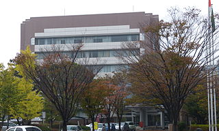
Chikushino is a city in Fukuoka Prefecture, Japan. As of 29 February 2024, the city had an estimated population of 106,513 in 48029 households, and a population density of 1200 persons per km2. The total area of the city is 87.73 km2 (33.87 sq mi).
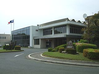
Kasuga is a city located in Fukuoka Prefecture, Japan. As of 31 March 2024, the city had an estimated population of 111,840 in 50874 households, and a population density of 260 persons per km². The total area of the city is 14.145 km2 (5.461 sq mi).

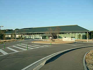
Munakata is a city in Japan, located in Fukuoka Prefecture. As of 31 March 2024, the city had an estimated population of 96,786 in 44884 households, and a population density of 810 persons per km². The total area of the city is 119.94 km2 (46.31 sq mi).

Nakagawa is a city located in Fukuoka Prefecture, Japan. The city was founded on October 1, 2018, making it the newest city in Japan. As of 31 March 2024, the city had an estimated population of 49,400 in 21613 households, and a population density of 660 persons per km². The total area is 74.95 km2 (28.94 sq mi).

Umi is a town located in Kasuya District, Fukuoka Prefecture, Japan. As of 31 March 2024, the town had an estimated population of 36,907 in 16691 households, and a population density of 1200 persons per km². The total area of the town is 30.21 km2 (11.66 sq mi)

Sue is a town located in Kasuya District, Fukuoka Prefecture, Japan.As of 29 February 2024, the town had an estimated population of 29,248 in 12810 households, and a population density of 1800 persons per km². The total area of the town is 16.31 km2 (6.30 sq mi)

Shingū is a town located in Kasuya District, Fukuoka Prefecture. As of 29 February 2024, the town had an estimated population of 33,142 in 13664 households, and a population density of 1800 persons per km². The total area of the town is 18.93 km2 (7.31 sq mi), and includes the island Ainoshima.
Hisayama is a town located in Kasuya District, Fukuoka Prefecture, Japan. As of 29 February 2024, the town had an estimated population of 9355 in 3836 households, and a population density of 250 persons per km². The total area of the town is 37.44 km2 (14.46 sq mi)

Kasuya is a district located in Fukuoka Prefecture, Japan, east of Fukuoka City.

Kotake is a town located in Kurate District, Fukuoka Prefecture, Japan. As of 29 February 2024, the town had an estimated population of 6983 in 3374 households, and a population density of 490 persons per km2. The total area of the town is 14.28 km2 (5.51 sq mi).

Kurate is a town located in Kurate District, Fukuoka Prefecture, Japan. As of 31 January 2024, the town had an estimated population of 14,988 in 7442 households, and a population density of 420 persons per km². The total area of the town is 35.60 km2 (13.75 sq mi).

Yoshitomi is a town located in Chikujō District, Fukuoka Prefecture, Japan. As of 2 December 2023, the town had an estimated population of 6,617 in 3075 households, and a population density of 1200 persons per km². The total area of the town is 5.72 km2 (2.21 sq mi).

Fukutsu is a city located in Fukuoka Prefecture, Japan. As of 29 February 2024, the city had an estimated population of 68,834 in 31114 households, and a population density of 1300 persons per km2. The total area of the city is 52.76 km2 (20.37 sq mi).

Kama is a city located in Fukuoka Prefecture, Japan. is a city located in Fukuoka Prefecture, Japan. As of 29 February 2024, the city had an estimated population of 34,800 in 18035 households, and a population density of 260 persons per km². The total area of the city is 135.11 km2 (52.17 sq mi).

Miyama is a city located in Fukuoka Prefecture, Japan. As of 31 December 2023, the city had an estimated population of 34,907 in 14658 households, and a population density of 330 persons per km². The total area of the city is 105.21 km2 (40.62 sq mi).

Miyawaka is a city located in Fukuoka, Japan. As of 31 January 2024, the city had an estimated population of 26,447 in 13369 households, and a population density of 190 persons per km². The total area of the city is 139.99 km2 (54.05 sq mi).

Itoshima is a city located in western Fukuoka Prefecture, Japan. As of 31 March 2024, the city had an estimated population of 103,655 in 46,192 households, and a population density of 480 persons per km². The total area of the city is 215.69 km2 (83.28 sq mi).


