| Tahiryuak Lake | |
|---|---|
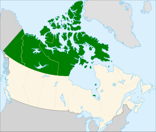
| Location | Victoria Island Northwest Territories |
| Coordinates | 70°58′N112°10′W / 70.967°N 112.167°W Coordinates: 70°58′N112°10′W / 70.967°N 112.167°W |
| Primary outflows | Kuuk River |
| Catchment area | Prince Albert Sound |
| Basin countries | Canada |
| Surface elevation | 221 metres (725 ft) [1] |
| Settlements | Nearest is Ulukhaktok |
Tahiryuak Lake[ pronunciation? ] is a lake located in the Canadian Arctic's Northwest Territories. It is situated in northcentral Victoria Island, north of Prince Albert Sound, southeast of Minto Inlet.

A lake is an area filled with water, localized in a basin, surrounded by land, apart from any river or other outlet that serves to feed or drain the lake. Lakes lie on land and are not part of the ocean, and therefore are distinct from lagoons, and are also larger and deeper than ponds, though there are no official or scientific definitions. Lakes can be contrasted with rivers or streams, which are usually flowing. Most lakes are fed and drained by rivers and streams.
Northern Canada, colloquially the North, is the vast northernmost region of Canada variously defined by geography and politics. Politically, the term refers to three territories of Canada: Yukon, Northwest Territories, and Nunavut. Similarly, the Far North may refer to the Canadian Arctic: the portion of Canada that lies north of the Arctic Circle, east of Alaska and west of Greenland. This area covers about 39% of Canada's total land area, but has less than 1% of Canada's population.
The lake is populated with silver charr [2] It is designated as a Key Habitat Site because of the high density of nesting king eiders. In addition, notable populations of Arctic tern, cackling goose, long-tailed duck, Pacific loon, pomarine jaeger, and Sabine's gulls frequent the area. [3]

The Arctic char or Arctic charr is a cold-water fish in the family Salmonidae, native to alpine lakes and arctic and subarctic coastal waters. Its distribution is circumpolar. It spawns in fresh water and populations can be lacustrine, riverine or anadromous, where they return from the ocean to their fresh water birth rivers to spawn. No other freshwater fish is found as far north; it is, for instance, the only fish species in Lake Hazen on Ellesmere Island in the Canadian Arctic. It is one of the rarest fish species in Britain and Ireland, found mainly in deep, cold, glacial lakes, and is at risk from acidification. In other parts of its range, such as the Nordic countries, it is much more common, and is fished extensively. In Siberia, it is known as golets and it has been introduced in lakes where it sometimes threatens less hardy endemic species, such as the small-mouth char and the long-finned char in Elgygytgyn Lake.
A Key Habitat Site is a Canadian Wildlife Service designation for an area that supports at least 1% of the country's population of any migratory bird species, or subspecies, at any time. There may be overlap with areas designated as a migratory bird sanctuary or National Wildlife Area.

The king eider is a large sea duck that breeds along Northern Hemisphere Arctic coasts of northeast Europe, North America and Asia. The birds spend most of the year in coastal marine ecosystems at high latitudes, and migrate to Arctic tundra to breed in June and July. They lay four to seven eggs in a scrape on the ground lined with grass and down.
Tahiryuak was a caribou hunting region of the Haneragmiut and the Kanianermiut Copper Inuit. [4]
Haneragmiut were a geographically defined Copper Inuit subgroup in the Canadian territory of Nunavut. They were the most westerly band of those that hunted in southern Victoria Island. They were generally located on the north shore of Dolphin and Union Strait, north of Cape Bexley, and south of Prince Albert Sound, on Victoria Island. Though they migrated seasonally both north and south for hunting, fishing, and trade, they were unaware that Victoria Island was an island.

Copper Inuit are a Canadian Inuit group who live north of the tree line, in what is now Nunavut's Kitikmeot Region and the Northwest Territories's Inuvik Region. Most historically lived in the area around Coronation Gulf, on Victoria Island, and southern Banks Island.


