This article needs additional citations for verification .(June 2014) (Learn how and when to remove this template message) |
| Tamparan | |
|---|---|
| Municipality | |
| Municipality of Tamparan | |
Map of Lanao del Sur with Tamparan highlighted | |
Location within the Philippines | |
| Coordinates: 7°52′44″N124°19′59″E / 7.879°N 124.333°E Coordinates: 7°52′44″N124°19′59″E / 7.879°N 124.333°E | |
| Country | |
| Region | Autonomous Region in Muslim Mindanao (ARMM) |
| Province | Lanao del Sur |
| District | 1st District |
| Barangays | 44 (see Barangays) |
| Government [1] | |
| • Type | Sangguniang Bayan |
| • Mayor | Topaan D. Disomimba |
| • Electorate | 13,012 voters (2016) |
| Area [2] | |
| • Total | 170.00 km2 (65.64 sq mi) |
| Population (2015 census) [3] | |
| • Total | 25,874 |
| • Density | 150/km2 (390/sq mi) |
| Time zone | PST (UTC+8) |
| ZIP code | 9704 |
| PSGC | 153626000 |
| IDD : area code | +63 (0)63 |
| Climate type | tropical climate |
| Income class | 5th municipal income class |
| Website | www |
Tamparan, officially the Municipality of Tamparan, is a 5th class municipality in the province of Lanao del Sur, Philippines. According to the 2015 census, it has a population of 25,874 people. [3]
Lanao del Sur, officially the Province of Lanao del Sur, is a province in the Philippines located in the Bangsamoro Autonomous Region in Muslim Mindanao (BARMM). The capital is the city of Marawi, and it borders Lanao del Norte to the north, Bukidnon to the east, and Maguindanao and Cotabato to the south. To the southwest lies Illana Bay, an arm of the Moro Gulf.
The Philippines, officially the Republic of the Philippines, is an archipelagic country in Southeast Asia. Situated in the western Pacific Ocean, it consists of about 7,641 islands that are categorized broadly under three main geographical divisions from north to south: Luzon, Visayas, and Mindanao. The capital city of the Philippines is Manila and the most populous city is Quezon City, both part of Metro Manila. Bounded by the South China Sea on the west, the Philippine Sea on the east and the Celebes Sea on the southwest, the Philippines shares maritime borders with Taiwan to the north, Vietnam to the west, Palau to the east, and Malaysia and Indonesia to the south.
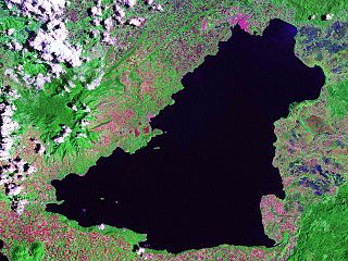
The Islamic Municipality of Tamparan is located on the eastern part of Lanao del Sur. It is bounded on the north by the Municipality of Taraka, on the south by Poona-Bayabao, and on the west by Lake Lanao.
Lake Lanao is a large ancient lake in the Philippines, located in Lanao del Sur province in the country's southern island of Mindanao. With a surface area of 340 km2 (130 sq mi), it is the largest lake in Mindanao, and the second largest lake in the Philippines and counted as one of the 15 ancient lakes in the world. Scholars have been pushing for the lake's inclusion in the UNESCO World Heritage List.
Tamparan is approximately 27 kilometres (17 mi) from Marawi City, the biggest center in the province and also the nearest center of commercial activities to Tamparan. Tamparan and Marawi City are connected by road passing through the municipalities of Ditsaan-Ramain, Bubong, Buadi-Puso Buntong, Mulondo and Taraka. Tamparan is also accessible by water transportation through the Lake Lanao.

Bubong, officially the Municipality of Bubong, is a 2nd class municipality in the province of Lanao del Sur, Philippines. According to the 2015 census, it has a population of 22,336 people.
The municipality of Tamparan has a total land area of 17,000 hectares (42,000 acres) more or less. Agricultural area comprises 42.30%, built-up area is 5.46%, open grassland 48.60%, while roads/creeks and river constitute 3.64%.
The Municipality lies on the plain and slightly slopy area hence erosion is less. But due to its location along the lake, some of the areas are affected by the rise and fall of the lake water level.
The month of February has the lowest average temperature of 17.6 °C (63.7 °F) and the month of April has the highest with 28.8 °C (83.8 °F). A stable north-west wind blows from January to September. In the months of October and November, wind blows either north-west or north-south
Generally, the municipality is under the fourth type of climate characterized by even distribution of rainfall through the year. Heaviest rain is experienced in the months of January, May and July. Dry months are September and November.
| Climate data for Tamparan, Lanao del Sur | |||||||||||||
|---|---|---|---|---|---|---|---|---|---|---|---|---|---|
| Month | Jan | Feb | Mar | Apr | May | Jun | Jul | Aug | Sep | Oct | Nov | Dec | Year |
| Average high °C (°F) | 28 (82) | 26 (79) | 28 (82) | 29 (84) | 27 (81) | 27 (81) | 27 (81) | 28 (82) | 28 (82) | 28 (82) | 28 (82) | 28 (82) | 29 (84) |
| Average low °C (°F) | 20 (68) | 19 (66) | 22 (72) | 22 (72) | 22 (72) | 22 (72) | 22 (72) | 22 (72) | 22 (72) | 22 (72) | 21 (70) | 20 (68) | 19 (66) |
| Average precipitation mm (inches) | 468 (18.43) | 295 (11.61) | 264 (10.39) | 77 (3.03) | 148 (5.83) | 193 (7.6) | 150 (5.91) | 265 (10.43) | 341 (13.43) | 210 (8.27) | 293 (11.54) | 274 (10.79) | 2,890 (113.78) |
| Source: [4] [5] | |||||||||||||
Tamparan is politically subdivided into 44 barangays.
A barangay or baranggay (, formerly referred to as barrio, is the smallest administrative division in the Philippines and is the native Filipino term for a village, district or ward. In metropolitan areas, the term often refers to an inner city neighbourhood, a suburb or a suburban neighborhood. The word barangay originated from balangay, a kind of boat used by a group of Austronesian peoples when they migrated to the Philippines.
Poblacion or población is the common term used for the central, downtown, old town or central business district area of a Philippine city or municipality, which may take up the area of a single barangay or multiple barangays. It is sometimes shortened to Pob.
Its name was derived from the Maranao word tamparan which literally means "frontge."[ citation needed ]
The Maranao people, also spelled Meranao, Maranaw(based on Marapatik) and Mëranaw, is the term used by the Philippine government to refer to the southern tribe who are the "people of the lake", a predominantly-Muslim region of the Philippine island of Mindanao. They are known for their artwork, weaving, wood, plastic and metal crafts and epic literature, the Darengen.
Maranao is an Austronesian language spoken by the Maranao people in the provinces of Lanao del Norte and Lanao del Sur in the Philippines, and in Sabah, Malaysia.
During the American colonial presence in the country Sultan Mangking Sugador was appointed by the American government as Municipal District President, a position equal to the rank of Municipal Mayor, although lesser in power than the latter. When asked by the American Officials about his name, the Sultan said “I am the Sultan of Tamparan,” referring to the dowa ka lokus-tribal leaders of Tamparan.[ citation needed ] Sultan Mangking Sugador became popular by his royal title that American officials started calling the town Tamparan.
The creation of the Municipality of Tamparan could be traced way back the Commonwealth Government of the Philippines under then President Manuel L. Quezon. It was in the year 1940 President Quezon issued an Executive Order known as Commonwealth Act No. 592 creating Dansalan (now Marawi City) as regular municipality and Tamparan as its municipal district covering the areas (now municipalities) of Masiu, Taraka, Poona-Bayabao, Lumba Bayabao, Maguing, Mulondo, Bumbaran and Wao.
Tamparan District became a regular municipality on September 28, 1960 by virtue of Executive Order No. 405 and consequently declared Islamic Municipality pursuant to Batas Pambansa (PB) Number 33 on June 4, 1984.[ citation needed ]
| Population census of Tamparan | ||
|---|---|---|
| Year | Pop. | ±% p.a. |
| 1918 | 3,308 | — |
| 1939 | 6,439 | +3.22% |
| 1948 | 11,743 | +6.90% |
| 1960 | 14,452 | +1.74% |
| 1970 | 11,939 | −1.89% |
| 1975 | 11,420 | −0.89% |
| 1980 | 10,196 | −2.24% |
| 1990 | 16,379 | +4.86% |
| 1995 | 17,507 | +1.26% |
| 2000 | 19,975 | +2.87% |
| 2007 | 27,875 | +4.70% |
| 2010 | 22,367 | −7.70% |
| 2015 | 25,874 | +2.81% |
| Source: Philippine Statistics Authority [3] [6] [7] [8] | ||
Majority of the Tamparanian (or Itamparanen in Meranau) traces their roots to Meranau ethnicity although there are also Tagalog, Bisaya and other ethnicity who migrated in the town. The vernacular language is Filipino in the form of Meranau, while Tagalog and English are the languages also widely used in education and business throughout the town.
Majority of Tamparanian are Muslims. Sunni Islam is the predominant religion and widely practiced. Many people have studied Islamic (Muslim) and Arabic education both within the country and abroad. Other religious group such as Christian could also be found in town.
Marawi is a Component City and the capital city of Lanao Del Sur. Based on the 2015 census, it had a population of 201,785.
Bacolod-Kalawi, officially the Municipality of Bacolod-Kalawi, is a 3rd class municipality in the province of Lanao del Sur, Philippines. According to the 2015 census, it has a population of 20,841 people.

Balabagan, officially the Municipality of Balabagan, is a 4th class municipality in the province of Lanao del Sur, Philippines. According to the 2015 census, it has a population of 26,819 people.

Balindong, officially the Municipality of Balindong, is a 4th class municipality in the province of Lanao del Sur, Philippines. According to the 2015 census, it has a population of 29,180 people.

Bayang, officially the Municipality of Bayang, is a 5th class municipality in the province of Lanao del Sur, Philippines. According to the 2015 census, it has a population of 23,965 people.

Calanogas, officially the Municipality of Calanogas, is a 5th class municipality in the province of Lanao del Sur, Philippines. According to the 2015 census, it has a population of 13,750 people.

Lumba-Bayabao, officially the Municipality of Lumba-Bayabao, is a 2nd class municipality in the province of Lanao del Sur, Philippines. According to the 2015 census, it has a population of 36,151 people.

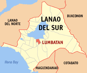
Lumbatan, officially the Municipality of Lumbatan, is a 5th class municipality in the province of Lanao del Sur, Philippines. According to the 2015 census, it has a population of 19,105 people.

Lumbayanague, officially the Municipality of Lumbayanague, is a 4th class municipality in the province of Lanao del Sur, Philippines. According to the 2015 census, it has a population of 16,372 people.

Maguing, officially the Municipality of Maguing, is a 2nd class municipality in the province of Lanao del Sur, Philippines. According to the 2015 census, it has a population of 24,531 people.

Masiu, officially the Municipality of Masiu, is a 5th class municipality in the province of Lanao del Sur, Philippines. According to the 2015 census, it has a population of 29,176 people.

Mulondo, officially the Municipality of Mulondo, is a 3rd class municipality in the province of Lanao del Sur, Philippines. According to the 2015 census, it has a population of 16,067 people.

Pagayawan, officially the Municipality of Pagayawan, is a 5th class municipality in the province of Lanao del Sur, Philippines. According to the 2015 census, it has a population of 13,139 people.

Saguiaran, officially the Municipality of Saguiaran, is a 4th class municipality in the province of Lanao del Sur, Philippines. According to the 2015 census, it has a population of 24,619 people.

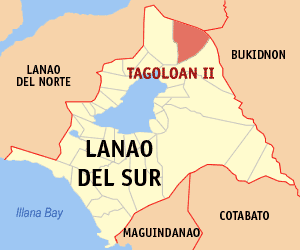
Tagoloan II, officially the Municipality of Tagoloan II, is a 4th class municipality in the province of Lanao del Sur, Philippines. According to the 2015 census, it has a population of 11,169 people.

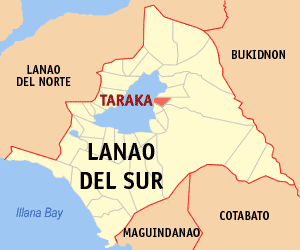
Taraka, officially the Municipality of Taraka, is a 4th class municipality in the province of Lanao del Sur, Philippines. According to the 2015 census, it has a population of 23,644 people.

Lumbaca-Unayan, officially the Municipality of Lumbaca-Unayan, is a — municipality in the province of Lanao del Sur, Philippines. According to the 2015 census, it has a population of 7,260 people.