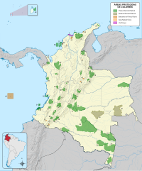
Boyacá is one of the thirty-two departments of Colombia, and the remnant of Boyacá State, one of the original nine states of the "United States of Colombia".

Apure State is one of the 23 states of Venezuela. Its territory formed part of the provinces of Mérida, Maracaibo, and Barinas, in accordance with successive territorial ordinations pronounced by the colonial authorities. In 1824 the Department of Apure was created, under jurisdiction of Barinas, which laid the foundations for the current entity. In 1856 it separated from Barinas and for the first time Apure appeared as an independent province, which in 1864 acquired the status of state. In 1881, however, a new territorial division combined Apure and Guayana to form a single state named Bolívar. In 1899 it reestablished its autonomy and finally, by means of the Constitution of 1909, gained its current borders.

Táchira State is one of the 23 states of Venezuela. The state capital is San Cristóbal.

The Apure River is a river of southwestern Venezuela, formed by the confluence of the Sarare and Uribante near Guasdualito, in Venezuela, at 7°15′N70°40′W, and flowing across the Llanos into the Orinoco. It provides significant transportation in the area.

The Televisora Regional del Táchira (TRT) is a privately owned Venezuelan regional television network based in the city of San Cristóbal in Táchira. Including Táchira, TRT can be seen in the southern part of the Zulia, northeastern Barinas, and northern Apure in Venezuela. Its signal can also be seen in Colombia in the Norte de Santander Department and northern Arauca Department. It broadcasts on channel six.

The Cordillera Oriental is the widest of the three branches of the Colombian Andes. The range extends from south to north dividing from the Colombian Massif in Huila Department to Norte de Santander Department where it splits into the Serranía del Perijá and the Cordillera de Mérida in Venezuelan Andes. The highest peak is Ritacuba Blanco at 5,410 m (17,750 ft) in the Sierra Nevada del Cocuy.
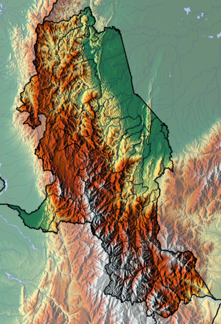
The department of Norte de Santander in northwestern Colombia, and its capital, Cúcuta, contains several rivers. The rivers are mostly part of the Maracaibo Lake basin, with the southeastern section located in the Magdalena River basin. Important fluvial elements are the Zulia, Catatumbo and Pamplonita Rivers. The entity in charge of taking care of these hydrology of Norte de Santander is Corponor.
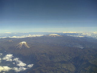
Los Nevados National Natural Park is a national park located in the Cordillera Central of the Colombian Andes. The park surrounds the northern volcanic complex formed by Nevado del Ruiz, Nevado del Tolima, Nevado de Santa Isabel, the paramillos of Cisne, Santa Rosa and Quindío and the Cerro Bravo and Cerro Machín.
The Tamá harlequin frog or Venezuela stubfoot toad is a species of toad in the family Bufonidae. It is endemic to the Páramo de Tamá on the Venezuelan-Colombian border and occurs in Apure and (likely) Táchira states of Venezuela and Norte de Santander Department on the Cordillera Oriental of Colombia.
The Helena's marsupial frog is a species of frog in the family Hemiphractidae. It is endemic to the Páramo de Tamá on the Venezuelan-Colombian border and occurs in Apure and Táchira states of Venezuela and Norte de Santander Department on the Cordillera Oriental of Colombia. It is named after Helen Gaige, an American herpetologist.
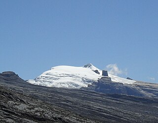
The Sierra Nevada del Cocuy Chita or Guican National Natural Park (or Sierra Nevada de Chita or Sierra Nevada de Güicán, Spanish: Parque Natural Sierra Nevada del Cocuy Chita o Guican is a national park and a series of highlands and glaciated peaks located within the Cordillera Oriental mountain range in the Andes Mountains of Colombia, at its easternmost point. It also corresponds to the highest range of the Eastern Cordillera and holds the biggest glacial mass in South America, north of the Equator. Since 1977, this region is protected within a National Natural Park because of its fragile páramos, extraordinary bio-diversity and endemism, and its function as a corridor for migratory species under conditions of climate change. Among the Sierra’s natural attractions are the remaining 18 ice-covered peaks, glacial lakes and waterfalls.

Chingaza National Natural Park is located in the Eastern Ranges of the Colombian Andes, northeast of Bogotá, Colombia in the departments of Cundinamarca and Meta. The elevation in the park, to the east of the Altiplano Cundiboyacense, ranges from 800 metres (2,600 ft) to 4,020 metres (13,190 ft), and the temperature ranges from 4 to 21.5 °C. The park extends over the Cundinamarca municipalities La Calera, Fómeque, Guasca and San Juanito (Meta).

The Colombia–Venezuela border is an international border of 2219 kilometers (1378 mi) between Colombia and Venezuela, with a total of 603 milestones that demarcate the line. It is the longest border of both Colombia and Venezuela.

The General Juan Pablo Peñaloza National Park Also Páramos Batallón y La Negra National Park Is a national park of Venezuela that is formed by several páramos: Among them Batallón and La Negra, which are an important source of water supply. It is located between the states Mérida and Táchira, northwest of the Táchira depression in the Páramos de El Batallón and La Negra in Venezuela.

The El Tamá National Park It is a protected area with the status of a national park that is located between the Andes and plains of Venezuela. It protects part of the Tamá Massif. It has an area of 139,000 hectares and is located in the states of Táchira and Apure, near the border with Colombia. Created as a National Park on December 12, 1978, by the then President Carlos Andrés Pérez.
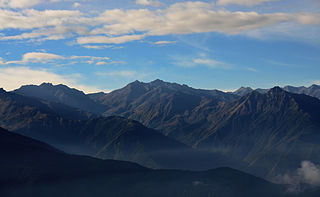
The Venezuelan Andes montane forests (NT0175) is an ecoregion in the northern arm of the Andes in Venezuela. It contains montane and cloud forests, reaching up to the high-level Cordillera de Merida páramo high moor ecoregion. The forests are home to many endemic species of flora and fauna. Their lower levels are threatened by migrant farmers, who clear patches of forest to grow crops, then move on.

The Tamá Massif is a group of mountains on the border between Colombia and Venezuela to the south of Lake Maracaibo. It contains evergreen rainforest and cloud forest at the lower levels, and páramos at the highest levels.

The Táchira Depression is a saddle of land connecting the Lake Maracaibo basin to the Orinoco basin in the state of Táchira, Venezuela. It forms a break in the eastern Andes, separating the Tamá Massif to the west from the Cordillera de Mérida to the east. The depression has been thought to present a barrier to the movement of species between the Colombian and Venezuelan Andes, but this effect may have been relatively low during the recent ice ages. The mountains of the region have potential for coffee farming and hydroelectric power generation, while the lower levels are suitable for farming.
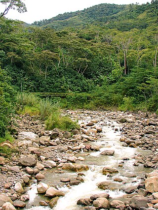
The Quinimarí River is a river in northwestern Venezuela.
Peperomia venezueliana is a species of herb and hemiepiphyte subshrub from the genus Peperomia. It grows in wet tropical biomes. It was discovered by Casimir de Candolle in 1866, in Venezuela..


