The dingiso, also known as the bondegezou, is an endangered, long-tailed marsupial found only in mountain forests on the west of the island of New Guinea. It is a species of tree-kangaroo, which are mammals native to Australia and New Guinea that feed on leaves or other plant matter. It belongs to the macropodid family (Macropodidae) with kangaroos, and carries its young in a pouch like other marsupials. Though sacred to the local Moni people, it is still threatened by hunting and habitat loss.

The Foja Mountains are located just north of the Mamberamo river basin in Papua, Indonesia. The mountains rise to 2,193 metres (7,195 ft), and have 3,000 square kilometers of old growth tropical rainforest in the interior part of the range. The Foja forest tract covers 9,712 square kilometers and is the largest tropical forest without roads in the Asia Pacific region.

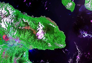
Huon Peninsula is a large rugged peninsula on the island of New Guinea in Morobe Province, eastern Papua New Guinea. It is named after French explorer Jean-Michel Huon de Kermadec. The peninsula is dominated by the steep Saruwaged and Finisterre and Cromwell Mountains. The nearest large town is the Morobe provincial capital Lae to the south, while settlements on the north coast include the former German town of Finschhafen, the district capital of Wasu, Malalamai and Saidor with its World War II era Saidor Airport.

The Bird's Head Peninsula or Doberai Peninsula, is a large peninsula that makes up the northwest portion of the island of New Guinea, comprising the Indonesian provinces of Southwest Papua and West Papua. The peninsula just to the south is called the Bomberai Peninsula, while the peninsula at the opposite end of the island is called the Bird's Tail Peninsula.

The golden-mantled tree-kangaroo is a critically endangered, furry, bear-like mammal found only in mountain rain forests on the island of New Guinea. Like other tree-kangaroos, it lives in trees and feeds on plant matter. It belongs to the macropod family (Macropodidae) with kangaroos, and carries its young in a pouch like other marsupials. The range is restricted to two small mountain areas in the north and it is threatened by hunting and habitat loss.

The tenkile, also known as Scott's tree-kangaroo, is a species of tree-kangaroo in the family Macropodidae. It is endemic to a very small area of the Torricelli Mountains of Papua New Guinea. Its natural habitat is subtropical or tropical dry forests. It is threatened by habitat loss and by hunting. The tenkile is listed as endangered due to hunting and logging activities in Papua New Guinea. The tenkile is hunted for its meat, and is the main protein source for the residents of Papua New Guinea. The population of Papua New Guinea has increased in recent years due to improvements in healthcare; therefore increasing need in tenkile meat which means that more tenkiles are being hunted. Additionally, tenkiles are poached for their fur and are captured and sold as a part of the illegal pet trade. Domesticated dogs also hunt tenkiles. Deforestation in Papua New Guinea affects all tree-kangaroos, however industrial logging that occurs in the Torricelli Mountain Range decreases the species' already restricted habitat. The Torricelli Mountain Range faces additional deforestation due to the timber industry, and the production of coffee, rice and wheat.

The northern glider is a species of marsupial in the family Petauridae. It is endemic to Papua New Guinea, becoming known to science in 1981 after being discovered in the Torricelli Mountains. This species has been found in primary, mid-montane tropical moist forests. It is also known from rural gardens close to forest. The northern glider is Critically Endangered because its occurrence is less than 100 km2, all individuals are located within a single area, and a continuing decline of its habitat quality due to deforestation and human encroachment. They also face a major threat from hunting.

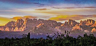
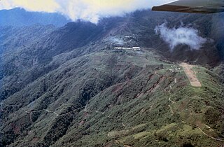
The New Guinea Highlands, also known as the Central Range or Central Cordillera, is a long chain of mountain ranges on the island of New Guinea, including the island's tallest peak, Puncak Jaya, Indonesia, 16,024 ft (4,884 m), the highest mountain in Oceania. The range is home to many intermountain river valleys, many of which support thriving agricultural communities. The highlands run generally east-west the length of the island, which is divided politically between Indonesia in the west and Papua New Guinea in the east.
The Prince Alexander Mountains are a mountain range in Papua New Guinea. The range is located on the northern coast of New Guinea. The Torricelli Mountains lie to the west, and the basin of the Sepik River lies to the south. Mount Turu is a notable peak, located towards the eastern end of the range.

The Northern New Guinea lowland rain and freshwater swamp forests is a tropical moist broadleaf forest ecoregion of northern New Guinea.

The Central Range montane rain forests is a tropical moist forest ecoregion on the island of New Guinea. The ecoregion covers the Central Range of the New Guinea Highlands, which extends along the spine of the island. The montane rain forests of the ecoregion are distinct from the surrounding lowland forests, and are home to many endemic plants and animals.

The Central Range sub-alpine grasslands is a montane grasslands and shrublands ecoregion on the island of New Guinea. The ecoregion covers the highest-elevation portions of the New Guinea Highlands, which extend along the spine of the island. The high elevations support rare tropical sub-alpine and alpine habitats, including many endemic plants and animals.

The Huon Peninsula montane rain forests is a tropical moist forest ecoregion in New Guinea. The ecoregion covers the mountains of northeastern New Guinea's Huon Peninsula.

The Nimba Range forms part of the southern extent of the Guinea Highlands. The highest peak is Mount Richard-Molard on the border of Côte d'Ivoire and Guinea, at 1,752 m (5,750 ft). "Mount Nimba" may refer either to Mount Richard-Molard or to the entire range. Other peaks include Grand Rochers at 1694 m (5558 ft), Mont Sempéré at 1682 m (5518 ft), Mont Piérré Richaud at 1670 m (5479 ft), Mont Tô at 1675 m (5495 ft), and Mont LeClerc 1577 m (5174 ft), all of them are located in Guinea. Mount Nimba Strict Nature Reserve of Guinea and Côte d'Ivoire covers significant portions of the Nimba Range.

The Vogelkop–Aru lowland rain forests is a tropical moist forest ecoregion in Indonesia. The ecoregion covers the peninsular lowlands of western New Guinea, along with the Aru Islands and other nearby islands.

The Vogelkop montane rain forests is a tropical moist forest ecoregion in western New Guinea. The ecoregion covers the mountains of western New Guinea's Bird's Head and Bomberai peninsulas.

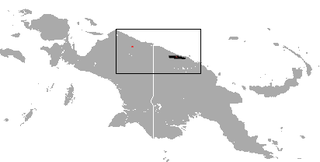
The Northern New Guinea montane rain forests is a tropical moist forest ecoregion in northern New Guinea. The ecoregion covers several separate mountain ranges lying north of New Guinea's Central Range and south of the Pacific Ocean.

Mamberamo Foja Wildlife Reserve is a large protected area on New Guinea, in Indonesia's Papua Province. It covers an area of 16,610 km², and extends along the Mamberamo River and its tributaries from the foothills of the Central Range to the Pacific Ocean.

The Southeastern Papuan rain forests is a tropical moist forest ecoregion in southeastern New Guinea. The ecoregion covers the mountainous center and coastal lowlands of the Papuan Peninsula.

The Southern New Guinea lowland rain forests is a tropical moist forest ecoregion in southeastern New Guinea. The ecoregion covers portions of New Guinea's southern lowlands.


