Trewilga

Last updated

Trewilga
New South Wales
Australia New South Wales relief location map.png
Red pog.svg
Trewilga
Trewilga
Coordinates 32°47′11″S148°13′47″E / 32.78639°S 148.22972°E / -32.78639; 148.22972
Population24 (SAL 2021) [1]
Established1889
Postcode(s) 2869
Time zone AEST (UTC+10)
 • Summer (DST)AEDT (UTC+11)
Location
  • 401 km (249 mi) WNW of Sydney
  • 79 km (49 mi) SSW of Dubbo
  • 41 km (25 mi) N of Parkes
LGA(s) Parkes Shire
County Narromine [2]
Parish Mingelo [2]
State electorate(s) Orange [3]
Federal division(s) Calare [4]
FootnotesCoordinates: [2]
Distances: [5]

Trewilga is a bounded rural locality in Parkes Shire, within the Central West region of New South Wales, Australia. There was once a village and railway station of the same name. Prior to 1913, the village was known as Mingelo.

Contents

Location

Trewilga is approximately 401 km (249 mi) west-northwest of Sydney. The nearest settlement is Peak Hill, which lies 7.4 km away, to the north-north-west.

History

Aboriginal and early settler history

The area later known as Trewilga lies on the traditional lands of Wiradjuri people. An Aboriginal basalt quarry site has been identified near Trewilga and bi-facial choppers, numerous broken choppers, and stone flakes were recorded there. [6] There is a significant Wiradjuri population in the nearby town of Peak Hill. [7]

The name Trewilga was that of an early settler selection in the area. [8]

The area was opened up in the Australian Gold Rush, but mining in the area seems to have commenced in the 1880s [9] and had its heyday in the first three decades of the 20th-century, when quartz reefs were mined in the area. In the early 1890s there appears to have been a crushing battery there but, later, the quartz was transported to nearby Peak Hill to be crushed, [10] [11] [12] [13]

Village history

A village was gazetted in 1889. [14] The village was originally known as Mingelo. A school opened in January 1892. [15] The post office was renamed Trewiliga in 1905, [16] and the school in 1912. [15] However, the village itself was not officially renamed Trewilga, until 1913, [17] in time for the opening of its new railway station in 1914. [18] Some land was sold to the west of the original village, just east of the new railway station. [14] There was a siding there that was used for the loading of bagged wheat. [19]

A cemetery was dedicated to the north-west of the village. [14] [20] [21] The village's Anglican church was erected in 1925. [22] [23] [24] The village had a hotel, known as the Mingelo Hotel, in 1905, and opposite it was a racecourse, the venue for occasional horse racing events. [25] The hotel burned to the ground in a fire in 1909 and its licence was subsequently cancelled; [26] [27] it was not rebuilt. At its peak, the village probably had about forty houses. [28]

By 1926, Trewilga's days as a mining village seemed to be over and it was described as "just a small place consisting of a Post and Telegraph Office, a few private residences and a tennis court, Public School, Hall, and English Church". [28]

The school was destroyed by fire on 5th February 1951. [15] Trewilga railway station closed in 1974 [18] and its post office closed in 1976. The Village of Trewilga ceased to exist officially, in 1979, when its name was discontinued by the Geographical Names Board of N.S.W. [29]

Surrounding area

During the First World War, an estate known as 'Harvey Park', three miles from Trewilga railway station—in the neighbouring County of Kennedy—was sub-divided into 22 farms as part of the Soldier Settlement program.

Some of the men placed on the soldier settlement farms had lost limbs as the result of wounds in battle but, after receiving artificial limbs, worked their farms themselves. [30] The new farms were not viable [31] [32] and many soldier settlers walked off their land, thereby forfeiting both the land and the cost of any improvements they had made. [33]

Present day

Today mining remains an important feature of the community with twenty mines in the district. [34] The area is however, predominantly agricultural. Two streets of the old village, Parkes and Tomingley Streets, still appear on maps, as do allotments within the site of the former village. [14] [35] The modern-day Newell Highway now bypasses the site of the old village and it instead runs closer to the alignment of the Parkes-Narrowmine railway line, [35] near to where the old Trewilga station once stood. [14]

Goobang National Park lies to the east of the locality.

Related Research Articles

<span class="mw-page-title-main">Cobar</span> Town in New South Wales, Australia

Cobar is a town in central western New South Wales, Australia whose economy is based mainly upon base metals and gold mining. The town is 712 km (442 mi) by road northwest of the state capital, Sydney. It is at the crossroads of the Kidman Way and Barrier Highway. The town and the local government area, the Cobar Shire, are on the eastern edge of the outback. At the 2016 census, the town of Cobar had a population of 3,990. The Shire has a population of approximately 4,700 and an area of 44,065 square kilometres (17,014 sq mi).

<span class="mw-page-title-main">Narromine</span> Town in New South Wales, Australia

Narromine (/næroʊmaɪn/) is a rural Australian town located approximately 40 kilometres (25 mi) west of Dubbo in the Orana region of New South Wales. The town is at the centre of Narromine Shire. The 2016 census recorded a population of 3,528. Narromine holds strong historical ties to the Australian Military, as it was the location of RAAF No.19 Inland Aircraft Fuel Depot (IAFD) during World War II. The base contributed to the preparation of troops through a training organisation known as the Empire Air Training Scheme (EATS). The town was one of twelve locations for the No.5 Elementary Flying Training School RAAF in 1940.

<span class="mw-page-title-main">Stuart Town, New South Wales</span> Town in New South Wales, Australia

Stuart Town, formerly known as Ironbark, is a small town on the Central Western Slopes of New South Wales, Australia within Dubbo Regional Council. It is located 317 kilometres (197 mi) north-west of the state capital, Sydney. At the 2011 census, Stuart Town had a population of 487. The area around the town is rich in cattle farming and orchards, so the town serves as a service centre to that area.

<span class="mw-page-title-main">Peak Hill, New South Wales</span> Town in New South Wales, Australia

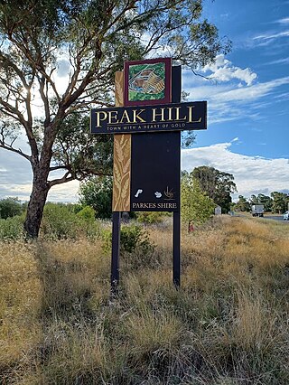
Peak Hill is a town in Parkes Shire in the Central West of New South Wales, Australia. At the 2021 census, Peak Hill had a population of 768 people. It is located on the Newell Highway and the Parkes to Narromine railway line.

<span class="mw-page-title-main">Nerrigundah, New South Wales</span> City in New South Wales, Australia

Nerrigundah is a small village on the Eurobodalla Nature Coast in south eastern New South Wales. Situated at the head of the Tuross River Valley, it is nineteen kilometres inland from Bodalla. At the 2016 census, Nerrigundah had a population of 25.

<span class="mw-page-title-main">Wongarbon</span> Town in New South Wales, Australia

Wongarbon is a village approximately 18 kilometres east of Dubbo on the Mitchell Highway between Dubbo and Wellington, New South Wales, Australia. The name is also applied to the surrounding area for postal and statistical purposes. At the 2016 census, Wongarbon had a population of 766.

<span class="mw-page-title-main">Albert, New South Wales</span> Town in New South Wales, Australia

Albert is a town in the Central West region of New South Wales, Australia. The town is in the Lachlan Shire local government area, 481 kilometres (299 mi) west north west of the state capital, Sydney. At the 2016 census, Albert had a population of 81, though Albert once had a population of 900.

<span class="mw-page-title-main">Leadville, New South Wales</span> Town in New South Wales, Australia

Leadville is a town in New South Wales, Australia. The town is located in the Warrumbungle Shire local government area, 376 kilometres (234 mi) north west of the state capital, Sydney. At the 2016 census, Leadville and the surrounding area had a population of 169.

<span class="mw-page-title-main">Girilambone, New South Wales</span> Town in New South Wales, Australia

Girilambone is a small village in western New South Wales, Australia. It is located north of Nyngan and 666 km north-west of Sydney. The name is also applied to the surrounding area, for postal and statistical purposes. At the 2016 census, the population of the village and its surrounding area was only 107, but it had fallen to just 86 in 2021. The village was originally associated with copper mining.

Burraga is located in the Central Tablelands of New South Wales, 47 kilometres south west of Oberon and about 67 kilometres (42 mi) south of Bathurst. It is within Oberon Shire. At the 2016 census, Burraga had a population of 91.

<span class="mw-page-title-main">Colinton, New South Wales</span> Town in New South Wales, Australia

Colinton is a locality in the Snowy Monaro Region, New South Wales, Australia. At the 2016 census, it had a population of 127. There was once a village and railway station of the same name.

<span class="mw-page-title-main">Wattle Flat, New South Wales</span> Town in New South Wales, Australia

Wattle Flat is a locality in the Bathurst Region of New South Wales, Australia. It had a population of 257 people as of the 2016 census. There is a small village of the same name, near the confluence of Big Oaky Creek and its tributary Solitary Creek.

Bobadah was a mining village, now a locality, in the Orana region of New South Wales, Australia. It was also known as Carpina, its official name, although that name was rarely used. It is now a ghost town, with its community hall being its last remaining building. Its population in 2016, including the surrounding area, was 10. It was once a larger settlement associated with the nearby Overflow Mine.

<span class="mw-page-title-main">Hermidale</span> Village in New South Wales, Australia

Hermidale is a village in the Orana region of New South Wales, Australia. It is 600km north-west of Sydney and the two closest towns are Nyngan and Cobar. It lies on the Barrier Highway. At the 2021 Census, the population of Hermidale was 127.

<span class="mw-page-title-main">Gilgunnia</span> Locality in New South Wales, Australia

Gilgunnia is a locality and ghost town in the Orana region of New South Wales, Australia, within the Parish of South Peak in Blaxland County and Cobar Shire. It was once a settlement associated with gold mining, but in 2016 its population was zero. The nearest settlements are Mount Hope and Nymagee.

<span class="mw-page-title-main">Mount Allen, New South Wales</span> Australian locality and ghost town

Mount Allen is a ghost town in the Orana region of New South Wales, Australia. There was once a village of the same name associated with gold mining. For statistical purposes, it is considered part of Mount Hope.

Caloola is a locality in the Central West region of New South Wales. There once was a small village of the same name but it is a ghost town today. At the 2016 census, the locality had a population of 88.

Dalmorton is a locality in the Northern Rivers region of New South Wales, Australia. There once was a village of the same name, which was associated with gold mining. Much of the area of the locality is now reserved as National Parks or State Forests. At the 2016 census, the population of Dalmorton was four.

<span class="mw-page-title-main">North Yalgogrin</span> Town in New South Wales, Australia

North Yalgogrin is a locality in the Bland Shire local government area of New South Wales. There once was a village there, named Yalgogrin, but better known as Yalgogrin North.

<span class="mw-page-title-main">Wrightville</span>

Wrightville was a mining village in the Orana region of New South Wales, Australia. Once it was a significant settlement, with its own municipal government, public school, convent school, post office, police station, four hotels, and railway connection. At its peak, around 1907, its population probably reached 2,000 people. Its site and that of the adjacent former village of Dapville are now an uninhabited part of Cobar.

References

  1. Australian Bureau of Statistics (28 June 2022). "Trewilga (Suburb and Locality)". Australian Census 2021 QuickStats. Retrieved 28 June 2022.  OOjs UI icon edit-ltr-progressive.svg
  2. 1 2 3 "Trewilga". Geographical Names Register (GNR) of NSW. Geographical Names Board of New South Wales . Retrieved 28 November 2015. OOjs UI icon edit-ltr-progressive.svg
  3. "Orange". New South Wales Electoral Commission . Retrieved 23 November 2019.
  4. "Calare". Australian Electoral Commission . Retrieved 28 November 2015.
  5. "Travelmate". travelmate.com.au. Retrieved 28 November 2015.
  6. "Tomingley Gold Project Cultural Heritage Assessment , Volume 2, Part 5" (PDF). OzArk Environmental and Heritage Management Pty Ltd. October 2011. pp. 5–40.
  7. Burbidge, Belinda (2014). "Contemporary Wiradjuri relatedness in Peak Hill, New South Wales - A thesis submitted in fulfillment of the requirements for the degree of Doctor of Philosophy". Department of Anthropology, The University of Sydney.
  8. "BRIEF MENTION". Western Champion (Parkes, NSW : 1898 - 1934). 5 September 1912. p. 16. Retrieved 27 February 2021.
  9. "Government Gazette Notices". New South Wales Government Gazette (Sydney, NSW : 1832 - 1900). 18 February 1887. p. 1172. Retrieved 27 February 2021.
  10. "MINING NEAR MINGELO". Western Champion (Parkes, NSW : 1898 - 1934). 7 May 1909. p. 22. Retrieved 27 February 2021.
  11. "Gold at Trewilga". Molong Express and Western District Advertiser (NSW : 1887 - 1954). 7 December 1918. p. 8. Retrieved 27 February 2021.
  12. "CONFLICTING APPLICATIONS". Forbes Advocate (NSW : 1911 - 1954). 31 July 1931. p. 6. Retrieved 27 February 2021.
  13. "Mining Notes". Sydney Mail and New South Wales Advertiser (NSW : 1871 - 1912). 20 August 1892. p. 447. Retrieved 27 February 2021.
  14. 1 2 3 4 5 "Parish of Mingelo, County of Narromine [cartographic material]". Trove. Retrieved 24 November 2020.
  15. 1 2 3 "Trewilga (previously Mingelo)". nswgovschoolhistory.cese.nsw.gov.au. Retrieved 19 December 2020.
  16. "MINGELO POSTAL DESIGNATION CHANGED TO "TREWILGA."". Forbes Advocate (NSW : 1911 - 1954). 7 January 1913. p. 5. Retrieved 24 November 2020.
  17. "ALTERATION OF NAME OF VILLAGE OF MINGELO". Government Gazette of the State of New South Wales (Sydney, NSW : 1901 - 2001). 17 September 1913. p. 5802. Retrieved 24 November 2020.
  18. 1 2 "Trewilga Station". www.nswrail.net. Retrieved 24 November 2020.
  19. "Trewilga Station - Photograph, Bagged wheat being loaded onto wagons. (1940)". www.nswrail.net. Retrieved 10 September 2023.
  20. "Find a cemetery in NSW - Cemeteries & Crematoria NSW". NSW Department of Industry. 10 June 2020. Retrieved 24 November 2020.
  21. "Trewilga (Mingelo) Cemetery". Australian Cemeteries Index.
  22. "PEAK HILL". Western Champion (Parkes, NSW : 1898 - 1934). 17 September 1925. p. 3. Retrieved 27 February 2021.
  23. "NEW ANGLICAN CHURCH". Sydney Morning Herald (NSW : 1842 - 1954). 13 November 1928. p. 12. Retrieved 27 February 2021.
  24. "CHURCH MEMORANDA". Narromine News and Trangie Advocate (NSW : 1898 - 1955). 10 May 1946. p. 3. Retrieved 28 February 2021.
  25. "Mingelo Races. - The Peak Hill Express (NSW : 1902 - 1952) - 17 Nov 1905". Trove. Retrieved 28 February 2021.
  26. "Fire at Mingelo". Dubbo Dispatch and Wellington Independent (NSW : 1887 - 1932). 27 November 1909. p. 4. Retrieved 28 February 2021.
  27. "Government Gazette Notices". Government Gazette of the State of New South Wales (Sydney, NSW : 1901 - 2001). 16 February 1910. p. 940. Retrieved 28 February 2021.
  28. 1 2 "Letters from Young Folks. - The Land (Sydney, NSW : 1911 - 1954) - 22 Oct 1926". Trove. Retrieved 28 February 2021.
  29. "GEOGRAPHICAL NAMES ACT, 1966". Government Gazette of the State of New South Wales (Sydney, NSW : 1901 - 2001). 2 February 1979. p. 574. Retrieved 24 November 2020.
  30. "SETTLING THE MEN ON THE LAND - Sydney Mail (NSW : 1912 - 1938) - 14 Nov 1917". Trove. Retrieved 25 November 2020.
  31. "CHAMBER OF COMMERCE". Western Champion (Parkes, NSW : 1898 - 1934). 9 November 1922. p. 16. Retrieved 25 November 2020.
  32. "Around the Country". Country Life Stock and Station Journal (Sydney, NSW : 1924 - 1925). 28 November 1924. p. 26. Retrieved 25 November 2020.
  33. "Government Gazette Notices". Government Gazette of the State of New South Wales (Sydney, NSW : 1901 - 2001). 13 February 1925. p. 937. Retrieved 25 November 2020.
  34. Downes, P, NSW Metallic Mineral Occurrence Database. (NSW Department Of Mineral Resources , 1997)
  35. 1 2 "Trewilga". Google Maps. Retrieved 24 November 2020.