Typhoon Paka, known in the Philippines as Typhoon Rubing, was an extremely powerful and long-lived storm that devastated Guam and the Marshall Islands in December 1997. One of the strongest Pacific typhoons ever recorded in the month of December, Paka was the last tropical cyclone of the 1997 Pacific hurricane and typhoon seasons and the last of a record eleven super typhoons that formed in 1997. Paka, which is the Hawaiian name for Pat, developed on 28 November from a trough well to the southwest of Hawaii. The storm tracked generally westward for much of its duration, and on 7 December it crossed into the western Pacific Ocean. Much of its track was characterized by fluctuations in intensity, and on 10 December the cyclone attained typhoon status as it crossed the Marshall Islands. On 16 December, Paka struck Guam and Rota with winds of 230 km/h (140 mph), and it strengthened further to reach peak winds on 18 December over open waters as the final super typhoon of the year. Subsequently, it underwent a steady weakening trend, and on 23 December Paka dissipated.

The 2004 Pacific typhoon season was an extremely active season that featured the second-highest ACE ever recorded in a single season, second only to 1997, which featured 29 named storms, nineteen typhoons, and six super typhoons. It was an event in the annual cycle of tropical cyclone formation, in which tropical cyclones form in the western Pacific Ocean. The season ran throughout 2004, though most tropical cyclones typically develop between May and October. The season's first named storm and also the first typhoon, Sudal, developed on April 4, later was reached typhoon status two days later, and became the first super typhoon of the year three days later. The season's last named storm, Noru, dissipated on December 22.

The 2002 Pacific typhoon season was a slightly above average Pacific typhoon season, producing twenty-six named storms, fifteen becoming typhoons, and eight super typhoons. It had an ACE over 400 units, making it one of the most active seasons worldwide. It was an event in the annual cycle of tropical cyclone formation, in which tropical cyclones form in the western Pacific Ocean. The season ran throughout 2002, though most tropical cyclones typically develop between May and October. The season's first named storm, Tapah, developed on January 11, while the season's last named storm, Pongsona, dissipated on December 11. The season's first typhoon, Mitag, reached typhoon status on March 1, and became the first super typhoon of the year four days later.

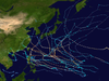
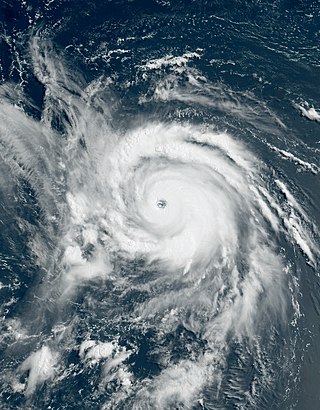
The 1997 Pacific typhoon season was a record-breaking season featuring eleven tropical cyclones reaching super typhoon intensity, tying the record with 1965 with the most intense tropical cyclones globally, and was the ninth and last consecutive year of above-average tropical cyclone activity that started in 1989. Its extremely high activity produced highest ACE index ever index recorded in a single tropical cyclone season. In addition, this season had ten Saffir-Simpson Category 5-equivalent tropical cyclones, the most ever recorded, even greater than the 2005 Atlantic hurricane season, and 2020 Atlantic hurricane season, for Category 4, which had nearly half of the amount. The 1997–98 El Niño event was a contributing factor to this unusually high activity. Despite this, the season produced an average number of tropical storms, spawning 28 tropical storms.

The 1992 Pacific typhoon season was the fourth consecutive above-average season, producing 31 tropical storms, 16 typhoons and five super typhoons. It had no official bounds; it ran year-round in 1992. Despite this, most tropical cyclones tend to form in the northwestern Pacific Ocean between May and November. These dates conventionally delimit the period of each year when most tropical cyclones form in the northwestern Pacific Ocean.

The 1987 Pacific typhoon season was a below average season, though it featured a relatively high amount of typhoons. It had no official bounds; it ran year-round in 1987, but most tropical cyclones formed between May and November. Tropical storms that formed in the entire basin were assigned a name by the Joint Typhoon Warning Center. Tropical depressions that enter or form in the Philippine area of responsibility are assigned a name by the Philippine Atmospheric, Geophysical and Astronomical Services Administration or PAGASA. This can often result in the same storm having two names.
The 1980 Pacific typhoon season was a slightly-below average season when compared to the long-term average, though it featured several intense storms. It ran year-round in 1980, but most tropical cyclones formed between June and December. These dates conventionally delimit the period of each year when most tropical cyclones form in the northwestern Pacific Ocean. A total of 28 tropical depressions formed this year in the Western Pacific, of which 24 became tropical storms and were assigned a name by the Joint Typhoon Warning Center. Beginning in March, tropical cyclones formed in each subsequent month through December. Of the 24 named storms, 15 storms reached typhoon intensity, of which 2 reached super typhoon strength.

The 1972 Pacific typhoon season was an above average season, producing 31 tropical storms, 24 typhoons and 2 intense typhoons. It has no official bounds; it ran year-round in 1972, but most tropical cyclones tend to form in the northwestern Pacific Ocean between June and December. These dates conventionally delimit the period of each year when most tropical cyclones form in the northwestern Pacific Ocean.
Typhoon Dolphin, known in the Philippines as Typhoon Ulysses, was the final named storm and typhoon of the 2008 Pacific typhoon season. The only impact that was reported from Dolphin was to the M/Bca Mae Jan, which was a cargo passenger ship which sank on December 14, due to rough seas caused by Dolphin. There were 46 people reported dead while seven were reported as missing.

Typhoon Melor, known in the Philippines as Super Typhoon Quedan, was a powerful typhoon that hit Japan in early October 2009, causing significant damage. As part of the 2009 Pacific typhoon season, Melor formed as a tropical depression on September 29 and rapidly intensified into a Category 4-equivalent typhoon just three days later. Subsequently, on October 4, Melor became the second Category 5-equivalent super typhoon to form in the season. During the next days, the typhoon would interact with Typhoon Parma southeast of Taiwan, causing Parma to be almost stationary over northern Luzon and drop near-records of rainfall there. Afterwards, Melor gradually weakened in its approach to Japan, making landfall on October 7. As the storm exited Japan during the next day, it transitioned into an extratropical cyclone. The remnants of Melor were absorbed by a newly-formed extratropical cyclone near Alaska, which strengthened significantly and impacted the West Coast of the United States on October 13.

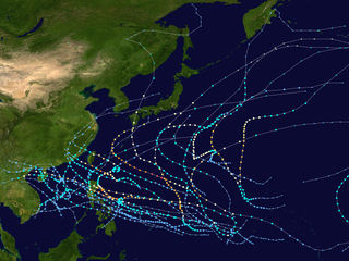
The 2015 Pacific typhoon season was a slightly above average season that produced twenty-seven tropical storms, eighteen typhoons, and nine super typhoons. The season ran throughout 2015, though most tropical cyclones typically develop between May and November. The season's first named storm, Mekkhala, developed on January 15, while the season's last named storm, Melor, dissipated on December 17. The season saw at least one named tropical system forming in each of every month, the first time since 1965. Similar to the previous season, this season saw a high number of super typhoons. Accumulated cyclone energy (ACE) during 2015 was extremely high, the third highest since 1970, and the 2015 ACE has been attributed in part to anthropogenic warming, and also the 2014-16 El Niño event, that led to similarly high ACE values in the East Pacific.

Typhoon Roy, known in the Philippines as Typhoon Asiang, was the second-most intense January tropical cyclone on record in the Western Pacific basin. Forming out of an area of disturbed weather on January 7, 1988, Roy quickly intensified as it moved through the Marshall Islands. By January 9, the storm intensified into a typhoon and attained its peak intensity the following day. At its peak, sustained winds reached 215 km/h (135 mph). Slight weakening took place before the storm moved through the Mariana Islands. Continuing westward, the system eventually struck the Philippines as a minimal typhoon before dissipating over the South China Sea on January 19.

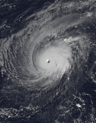
Typhoon Gay, known in the Philippines as Typhoon Seniang, was the strongest and longest-lasting storm of the 1992 Pacific typhoon season and most intense globally in 1992. It formed on November 14 near the International Date Line from a monsoon trough, which also spawned two other systems. Typhoon Gay later moved through the Marshall Islands as an intensifying typhoon, and after passing through the country it reached its peak intensity over open waters. The Joint Typhoon Warning Center (JTWC) estimated peak winds of 295 km/h (183 mph) and a minimum barometric pressure of 872 mb (25.8 inHg). However, the Japan Meteorological Agency (JMA), which is the official warning center in the western Pacific, estimated winds of 205 km/h (127 mph), with a pressure of 900 mbar (27 inHg). Gay weakened rapidly after peaking because of interaction with another typhoon, and it struck Guam with winds of 160 km/h (99 mph) on November 23. The typhoon briefly re-intensified before weakening and becoming extratropical south of Japan on November 30.

Severe Tropical Storm Zelda was the last tropical cyclone of the 1991 Pacific typhoon season; it struck the Marshall Islands on November 28. The area of low pressure that eventually became Zelda formed near the International Date Line, and strengthened into a tropical depression on November 27. The Joint Typhoon Warning Center (JTWC) reported that the depression had reached tropical storm intensity near the Marshall Islands on November 28, thus naming it Zelda. On November 29, the storm quickly strengthened to 65 knots according to the JTWC, equivalent to a Category 1 typhoon on the Saffir–Simpson hurricane wind scale. It reached a peak of 80 kn according to the JTWC, and 60 kn according to the Japanese Meteorological Agency (JMA), with a barometric pressure of 975 hectopascals (28.8 inHg). Zelda weakened into a tropical storm on December 2, and then a tropical depression two days later. The JTWC discontinued warnings late on December 4, while the JMA declared the storm to be extratropical the next day and continued to track until it crossed the International Date Line again on December 7.
This timeline documents all of the events of the 2015 Pacific typhoon season. Most of the tropical cyclones formed between May and November. The scope of this article is limited to the Pacific Ocean, north of the equator between 100°E and the International Date Line. This area, called the Western Pacific basin, is the responsibility of the Japanese Meteorological Agency (JMA). They host and operate the Regional Specialized Meteorological Center (RSMC), located in Tokyo. The Japanese Meteorological Agency (JMA) is also responsible for assigning names to all tropical storms that are formed within the basin. However, any storm that enters or forms in the Philippine Area of Responsibility (PAR) will be named by the Philippine Atmospheric, Geophysical and Astronomical Services Administration (PAGASA) using a local name. Also of note - the Western Pacific basin is monitored by the United States' Joint Typhoon Warning Center (JTWC), which gives all Tropical depressions a number with a "W" suffix.
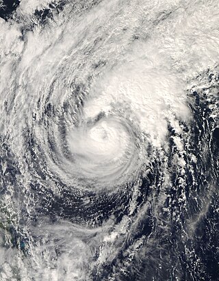
Typhoon Nangka was a large and powerful tropical cyclone that impacted central Japan in mid-July 2015. Nangka started its long-living journey as a tropical disturbance over the Marshall Islands and west of the International Dateline, becoming the eleventh named storm of the annual typhoon season on July 3. It quickly intensified while moving to the west-northwest, attaining typhoon status on July 6. Nangka moved through the Northern Marianas Islands, passing directly over the uninhabited island of Alamagan. Shortly thereafter, the typhoon attained peak winds; the Japan Meteorological Agency (JMA) estimated 10‑minute sustained winds of 185 km/h (115 mph), while the unofficial Joint Typhoon Warning Center (JTWC) estimated 1‑minute winds of 250 km/h (155 mph), making it a super typhoon. Nangka later weakened as it curved to the north, moving across central Japan on July 16 as a minimal typhoon. The storm weakened soon after, dissipating in the Sea of Japan on July 18.

Typhoon Alice was an unusual West Pacific tropical cyclone that caused extensive damage in the Marshall Islands in January 1979. The first tropical cyclone and the first typhoon of the 1979 Pacific typhoon season, Alice formed on December 31, 1978, from a tropical disturbance at both an atypically low latitude near the equator and during a time of year climatologically unfavorable for tropical cyclogenesis. The system strengthened as it tracked northwest, reaching tropical storm strength on January 1, 1979. Alice then began to move erratically through the Marshall Islands, causing heavy rainfall and gusty winds that destroyed crops throughout the archipelago. Significant damage occurred in Majuro and Enewetak Atoll, where gusts of 80 mph (130 km/h) were reported and one person was injured. Nuclear cleanup operations on Enewetak in the wake of postwar nuclear tests there were disrupted, with repair of cleanup facilities lasting several months. The damage toll was estimated at between US$50,000–$500,000.

Typhoon Jelawat, known in the Philippines as Tropical Storm Caloy, was a powerful typhoon that affected the Caroline Islands in March 2018. The third tropical storm and the first typhoon of the 2018 Pacific typhoon season, Jelawat originated as a tropical disturbance that struck the Federated States of Micronesia before organizing into a tropical depression on March 24. It further intensified into a tropical storm on the following day, according to the Japan Meteorological Agency, receiving the name Jelawat. Drifting northward, the storm remained unorganized while staying east of the Philippines, though environmental conditions became more favorable along its path. On March 29, Jelawat took an unexpected sharp turn east as it intensified into a typhoon. Upon shifting northeast, Jelawat rapidly intensified on March 30 due to low vertical wind shear and substantial outflow, peaking as a Category 4-equivalent super typhoon. Shortly afterward, the storm began to weaken as wind shear sharply increased, falling below typhoon strength on March 31. The storm transitioned into a subtropical cyclone on April 1, before dissipating on that same day.

Typhoon Faxai was the strongest tropical cyclone worldwide in 2001. The twenty-fifth named storm and the sixteenth typhoon of the 2001 Pacific typhoon season, Faxai originated from a circulation in the monsoon trough. The system remained stationary for several days near Kosrae, pouring heavy rain that knocked down power. An indirect death occurred on the island as well. As the storm steadily intensified, Faxai moved west-northwestward at a very slow pace as it neared Pingelap, damaging crops, before bringing strong winds and rainfall that produced two landslides in Pohnpei on December 20. Intensity fluctuated, but convection in the core became more defined and by December 21, Faxai had intensified into a typhoon. A period of rapid intensification then followed, and by early December 23, Faxai reached its peak intensity.

Severe Tropical Storm Axel was a moderate tropical storm which affected the Marshall, Caroline, and Mariana islands in January 1992. The first tropical depression and storm of the 1992 Pacific typhoon season, Axel developed from a significant equatorial westerly wind burst east of New Guinea, alongside two other cyclones, Betsy and Mark, in the Southern Hemisphere, intensifying at an abnormally low latitude. By January 9, Axel had peaked as a high-end tropical storm, passing near Kosrae and Pingelap in the eastern Caroline Islands. Soon after, Axel began steadily weakening due to increased wind shear. As a result, just prior of passing south of Guam, Axel weakened into a tropical depression. Recurving northwards soon after, on January 15, Axel transitioned into an extratropical low, dissipating just a few hours later.