![]() Soudelor at peak intensity on August 4 | |
Meteorological history | |
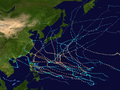
---|---|
Formed | July 29,2015 |
Dissipated | August 12,2015 |
Violent typhoon | |
10-minute sustained (JMA) | |
Highest winds | 215 km/h (130 mph) |
Lowest pressure | 900 hPa (mbar);26.58 inHg |
Category 5-equivalent super typhoon | |
1-minute sustained (SSHWS/JTWC) | |
Highest winds | 285 km/h (180 mph) |
Lowest pressure | 907 hPa (mbar);26.78 inHg |
Overall effects | |
Fatalities | 59 total |
Damage | $4.09 billion (2015 USD) |
Areas affected |
|
IBTrACS | |
Part of the 2015 Pacific typhoon season |
Typhoon Soudelor,known in the Philippines as Super Typhoon Hanna,was the third most intense tropical cyclone worldwide in 2015 after Hurricane Patricia and Cyclone Pam as well as the strongest tropical cyclone of the 2015 Pacific typhoon season. Soudelor had severe impacts in the Northern Mariana Islands,Taiwan,and eastern China,resulting in 40 confirmed fatalities. Lesser effects were felt in Japan,South Korea and the Philippines. The thirteenth named storm of the annual typhoon season,Soudelor formed as a tropical depression near Pohnpei on July 29. The system strengthened slowly at first before entering a period of rapid intensification on August 2. Soudelor made landfall on Saipan later that day,causing extensive damage. Owing to favorable environmental conditions,the typhoon further deepened and reached its peak intensity with ten-minute maximum sustained winds of 215 km/h (130 mph) and a central atmospheric pressure of 900 hPa (mbar;26.58 inHg) on August 3. The Joint Typhoon Warning Center assessed one-minute sustained winds at 285 km/h (180 mph),making Soudelor a Category 5-equivalent super typhoon. Steady weakening ensued thereafter as the storm moved generally west-northwest. Soudelor made landfall over Hualien,Taiwan,late on August 7 and emerged over in the Taiwan Strait early the next day. The typhoon soon moved inland over eastern China and degraded to a tropical depression by August 9.
Soudelor was the second worst storm to strike Saipan in the Northern Mariana Islands in nearly 30 years (following Typhoon Yutu of 2018). Hundreds of homes were damaged or destroyed and power was expected to take a month to restore. Two people died in Guam due to rip currents. In Taiwan,torrential rains and destructive winds caused widespread damage and disruptions. A record-breaking 4.85 million households lost power on the island. At least 8 people died and 420 others sustained injury there;a ninth person died in the storm's aftermath. Portions of eastern China saw their heaviest rains in 100 years,resulting in deadly floods and landslides. Typhoon Soudelor killed 45 people in eastern China after parts of the country were hit by the heaviest rains in a century. Total economic losses were counted to be ¥24.627 billion (US$3.97 billion). [1]
On July 28, 2015, the Joint Typhoon Warning Center (JTWC) [nb 1] began monitoring a tropical disturbance about 415 km (258 mi) north of Kwajalein Atoll in the Marshall Islands. The system featured a developing low level circulation accompanied by deep convection. [3] Moving generally west under the influence of a subtropical ridge, [4] the disturbance gradually organized amid favorable environmental conditions. A tropical upper tropospheric trough (TUTT) cell enhanced upper-level outflow, offsetting the negative effects of moderate wind shear; high sea surface temperatures and ocean heat content provided ample energy for further development. [5] At 14:30 UTC on July 29, the JTWC issued a Tropical Cyclone Formation Alert for the system. [6] Several hours later, the Japan Meteorological Agency (JMA) [nb 2] began monitoring the system as a weak tropical depression; [8] the agency began full advisories on the system at 00:00 UTC on July 30. [9] The JTWC followed suit later that day, designating the system as Tropical Depression 13W. [10] The cyclone achieved tropical storm intensity by 12:00 UTC, at which time it was assigned the name Soudelor, a title of legendary rulers in the Pohnpeian language. [11] [12] [13] A central dense overcast developed over the circulation center shortly thereafter. [14]
Some structural degradation took place on July 31 owing to subsidence from a TUTT cell to the north. [15] [16] Following a retreat of the TUTT cell northward, [17] Soudelor's convective structure improved with well-defined banding features wrapping into the circulation by August 1. [18] The organizing storm, with a redeveloped central dense overcast, soon entered a region favoring rapid intensification, including low wind shear, sea surface temperatures of 31–32 °C (88–90 °F) and high ocean heat content. [19] Therefore, the JMA upgraded Soudelor to a severe tropical storm by 18:00 UTC. [20] Rapid intensification ensued on August 2 as the storm approached the Northern Mariana Islands with both agencies classifying Soudelor as a typhoon. [21] [22] [23] The typhoon developed an unusually small eye only 8 km (5.0 mi) in diameter, among the smallest ever observed in a tropical cyclone. At 14:54 UTC, Soudelor made landfall along the southern coast of Saipan. [21]
After undergoing an eyewall replacement cycle, [24] Soudelor continued rapid intensification, reaching peak intensity on August 3. The JMA estimated peak ten-minute maximum sustained winds of 215 km/h (134 mph) and a minimum central pressure of 900 hPa (27 inHg), [25] while the JTWC estimated peak one-minute maximum sustained winds of 285 km/h (177 mph), classifying Soudelor as a Category 5-equivalent super typhoon. Intensity leveled off thereafter, and after maintaining Category 5 intensity for 24 hours, Soudelor was downgraded to a Category 4 super typhoon late on August 4. [26] On August 5, PAGASA reported that the Typhoon Soudelor entered the Philippine Area of Responsibility assigning the name Hanna. [27] Soudelor weakened further to a Category 2-equivalent typhoon and stayed at that intensity for a day. On August 7, the typhoon reintensified to reach a secondary peak as a Category 3-equivalent typhoon, [26] and later that day, Typhoon Soudelor made landfall over Xiulin, Hualien in Taiwan at 20:40 UTC on August 7 (04:40 TST on August 8), and it arrived in the Taiwan Strait from Taixi, Yunlin around 03:00 UTC (11:00 TST) on August 8. [28] [29] Around 14:10 UTC (22:10 CST) on the same day, Soudelor made landfall over Xiuyu District, Putian, Fujian in China as a Category 1-equivalent typhoon. [30] [31] Quickly degrading, Soudelor moved erratically northwest. 24 hours after landfall, Soudelor was downgraded to a depression, before becoming extratropical six hours later The remnants re-looped eastward, before briefly re-attaining gale-force winds as it moved offshore near Yancheng, Jiangsu. The remnants were last noted on August 13, affecting Kyushu and Chūgoku region.[ citation needed ]
Typhoon Soudelor passed directly over Saipan on August 2 as an intensifying Category 2 equivalent storm according to the JTWC, [32] causing widespread damage on the island. [33] Post-storm damage surveys determined Soudelor to have been substantially stronger at landfall: a Category 4-equivalent with sustained winds of 215 km/h (134 mph) with gusts in excess of 260 km/h (160 mph). [34] [35] The National Weather Service's anemometer at Saipan International Airport broke after recording a gust of 146 km/h (91 mph). [21] The winds downed numerous trees and power lines, leaving much of the island without power and rendering roads impassible. [36] In some areas, cars were flipped over by the force of the wind. The island's power plant lost part of its roof and was flooded. [37] Damage to the island's electrical infrastructure was tremendous, with 150 power poles and 114 transformers damaged or destroyed. [38] A total of 464 residents sought refuge in public shelters. [39] Acting Governor Ralph DLG Torres declared "a state of disaster and significant emergency". Philip Dauterman of the Commonwealth Health Center in Saipan likened damage to that caused by Typhoon Pongsona which struck Guam in December 2002. [37] In addition, John Hirsh from the American Red Cross said that Soudelor is the most damaging cyclone to hit Saipan since Typhoon Kim in 1986 struck the island nearly thirty years prior. [40]
Initial assessments by the Emergency Operations Center indicate that 384 homes were destroyed. A separate assessment by the American Red Cross showed 808 homes affected. Of this total, 158 were destroyed, 296 sustained major damage, and 354 were affected or sustained minor damage. [41] Total damage exceeded US$21 million (2015 USD) on Saipan. Forty people were injured across the island. [34] On August 8 and 9, two people drowned in separate rip current incidents in western Guam. [42]
The local power company, Commonwealth Utilities Corp., stated they only had 77 replacement power poles and no transformers. Repairs to the electric grid, water supply network, and wastewater systems were expected to take three to four weeks. [38] Three Mobil gas stations re-opened on August 4 for first responders and emergency services. [43] Relief supplies from Guam and Hawaii were sent to Saipan that day. Members of the Guam National Guard, Guam Power Authority, and the Coast Guard also provided assistance. [39] On August 6, United States President Barack Obama declared the Northern Mariana Islands a federal disaster area, allowing residents to receive government aid. Saipan was granted individual assistance while Tinian and Rota received public assistance. [44] [45] By September, the Federal Emergency Management Agency approved US$25.9 million in aid to residents of Saipan. [46]
Prior to striking Taiwan, the circulation of Typhoon Soudelor battered Japan's southern Ryukyu Islands with typhoon-force winds. Sustained winds on Yonaguni island reached 163 km/h (101 mph) with concurrent gusts to 233 km/h (145 mph), the strongest winds recorded in relation to the storm throughout its path. Ishigaki Island saw a peak gust of 198 km/h (123 mph). Farther north at Kadena Air Base on Okinawa Island, gusts reached 84 km/h (52 mph). Heavy rains accompanied these winds, with Yonaguni reporting 451 mm (17.74 in) during the storm's passage. [47] Structural impact was relatively minor, mainly confined to damaged roofs on Yonaguni island. Three people sustained minor injuries in the region. [48] Losses to agriculture, forestry, and fisheries across the Yaeyama District reached ¥360 million (US$2.9 million). A total of 6,748 hectares (16,670 acres) of crops sustained damage. [49] In Miyako-jima, crops sustained significant damage from salt; relatively little rain coupled with strong winds allowed sea spray to travel farther inland than normal. Preliminary estimates placed losses at ¥94.52 million (US$761,000). [50] On August 10, a family of four was swept out to sea near Irabu-jima by residual swells from the typhoon; three drowned while the fourth, an 8-year-old girl, was rescued. [51]
On August 6, four people in Su'ao, Yilan were swept away while watching waves. One person, a child, survived; two others are confirmed dead, and the fourth is still missing. [52] [53] By August 10, eight fatalities had been confirmed, while four others were reported missing. Additionally, 420 people sustained injuries. [54] All 279 domestic flights were canceled on August 8, as well as at least 37 international flights. [55]
The center of the storm made landfall in eastern Taiwan at 04:40 a.m. local time on August 8. By mid-morning, Soudelor had maximum sustained winds of 173 km/h (107 mph; 93 kn), according to Taiwan's Central Weather Bureau (CWB). [56] Northern and mountainous areas of Taiwan saw the strongest winds, with Pengjia Islet reporting sustained winds of 150 km/h (93 mph) and a peak gust of 211 km/h (131 mph). A gust of 230 km/h (143 mph) was reported in Su'ao; however, this value was later retracted by the CWB due to possible accuracy concerns. Taoyuan International Airport in Taoyuan reported a gust of 150 km/h (93 mph). [47] These winds caused Taipei 101's tuned mass damper to sway a record 100 cm (39 in). [57] Taiping Mountain in eastern Taiwan's Yilan County saw the heaviest rains from the typhoon, with accumulations peaking at 1,334 mm (52.52 in). [47] [56] Rainfall in the Wulai District reached 722 mm (28.4 in) in 24 hours, the second-highest on record behind Typhoon Matsa in 2005. Twelve-hour accumulations amounted to a record 632 mm (24.9 in). [58]
At the height of the storm, 4.85 million households lost electricity. [54] This was the largest blackout on record in Taiwan due to a typhoon, surpassing the previous record of 2.79 million after Typhoon Herb in 1996. [59] Water supply to 429,248 homes and land line telephone service to 64,992 homes was cut during the storm. [54] A contaminated Nanshi River suffered a drastic overflow, and soon mixed with the primary water source of the Taipei-Keelung metropolitan area. [60] The river's turbidity reached record levels in just two hours, catching Taipei's Water Department off-guard. [58] The excess water overwhelmed the regional purification system. As a result, the water supply to approximately 5 million households in Taipei was polluted for the next few days. [61] Agricultural damage in Taiwan exceeded NT$3.03 billion (US$94.8 million). The banana crop suffered the greatest impact, with 5,436 hectares (13,430 acres) damaged; losses from the crop reached NT$460.15 million (US$14.3 million). [62] Six windmills of Taipower were destroyed. [63]
Approximately 100 people were listed as missing after contact was lost with Xiaoyi village (Siaoyi) in Wulai District of New Taipei City during the storm on August 8. Reports from firefighters dispatched to search for residents reported that homes in the area had "disappeared" following a large landslide. [64] [65] All residents were later accounted for on August 10. [66]
A soldier was crushed to death while trying to clear debris on August 13. [67]
Typhoon Soudelor killed 45 people in eastern China after parts of the country were hit by the heaviest rains in a century. Total economic losses were counted to be ¥24.627 billion (US$3.97 billion). [1]
Making landfall in Fujian around 10:10 p.m. local time on August 8, the storm brought damaging winds to coastal cities in the region. The storm is regarded as the most severe to strike Fujian Province in a decade. The strongest gust was 191 km/h (119 mph) in Putian while nearby Fuzhou saw gusts up to 134 km/h (83 mph). [47] [68] Gusts in excess of typhoon force were almost entirely confined to Fujian. Gale-force winds extended into Jiangxi and Zhejiang. Much of East China saw torrential rains from the storm, with accumulations of at least 100 mm (3.9 in) reported in several provinces. Portions of Zhejiang Province saw 24‑hour rainfall totals with a return period of 100–120 years. [68] Wencheng County recorded 645 mm (25.4 in) during the same span – the heaviest in 100 years. Country-wide accumulations peaked at 806 mm (31.7 in) within Wenzhou. Soudelor's merger with a cold front over Anhui and Jiangsu brought torrential rains to the region from August 9–10. The heaviest rains fell in central Jiangsu Province, peaking at 467 mm (18.4 in) along the central coastline. [68]
Typhoon Soudelor's proximity to the Philippines prompted PAGASA to issue Public Storm Warning Signal#1, the lowest on a five-tier scale, for Batanes and Cagayan provinces, including the Calayan islands, from August 6–8. [69] [70] [71] Signal #2 was raised for Batanes on August 7. [70] The storm's circulation enhanced the southwest monsoon and brought rains to Luzon and portions of the Western Visayas. Overall impacts were minor, with 58,255 people affected; 45,444 of these people sought refuge in public shelters. Agricultural damage in Batanes were at ₱363,000 (US$7,900). [72]
Hong Kong experienced its hottest day on August 8, since records began, as a result of air descending on the outer fringe of Soudelor. The Hong Kong Observatory observed a temperature of 36.3 °C (97.3 °F), breaking the previous record of 36.1 °C (97.0 °F) set in 1900 and 1990. [73] Air pollution was also severe on August 7 and 8 across the entire territory, with readings on Tap Mun reaching level 10. [74]
The typhoon's remnants brought locally heavy rain to parts of South Korea on August 11, with accumulations reaching 25 to 60 mm (0.98 to 2.4 in). [75]
Due to the destruction and deaths caused by the storm in the Northern Mariana Islands, Taiwan and China, the name Soudelor was officially retired at the Fourth Joint Session of the ESCAP/WMO Typhoon Committee and WMO/ESCAP Panel on Tropical Cyclones during 2016. In February 2017, they chose the name Saudel to replace Soudelor. [76]
The 2004 Pacific typhoon season was an extremely active season that featured the second-highest ACE ever recorded in a single season, second only to 1997, which featured 29 named storms, nineteen typhoons, and six super typhoons. It was an event in the annual cycle of tropical cyclone formation, in which tropical cyclones form in the western Pacific Ocean. The season ran throughout 2004, though most tropical cyclones typically develop between May and October. The season's first named storm and also the first typhoon, Sudal, developed on April 4, later was reached typhoon status two days later, and became the first super typhoon of the year three days later. The season's last named storm, Noru, dissipated on December 22.
The 2003 Pacific typhoon season was a slightly below average yearlong period of tropical cyclogenesis exhibiting the development of 45 tropical depressions, of which 21 became named storms; of those, 14 became typhoons. Though every month with the exception of February and March featured tropical activity, most storms developed from May through October. During the season, tropical cyclones affected the Philippines, Japan, China, the Korean Peninsula, Indochina, and various islands in the western Pacific.
The 1994 Pacific typhoon season was the seventh and final consecutive to have above average tropical cyclone activity, but also it was the extremely active season in the annual cycle of tropical cyclone formation in the Western North Pacific, being the second most active season in the basin, only behind 1964. With a total of 36 tropical storms, where 20 of them reached typhoon strength and 6 further strengthening into super typhoons, during the course of the season, much like the Pacific hurricane season. The season had no official bounds and it ran year-round in 1994, but most tropical cyclones tend to form in the northwestern Pacific Ocean between May and November. Tropical storms that formed west of the date line were assigned a name by the Joint Typhoon Warning Center. The World Meteorological Organization-designated Regional Specialized Meteorological Centre for tropical cyclones for the region is the Japan Meteorological Agency. Tropical depressions that entered or formed in the Philippine area of responsibility were assigned a name by the Philippine Atmospheric, Geophysical and Astronomical Services Administration or PAGASA. This can result in some storms having two names.
The 1992 Pacific typhoon season was the fourth consecutive above-average season, producing 31 tropical storms, 16 typhoons and five super typhoons. It had no official bounds; it ran year-round in 1992. Despite this, most tropical cyclones tend to form in the northwestern Pacific Ocean between May and November. These dates conventionally delimit the period of each year when most tropical cyclones form in the northwestern Pacific Ocean.
Typhoon Mireille, known in the Philippines as Typhoon Rosing, was the costliest typhoon on record, until it was surpassed by Typhoon Doksuri in 2023. Striking Japan in September 1991, it became the 20th named storm of the 1991 Pacific typhoon season, Mireille formed on September 13 from the monsoon trough near the Marshall Islands. It moved westward for several days as a small system, steered by the subtropical ridge to the north. The storm rapidly intensified to typhoon status on September 16, and several days later passed north of Saipan in the Northern Marianas Islands. Mireille intensified further after deleterious effects from a nearby tropical storm subsided. On September 22, the American-based Joint Typhoon Warning Center (JTWC) estimated maximum 1-minute sustained winds of 240 km/h (150 mph), and on the next day, the official Japan Meteorological Agency (JMA) estimated 10‑minute sustained winds of 185 km/h (115 mph). The typhoon weakened slightly while turning northward, passing just east of Miyako-jima and later to the west of Okinawa. On September 27, Mireille made landfall near Nagasaki in southwestern Japan with winds of 175 km/h (109 mph), the strongest since Typhoon Nancy in 1961. The storm accelerated to the northeast through the Sea of Japan, moving over Hokkaido before becoming extratropical on September 28. The remnants of Mireille continued to the east, passing through the Aleutian Islands of Alaska on October 1.
Typhoon Omar of 1992, known in the Philippines as Typhoon Lusing, was the strongest and costliest typhoon to strike Guam since Typhoon Pamela in 1976. The cyclone formed on August 23 from the monsoon trough across the western Pacific Ocean. Moving westward, Omar slowly intensified into a tropical storm, although another tropical cyclone nearby initially impeded further strengthening. After the two storms became more distant, Omar quickly strengthened into a powerful typhoon. On August 28, it made landfall on Guam with winds of 195 km/h (120 mph). The typhoon reached its peak intensity the next day, with estimated 1‑minute winds of 240 km/h (150 mph), making it a "super typhoon" according to the Joint Typhoon Warning Center (JTWC). Omar weakened significantly before striking eastern Taiwan on September 4, proceeding into eastern China the next day and dissipating on September 9.
Typhoon Billie, known in the Philippines as Typhoon Nitang, was an early August Category 4–equivalent typhoon that affected southern Japan, Taiwan and China. Billie left 48 people dead and eight others missing and left $2.6 million in damage in Taiwan and eastern China after its 3449 km track across the far western Pacific.
Typhoon Soudelor, known in the Philippines as Typhoon Egay, was a powerful typhoon that underwent rapid deepening east of Taiwan in the 2003 Pacific typhoon season. It was the sixth named storm by the Japan Meteorological Agency (JMA) of the season, as well as the third typhoon. It formed on June 12 from a disturbance in the monsoon trough, located east of the Philippines. The system moved generally to the northwest after its genesis, gradually intensifying into a tropical storm. While offshore the Philippines, Soudelor dropped heavy rainfall that caused flooding and left thousands homeless. The storm caused $2.46 million in damage, and 12 deaths.
The 2009 Pacific typhoon season was a below average season that spawned only 22 named storms, 13 typhoons, and five super typhoons. Despite this, it was a very deadly season, with the Philippines having experienced its deadliest season in decades due to the impact of typhoons Ketsana and Parma, while typhoon Morakot went on to become the deadliest storm to impact Taiwan in its modern history. The first half of the season was very quiet, whereas the second half of the season was extremely active. The season's first named storm, Kujira, developed on May 3, while the season's last named storm, Nida, dissipated on December 3.
Typhoon Tingting was a destructive tropical cyclone that produced record-breaking rains in Guam. The eighth named storm of the 2004 Pacific typhoon season, Tingting originated from a tropical depression over the open waters of the western Pacific Ocean. The storm gradually intensified as it traveled northwest, becoming a typhoon on June 28 and reaching its peak the following day while passing through the Mariana Islands. After maintaining typhoon intensity for three days, a combination of dry air and cooler sea surface temperatures caused the storm to weaken as it traveled northward. On July 1, the storm passed by the Bonin Islands, off the coast of Japan, before moving out to sea. By July 4, Tinting had transitioned into an extratropical cyclone. The remnants were last reported by the Japan Meteorological Agency, the Regional Specialized Meteorological Center for the western Pacific basin, near the International Date Line on July 13.
The 2015 Pacific typhoon season was a slightly above average season that produced twenty-seven tropical storms, eighteen typhoons, and nine super typhoons. The season ran throughout 2015, though most tropical cyclones typically develop between May and November. The season's first named storm, Mekkhala, developed on January 15, while the season's last named storm, Melor, dissipated on December 17. The season saw at least one named tropical system forming in each of every month, the first time since 1965. Similar to the previous season, this season saw a high number of super typhoons. Accumulated cyclone energy (ACE) during 2015 was extremely high, the third highest since 1970, and the 2015 ACE has been attributed in part to anthropogenic warming, and also the 2014-16 El Niño event, that led to similarly high ACE values in the East Pacific.
Typhoon Andy, known in the Philippines as Typhoon Iliang, was an intense tropical cyclone that made landfall in Taiwan. Andy formed along the northern edge of the monsoon trough south of Guam on July 22, 1982. It became a tropical storm the next day, although this system was initially poorly organized. Andy moved steadily west during the first few days of its life. After looping south of Guam, the cyclone moved northwest and strengthened. Andy turned westward near the 18th parallel on July 25. The system became a strong typhoon for a prolonged period on July 27 and July 28 while attaining a peak intensity of 185 km/h (115 mph). However, the typhoon struck Southern Taiwan on July 29. Continuing westward through the Formosa Strait, the storm made its final landfall in southern China on July 30 and dissipated inland two days later.
Typhoon Lynn, more commonly known in the Philippines as Typhoon Pepang, was a typhoon that was responsible for the worst flooding in Taiwan in 40 years. Typhoon Lynn originated from an area of disturbed weather in the central north Pacific in mid-October 1987. On October 15, the system was upgraded into a tropical storm. Moving west-northwest, it slowly deepened over the next few days, though the intensification process briefly stopped on October 15. Two days later, Lynn was upgraded into a typhoon, while passing northwest of Guam. Lynn maintained low-end typhoon strength until October 19, when the storm began to rapidly intensify. On October 21, Lynn attained its peak intensity while tracking towards the west. Weakening then commenced soon after Lynn interacted with Luzon. However, the core of the typhoon remained well offshore both the Philippines and Taiwan. On October 25, Lynn weakened to a severe tropical storm. Three days later, it dissipated, though its remains later brought rain to China.
Typhoon Dolphin was a powerful tropical cyclone that produced the first typhoon-force winds on Guam since Typhoon Pongsona in 2002. The seventh named storm of the 2015 Pacific typhoon season, Dolphin formed on May 6 in the vicinity of the Federated States of Micronesia (FSM). Moving eastward at first, the storm slowly organized before beginning a north and west-northwest trajectory. Dolphin intensified into a typhoon before passing between Guam and Rota on May 15, producing typhoon-force winds on both islands. It later rapidly intensified as it curved to the north. The American-based Joint Typhoon Warning Center (JTWC) designated Dolphin as a super typhoon, while the Japan Meteorological Agency (JMA) estimated 10 minute sustained winds of 185 km/h (115 mph). Dolphin turned to the northeast and weakened, becoming extratropical on May 20 and exiting the western Pacific basin on May 24.
Typhoon Chan-hom, known in the Philippines as Typhoon Falcon, was a large, powerful and long-lived tropical cyclone that affected most countries in the western Pacific basin. The ninth named storm of the 2015 Pacific typhoon season, Chan-hom developed on June 29 from a westerly wind burst that also spawned Tropical Cyclone Raquel in the southern hemisphere. Chan-hom slowly developed while moving to the northwest, aided by warm waters but disrupted by wind shear. The storm meandered near the Northern Marianas Islands, passing over the island of Rota before beginning a steady northwest track. While near the island, the storm dropped heavy rainfall on neighboring Guam, causing flooding and minor power outages. Chan-hom intensified into a typhoon on July 7, and two days later passed between the Japanese islands of Okinawa and Miyako-jima. There, strong winds left 42,000 people without power, while 27 people were injured. Around that time, the storm caused a surge in the monsoon trough, in conjunction with Tropical Storm Linfa, which caused flooding and killed 16 people in the Philippines.
Typhoon Goni, known in the Philippines as Typhoon Ineng, was a powerful tropical cyclone that affected much of East Asia in late August 2015. Developing in tandem with Typhoon Atsani to its east, Goni formed on August 13, and passed through the Mariana Islands two days later. By that time, radar imagery showed a formative eye, signaling an rapidly intensifying storm. Goni evolved into an intense typhoon in the Philippine Sea before weakening and stalling north of Luzon. The typhoon re-intensified and attained peak winds of 185 km/h (115 mph) on August 23 while moving through the southern Ryukyu Islands. Goni weakened slightly and moved across the Japanese island of Kyushu. The tropical cyclone transitioned into an extratropical cyclone in the Sea of Japan on August 25, crossed into eastern Russia and China a day later, and dissipated on August 30.
Typhoon Dujuan, known in the Philippines as Super Typhoon Jenny, was the second most intense tropical cyclone of the Northwest Pacific Ocean in 2015 in terms of ten-minute maximum sustained winds, tied with Noul. The twenty-first named storm and the thirteenth typhoon of the 2015 Pacific typhoon season, Dujuan brought extremely powerful winds throughout the Yaeyama Islands and Taiwan in late September, causing 3 deaths in Taiwan. The typhoon also caused over ¥2.5 billion (US$392.9 million) damage in East China.
Typhoon Meranti, known in the Philippines as Super Typhoon Ferdie, was one of the most intense tropical cyclones on record. Impacting the Batanes in the Philippines, Taiwan, as well as Fujian Province in September 2016, Meranti formed as a tropical depression on September 8 near the island of Guam. Tracking to the west northwest, Meranti gradually intensified until September 11, at which point it began a period of rapid intensification. Continuing to rapidly intensify, it became a super typhoon early on September 12, as it passed through the Luzon Strait, ultimately reaching its peak intensity on September 13 with 1-minute sustained winds of 315 km/h (195 mph). Shortly afterwards, it passed directly over the island of Itbayat. Meranti passed to the south of Taiwan as a super typhoon, and began weakening steadily as a result of land interaction. By September 15, it struck Fujian Province as a Category 2-equivalent typhoon, becoming the strongest typhoon on record to impact the province. Upon moving inland, rapid weakening ensued and Meranti became extratropical the next day, dissipating shortly afterwards after it passed to the south of the Korean Peninsula.
The 2023 Pacific typhoon season was the fourth and final consecutive below-average season and became the third-most inactive typhoon season on record in terms of named storms, with just 17 named storms developing, only ahead of 2010 and 1998. Despite the season occurring during an El Niño event, which typically favors activity in the basin, activity was abnormally low. This was primarily due to a consistent period of negative PDO, which typically discourages tropical storm formation in this basin. The season was less active than the 2023 Atlantic hurricane season in terms of named storms, the fourth such season on record, after 2005, 2010 and 2020. The season's number of storms also did not exceed that of the 2023 Pacific hurricane season. Only ten became typhoons, with four strengthening further into super typhoons. However, it was very destructive, primarily due to Typhoon Doksuri which devastated the northern Philippines, Taiwan, and China in July, becoming the costliest typhoon on record as well as the costliest typhoon to hit mainland China, and Typhoon Haikui in September, which devastated China, Taiwan, and Hong Kong. The season was less active in Southeast Asia, with no tropical storm making landfall in mainland Vietnam.
Typhoon Yutu, known in the Philippines as Typhoon Rosita, was an extremely powerful tropical cyclone that caused catastrophic destruction on the islands of Tinian and Saipan in the Northern Mariana Islands, and later impacted the Philippines. It is the strongest typhoon ever recorded to impact the Mariana Islands, and is tied as the second-strongest tropical cyclone to strike the United States and its unincorporated territories by both wind speed and barometric pressure. It also tied Typhoon Kong-rey as the most powerful tropical cyclone worldwide in 2018. Yutu also affected the Marianas and the Philippines after Typhoon Mangkhut had caused extensive damage there in September.
Typhoon Soudelor made landfall at 10:10 p.m. local time Aug. 8, 2015 with maximum sustained winds of 85 mph in Xiuyu District, Putian City in Fujian Province in southeast China.