Meteorological history | |
---|---|
Formed | August 31,2024 |
Dissipated | September 9,2024 |
Violent typhoon | |
10-minute sustained (JMA) | |
Highest winds | 195 km/h (120 mph) |
Lowest pressure | 915 hPa (mbar);27.02 inHg |
Category 5-equivalent super typhoon | |
1-minute sustained (SSHWS/JTWC) | |
Highest winds | 260 km/h (160 mph) |
Lowest pressure | 916 hPa (mbar);27.05 inHg |
Overall effects | |
Fatalities | 844 |
Injuries | 2,279 |
Missing | 129 |
Damage | >$16.6 billion (2024 USD) (Third-costliest Pacific typhoon on record in nominal terms,second-costliest in Chinese history) |
Areas affected | |
IBTrACS | |
Part of the 2024 Pacific typhoon season |
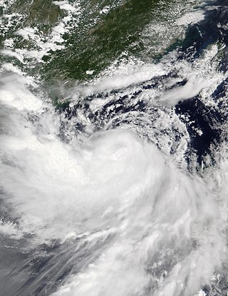
Typhoon Yagi,known in the Philippines as Severe Tropical Storm Enteng,was a deadly and extremely destructive tropical cyclone which impacted Southeast Asia and South China in early September 2024. Yagi,which means goat or the constellation of Capricornus in Japanese,was the eleventh named storm,the first violent typhoon,and the first super typhoon of the annual typhoon season. It was one of the most intense typhoons ever to strike Northern Vietnam,the strongest typhoon to strike Hainan during the meteorological autumn,and the strongest since Rammasun in 2014. It is one of the four Category 5 super typhoons recorded in the South China Sea,alongside Pamela in 1954,Rammasun in 2014 and Rai in 2021.
Yagi originated from a low-pressure area that formed on August 30,approximately 540 km (330 mi) northwest of Palau. On September 1,the system was classified as a tropical storm and named Yagi by the Japan Meteorological Agency (JMA). After making landfall over Casiguran,Aurora,in the Philippines,on September 2,Yagi weakened as it moved inland through the rugged terrain of the Cordillera Central of Luzon. It later emerged over the South China Sea and began merging with a secondary circulation west of Lingayen Gulf,with its deep convection starting to wrap and develop convective bands extending west and south. On September 5,the JMA reported that the storm reached its peak intensity with ten-minute sustained winds of 195 km/h (120 mph) and a central pressure of 915 hPa (27.02 inHg). It subsequently peaked as a Category 5-equivalent super typhoon on the Saffir-Simpson scale,with one-minute sustained winds of 260 km/h (160 mph). After weakening during an eyewall replacement cycle,Yagi slightly restrengthened before making landfall near Wenchang in China's Hainan Province on September 6. Yagi passed over northern Hainan and directly over Haikou,before briefly making landfall over Xuwen County in mainland Guangdong Province and moving into the open waters of the Gulf of Tonkin. It made landfall over Haiphong and Quảng Ninh,Vietnam,on September 7 and moved southwestwards inland until it was last noted on September 9.
The combination of Typhoon Yagi and the southwest monsoon led to heavy rains over Luzon,causing widespread flash floods in various areas. The Hong Kong Observatory issued a Gale or Storm No. 8 warning as Typhoon Yagi approached. The Chinese island of Hainan experienced extreme rainfall and over 57,000 buildings were damaged there. In preparation for Typhoon Yagi,schools and transport services in areas within the storm's trajectory were closed. In the Philippines,21 people were killed while 26 others were reported missing. In Vietnam,over 329,000 structures were affected and 325 people died,with 24 more missing;a majority of the casualties were caused by landslides. The remnants of Yagi caused catastrophic flooding and landslides in Myanmar,where 433 deaths and 79 missing were confirmed. These remnants also caused extensive flooding and deaths in Laos and Thailand. In total,the typhoon caused at least 844 deaths,2,279 injuries,and left 129 people missing. Yagi also damaged,flooded or destroyed over 741,800 structures,resulting in US$16.6 billion in damage across eight countries and territories.
The origins of Typhoon Yagi can be traced back to August 30, when the Japan Meteorological Agency (JMA) reported that a low-pressure area had formed approximately 540 km (330 mi) northwest of Palau. [1] [2] The broad low-pressure area began to organise and developed into a tropical depression on August 31. [3] Deep convection activity became concentrated around a circulation centre, which was in a favourable environment with excellent equatorward and poleward outflow and warm sea surface temperatures of 29–30 °C (84–86 °F). [4] On September 1, the Philippine Atmospheric, Geophysical and Astronomical Services Administration (PAGASA) declared the system a tropical depression and named it Enteng, as it formed within the Philippine Area of Responsibility. [5] At 03:00 UTC that day, the United States Joint Typhoon Warning Center (JTWC) issued a tropical cyclone formation alert due to its low-level circulation centre becoming well-defined with formative banding in its northern quadrants. [6] A few hours later, the system was classified as tropical depression 12W, exhibiting a rapidly consolidating low-level circulation, a compact central dense overcast (CDO), and deep convective banding over the western semicircle; it then intensified into a tropical storm and was named Yagi by the JMA. [7] [8]
Yagi then shifted northwestwards along the southwestern edge of a mid-level subtropical high, [8] which caused its convection to be sheared to the north and left the low-level circulation centre exposed. [9] As the system progressed up the coast of Luzon island, the colder cloud tops in the CDO continued to expand, [10] and at 14:00 PHT (06:00 UTC) on September 2, the storm made landfall in Casiguran, Aurora. [11] [12] Over the next six hours, [12] Yagi moved further inland into Luzon and weakened as it interacted with the rugged terrain of the Cordillera Central. [13] At 05:00 PHT on September 3 (21:00 UTC on September 2), it emerged over the South China Sea and began merging with a secondary circulation located west of Lingayen Gulf, [14] with Yagi's deep convection starting to wrap and develop convective bands extending to the west and south. [15] At around 06:00 UTC on September 3, the JMA reported that Yagi had intensified into a severe tropical storm due to warm sea surface temperatures and high ocean heat content. [16] Early the next day, both the JMA and the JTWC upgraded the storm to a minimal typhoon as an eye began to form on satellite imagery, [17] and Yagi started moving west-northwestwards along the southwestern edge of a mid-level subtropical high, [18] with a pinhole eye developing as the typhoon underwent rapid intensification. [19]
On September 5, the JTWC upgraded the system to super typhoon status with estimated 1-minute maximum sustained winds of 260 km/h (160 mph)—making it a Category 5-equivalent super typhoon, [20] only the fourth such storm in the South China Sea, after Pamela in 1954, Rammasun in 2014 and Rai in 2021—noting the sharply defined eye with a diameter of 17.3 miles (27.8 km). [21] [22] The JMA meanwhile upgraded Yagi to a violent typhoon, and estimated that it peaked in intensity with a minimum central pressure of 915 hPa (27.02 inHg), [23] and 10-minute maximum sustained winds of 195 km/h (120 mph). [24] Later that morning, [25] it weakened as it underwent an eyewall replacement cycle, [26] with its inner eyewall remained intact and outer eyewall weakened, [24] before restrengthening slightly and making landfall near Wenchang in Hainan Province around 16:20 CST on September 6. [27] This made Yagi the strongest typhoon to strike Hainan since Rammasun in 2014. [28] After making landfall over Hainan Province, the typhoon's structure continued to feature a 24 miles (39 km) diameter eye, a nearly complete eyewall, and spiral banding in the southern semicircle. [29] Yagi passed over northern Hainan and directly over Haikou, before making another landfall in Xuwen County, in mainland Guangdong province and entering into the open waters of the Gulf of Tonkin. [30] [31] On September 7, Yagi, which had steadily reorganised and rapidly intensified again with a well-defined circulation centre and very strong convection—evidenced by a large band of cloud tops at −80 °C (−112 °F) or colder in the southern part of the system—made landfall over Haiphong and Quảng Ninh, Vietnam. [32] The JTWC described it as historic, [33] considering it one of the most intense typhoons ever to strike northern Vietnam. [34] [35] Shortly after landfall, the JTWC discontinued warnings on the system due to warming cloud tops and a filling cloud eye feature. [36] Yagi continued to weaken rapidly as it moved southwestwards along the southeastern edge of a mid-level subtropical high after it made landfall, [37] becoming a tropical depression on September 8. [38] The JMA continued to monitor the system until it reported that the storm dissipated at 18:00 UTC the following day. [39]
As the Philippine Atmospheric, Geophysical and Astronomical Services Administration (PAGASA) started to track Yagi (known as "Enteng" in the Philippines) as a tropical depression on September 1, Tropical Cyclone Wind Signal No. 1 was raised in Albay; Biliran; Burias Island; Eastern Samar; Masbate; Northern Samar; Sorsogon; Ticao Island; northeastern portion of Leyte; eastern portions of Cagayan and Isabela; southern portions of Quirino and Nueva Vizcaya; and northern Quezon. [40] Shortly after Yagi became a tropical storm, the PAGASA raised Signal No. 2 for the northeastern portion of Camarines Sur, the entire province of Abra; Apayao; Babuyan Islands; Cagayan; Ilocos Norte; Ifugao; Isabela; Kalinga; Mountain Province; Polillo Islands; Quirino, and northern portions of Aurora; Camarines Norte; Ilocos Sur; and Nueva Vizcaya. At their next bulletin, the agency also added Benguet; La Union; Nueva Ecija; Rizal; Laguna; Marinduque, some parts of Batangas; Bulacan; Pampanga; and Pangasinan, as well as Metro Manila to Signal No. 1 because of gusty winds and heavy rains caused by the storm. [41] By September 4, most TCWS signals were lowered by the PAGASA as the storm left the Philippine Area of Responsibility. [42]
Classes in Metro Manila and multiple provinces across Luzon and the Visayas were suspended on September 2 and 3. [43] [44] Several domestic flights to Bicol, Cagayan Valley, Mimaropa, the Visayas and Zamboanga Peninsula were also cancelled at Ninoy Aquino International Airport, while operations at six regional airports were suspended. [45] Forced evacuations were ordered in Naga, Camarines Sur. [46] An evacuation advisory was raised for the Marikina River after water levels reached 16 metres (52 ft). [47] Salvage operations for the MT Terranova, which sank in Manila Bay and caused an oil spill during Typhoon Gaemi (locally called Carina) in July, were also suspended. [48] The Premier Volleyball League postponed the championship match of its 2024 Reinforced Conference originally scheduled on September 2. [49] The Government Service Insurance System prepared emergency loan programs for calamity-hit individuals. [50] According to the National Disaster Risk Reduction and Management Council, 80,842 people were preemptively evacuated. [51]
In preparation for Yagi, schools were closed across Hainan Province on September 5 and suspensions to local transport and shipping occurred the following day. The storm was expected to make landfall near Qionghai. [52] In Guangdong Province, all coastal attractions and activities were cancelled along with flights at Zhuhai Jinwan Airport. [53] More than 420,000 people were evacuated in Hainan, while nearly 500,000 others were evacuated in Guangdong. Emergency warnings were also issued in southern coastal parts of Guangxi Province. [54]
On September 3, the Hong Kong Observatory issued a Standby Signal No.1 warning over Hong Kong as Yagi approached the territory [55] at the strength of a Category 4 typhoon. [56] The following day, the Strong Wind Signal No. 3 was hoisted, and six HK Express flights were rescheduled. [57] More than 100 flights were also cancelled. [30] A Northeast Gale or Storm No. 8 signal was raised in the early evening on September 5. All trading in the Hong Kong Stock Exchange was cancelled on September 6. [58] The Hong Kong–Zhuhai–Macau Bridge was also closed to traffic. [59]
Dozens of flights at the Macau International Airport on Taipa island were cancelled. Schools were closed and ferry services to Hong Kong Island were suspended. [60] [61] All three bridges connecting the Macau Peninsula with Taipa were closed, while a Typhoon Signal No.8 warning was raised over the territory. [62]
The National Center for Hydro-Meteorological Forecasting forecast Typhoon Yagi to make landfall in Vietnam between the Quảng Ninh and Haiphong areas. [63] In response, [64] authorities advised against fishing in hazardous waters, [65] organising outdoor gatherings, [66] and recommended strengthening home defences and inspecting dykes, especially at landing sites. [67] Twelve northern provinces ordered schools to close in anticipation of the impacts of the typhoon, covering at least 6.5 million students including in Haiphong, Quảng Ninh, Bắc Giang, [65] Nam Định, [64] Thái Bình, [68] Hanoi, Hà Nam, Phú Thọ, and Ninh Bình. [69] All coastal localities from Quảng Ninh to Nghệ An banned vessels from operating, and approximately 310 domestic and international flights scheduled for September 7 were cancelled. [68] [69] Nearly 50,000 people were evacuated from coastal areas of northern Vietnam. [70]
Airports including Nội Bài (Hanoi), Cát Bi (Haiphong), Vân Đồn (Quảng Ninh), and Thọ Xuân (Thanh Hóa) were asked to temporarily suspend operations on September 7 during specific time periods. [71] By the morning of September 6, one day before the typhoon was officially expected to make landfall in Vietnam, Prime Minister Phạm Minh Chính issued an urgent directive to numerous provinces and cities as well as to the relevant ministers, urging them to take prompt action to respond to and minimise the damage caused by the storm. [72] Ferry services between the mainland and Phú Quốc in southern Vietnam were also suspended starting from September 6. [73] The Ministry of Industry and Trade instructed local authorities to stockpile essential goods for five to ten days. [74] Twelve rail routes in the North-South railway system were suspended. [75] The People's Army of Vietnam mobilised 460,000 personnel to help in disaster response. [28] [76] A friendly football match between Thailand and Russia scheduled at Mỹ Đình National Stadium in Hanoi on September 7 was cancelled. [77]
Heavy rain and flooding warnings were issued in Laos, Cambodia and Thailand. [78] [79] [80] Rainfall was also expected to impact parts of Myanmar bordering Laos and Thailand. [81] A flood warning was issued by the Mekong River Commission in Luang Prabang on September 12. [82] Flood warnings were also issued for September 14 in Vientiane, Nong Khai, and Chiang Khan. [83]
Country / territory | Deaths | Injuries | Missing | Damage cost (USD) |
---|---|---|---|---|
Philippines | 21 [84] | 22 | 26 | ≥$60.08 million |
Hong Kong | 0 | 9 | 0 | Unknown |
Macau | 0 | 2 | 0 | Unknown |
Mainland China | 4 [85] | 95 | 0 | ≥$12.3 billion |
Vietnam | 325 [a] | 1,987 [a] | 24 | ≥$3.37 billion [89] [90] [91] |
Laos | 7 | 0 | 0 | ≥$7.9 million [92] |
Thailand | 52 [93] | 111 | 0 | ≥$900 million [94] |
Myanmar | 433 | 48 | 79 | Unknown |
Total | 844 | 2,279 | 129 | ≥$16.6 billion |
Yagi, combined with the effects of the southwest monsoon, resulted in 21 deaths, 22 injuries and 26 people missing. [95] Yagi caused flooding in Metro Manila, and in the provinces of Bulacan, Camarines Norte, Camarines Sur, Cavite, Laguna, Northern Samar, Pangasinan, and Rizal. [96] [97] In Manila Bay, several ships ran aground off the coast of Navotas, while two others collided with each other, causing a fire on one of the vessels. [98] A barge also ran aground in Rosario, Cavite. [99]
In Metro Manila, Calabarzon, and Bulacan, around 28,000 people lost electricity. [100] The NDRRMC reported that the storm impacted 2,828,710 people and displaced 80,842, [51] resulting in total damages amounting to ₱2.96 billion ( US$ 60.08 million). This includes ₱2.26 billion ( US$ 45.89 million) in agricultural losses [101] and ₱698.9 million ( US$ 14.19 million) in infrastructural damage. The storm affected 7,622 homes, with 493 completely destroyed, caused power outages in 65 cities and municipalities, blocked roads in 175 locations, and rendered 31 bridges impassable. [51]
Additionally, the storm damaged 37,471 hectares (92,590 acres) of crops. [101] The Ambuklao and Binga Dams in Benguet, [102] as well as the Bustos and Ipo Dams in Bulacan were opened to offset rising water levels brought by Yagi, [103] while the La Mesa Dam in Quezon City overflowed, raising concerns about flooding in the Tullahan River. [104] Although Yagi moved farther from the Philippine Area of Responsibility, its trough continued to bring rainfall to Northern Luzon. [105] On September 4, the small asteroid 2024 RW1 , provisionally known as CAQTDL2 and measuring about 1 m (3 ft 3 in) in size, [106] entered Earth's atmosphere over the Philippines; [107] it was discovered by Jacqueline Fazekas at the NASA-funded Catalina Sky Survey, though observing the resulting fireball from the ground was challenging due to Typhoon Yagi. [108]
This section needs expansion. You can help by adding to it. (October 2024) |
Four people were killed and 95 sustained injuries in Hainan after Yagi made landfall on the island. [85] Power outages affecting about 830,000 households [28] [76] and downed trees were also reported. [109] By September 7, 1.2 million people were still left without power. [110] Nearly all of Hainan experienced rainfall exceeding 200 millimetres (7.9 in), with Haikou recording about 525 millimetres (20.7 in) of rain. [110] Chinese authorities estimated that economic losses in Hainan reached CN¥78.6 billion ( US$ 12.19 billion), while infrastructure damages totaled ¥728 million ( US$ 112.87 million), resulting in total damages amounting to ¥79.33 billion ( US$ 12.3 billion). [111] [112] Around 57,000 houses were destroyed or damaged on the island. [113]
Yagi also caused flooding in Yunnan Province, affecting 814 households and resulting in the relocation of 2,130 residents in Hekou Yao Autonomous County, located on the Red River on the border with Vietnam. [114] Heavy rainfall also caused the Zuo River in Guangxi to rise, flooding the provincial capital Nanning. [115]
In Hong Kong, Yagi injured nine people [116] and displaced 270. [30] [117] There were 79 reports of fallen trees. [118] [119] A waterspout was reported in the eastern waters of the territory on September 6. [120] Two people were injured and ten others were displaced in Macau. [62]
Prior to Yagi's landfall on the country, the storm killed one person and uprooted trees in Ho Chi Minh City on September 4. [86] Some roofs were blown off along with some electric poles in Bình Dương province, causing power outages in some areas on September 4. [121] [122] On September 6, the storm uprooted trees, roofs and signboards across the country, resulting in three deaths and seven injuries. [87] [88]
When Yagi made landfall in Haiphong and Quảng Ninh Province on September 7, a peak gust of 62 m/s was observed at a weather station in Bãi Cháy. [123] Yagi killed at least 321 people, injured 1,978 and left 24 missing. [124] At least 126 of the deaths were recorded in Lào Cai province alone. [125] At least 130,000 people were displaced nationwide. Over 241,000 houses were damaged across the country, while floodwaters submerged 84,000 houses, [124] and 280,000 hectares (690,000 acres) of crops [126] and destroyed 1,000 fisheries. [127] [128] Damage also occurred to 2,350 schools and 745 health facilities. [124] UNICEF estimated that three million people across the country were at risk of disease due to the lack of drinking water and sanitation, while two million children were in need of access to education, psychosocial support, and school feeding programmes. [129]
In Hanoi, four people died, 6,521 buildings were damaged [130] and over 100,000 trees were uprooted. [131] The Ministry of Agriculture and Rural Development said that 1.5 million fowl and 2,500 other livestock were killed in flooding. [132] Power outages also occurred in Quảng Ninh and Thái Bình. [30] Parts of Haiphong were submerged in 0.5 metres (1 ft 8 in) of water, [133] and two people were killed there. [130]
In Quảng Ninh, 29 people were killed, 1,609 were injured and 102,467 houses were damaged or destroyed. [130] [125] At least 30 boats were sunk or severely damaged in the province. [134] [127] Cát Bà Island, a popular tourist destination in Hạ Long Bay, was devastated; 4,700 buildings and 21 ships were damaged, including 130 buildings severely damaged or destroyed and 18 ships sunk. [135] [136] The island suffered a total loss of power, water, internet and cell service; transportation links with the mainland were completely severed for three days until ferry services resumed on September 9. [137]
The fishing sector of Vân Đồn district, Quảng Ninh reported equipment losses of VND 2.2 trillion (US$89.58 million), [138] while preliminary damage inflicted by Yagi in Quảng Ninh province as whole is estimated to be around 24.876 trillion VND (US$1.01 billion). [89] The City Council of Haiphong reported that the city sustained an estimated 13 trillion VND (US$536 million) worth of damage on infrastructures and agriculture. [139] PVI Insurance Corporation reported that preliminary insured losses of the company's customers caused by the typhoon had surpassed VND 2 trillion (US$81.43 million) by September 11. The company itself is still working to assess total payouts. [140] Stock values of many insurance companies plunged down between 1% and 4.6% at the Ho Chi Minh City Stock Exchange on September 10 as the result of Yagi's damage. [141] Insured losses overall due to the typhoon are estimated at 11.6 trillion VND (US$462 million). [142] The Ministry of Planning and Investment and Ministry of Agriculture and Rural Development of Vietnam estimated that agricultural and infrastructural losses caused by the typhoon might have reached 81.7 trillion VND (US$3.37 billion) and more, while total economic losses are currently under assessment. [89] [90] [91]
In the northern midlands and mountain highlands, water levels in several rivers reached dangerously high levels. Widespread downpours resulted in average rainfall of 400–600 millimetres (16–24 in) in provinces such as Lào Cai, Yên Bái, and Thái Nguyên, with some areas receiving nearly 800 millimetres (31 in), triggering catastrophic flooding. The deluge caused deep inundation, widespread landslides, and paralysed transport networks, isolating numerous communities. Dozens died while relief and rescue works were hampered. [143] Widespread power outages occurred in Lào Cai, Cao Bằng, and Bắc Kạn provinces, affecting several hundred thousand residents. [144]
On September 8, a landslide struck Hòa Sử Pán village near Sa Pa town in Lào Cai, killing six people and injuring nine others. In the same night, a passenger bus carrying 20 people was swept into a flooded stream by another landslide in the mountainous Cao Bằng province. The following day, a landslide killed nine people in the village of Lũng Lỳ in Cao Bằng. [145] In Phú Thọ province, damage from the typhoon later resulted in the collapse of the Phong Châu Bridge on September 9, sending at least 10 cars and two scooters into the Red River. According to Deputy Prime Minister Hồ Đức Phớc, three people were rescued while 10 remained missing. [146] [147] Floods reaching up to 1 metre (3 ft 3 in) affected Hanoi [148] and Yên Bái city, [149] inundated 18,000 homes across Yên Bái province [150] and displaced 59,000 residents. [151] Power outages affected 5.7 million people nationwide. [149] On September 10, a landslide buried the village of Làng Nủ in Lào Cai, killing at least 48 people and leaving 39 others missing. [152] Another landslide in Lào Cai buried the village of Nậm Tông, killing 10 people and leaving eight missing. [153]
Floodwater control by dams along Red River tributaries located in China was flagged as a matter of diplomatic concern. Chinese authorities agreed to slow the rate of water discharge from upstream dams and to store excess water in reservoirs, in order to reduce flood peaks downstream. [154] [155]
Yagi brought heavy rainfall that caused flooding across Laos, killing seven people and damaging 298 houses, 252 roads, 77 schools and 11 hospitals. [92] [156] In Luang Namtha Province, heavy rains forced the closure of Luang Namtha Airport. [157] Three hundred people were evacuated from 17 villages across the province. [151] Flooding also occurred in Luang Prabang, Oudomxay, and Bokeo Provinces, [83] as well as in parts of Vientiane Prefecture. [158]
In Thailand, 52 people were killed, [93] including at least 36 in Chiang Rai province [159] and six in Chiang Mai province. [160] Across the country, 34,000 households were damaged, [161] including 11,772 in Phra Nakhon Si Ayutthaya, 10,499 in Chiang Mai, [162] 2,928 in Chiang Rai, 720 in Tak, 576 in Phitsanulok, 361 in Sukhothai and 343 in Ang Thong. [160] Around 9,000 families were affected. [151] In Chiang Rai, 108 people were injured [159] and damage occurred across 46 villages in five districts. [151] [162] Six landslides occurred in Mae Ai district, [163] one of which killed six people and injured three others. [164] Flooding also damaged 1,191 homes and 92 shops across five villages in Mae Sai district. [165] Chiang Rai International Airport was closed due to flooding of access roads. [161] Parts of Bueng Khan and Nong Khai provinces were inundated in up to 2 metres (6 ft 7 in) of water after the Mekong River burst its banks. [166]
In Myanmar, the remnants of Yagi caused extensive flooding and landslides, which were considered the worst to hit central Myanmar in 60 years. [167] The country's junta confirmed 433 deaths, 79 missing, [168] [169] and 48 injuries. [170] Radio Free Asia put the number of missing at 200. [171] [172] At least 320,000 people were displaced, [173] while 24 bridges, 1,040 schools, 129 office buildings, five dams, 386 religious buildings, 14 electrical transformers, 456 lampposts and more than 158,373 houses were damaged by floods; 2,116 additional houses were destroyed. [174] [175] An additional 150,000 homes and 260,000 hectares (640,000 acres) of crops were flooded, [176] while nearly 130,000 animals also died. [177] Heavy rains also caused parts of several pagodas at the ancient UNESCO World Heritage site of Bagan to collapse. [174] Parts of the Yangon–Mandalay Railway were flooded, resulting in the suspension of journeys. [82] In Mandalay Region, 53,972 people were affected. [178]
In the village of Thaye Pin, 310 of the 350 houses were destroyed, and 700 residents were believed to be missing. [179] Heavy rains caused a dam to collapse in Soendin Township, flooding 20 villages under up to 8 ft (2.4 m) of water. [180] In Taungoo District, 200 villages were flooded, and rescuers claimed 400 people were dead or missing. [181] Another rescuer in Kalaw, Shan State claimed 100 people died and 200 others were missing due to floods and landslides. [182] Additionally, 18 members of a defense force were killed by a landslide in Pekon Township, [183] while 14 more died [184] and over 200 houses were damaged due to flooding in Mong Kung Township. [185] Additionally, the Pa-O National Liberation Army claimed "tens-of-thousands" were missing. [186]
Communication lines in Tachileik were cut by the floods. [151] At least 26 people, including 20 KNDF soldiers and six civilians died in Kayah State. [187] [183] Naypyidaw, the country's capital, was extensively flooded, with thousands of houses submerged beneath up to 7 ft (2.1 m) of floodwater, killing 164 people, [188] destroying 33 houses and damaging 3,891 more. [189]
The severity of the damage prompted Min Aung Hlaing, the country's military ruler, to issue an appeal for foreign aid. [190] According to the government, 3,600 people were rescued. [191] The United Nations estimated that around 887,000 people across 65 townships were affected by the disaster. [192]
Philippine President Bongbong Marcos conducted aerial inspections of La Mesa Dam, Marikina, and Antipolo, [193] announcing that over ₱16 million ( US$ 324,873.1) in humanitarian aid has been allocated to the hardest-hit areas. [194] The Department of Social Welfare and Development reported that assistance and relief goods valued at ₱700 million (US$14.21 million) have been distributed to the impacted families. [195] A state of calamity was declared in Camarines Sur, Naga City and Allen, Northern Samar due to floods caused by Yagi. [196]
On the afternoon of September 10, the Presidium of the Vietnamese Fatherland Front Committee held a ceremony to launch a fundraising campaign to support people affected by the storm, when the state budget is still limited. The Standing Committee of the Vietnamese Fatherland Front Central Committee and the Central Relief Mobilisation Committee pledged to use all donated funds for the right purposes, effectively, and transparently. [197] As of 5:00 p.m. on September 19, the total amount of funds transferred to the Central Relief Fund's account had reached VND 1.495 billion (US$60.77 million), of which VND 1.035 billion (US$42.17 million) has been disbursed to localities. [198] Additionally, with nearly 100 factories damaged, Vietnamese Prime Minister Phạm Minh Chính announced a US$4.62 million recovery package for Haiphong. [113] Prime Minister Paetongtarn Shinawatra visited Chiang Rai on September 13. [199] She later pledged that government would release US$90 million in aid and provide up to US$6,000 for each household affected by the floods. [176] On September 12, BingX initiated a donation campaign, committing 1 billion VND (US$430,000) to the Vietnamese Fatherland Front Committee to aid those impacted by the typhoon. [200] In addition, China and Vietnam collaborated on flood control. [201]
In response to the severe effects of Typhoon Yagi, the United States pledged US$1 million in immediate humanitarian aid to Vietnam, [202] while the Australian government allocated AUD$3 million (US$2 million) for emergency assistance and crucial services to Vietnam. [203] Australia sent emergency relief supplies aboard a C-17 Globemaster, which included essential provisions for families such as shelter and hygiene kits. [204] The Red Cross Society of China also donated 100,000 USD to the Red Cross Society of Vietnam. [205] The Swiss Agency for Development and Cooperation committed US$1.17 million, sending six specialists to aid in the recovery efforts to Vietnam. [206] The European Union has provided € 2.2 million ( US$ 2.6 million) in humanitarian aid, with €1.2 million ( US$ 1.42 million) directed to Myanmar, €650,000 ( US$ 768,755) to Vietnam, €200,000 ( US$ 236,540) to the Philippines, and €150,000 ( US$ 177,405) to Laos, to support those most affected by Typhoon Yagi. [207] The United Kingdom announced £1 million of humanitarian assistance to Vietnam. [208] The Japanese government, via the Japan International Cooperation Agency, has dispatched emergency supplies to assist Vietnam in recovering from recent storm damage, while South Korea donated US$2 million. [209] Indian billionaire businessman Gautam Adani has committed to donating US$1 million to help Vietnam recover from the damage caused by Typhoon Yagi. [210]
Rank | Typhoon | Season | Damage (2023 USD) |
---|---|---|---|
1 | Doksuri | 2023 | $28.4 billion |
2 | Mireille | 1991 | $22.4 billion |
3 | Hagibis | 2019 | $20.6 billion |
4 | Jebi | 2018 | $17 billion |
5 | Yagi | 2024 | $16.6 billion |
6 | Songda | 2004 | $15 billion |
7 | Fitow | 2013 | $13.6 billion |
8 | Faxai | 2019 | $11.9 billion |
9 | Saomai | 2000 | $11.1 billion |
10 | Lekima | 2019 | $11.1 billion |
Source: |
The Singapore Red Cross Society will provide S$50,000 to support the Vietnam Red Cross Society's continued humanitarian efforts. [211] The Singapore Armed Forces will deploy an Airbus A330 MRTT and two Lockheed C-130 aircraft to deliver humanitarian assistance to communities affected by Typhoon Yagi in Laos, Myanmar, and Vietnam. [212] India responded in Myanmar, Vietnam, and Laos by deploying its C-17 aircraft to deliver humanitarian aid, [213] including relief assistance valued at US$1 million to Vietnam [214] and ten tonnes of relief items to Myanmar. The military government of Myanmar also opened 400 relief camps. [176] More than 100 flood victims near Naypyidaw were hospitalised for food poisoning after consuming donated food. [215] The embassy of Ireland in Hanoi announced on September 18 a €250,000 ( US$ 295,675) contribution to support UNICEF in supplying clean water, sanitation, and hygiene resources to vulnerable children and families impacted by the typhoon. [216] The Canadian embassy in Hanoi reported that Canada has committed CAD 560,000 ( US$ 1.12 million) in humanitarian aid to help the Vietnamese people impacted by the heavy flooding and landslides resulting from Typhoon Yagi. [217] The Ministry of Emergency Situations of Russia provided humanitarian aid, which was delivered to Lao Cai province of Vietnam, the area most severely affected by the typhoon. [218] The United Nations Office for the Coordination of Humanitarian Affairs (OCHA) announced a US$2 million fund to support Vietnam's response to Typhoon Yagi. [219]
Most countries that provided aid expressed their condolences to Vietnam, [220] [221] [222] including Argentina, Belgium, Belarus, Brunei, Bulgaria, Canada, Cuba, the Czech Republic, Germany, Kazakhstan, Laos, Norway, New Zealand, Seychelles, Singapore, Slovenia, Spain, Thailand, the United Kingdom, Uzbekistan, and the Vatican. [223] [224] [225]
The 2013 Pacific typhoon season was a devastating and catastrophic season that was the most active since 2004, and the deadliest since 1975. It featured Typhoon Haiyan, one of the most powerful storms in history, as well as one of the strongest to make landfall on record. It featured 31 named storms, 13 typhoons, and five super typhoons. The season's first named storm, Sonamu, developed on January 4 while the season's last named storm, Podul, dissipated on November 15. Collectively, the storms caused 6,829 fatalities, while total damage amounted to at least $26.41 billion (USD), making it, at the time, the costliest Pacific typhoon season on record, until it was surpassed five years later. As of 2024, it is currently ranked as the fifth-costliest typhoon season.
The 2017 Pacific typhoon season was a below-average season in terms of accumulated cyclone energy and the number of typhoons and super typhoons, and the first since the 1977 season to not produce a Category 5-equivalent typhoon on the Saffir–Simpson scale. The season produced a total of 27 named storms, 11 typhoons, and only two super typhoons, making it an average season in terms of storm numbers. It was an event in the annual cycle of tropical cyclone formation, in which tropical cyclones form in the western Pacific Ocean. The season runs throughout 2017, though most tropical cyclones typically develop between May and October. The season's first named storm, Muifa, developed on April 25, while the season's last named storm, Tembin, dissipated on December 26. This season also featured the latest occurrence of the first typhoon of the year since 1998, with Noru reaching this intensity on July 23.
The 2018 Pacific typhoon season was at the time, the costliest Pacific typhoon season on record, until the record was beaten by the following year. The season was well above-average, producing twenty-nine storms, thirteen typhoons, seven super typhoons and six Category 5 tropical cyclones. The season ran throughout 2018, though most tropical cyclones typically develop between May and October. The season's first named storm, Bolaven, developed on January 3, while the season's last named storm, Man-yi, dissipated on November 28. The season's first typhoon, Jelawat, reached typhoon status on March 29, and became the first super typhoon of the year on the next day.
Tropical Depression 18W was a tropical depression that impacted Vietnam, Laos and Thailand during mid September 2013. The system was first noted as a tropical depression on September 16, 2013, while it was located within the South China Sea to the south east of Hanoi in Vietnam. Over the next two days the system gradually developed further, before it was reported by the Vietnamese National Centre for Hydro Meteorological Forecasting that the system had developed into their eighth tropical storm of 2013. However, other meteorological agencies did not report that the system had developed into a tropical storm.
Tropical Storm Kujira was a tropical cyclone that prompted the PAGASA to declare the beginning of the rainy season in the Philippines. The ninth tropical depression, 8th named storm, and first storm to make landfall on China in the 2015 Pacific typhoon season, it formed as a tropical depression south of the Paracel Islands on June 19.
Tropical Storm Vamco was a weak tropical cyclone which affected Indochina in mid-September 2015. Formed from a tropical disturbance on September 13, the system developed into a tropical storm and reached its peak intensity on September 14. Vamco made landfall in Vietnam and affected Laos, Thailand and Cambodia. The storm caused flooding in these countries and damages amounted to US$14.1 million. Fifteen people died in the floods.
Severe Tropical Storm Mirinae was a tropical cyclone of moderate intensity that struck Hainan Island, China and Northern Vietnam in late July 2016. The third named storm of the annual typhoon season, Mirinae formed on July 25, 2016 as a tropical depression west of Luzon, Philippines. On July 26, it moved west-northwestwards, and it had intensified into a tropical storm before making landfall on Hainan Island, China. After passing over Hainan, it intensified into a severe tropical storm and made landfall over the Red River Delta in Northern Vietnam late on July 27, and dissipated the next day.
Severe Tropical Storm Talas was a tropical cyclone that affected Vietnam in mid-July 2017. The storm was first identified as a tropical disturbance over the South China Sea on July 13 and was upgraded to a tropical depression the following day. On July 15, the depression intensified into a named storm of the 2017 Pacific typhoon season. Before making landfall in Vietnam, Talas reached its peak intensity as a severe tropical storm on July 16. It weakened to an area of low pressure on July 17 as it moved inland. Throughout Vietnam, the storm resulted in 14 fatalities and damaged approximately 2,700 homes. Rough seas caused about 50 boats to sink. Nearly 50,000 hectares of vegetable fields, around 800 ha of aquaculture, and 47,600 ha of rice and other subsidiary crops were affected. The storm caused an estimated US$8.8 million in damages in Hainan province, China, increased rainfall in Myanmar and Thailand, and triggered landslides and flooding in parts of Central and Northern Laos.
Tropical Storm Sonca was a weak tropical cyclone that impacted Southeast Asia during the end of July 2017. As the 10th named storm of the 2017 Pacific typhoon season, Tropical Storm Sonca formed south of Hong Kong, after drifting westward for multiple days, the storm intensified into a tropical storm, receiving the name Sonca. The storm later affected Hainan, reaching its peak intensity. On July 25, the storm made landfall over the Quảng Trị province, then dissipated.
Typhoon Doksuri, known in the Philippines as Tropical Storm Maring, was a strong Category 2 typhoon that mostly impacted the Philippines and Vietnam during mid-September 2017. Forming as the nineteenth named storm of the season, Doksuri developed as a weak tropical depression over to the east of Visayas on September 10.
Typhoon Damrey, known in the Philippines as Severe Tropical Storm Ramil, was a strong tropical cyclone that affected the Philippines and Vietnam during early November 2017. Damrey first originated as a tropical depression over the Philippine archipelago of Visayas on October 31. Emerging into the South China Sea a few days later, the system strengthened into the second deadliest and twenty-third named storm of the 2017 Pacific typhoon season. Rapidly intensifying, Damrey became the season's tenth typhoon on November 3, reaching its peak intensity as a Category 2 on the same day. Damrey made landfall over Khánh Hoà, Vietnam on November 4 and began to rapidly weaken, fully dissipating on November 5.
Tropical Storm Son-Tinh, known in the Philippines as Tropical Storm Henry, was a weak but very deadly tropical cyclone that devastated Vietnam and Laos in July 2018. Son-Tinh originated from an area of low pressure over the Philippine Sea on July 15, 2018. Moving quickly westwards, Son-Tinh strengthened to the ninth tropical storm of the annual typhoon season on July 17. Intensifying only slightly while crossing the South China Sea, Son-Tinh made its first landfall over Hainan Island on July 18. After emerging into the Gulf of Tonkin, Son-Tinh restrengthened before making its second landfall as a tropical storm in Northern Vietnam on July 19. Once inland, Son-Tinh weakened into a low pressure area as it slowed and made a clockwise loop. The remnants of Son-Tinh then emerged back over water and regenerated into a tropical depression late on July 21.
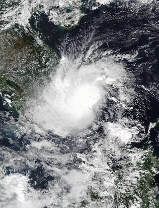
Tropical Storm Toraji was a weak, short-lived system that impacted Vietnam in November 2018. Forming as the twenty-seventh named storm of the 2018 Pacific typhoon season, Toraji developed as a tropical depression to the southeast of Vietnam on November 16. Quickly organising, the system strengthened into a tropical storm the next day. Toraji rapidly weakened thereafter early on November 18, when the storm made landfall over southeastern Vietnam, later dissipating. The storm's remnants moved into the Gulf of Thailand when Toraji re-organised back into a tropical depression on November 20. However Toraji quickly deteriorated on the same day as it moved closer to the Malay Peninsula.
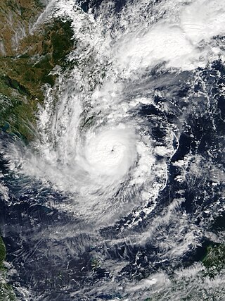
Severe Tropical Storm Usagi, known in the Philippines as Tropical Storm Samuel, was a tropical cyclone that affected the Philippines and Southern Vietnam in late November 2018, causing severe damage around the Visayas region and Ho Chi Minh City. The storm formed from a disturbance in the Central Pacific basin on November 3, but did not develop into a tropical storm until almost three weeks later, on November 13. Usagi underwent rapid intensification and peaked in intensity before making its final landfall on Vũng Tàu, Bà Rịa–Vũng Tàu province as a weakening tropical storm on November 25. While never considered as a typhoon by the Japan Meteorological Agency (JMA), the Joint Typhoon Warning Center (JTWC) assessed its intensity to be equivalent to Category 2 status on the Saffir–Simpson scale. Usagi caused one death and ₱52.2 million (US$992,000) in damages in the Philippines, most of which came from agriculture. Usagi caused 3 deaths and ₫925 billion in damages in Vietnam.
The 2024 Pacific typhoon season is an ongoing event in the annual cycle of tropical cyclone formation in the western Pacific Ocean. It is the fifth-latest starting Pacific typhoon season on record, as well as the deadliest since 2013, and the fifth-costliest Pacific typhoon season on record, mostly due to Yagi. This season also saw the most active November on record, with 4 storms active at the same time. The season runs throughout 2024, though most tropical cyclones typically develop between May and October. The season's first named storm, Ewiniar, developed on May 25, and eventually intensified into the first typhoon of the season.
Tropical Storm Linfa was a weak, short-lived but deadly and destructive tropical cyclone that was the twelfth wettest tropical cyclone on record and the second of nine tropical cyclones in a row to strike Vietnam in 2020, a little under a month after the less damaging Tropical Storm Noul. The fifteenth named storm of the 2020 Pacific typhoon season, Linfa originated from a tropical depression which formed just to the west of the Philippines on October 6. After passing through the island nation, the storm emerged into the South China Sea and slowly gained strength, earning the name Linfa on October 10 on approach to Vietnam. On the next day, Linfa had reached peak strength and made landfall in Vietnam, marking the beginning of a devastating series of floods in the country and worsening the already active monsoon season. Linfa quickly dissipated as it moved inland, but associated thunderstorms continued for several days.
Severe Tropical Storm Conson, known in the Philippines as Typhoon Jolina, was a strong tropical cyclone that impacted the central Philippines and Vietnam during the 2021 Pacific typhoon season. Being the thirteenth named storm of the said event, Conson originated as a low-pressure area first monitored approximately 500 km (310 mi) west of Guam. It formed as a tropical depression over the Pacific Ocean on September 5, 2021. As it formed within the Philippine Area of Responsibility, the Philippine Atmospheric, Geophysical, and Astronomical Services Administration (PAGASA) named the storm Jolina. Over the next day, it intensified into a tropical storm and was named Conson by the Japan Meteorological Agency (JMA). As the storm neared Samar Island, it intensified into a severe tropical storm, and later into a typhoon according to the PAGASA prior to its first landfall in Eastern Samar. The storm retained its strength as it crossed Visayas and later Calabarzon before weakening over Manila Bay prior to its final landfall in Bataan. It subsequently emerged into the South China Sea where it struggled to reintensify further. It then weakened into a tropical depression just offshore of Vietnam before moving ashore near Da Nang. It then rapidly weakened before dissipating on September 13.
Severe Tropical Storm Ma-on, known in the Philippines as Severe Tropical Storm Florita, was a tropical cyclone that impacted the Philippines in August 2022. The ninth named storm of the 2022 Pacific typhoon season, Ma-on originated as a disturbance over in the Pacific Ocean on August 18, and was upgraded to a tropical depression during the next day. The depression strengthened into a tropical storm receiving the name Ma-on, and became a severe tropical storm late on August 23 before making landfall in the Philippines. It would later make landfall in China and Vietnam on August 25. Ma-on weakened back to a tropical depression and due to unfavorable conditions it dissipated on August 26, 2022.
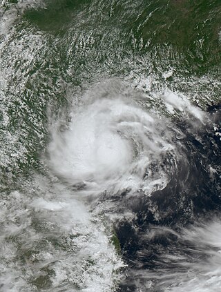
Severe Tropical Storm Prapiroon, known in the Philippines as Tropical Depression Butchoy was a compact tropical cyclone that made landfall in Hainan and Vietnam in July 2024. It was the fourth named storm of the annual typhoon season. Prapiroon was first identified as an area of persistent convection southeast of Manila, Philippines, on July 15. Several days later, the low-pressure system crossed into the South China Sea. As the storm progressed northwestward along the southern edge of a mid-level subtropical ridge, it intensified into a tropical storm and was named Prapiroon by the Japan Meteorological Agency (JMA) around 00:00 UTC on July 21. However, a few hours later, wind shear and dry air entrainment began to affect the storm. Despite this, deep convection continued to build around the center over the next six hours, resulting in a compact system as it approached Hainan. Prapiroon made landfall near Wanning, Hainan, with winds of 95 km/h (60 mph). After making landfall, the storm maintained its well-defined eye while moving across central Hainan, leading the JMA to upgrade it to a severe tropical storm at 00:00 UTC on July 23. On July 22, the JMA estimated peak 10-minute sustained winds of 100 km/h (65 mph) and a minimum barometric pressure of 985 hPa (29.09 inHg). Despite having persistent deep convection over its center earlier, Prapiroon soon encountered high wind shear and a dry environment. By the same day, it made its second landfall in Quảng Ninh, Vietnam, becoming the first tropical cyclone to strike Vietnam in 640 days. The JMA indicated that the storm dissipated, marking the end of Prapiroon's time as a tropical cyclone on July 25.
Tropical Storm Soulik, known in the Philippines as Tropical Depression Gener, was a weak tropical cyclone that impacted both the Philippines and Vietnam. It formed as the fifteenth named storm of the annual typhoon season in September 2024, Soulik originated from a low-pressure area to the east-northeast of Manila, Philippines on September 14, when it was designated as tropical depression Gener due to its formation within the Philippine Area of Responsibility on September 16. The system gradually shifted westward along the southern edge of a mid-level subtropical high, making landfall in Palanan, Isabela, on September 17. As it traveled further into Luzon, it weakened while encountering the rugged terrain of the Cordillera Central. After emerging over the South China Sea on the next day, the system displayed a broad, disorganized low-level circulation. Although two disturbances in the South China Sea were initially expected to merge closer to Vietnam, the Joint Typhoon Warning Center considered merging these disturbances into one system. Early the next day, the depression strengthened into a tropical storm named Soulik by the Japan Meteorological Agency (JMA). Soulik made landfall near Quang Binh and Quảng Trị, Vietnam, at around 2 p.m. local time. It quickly weakened to a tropical depression due to land interaction, and the JMA continued to monitor the system until it dissipated on September 20.
{{cite news}}
: CS1 maint: archived copy as title (link)A newly spotted asteroid named 2024 RW1 burned up in the atmosphere over the South Pacific, creating a spectacular bright flash in the sky over the Philippines just hours after first being detected