Typhoon Chan-hom (2015)

Last updated

Map key
  Tropical depression (≤38 mph, ≤62 km/h)
  Tropical storm (39–73 mph, 63–118 km/h)
  Category 1 (74–95 mph, 119–153 km/h)
  Category 2 (96–110 mph, 154–177 km/h)
  Category 3 (111–129 mph, 178–208 km/h)
  Category 4 (130–156 mph, 209–251 km/h)
  Category 5 (≥157 mph, ≥252 km/h)
  Unknown
Storm type
Disc Plain black.svg Tropical cyclone
Solid black.svg Subtropical cyclone
ArrowUp.svg Extratropical cyclone, remnant low, tropical disturbance, or monsoon depression

During June 2015, a near record strength pulse in the Madden–Julian oscillation, lead to a period of significant weather across the Western Pacific. [1] [2] This significant weather included a major westerly wind burst during late June, which caused a set of twin tropical cyclones to develop. [3] The first tropical cyclone developed in the Southern Hemisphere during June 28, before it later developed into Tropical Cyclone Raquel during June 30. [3] The second tropical cyclone was first noted by the United States Joint Typhoon Warning Center (JTWC) as a tropical disturbance during June 25, while it was located about 345 km (215 mi) to the south-southeast of Pohnpei State in the Federated States of Micronesia. [4] [nb 1]

Drifting generally northward, the disturbance slowly organized within a region of low to moderate wind shear and favorable outflow aloft. The circulation was enhanced by a surge of westerly winds to the south. [5] At 06:00  UTC on June 29, the Japan Meteorological Agency (JMA) [nb 2] classified the system as a tropical depression. [7] Following further organization, the JTWC issued a Tropical Cyclone Formation Alert that day at 22:30 UTC with the system located about 345 km (214 mi) northeast of Pohnpei. [8] Convection steadily deepened over the center and banding features began consolidating around the periphery. [9] On June 30, the JMA upgraded the cyclone to Tropical Storm Chan-hom. [7] [10] [nb 3] The JTWC assessed Chan-hom to be slightly weaker at this time, initiating it as a tropical depression. [9]

Situated along the southern periphery of a subtropical ridge, Chan-hom moved steadily to the west. [9] Upper-level ventilation allowed for growth of the cyclone, [12] but moderate wind shear displaced the center from the deepest convection for much of July 1. [13] That day, the JMA upgraded the system to a severe tropical storm. [7] Early on July 2, the large circulation of Chan-hom absorbed a smaller disturbance to its southeast, [14] and the storm turned to the west-southwest. Dvorak satellite classifications indicated that the system reached typhoon intensity following an expansion of the central dense overcast; the JTWC classified Chan-hom as such by 15:00 UTC, [15] although the JMA maintained it as a severe tropical storm. [7] Shortly thereafter, strong wind shear from a tropical upper tropospheric trough (TUTT) cell to the northeast dramatically weakened the storm. Convection was stripped away from Chan-hom's center and the storm's forward motion abruptly slowed. [16] [17] Alongside the shear, subsidence over the cyclone, a trough to the north, and a remnant vortex to the northeast all served to suppress convection. [18] By 12:00 UTC on July 3, Chan-hom had weakened to a tropical storm with winds of 85 km/h (53 mph). [19]

Tropical Storm Chan-hom over the Mariana Islands on July 5 Chan-hom 2015-07-05 0350Z.jpeg
Tropical Storm Chan-hom over the Mariana Islands on July 5

Coinciding with Chan-hom's abrupt collapse on July 3, the system turned northeast as it entered a weakness in the steering ridge. [16] [18] Later that day, the broad circulation turned north-northwest. [20] Wind shear eased early on July 4 as the TUTT cell retreated to the north and the subtropical ridge steadily re-established itself. Convection started redeveloping over the tropical storm. [21] Late on July 4 into July 5, the center of Chan-hom skirted the southern coast of Rota in the Mariana Islands. [22] [23] While near the island, Chan-hom executed an unusual counter-clockwise loop owing to interaction with a monsoon trough. [24] [25] Once clear of the Mariana Islands, steady development ensued owing to low wind shear and good outflow. [26] Early on July 7, Chan-hom attained typhoon intensity according to the JMA, [7] following to a burst in central convection. [27] [28] Microwave satellite imagery indicated the formation of an eye as convection deepened and banding features tightened around the circulation. [29]

On July 7, the typhoon entered the Philippine area of Responsibility and was assigned the local name Falcon. [30] Chan-hom's eye briefly improved in structure before entering a state of flux and collapsing later that day; convection on the northern side of the storm diminished simultaneously. [31] [32] The 65 km (40 mi) wide eye soon re-established itself and slowly contracted to a diameter of 40 km (25 mi) by July 8. [33] [34] A large storm, gale-force winds extended 445 km (277 mi) from Chan-hom's center on July 9. [35] Late on July 9 into July 10, Chan-hom passed between the Japanese islands of Okinawa and Miyako-jima. [36] The typhoon reached its peak strength during this time with estimated winds of 165 km/h (103 mph) and a barometric pressure of 935 mbar (hPa; 27.61  inHg). [37] Featuring multiple intense feeder bands and a well-defined 27 km (17 mi) eye, the JTWC assessed Chan-hom to have peaked as a Category 4-equivalent typhoon on the Saffir–Simpson hurricane wind scale with one-minute sustained winds of 220 km/h (140 mph). [38]

An eyewall replacement cycle and weakening convection along the northern side resulted in steady weakening starting on July 10. [39] [40] Increasing wind shear prevented the system from reorganizing as it neared East China. [41] Early on July 11, the typhoon reached the southwestern edge of the subtropical ridge and began turning to the north and later north-northeast. [42] Chan-hom made landfall in Zhoushan, Zhejiang, or roughly 140 km (87 mi) south-southeast of Shanghai, around 08:40 UTC. [43] The JMA assessed the storm to have had winds of 140 km/h (87 mph) while the JTWC estimated one-minute sustained winds at 155 km/h (96 mph). [42] [44] Based on the JTWC estimate, Chan-hom was the strongest typhoon to pass within 160 km (99 mi) of Shanghai in at least 35 years, [43] and it was the strongest landfall in Zhejiang in the month of July since recordkeeping began in 1949. [45] Thereafter the storm accelerated north-northeast and moved over the cool waters of the Yellow Sea, prompting further degradation of its structure. [46] Chan-hom weakened below typhoon-force around 18:00 UTC on July 11. [7] The system's low-level center completely exposed on July 12 as it approached the Korean Peninsula. [47] [48] Around 18:00 UTC, Chan-hom moved ashore on the Ongjin peninsula in North Korea, southwest of the capital Pyongyang, with winds of 85 km/h (53 mph). [49] [50] By 00:00 UTC on July 13 the system transitioned into an extratropical cyclone while retaining gale-force winds, [51] and six hours later the system dissipated over north-central North Korea. [7]

Preparations and impact

China

Typhoon Chan-hom hours before making landfall in China on July 11 Chan-hom 2015-07-11 0500Z.jpg
Typhoon Chan-hom hours before making landfall in China on July 11

Due to the typhoon, about 1.1 million people evacuated from areas along the coast. [50] Nearly 30,000 ships were called back to port, and 600 flights were canceled within the area. [52] Over 100 train rides were also canceled, [50] and portions of the Shanghai Metro was shut down. [53] The storm caused a concert for Chinese singer Wang Feng to be canceled. [54]

While moving over eastern China, Chan-hom produced sustained winds of 119 km/h (74 mph) and gusts to 177 km/h (110 mph), both at a station south of Shanghai called Shipu. Shanghai Pudong International Airport recorded wind gusts of 90 km/h (56 mph). [50] Gusts were strongest along the coast and along offshore islands. Rainfall from the storm peaked at 531 mm (20.9 in) in Yuyao, Ninghai, and Xiangshan, all parts of Ningbo city within Zhejiang. [45] The rains caused widespread flooding in eastern China; [50] 11 rivers in Zhejiang surpassed the warning level of 1.91 m (6.3 ft). The storm produced high waves from Fujian to Jiangsu provinces, [45] reaching five storeys high in Wenling, washing fish ashore and flooding the coast. [55]

Winds from Chan-hom were strong enough to knock down street signs across Zhejiang, as well as destroying an unoccupied building in Cixi City. [56] The storm's heavy rainfall caused a landslide in Ningbo and necessitated flood gates to be opened. [57] Also in the city, storm rains caused a hotel roof to collapse, killing one person and injuring two. [58] Throughout Zhejiang, Chan-hom wrecked 700 homes and damaged another 1,400. In neighboring Jiangsu, 300 homes were damaged or destroyed, causing ¥120 million (US$19.3 million) in economic losses. [59] The storm wrecked greenhouses and irrigation systems while also damaging crops. [60] Storm impacts mostly affected agriculture and transportation in the country; [61] over 200,000 ha (490,000 acres) of crop fields were impacted. [62] In the Nanhui District of Shanghai, 20% of peaches and 40% of pears were lost after being damaged by the storm's winds. [63] In Shanghai, the winds knocked down over 3,000 trees. [53] The high agriculture damage estimated at ¥3.62 billion (US$583 million) was mostly due to the typhoon's concurrence with the local harvesting of vegetables and melons. [53] Overall, Chan-hom affected 3.9 million people in eastern China, causing about ¥9.84 billion (US$1.58 billion) in damage. [45]

Elsewhere

Before the storm affected the Marianas Islands, the National Weather Service issued a typhoon watch and tropical storm warning for Guam and Rota, as well as a typhoon warning for Tinian, and Saipan. The United States Department of Defense issued a Condition of Readiness 3. [64] While looping near Rota, Chan-hom produced gusts of 60 km/h (37 mph). [50] On the other side of the Rota Channel, Andersen Air Force Base on northern Guam recorded wind gusts of 117 km/h (73 mph). Rainfall on the island totaled over 300 mm (12 in), based on radar estimates from the University of Guam, [65] and possibly as high as 410 mm (16 in). [50] On Guam, the storm caused minor power outages and flooding. [64]

Although Chan-hom did not directly affect the Philippines, both Chan-hom and Tropical Storm Linfa enhanced the monsoon for several days, which caused severe flooding throughout the country. [66] Heavy rains impacted portions of Luzon and the Western Visayas, with various events resulting in five deaths. Four people also went missing when their boat sank amid strong winds off the coast of Pangasinan. A brief tornado caused minor damage in Iba, Zambales. Nearly 34,000 people were affected by the monsoon event, which killed 16 people and caused 3.9 million (US$86,000) in agricultural losses. [67]

Fallen trees in Kadena Air Base, Japan Commonly asked questions during typhoons 150710-F-GR156-005.jpg
Fallen trees in Kadena Air Base, Japan

On July 9, the outer rainbands of Chan-hom began affecting the Japanese island of Okinawa. [50] Between July 9 and 10, 326 flights were canceled at Naha Airport, affecting more than 32,000 people. A total of 176 people sought refuge in public shelters. American military bases on the island were placed under Condition of Readiness 1, the highest level. [64] Early on July 10, a station near the southern end of Okinawa recorded peak wind gusts of 179.6 km/h (111.6 mph), along with sustained winds of 118.8 km/h (73.8 mph). Strong winds affected other Japanese islands in the region, and Miyako-jima recorded peak gusts of 118.8 km/h (73.8 mph). [50] The storm dropped heavy rainfall, peaking at 230 mm (9.1 in) in Nago, Okinawa. [68] At the height of the storm, 42,000 people lost power across Okinawa Prefecture. [64] The storm injured 27 people in Okinawa, [50] three seriously. [64] Two buildings were damaged. Agricultural damage across Okinawa reached ¥524 million (US$4.27 million), most of which was sustained by the mango crop. [69]

Passing north of Taiwan, the threat of Chan-hom caused the Taiwan Stock Exchange and other public buildings to close, as well as canceling several flights. [70] The storm brought ultimately heavy rainfall, reaching 388.5 mm (15.30 in) in Taipei. [50] The Shihmen Dam, which had dropped to 55% capacity before the storm, rose to 90.26% of its capacity due to the storm's rains. [71]

In South Korea, 574 flights were canceled and 163 boats were forced to remain at port. [72] The large circulation of the storm dropped heavy rainfall throughout the Korean Peninsula, beneficial in easing drought conditions. Notably, Mount Halla on the offshore Jeju Island recorded 1,250 mm (49 in) of rainfall during Chan-hon's passage. [73] Wind gusts reached 76 km/h (47 mph) in Muan County in southwestern South Korea. [50] Thunderstorms killed one person in the country. [72] Losses in South Jeolla Province were confirmed to be 4.8 billion (US$4.22 million). [74] When Chan-hom made landfall along North Korea, winds were generally less than 40 km/h (25 mph), [50] with gusts reaching up to 54 km/h (34 mph). The storm dropped heavy rainfall, reaching over 300 mm (12 in) in North Hamgyong Province along the east coast. Flooding was limited, as most of the country received about 102 mm (4.0 in) of rainfall from the storm. [49]

The remnants of Chan-hom later impacted southern areas of Khabarovsk Krai, producing heavy rain and high winds, peaking at 79 km/h (49 mph). [75] The winds downed numerous trees, some of which fell on cars, [76] and uprooted tombs in a graveyard in Khabarovsk. [77] The towns of Bikin, Sovetskaya Gavan, and Vyazma, saw 40 to 80 mm (1.6 to 3.1 in) of rain or roughly 60–70 percent of their average monthly precipitation for July during the storm's passage. [75] [76] Flooding affected dozens of homes in the region as rivers rose by 1 to 2 m (3.3 to 6.6 ft). [75] Power and telephone service was lost in 34 communities. [78] Ferry service between Vanino and Kholmsk was suspended, temporarily stranding 1,300 passengers. [76] Damages in Khabarovsk Krai reached 87 million (US$1.54 million). [79]

See also

Notes

  1. The Joint Typhoon Warning Center is a joint United States Navy United States Air Force task force that issues tropical cyclone warnings for the Pacific and Indian Oceans. [2]
  2. The Japan Meteorological Agency is the official Regional Specialized Meteorological Center for the western Pacific Ocean. [6]
  3. The name Chan-hom was submitted to the World Meteorological Organization by Laos and is a kind of tree. [11]

Related Research Articles

<span class="mw-page-title-main">2012 Pacific typhoon season</span> Typhoon season in the Western Pacific Ocean

The 2012 Pacific typhoon season was a slightly above average season that produced 25 named storms, fourteen typhoons, and four intense typhoons. It was a destructive and the second consecutive year to be the deadliest season, primarily due to Typhoon Bopha which killed 1,901 people in the Philippines. It was an event in the annual cycle of tropical cyclone formation, in which tropical cyclones form in the western Pacific Ocean. The season ran throughout 2012, though most tropical cyclones typically develop between May and October. The season's first named storm, Pakhar, developed on March 28, while the season's last named storm, Wukong, dissipated on December 29. The season's first typhoon, Guchol, reached typhoon status on June 15, and became the first super typhoon of the year on June 17.

<span class="mw-page-title-main">2015 Pacific typhoon season</span> Typhoon season in the Western Pacific Ocean

The 2015 Pacific typhoon season was a slightly above average season that produced twenty-seven tropical storms, eighteen typhoons, and nine super typhoons. The season ran throughout 2015, though most tropical cyclones typically develop between May and November. The season's first named storm, Mekkhala, developed on January 15, while the season's last named storm, Melor, dissipated on December 17. The season saw at least one named tropical system forming in each of every month, the first time since 1965. Similar to the previous season, this season saw a high number of super typhoons. Accumulated cyclone energy (ACE) during 2015 was extremely high, the third highest since 1970, and the 2015 ACE has been attributed in part to anthropogenic warming.

<span class="mw-page-title-main">2016 Pacific typhoon season</span> Typhoon season in the Western Pacific Ocean

The 2016 Pacific typhoon season is considered to have been the fourth-latest start for a Pacific typhoon season since reliable records began. It was an average season, with a total of 26 named storms, 13 typhoons, and six super typhoons. The season ran throughout 2016, though typically most tropical cyclones develop between May and October. The season's first named storm, Nepartak, developed on July 3, while the season's last named storm, Nock-ten, dissipated on December 28.

<span class="mw-page-title-main">Typhoon Usagi (2013)</span> Pacific typhoon in 2013

Typhoon Usagi, known in the Philippines as Super Typhoon Odette, was a violent tropical cyclone which affected Taiwan, the Philippines, China, and Hong Kong in September 2013. Usagi, or which means the constellation Lepus in Japanese, was the fourth typhoon and the nineteenth tropical storm in the basin. Developing into a tropical storm east of the Philippines late on September 16, Usagi began explosive intensification on September 19 and ultimately became a violent and large typhoon. Afterwards, the system weakened slowly, crossed the Bashi Channel on September 21, and made landfall over Guangdong, China on September 22.

<span class="mw-page-title-main">Typhoon Krosa (2013)</span> Pacific typhoon in 2013

Typhoon Krosa, known in the Philippines as Typhoon Vinta, was a typhoon that made landfall in the northern Philippines in late October 2013. Forming on October 27 near Guam, the storm slowly intensified while moving westward. Krosa developed an eye and became a typhoon before striking Luzon on October 31. The storm weakened over land, but re-intensified over the South China Sea, reaching peak winds of 150 km/h (93 mph) on November 2 off the southeast coast of China. Typhoon Krosa stalled and encountered unfavorable conditions, resulting in quick weakening. By November 3, it had weakened to tropical storm status, and was no longer being warned on by the next day. In northern Luzon, Krosa damaged 32,000 houses, including 3,000 that were destroyed, and caused four fatalities. High winds and rainfall left ₱277 million in damage.

<span class="mw-page-title-main">Typhoon Lekima (2013)</span> Pacific typhoon in 2013

Typhoon Lekima was the second most intense tropical cyclone worldwide in 2013, as well as the twenty-ninth named storm and the eleventh typhoon of the annual typhoon season. It developed into a tropical storm late on October 20. After Lekima intensified into a typhoon and underwent rapid deepening in a very favorable environment on October 22, the system reached peak intensity on the following day. Maintaining its strength for over one day, Lekima began to weaken on October 24, as stronger vertical wind shear and mid-latitude westerlies began to make the typhoon significantly decay. On October 26, Lekima transitioned into an extratropical cyclone east of Japan.

<span class="mw-page-title-main">
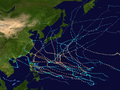
Meteorological history of Typhoon Haiyan</span>

Typhoon Haiyan's meteorological history began with its origins as a tropical disturbance east-southeast of Pohnpei and lasted until its degeneration as a tropical cyclone over southern China. The thirteenth typhoon of the 2013 Pacific typhoon season, Haiyan originated from an area of low pressure several hundred kilometers east-southeast of Pohnpei in the Federated States of Micronesia on November 2. Tracking generally westward, environmental conditions favored tropical cyclogenesis and the system developed into a tropical depression the following day. After becoming a tropical storm and attaining the name Haiyan at 0000 UTC on November 4, the system began a period of rapid intensification that brought it to typhoon intensity by 1800 UTC on November 5. By November 6, the Joint Typhoon Warning Center (JTWC) assessed the system as a Category 5-equivalent super typhoon on the Saffir–Simpson hurricane wind scale; the storm passed over the island of Kayangel in Palau shortly after attaining this strength.

<span class="mw-page-title-main">Typhoon Francisco (2013)</span> Pacific typhoon in 2013

Typhoon Francisco, known in the Philippines as Typhoon Urduja, was a powerful typhoon that strengthened to the equivalent of a Category 5 on the Saffir-Simpson scale, according to the Joint Typhoon Warning Center. The 25th named storm and the 10th typhoon of the 2013 Pacific typhoon season, Francisco formed on October 16 east of Guam from a pre-existing area of convection. With favorable conditions, it quickly intensified into a tropical storm before passing south of Guam. After stalling to the southwest of the island, Francisco turned to the northwest into an environment of warm waters and low wind shear, becoming a typhoon. The JTWC upgraded it to super typhoon status on October 18, while the Japan Meteorological Agency (JMA) estimated peak 10-minute sustained winds of 195 km/h (121 mph). Gradual weakening ensued, and after the typhoon turned to the northeast, Francisco deteriorated into a tropical storm on October 24. Passing southeast of Okinawa and mainland Japan, the storm accelerated and became extratropical on October 26, dissipating later that day.

<span class="mw-page-title-main">Hurricane Genevieve (2014)</span> Pacific hurricane and typhoon in 2014

Hurricane Genevieve, also referred to as Typhoon Genevieve, was the first tropical cyclone to track across all three northern Pacific basins since Hurricane Dora in 1999. Genevieve developed from a tropical wave into the eighth tropical storm of the 2014 Pacific hurricane season well east-southeast of Hawaii on July 25. However, increased vertical wind shear caused it to weaken into a tropical depression by the following day and degenerate into a remnant low on July 28. Late on July 29, the system regenerated into a tropical depression, but it weakened into a remnant low again on July 31, owing to vertical wind shear and dry air.

<span class="mw-page-title-main">Timeline of the 2015 Pacific typhoon season</span>

This timeline documents all of the events of the 2015 Pacific typhoon season. Most of the tropical cyclones formed between May and November. The scope of this article is limited to the Pacific Ocean, north of the equator between 100°E and the International Date Line. This area, called the Western Pacific basin, is the responsibility of the Japanese Meteorological Agency (JMA). They host and operate the Regional Specialized Meteorological Center (RSMC), located in Tokyo. The Japanese Meteorological Agency (JMA) is also responsible for assigning names to all tropical storms that are formed within the basin. However, any storm that enters or forms in the Philippine Area of Responsibility (PAR) will be named by the Philippine Atmospheric, Geophysical and Astronomical Services Administration (PAGASA) using a local name. Also of note - the Western Pacific basin is monitored by the United States' Joint Typhoon Warning Center (JTWC), which gives all Tropical depressions a number with a "W" suffix.

<span class="mw-page-title-main">Tropical Storm Mekkhala (2015)</span> Pacific typhoon in 2015

Severe Tropical Storm Mekkhala, known in the Philippines as Severe Tropical Storm Amang, was an early-season tropical cyclone that made landfall over the Philippines in January 2015. Mekkhala killed three people in the Bicol Region and caused light crop damage. Notably, the storm disturbed Pope Francis’ visit to the country after the victims of Typhoon Haiyan on November 8, 2013. Although the storm also caused an airplane crash in Tacloban, nobody was hurt in the incident.

<span class="mw-page-title-main">Tropical Storm Linfa (2015)</span> Pacific typhoon in 2015

Severe Tropical Storm Linfa, known in the Philippines as Severe Tropical Storm Egay, was a tropical cyclone that affected the northern Philippines, Taiwan and southern China in early July 2015. The tenth named storm of the annual typhoon season, Linfa developed on July 1 over in the Philippine Sea. It moved erratically westward toward the Philippines, eventually striking the island of Luzon on July 4. Linfa weakened across the island, but reorganized over the South China Sea. It turned northward and strengthened to near typhoon intensity, or winds of 120 km/h (75 mph), but weakened as it curved to the northwest toward southern China. On July 9, the storm made landfall along the Chinese province of Guangdong, dissipating the next day west of Hong Kong.

<span class="mw-page-title-main">Typhoon Nangka (2015)</span> Pacific typhoon in 2015

Typhoon Nangka was a large and powerful tropical cyclone that impacted central Japan in mid-July 2015. Nangka started its long-living journey as a tropical disturbance over the Marshall Islands and west of the International Dateline, becoming the eleventh named storm of the annual typhoon season on July 3. It quickly intensified while moving to the west-northwest, attaining typhoon status on July 6. Nangka moved through the Northern Marianas Islands, passing directly over the uninhabited island of Alamagan. Shortly thereafter, the typhoon attained peak winds; the Japan Meteorological Agency (JMA) estimated 10‑minute sustained winds of 185 km/h (115 mph), while the unofficial Joint Typhoon Warning Center (JTWC) estimated 1‑minute winds of 250 km/h (155 mph), making it a super typhoon. Nangka later weakened as it curved to the north, moving across central Japan on July 16 as a minimal typhoon. The storm weakened soon after, dissipating in the Sea of Japan on July 18.

<span class="mw-page-title-main">Typhoon Halola</span> Pacific typhoon in 2015

Typhoon Halola, known in the Philippines as Typhoon Goring, was a small but long-lived tropical cyclone in July 2015 that traveled 7,640 km (4,750 mi) across the Pacific Ocean. The fifth named storm of the 2015 Pacific hurricane season, Halola originated from a Western Pacific monsoon trough that had expanded into the Central Pacific by July 5. Over the next several days, the system waxed and waned due to changes in wind shear before organizing into a tropical depression on July 10 while well southwest of Hawaii. The depression strengthened into Tropical Storm Halola on the next day as it traveled westward. Halola crossed the International Date Line on July 13 and entered the Western Pacific, where it was immediately recognized as a severe tropical storm. The storm further strengthened into a typhoon over the next day before encountering strong wind shear on July 16, upon which it quickly weakened into a tropical depression as it passed south of Wake Island. However, the shear relaxed on July 19, allowing Halola to reintensify. On July 21, Halola regained typhoon status and later peaked with 10-minute sustained winds of 150 km/h (93 mph) and a minimum pressure of 955 hPa. From July 23 onward, increasing wind shear and dry air caused Halola to weaken slowly. The system fell below typhoon intensity on July 25 as it began to recurve northwards. Halola made landfall over Kyushu on July 26 as a tropical storm and dissipated in the Tsushima Strait shortly after.

<span class="mw-page-title-main">Typhoon Goni (2015)</span> Pacific typhoon in 2015

Typhoon Goni, known in the Philippines as Typhoon Ineng, was a powerful tropical cyclone that affected much of East Asia in late August 2015. Developing in tandem with Typhoon Atsani to its east, Goni formed on August 13, and passed through the Mariana Islands two days later. By that time, radar imagery showed a formative eye, signaling an rapidly intensifying storm. Goni evolved into an intense typhoon in the Philippine Sea before weakening and stalling north of Luzon. The typhoon re-intensified and attained peak winds of 185 km/h (115 mph) on August 23 while moving through the southern Ryukyu Islands. Goni weakened slightly and moved across the Japanese island of Kyushu. The tropical cyclone transitioned into an extratropical cyclone in the Sea of Japan on August 25, crossed into eastern Russia and China a day later, and dissipated on August 30.

<span class="mw-page-title-main">Typhoon Meranti</span> Pacific typhoon in 2016

Typhoon Meranti, known in the Philippines as Super Typhoon Ferdie, was one of the most intense tropical cyclones on record. Impacting the Batanes in the Philippines, Taiwan, as well as Fujian Province in September 2016, Meranti formed as a tropical depression on September 8 near the island of Guam. Tracking to the west northwest, Meranti gradually intensified until September 11, at which point it began a period of rapid intensification. Continuing to rapidly intensify, it became a super typhoon early on September 12, as it passed through the Luzon Strait, ultimately reaching its peak intensity on September 13 with 1-minute sustained winds of 315 km/h (195 mph). Shortly afterwards, it passed directly over the island of Itbayat. Meranti passed to the south of Taiwan as a super typhoon, and began weakening steadily as a result of land interaction. By September 15, it struck Fujian Province as a Category 2-equivalent typhoon, becoming the strongest typhoon on record to impact the province. Upon moving inland, rapid weakening ensued and Meranti became extratropical the next day, dissipating shortly afterwards after it passed to the south of the Korean Peninsula.

<span class="mw-page-title-main">Typhoon Nock-ten</span> Pacific typhoon in 2016

Typhoon Nock-ten, known in the Philippines as Super Typhoon Nina, was the strongest Christmas Day tropical cyclone worldwide in terms of 1-minute sustained winds. Forming as a tropical depression southeast of Yap and strengthening into the twenty-sixth tropical storm of the annual typhoon season on December 21, 2016, Nock-ten intensified into the thirteenth typhoon of the season on December 23. Soon afterwards, the system underwent explosive intensification and became a Category 5-equivalent super typhoon early on December 25. Nock-ten weakened shortly afterwards before making eight landfalls over the Philippines. The typhoon weakened rapidly due to the landfalls as it entered the South China Sea on December 26, turned southwest, and ultimately dissipated on December 28 due to the winter monsoon.

<span class="mw-page-title-main">Typhoon Lan (2017)</span> Pacific typhoon in 2017

Typhoon Lan, known in the Philippines as Super Typhoon Paolo, was the third-most intense tropical cyclone worldwide in 2017, behind only hurricanes Irma and Maria in the Atlantic. A very large storm, Lan was the twenty-first tropical storm and ninth typhoon of the annual typhoon season. It originated from a tropical disturbance that the United States Naval Research Laboratory had begun tracking near Chuuk on October 11. Slowly consolidating, it developed into a tropical storm on October 15, and intensified into a typhoon on October 17. It expanded in size and turned northward on October 18, although the typhoon struggled to intensify for two days. On October 20, Lan grew into a very large typhoon and rapidly intensified, due to favorable conditions, with a large well-defined eye, reaching peak intensity as a "super typhoon" with 1-minute sustained winds of 249 km/h (155 mph) – a high-end Category 4-equivalent storm – late on the same day. Afterward, encroaching dry air and shear caused the cyclone to begin weakening and turn extratropical, before it struck Japan on October 23 as a weaker typhoon. Later that day, it became fully extratropical before it was absorbed by a larger storm shortly afterward.

<span class="mw-page-title-main">2021 Pacific typhoon season</span> Typhoon season in the Western Pacific Ocean

The 2021 Pacific typhoon season was the second consecutive to have below-average tropical cyclone activity, with twenty-two named storms, and was the least active since 2011. Nine became typhoons, and five of those intensified into super typhoons. This low activity was caused by a strong La Niña that had persisted from the previous year. The season's first named storm, Dujuan, developed on February 16, while the last named storm, Rai, dissipated on December 21. The season's first typhoon, Surigae, reached typhoon status on April 16. It became the first super typhoon of the year on the next day, also becoming the strongest tropical cyclone in 2021. Surigae was also the most powerful tropical cyclone on record in the Northern Hemisphere for the month of April. Typhoons In-fa and Rai are responsible for more than half of the total damage this season, adding up to a combined total of $2.02 billion.

<span class="mw-page-title-main">Typhoon Prapiroon (2018)</span> Pacific typhoon in 2018

Typhoon Prapiroon, known in the Philippines as Severe Tropical Storm Florita, was a Category 1 typhoon that worsened the floods in Japan and also caused impacts in neighboring South Korea. The storm formed from an area of low pressure near the Philippines and strengthened to a typhoon before entering the Sea of Japan. The seventh named storm and the first typhoon of the annual annual typhoon season. Prapiroon originated from a low-pressure area far off the coast of Northern Luzon on June 28. Tracking westwards, it rapidly upgraded into a tropical storm, receiving the name Prapiroon due to favorable conditions in the Philippine Sea on the next day.

References

  1. Queensland Regional Office (2015). Tropical Cyclone Raquel (Report). Australian Bureau of Meteorology. Archived from the original on January 20, 2016. Retrieved September 11, 2015.
  2. 1 2 Annual Tropical Cyclone Report 2015 (PDF) (Report). United States Joint Typhoon Warning Center. Archived from the original (PDF) on August 16, 2016. Retrieved July 11, 2016.
  3. 1 2 Pacific El Niño-Southern Oscillation (ENSO) Applications Climate Center (August 14, 2015). "Pacific ENSO Update: 3rd Quarter 2015" (PDF). 21 (3). United States National Oceanic and Atmospheric Administration's National Weather Service. Archived (PDF) from the original on November 20, 2015. Retrieved August 15, 2015.{{cite journal}}: Cite journal requires |journal= (help)
  4. Significant Tropical Weather Outlook for the Western and South Pacific Oceans June 25, 2015 13z (Report). United States Joint Typhoon Warning Center. June 25, 2015. Archived from the original on June 28, 2015. Retrieved July 12, 2015.
  5. Significant Tropical Weather Outlook for the Western and South Pacific Oceans. Joint Typhoon Warning Center (Report). United States Navy. June 26, 2015. Archived from the original on June 28, 2015. Retrieved July 12, 2015.
  6. "Annual Report on Activities of the RSMC Tokyo - Typhoon Center 2000" (PDF). Japan Meteorological Agency. February 2001. p. 3. Retrieved July 9, 2013.
  7. 1 2 3 4 5 6 7 RSMC Tokyo — Typhoon Center (June 24, 2015). Typhoon Best Track 2015-08-24T05:00:00Z (Report). Japan Meteorological Agency. Retrieved December 21, 2015.
  8. Tropical Cyclone Formation Alert. Joint Typhoon Warning Center (Report). United States Navy. June 29, 2015. Archived from the original on July 2, 2015. Retrieved July 12, 2015.
  9. 1 2 3 Prognostic Reasoning for Tropical Depression 09W (Chan-hom) Warning Nr 01. Joint Typhoon Warning Center (Report). United States Navy. June 30, 2015. Archived from the original on July 2, 2015. Retrieved July 12, 2015.
  10. "RSMC Tropical Cyclone Advisory". Japan Meteorological Agency. June 30, 2015. Archived from the original on July 2, 2015. Retrieved July 12, 2015.
  11. "List of names for tropical cyclones adopted by the ESCAP/WMO Typhoon Committee for the western North Pacific and the South China Sea". Japan Meteorological Agency. 2015. Archived from the original on April 1, 2015. Retrieved July 12, 2015.
  12. Prognostic Reasoning for Tropical Storm 09W (Chan-hom) Warning Nr 03. Joint Typhoon Warning Center (Report). United States Navy. July 1, 2015. Archived from the original on July 2, 2015. Retrieved July 12, 2015.
  13. Prognostic Reasoning for Tropical Storm 09W (Chan-hom) Warning Nr 06. Joint Typhoon Warning Center (Report). United States Navy. July 1, 2015. Archived from the original on July 2, 2015. Retrieved July 12, 2015.
  14. Prognostic Reasoning for Tropical Storm 09W (Chan-hom) Warning Nr 07. Joint Typhoon Warning Center (Report). United States Navy. July 2, 2015. Archived from the original on July 2, 2015. Retrieved July 12, 2015.
  15. Prognostic Reasoning for Typhoon 09W (Chan-hom) Warning Nr 09. Joint Typhoon Warning Center (Report). United States Navy. July 2, 2015. Archived from the original on July 2, 2015. Retrieved July 12, 2015.
  16. 1 2 Prognostic Reasoning for Tropical Storm 09W (Chan-hom) Warning Nr 11. Joint Typhoon Warning Center (Report). United States Navy. July 3, 2015. Archived from the original on July 3, 2015. Retrieved July 12, 2015.
  17. Prognostic Reasoning for Typhoon 09W (Chan-hom) Warning Nr 10. Joint Typhoon Warning Center (Report). United States Navy. July 2, 2015. Archived from the original on July 3, 2015. Retrieved July 12, 2015.
  18. 1 2 Prognostic Reasoning for Tropical Storm 09W (Chan-hom) Warning Nr 12. Joint Typhoon Warning Center (Report). United States Navy. July 3, 2015. Archived from the original on July 3, 2015. Retrieved July 12, 2015.
  19. "RSMC Tropical Cyclone Advisory". Japan Meteorological Agency. July 3, 2015. Archived from the original on July 3, 2015. Retrieved July 12, 2015.
  20. Prognostic Reasoning for Tropical Storm 09W (Chan-hom) Warning Nr 14. Joint Typhoon Warning Center (Report). United States Navy. July 3, 2015. Archived from the original on July 5, 2015. Retrieved July 12, 2015.
  21. Prognostic Reasoning for Tropical Storm 09W (Chan-hom) Warning Nr 15. Joint Typhoon Warning Center (Report). United States Navy. July 4, 2015. Archived from the original on July 5, 2015. Retrieved July 12, 2015.
  22. Prognostic Reasoning for Tropical Storm 09W (Chan-hom) Warning Nr 18. Joint Typhoon Warning Center (Report). United States Navy. July 4, 2015. Archived from the original on July 5, 2015. Retrieved July 12, 2015.
  23. Prognostic Reasoning for Tropical Storm 09W (Chan-hom) Warning Nr 19. Joint Typhoon Warning Center (Report). United States Navy. July 5, 2015. Archived from the original on July 5, 2015. Retrieved July 12, 2015.
  24. Prognostic Reasoning for Tropical Storm 09W (Chan-hom) Warning Nr 20. Joint Typhoon Warning Center (Report). United States Navy. July 5, 2015. Archived from the original on July 5, 2015. Retrieved July 12, 2015.
  25. Clynt Ridgell (July 6, 2015). "Why Was Chan-Hom So Erratic? What's Next With Tropical Storm Nangka?". Pacific News Center. Retrieved July 12, 2015.
  26. Prognostic Reasoning for Tropical Storm 09W (Chan-hom) Warning Nr 21. Joint Typhoon Warning Center (Report). United States Navy. July 5, 2015. Archived from the original on July 5, 2015. Retrieved July 12, 2015.
  27. Prognostic Reasoning for Typhoon 09W (Chan-hom) Warning Nr 25. Joint Typhoon Warning Center (Report). United States Navy. July 6, 2015. Archived from the original on July 7, 2015. Retrieved July 12, 2015.
  28. "RSMC Tropical Cyclone Advisory". Japan Meteorological Agency. July 6, 2015. Archived from the original on July 7, 2015. Retrieved July 12, 2015.
  29. Prognostic Reasoning for Typhoon 09W (Chan-hom) Warning Nr 27. Joint Typhoon Warning Center (Report). United States Navy. July 7, 2015. Archived from the original on July 7, 2015. Retrieved July 12, 2015.
  30. Severe Weather Bulletin No. 01 re Typhoon "Falcon" (PDF) (Report). National Disaster Risk Reduction and Management Council. July 7, 2015. Retrieved July 12, 2015.
  31. Prognostic Reasoning for Typhoon 09W (Chan-hom) Warning Nr 28. Joint Typhoon Warning Center (Report). United States Navy. July 7, 2015. Archived from the original on July 7, 2015. Retrieved July 12, 2015.
  32. Prognostic Reasoning for Typhoon 09W (Chan-hom) Warning Nr 29. Joint Typhoon Warning Center (Report). United States Navy. July 7, 2015. Archived from the original on July 7, 2015. Retrieved July 12, 2015.
  33. Prognostic Reasoning for Typhoon 09W (Chan-hom) Warning Nr 30. Joint Typhoon Warning Center (Report). United States Navy. July 7, 2015. Archived from the original on July 7, 2015. Retrieved July 12, 2015.
  34. Prognostic Reasoning for Typhoon 09W (Chan-hom) Warning Nr 33. Joint Typhoon Warning Center (Report). United States Navy. July 8, 2015. Archived from the original on July 8, 2015. Retrieved July 12, 2015.
  35. Prognostic Reasoning for Typhoon 09W (Chan-hom) Warning Nr 33. Joint Typhoon Warning Center (Report). United States Navy. July 9, 2015. Archived from the original on July 9, 2015. Retrieved July 12, 2015.
  36. Prognostic Reasoning for Typhoon 09W (Chan-hom) Warning Nr 38. Joint Typhoon Warning Center (Report). United States Navy. July 9, 2015. Archived from the original on July 10, 2015. Retrieved July 12, 2015.
  37. "RSMC Tropical Cyclone Advisory". Japan Meteorological Agency. July 9, 2015. Archived from the original on July 9, 2015. Retrieved July 12, 2015.
  38. Prognostic Reasoning for Typhoon 09W (Chan-hom) Warning Nr 39. Joint Typhoon Warning Center (Report). United States Navy. July 10, 2015. Archived from the original on July 10, 2015. Retrieved July 12, 2015.
  39. Prognostic Reasoning for Typhoon 09W (Chan-hom) Warning Nr 40. Joint Typhoon Warning Center (Report). United States Navy. July 10, 2015. Archived from the original on July 10, 2015. Retrieved July 16, 2015.
  40. Prognostic Reasoning for Typhoon 09W (Chan-hom) Warning Nr 41. Joint Typhoon Warning Center (Report). United States Navy. July 10, 2015. Archived from the original on July 10, 2015. Retrieved July 16, 2015.
  41. Prognostic Reasoning for Typhoon 09W (Chan-hom) Warning Nr 42. Joint Typhoon Warning Center (Report). United States Navy. July 10, 2015. Archived from the original on July 10, 2015. Retrieved July 16, 2015.
  42. 1 2 Prognostic Reasoning for Typhoon 09W (Chan-hom) Warning Nr 44. Joint Typhoon Warning Center (Report). United States Navy. July 11, 2015. Archived from the original on July 11, 2015. Retrieved July 16, 2015.
  43. 1 2 Jeff Masters (July 11, 2015). "Category 2 Typhoon Chan-hom Makes Landfall 80 Miles From Shanghai, China". Weather Underground. Retrieved July 16, 2015.
  44. "RSMC Tropical Cyclone Advisory". Japan Meteorological Agency. July 11, 2015. Archived from the original on July 11, 2015. Retrieved July 16, 2015.
  45. 1 2 3 4 China Member Report (PDF) (Report). ESCAP/WMO Typhoon Committee 10th Integrated Workshop. 2015. pp. 4–6. Retrieved January 10, 2016.
  46. Prognostic Reasoning for Typhoon 09W (Chan-hom) Warning Nr 46. Joint Typhoon Warning Center (Report). United States Navy. July 11, 2015. Archived from the original on July 12, 2015. Retrieved July 16, 2015.
  47. Prognostic Reasoning for Tropical Storm 09W (Chan-hom) Warning Nr 48. Joint Typhoon Warning Center (Report). United States Navy. July 12, 2015. Archived from the original on July 12, 2015. Retrieved July 16, 2015.
  48. Prognostic Reasoning for Tropical Storm 09W (Chan-hom) Warning Nr 49. Joint Typhoon Warning Center (Report). United States Navy. July 12, 2015. Archived from the original on July 12, 2015. Retrieved July 16, 2015.
  49. 1 2 North Korea Member Report (PDF) (Report). ESCAP/WMO Typhoon Committee 10th Integrated Workshop. 2015. pp. 4–6. Retrieved January 10, 2016.
  50. 1 2 3 4 5 6 7 8 9 10 11 12 13 Jon Erdman; Nick Wiltgen (July 12, 2015). "Typhoon Chan-hom Brought High Winds to Guam, Okinawa, China, Korea". Weather.com. Retrieved January 3, 2016.
  51. "RSMC Tropical Cyclone Advisory". Japan Meteorological Agency. July 13, 2015. Archived from the original on July 14, 2015. Retrieved July 16, 2015.
  52. "Typhoon Chan-hom slams eastern China's Zhoushan city". CNN. July 12, 2015.
  53. 1 2 3 "Typhoon Chan-Hom weakens, leaves east China regions". ReliefWeb. Xinhua. July 12, 2015. Retrieved January 12, 2016.
  54. Francis Eduard Ang (August 25, 2015). "Zhang Ziyi Four to Five Months Pregnant, Says New Source". Yibida. Retrieved January 10, 2016.
  55. "Typhoon Chan-hom batters China's Zhejiang province and South Korea". News Corp Australia. July 14, 2015. Retrieved January 10, 2016.
  56. Bill Savadove. "Typhoon Chan-hom swipes eastern China". ReliefWeb. Agence France-Presse. Retrieved January 12, 2016.
  57. "Typhoon Chan-Hom moves up north, battering Shandong Province". CCTV. July 13, 2015. Retrieved January 10, 2016.
  58. Keira Lu Huang (July 12, 2015). "Million evacuated as Chan-hom hits". South China Morning Post.  via Lexis Nexis (subscription required)
  59. "颱風燦鴻致浙蘇滬300余萬人受災 經濟損失超85億" (in Chinese). 国际日报. 中國新聞網. July 14, 2015. Retrieved July 14, 2015.
  60. "Typhoon Chan-hom grounds domestic flights in South Korea". eNews Channel Africa. July 12, 2015. Retrieved January 10, 2016.
  61. "Insured Losses Due to Typhoon Chan-hom Estimated at up to $2.2B". Claims Journal. July 16, 2015. Retrieved July 17, 2015.
  62. Iris Lai (July 14, 2015). "-Typhoon Chan-hom's Insured Loss Expected Up to 2.2 Billion Yuan". BestWire.  via Lexis Nexis (subscription required)
  63. "Typhoon devastates annual peach crop". Shanghai Daily. July 14, 2015.  via Lexis Nexis (subscription required)
  64. 1 2 3 4 5 Dave Ornauer (July 11, 2015). "Pacific Storm Tracker: Typhoon 09W (Chan-hom), # 51 Final". Stars and Stripes. Retrieved July 15, 2015.
  65. "A Quarterly Bulletin of the Pacific El Niño-Southern Oscillation Applications Climate (PEAC) Center" (PDF). Pacific ENSO Update. 21 (3). July 30, 2015. Retrieved December 21, 2015.
  66. "Falcon maintains strength, continues to bring monsoon rains". Manila, Philippines: CNN Philippines. July 8, 2015. Archived from the original on July 9, 2015. Retrieved July 12, 2015.
  67. SitRep No. 10 re Effects of Enhanced Southwest Monsoon (PDF) (Report). National Disaster Risk Reduction and Management Council. July 15, 2015. Retrieved July 16, 2015.
  68. Japan Member Report (PDF) (Report). ESCAP/WMO Typhoon Committee 10th Integrated Workshop. 2015. p. 7. Retrieved January 3, 2016.
  69. "台風9号被害5.2億 キビが全体の7割". Yahoo! News (in Japanese). 琉球新報. July 14, 2015. Archived from the original on July 16, 2015. Retrieved July 15, 2015.
  70. "Super Typhoon Chan-hom bringing strong winds and rain to China, Japan". CBC News. Associated Press. July 10, 2015. Retrieved January 10, 2016.
  71. "Water supplies likely to stabilize nationwide by September end: WRA". The China Post. July 14, 2015.  via Lexis Nexis (subscription required)
  72. 1 2 "At least one dead as typhoon Chan-hom hits South Korea". BBC. July 13, 2015.  via Lexis Nexis (subscription required)
  73. South Korea Member Report (PDF) (Report). ESCAP/WMO Typhoon Committee 10th Integrated Workshop. 2015. Retrieved January 10, 2016.
  74. 오승현 (January 31, 2016). "이상수온·태풍 찬홈 피해복구비 48억 확정" (in Korean). 남도일보. Retrieved February 1, 2016.
  75. 1 2 3 "Тайфун "Чан-Хом" затопил три района в Хабаровском крае" (in Russian). Ведомости. July 15, 2015. Retrieved July 15, 2015.
  76. 1 2 3 Наталья Широкова (July 14, 2015). "Тайфун "Чан-Хом" завалил Хабаровск тополями" (in Russian). Российской газеты. Retrieved July 15, 2015.
  77. "Typhoon Chan-Hom rips up tombstones in eastern Russia". The Siberian Times. July 15, 2015. Retrieved January 10, 2016.
  78. "Более 20 домов подтоплены в Хабаровском крае после тайфуна "Чан-Хом"" (in Russian). Khabarovsk, Russia: РИА Новости. July 15, 2015. Retrieved July 15, 2015.
  79. "Управляющие компании несут колоссальные убытки после тайфуна «Чан-Хом» в Хабаровске" (in Russian). Khabarovsky, Russia: ДВХАБ. July 23, 2015. Retrieved July 24, 2015.
Typhoon Chan-hom (Falcon)
Chan-hom 2015-07-10 0230Z.png
Typhoon Chan-hom at peak intensity on July 10