 Typhoon Haikui nearing Taiwan at peak intensity on September 3 | |
| Meteorological history | |
|---|---|
| Formed | August 27, 2023 |
| Dissipated | September 6, 2023 |
| Very strong typhoon | |
| 10-minute sustained (JMA) | |
| Highest winds | 155 km/h (100 mph) |
| Lowest pressure | 945 hPa (mbar);27.91 inHg |
| Category 3-equivalent typhoon | |
| 1-minute sustained (SSHWS/JTWC) | |
| Highest winds | 195 km/h (120 mph) |
| Lowest pressure | 945 hPa (mbar);27.91 inHg |
| Overall effects | |
| Fatalities | 16 total |
| Injuries | 2 total |
| Damage | $2.55 billion (2023 USD) |
| Areas affected |
|
| IBTrACS | |
Part of the 2023 Pacific typhoon season | |
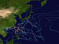
Typhoon Haikui,known in the Philippines as Typhoon Hanna,was the first major storm to hit Taiwan since Megi in 2016 and the first typhoon to do so since Nesat in 2017. It also caused serious rainfall in Hong Kong,making it the wettest tropical cyclone to affect the region. Haikui means sea anemone in Chinese. The eleventh tropical storm and eighth typhoon of the 2023 Pacific typhoon season,Haikui began its life as a broad low-pressure area near the Northern Mariana Islands on August 27. The system intensified to a tropical storm the next day and was named Haikui by the Japan Meteorological Agency (JMA),with the Joint Typhoon Warning Center (JTWC) following suit shortly thereafter;PAGASA then named the same system as Hanna when it entered the Philippine area of responsibility. In the succeeding days,Haikui reached severe tropical storm strength and eventually became a typhoon,before making landfall near Taitung City,Taiwan on September 3.
Contents
- Meteorological history
- Preparations and impact
- Philippines
- Taiwan
- Mainland China
- Hong Kong
- Retirement
- See also
- References
- External links
The remnants of Haikui caused torrential rain in Hong Kong as it stalled over Pearl River Delta,resulting in issuing a Black rainstorm signal for 16 hours,the longest duration ever since the rainstorm warning system was implemented in 1992. Haikui also further enhanced the southwest monsoon in the Philippines,causing extensive rainfall in Luzon. Overall,Haikui caused US$2.33 billion worth of damages throughout its onslaught.

