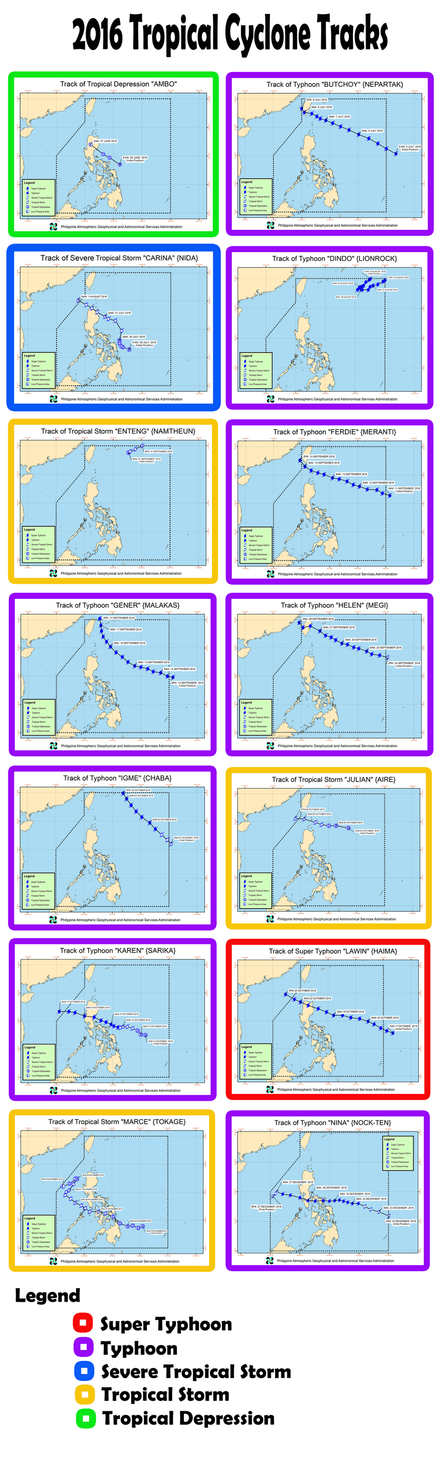
Typhoon Nock-ten

Last updated

Map key
  Tropical depression (≤38 mph, ≤62 km/h)
  Tropical storm (39–73 mph, 63–118 km/h)
  Category 1 (74–95 mph, 119–153 km/h)
  Category 2 (96–110 mph, 154–177 km/h)
  Category 3 (111–129 mph, 178–208 km/h)
  Category 4 (130–156 mph, 209–251 km/h)
  Category 5 (≥157 mph, ≥252 km/h)
  Unknown
Storm type
Disc Plain black.svg Tropical cyclone
Solid black.svg Subtropical cyclone
ArrowUp.svg Extratropical cyclone, remnant low, tropical disturbance, or monsoon depression

On December 20, the Japan Meteorological Agency started to monitor a tropical depression that had formed about 1,090 km (675 mi) to the southeast of Yap Island in the Federated States of Micronesia. [4] [5] The broad and poorly organized system was being affected by moderate to high vertical wind shear, which was being offset by warm sea surface temperatures. [5] Soon, the JTWC upgraded the system to a tropical depression, with the designation of 30W, based on improved environmental conditions and an ASCAT image. [6] Late on the same day, when central convection was increasing and consolidating over a defined low-level circulation center (LLCC), both the JMA and the JTWC upgraded it to a tropical storm, with the former assigning the name Nock-ten. [7] [8] One day later, late on December 22, the JMA upgraded the system to a severe tropical storm, and Nock-ten started to form an eye revealed by microwave imagery. [9] [10]

Tracking west-northwestward and then westward along the southern periphery of a deep-layered subtropical ridge, Nock-ten intensified into a typhoon at noon UTC on December 23. [11] [12] Immediately after that, explosive intensification commenced with a sharp eye embedded in a symmetric central dense overcast feature. [13] At 06:00 UTC on December 24, Nock-ten reached its peak intensity with estimated ten-minute maximum sustained winds of 195 km/h (120 mph) and the central pressure at 915 hPa (27.02 inHg); therefore, it was the latest-forming typhoon of such intensity or stronger on record. [14] The JTWC also upgraded Nock-ten to a Category 4-equivalent super typhoon, when the system was in an area of low vertical wind shear, excellent dual-channel outflow, and sea surface temperatures of 29 °C. [15] Although the eye became cloud-filled in the afternoon, it cleared again late on the same day and while the JMA did not raise its intensity estimate further, the JTWC did so. [16] [17]

On December 25, the JTWC reported that the Dvorak technique analyses at 03:00 UTC from "all reporting agencies" indicated a T-number of 7.0; [18] therefore, the JTWC added a non-synoptic entry to the operational best track for that time, indicating one-minute maximum sustained winds of 260 km/h (160 mph), equivalent to Category 5 on the Saffir–Simpson scale. [19] However, land interaction soon impacted the typhoon, as its convective cloud tops had become warmer. [18] Later, Nock-ten made landfall over the Philippines eight times: Bato, Catanduanes at 18:30 PST (10:30 UTC) and Sagñay, Camarines Sur at 21:30 PST (13:30 UTC) on December 25; San Andres, Quezon at 02:00 PST (18:00 UTC), Torrijos, Marinduque at 04:30 PST (20:30 UTC), Verde Island, Batangas at 09:15 PST (01:15 UTC), Tingloy, Batangas at 10:10 PST (02:10 UTC), Calatagan, Batangas at 11:40 PST (03:40 UTC), and Lubang Island, Occidental Mindoro at 13:00 PST (05:00 UTC) on December 26. [20]

The eight landfalls significantly eroded Nock-ten, and the structure became much more asymmetric and ragged. [21] Thus, when Nock-ten emerged into the South China Sea early on December 26, it had weakened into a minimal typhoon. [22] Subsequently, although Nock-ten's structure briefly improved, it was downgraded to a severe tropical storm by the JMA and a tropical storm by the JTWC early on December 27, as its LLCC had started to become exposed. [23] [24] Poleward outflow was no longer offsetting the effects of strong vertical wind shear, leading to rapid weakening. [25] After the JMA downgraded the system to a tropical storm at 09:00 UTC, Nock-ten further weakened to a tropical depression late on the same day. [26] [27] Influenced by a Northeast Monsoon surge, the system accelerated southwestward, and convection was unable to develop over the fully exposed LLCC due to high vertical wind shear and colder dry air. [28] The JTWC issued its final warning for the system early on December 28, and the tropical depression dissipated in the afternoon. [29] [30] [31]

Preparations and impact

Highest PSWS raised by PAGASA across the Philippines in relation to Typhoon Nina (Nock-Ten) Nina PSWS.png
Highest PSWS raised by PAGASA across the Philippines in relation to Typhoon Nina (Nock-Ten)

Nock-ten made eight landfalls in the Philippines. [32] According to the NDRRMC, a total of 98,771 families were preemptively evacuated in CALABARZON, MIMAROPA, Bicol, and Eastern Visayas region. [33]

A total of 13 people have been reported dead while total damages have been reported up to 6.12 billion (US$123 million). [34]

On December 26, 2016, MV Starlite Atlantic sank off the coast of Tingloy, Batangas during the onslaught of the typhoon. The vessel was anchored in Batangas Bay when the typhoon passed over it with winds of up to 185 km/h in the center and gusts of 215 km/h. The typhoon generated huge waves between six and eight meters in height, causing the vessel to come off its mooring and drift toward Tingloy where it sank. One person died and 18 were reported missing in the incident, while the Philippine Coast Guard rescued 15 out of the 34 crew. [35] [36] [37]

Highest Public Storm Warning Signal

Typhoon Nock-ten (Nina)
Nock-ten 2016-12-25 0210Z (gallery).jpg
Nock-ten approaching the Philippines at peak intensity on Christmas Day
PSWS#LuzonVisayasMindanao
4Camarines Norte, Camarines Sur, Catanduanes, Southern Portion of QuezonNoneNone
3Albay, Burias Island, Marinduque, Batangas, Lubang Island, Cavite, Laguna, Northern Portion of Oriental Mindoro, Northern Portion of Occidental Mindoro, Rest of Quezon, Sorsogon, Southern Portion of Metro ManilaNoneNone
2Rizal, Bulacan, Bataan, Pampanga, Southern Portion of Zambales, Polillo Islands, Rest of Occidental Mindoro, Rest of Oriental Mindoro, Romblon, Masbate including Ticao Island, Rest of Metro ManilaNorthern SamarNone
1Rest of Zambales, Tarlac, Nueva Ecija, Nueva Vizcaya, Quirino, Aurora, Pangasinan, Calamian Group of IslandsSamar, Eastern Samar, Biliran, Leyte, Rest of Cebu, Aklan, CapizNone

Retirement

Aerial photo shows the damage of Typhoon Nina to the communities of Camarines Sur. PH10-122716 FRIAS2-1.jpg
Aerial photo shows the damage of Typhoon Nina to the communities of Camarines Sur.

PAGASA announced that Nina had removed from their naming lists, because it had caused over ₱1 billion in damages; subsequently on January 17, 2017, PAGASA announced that they selected Nika to supersede Nina for the 2020 season.

On the other hand, during the 49th annual session of the ESCAP/WMO Typhoon Committee during 2017, they announced that the Nock-ten had also removed from the naming lists. In March 2018, the Typhoon Committee officially chose Hinnamnor as its replacement name. But the name Hinnamnor was also retired after the 2022 season and was replaced by Ong-mang. [38]

See also

Related Research Articles

<span class="mw-page-title-main">2012 Pacific typhoon season</span> Typhoon season in the Western Pacific Ocean

The 2012 Pacific typhoon season was a slightly above average season that produced 25 named storms, fourteen typhoons, and four intense typhoons. It was a destructive and the second consecutive year to be the deadliest season, primarily due to Typhoon Bopha which killed 1,901 people in the Philippines. It was an event in the annual cycle of tropical cyclone formation, in which tropical cyclones form in the western Pacific Ocean. The season ran throughout 2012, though most tropical cyclones typically develop between May and October. The season's first named storm, Pakhar, developed on March 28, while the season's last named storm, Wukong, dissipated on December 29. The season's first typhoon, Guchol, reached typhoon status on June 15, and became the first super typhoon of the year on June 17.

<span class="mw-page-title-main">2015 Pacific typhoon season</span> Typhoon season in the Western Pacific Ocean

The 2015 Pacific typhoon season was a slightly above average season that produced twenty-seven tropical storms, eighteen typhoons, and nine super typhoons. The season ran throughout 2015, though most tropical cyclones typically develop between May and November. The season's first named storm, Mekkhala, developed on January 15, while the season's last named storm, Melor, dissipated on December 17. The season saw at least one named tropical system forming in each of every month, the first time since 1965. Similar to the previous season, this season saw a high number of super typhoons. Accumulated cyclone energy (ACE) during 2015 was extremely high, the third highest since 1970, and the 2015 ACE has been attributed in part to anthropogenic warming.

<span class="mw-page-title-main">2016 Pacific typhoon season</span> Typhoon season in the Western Pacific Ocean

The 2016 Pacific typhoon season is considered to have been the fourth-latest start for a Pacific typhoon season since reliable records began. It was an average season, with a total of 26 named storms, 13 typhoons, and six super typhoons. The season ran throughout 2016, though typically most tropical cyclones develop between May and October. The season's first named storm, Nepartak, developed on July 3, while the season's last named storm, Nock-ten, dissipated on December 28.

<span class="mw-page-title-main">2018 Pacific typhoon season</span> Typhoon season in the Western Pacific Ocean

The 2018 Pacific typhoon season was at the time, the costliest Pacific typhoon season on record, until the record was beaten by the following year. The season was well above-average, producing twenty-nine storms, thirteen typhoons, seven super typhoons and six Category 5 tropical cyclones. The season ran throughout 2018, though most tropical cyclones typically develop between May and October. The season's first named storm, Bolaven, developed on January 3, while the season's last named storm, Man-yi, dissipated on November 28. The season's first typhoon, Jelawat, reached typhoon status on March 29, and became the first super typhoon of the year on the next day.

<span class="mw-page-title-main">Timeline of the 2012 Pacific typhoon season</span>

This timeline documents all of the events of the 2012 Pacific typhoon season. The scope of this article is limited to the Pacific Ocean, north of the equator between 100°E and the International Date Line. During the season, 34 systems were designated as tropical depressions by either the Japan Meteorological Agency (JMA), the Philippine Atmospheric, Geophysical and Astronomical Services Administration (PAGASA), the Joint Typhoon Warning Center (JTWC), or other National Meteorological and Hydrological Services such as the China Meteorological Administration and the Hong Kong Observatory. Since the JMA runs the Regional Specialized Meteorological Centre (RSMC) for the Western Pacific, they assigned names to tropical depressions which developed into tropical storms in the basin. PAGASA also assigned local names to systems which are active in their area of responsibility; however, these names are not in common use outside of the Philippines.

<span class="mw-page-title-main">Typhoon Vongfong (2014)</span> Pacific typhoon in 2014

Typhoon Vongfong, known in the Philippines as Super Typhoon Ompong, was the most intense tropical cyclone worldwide in 2014, and struck Japan as a large tropical system. It also indirectly affected the Philippines and Taiwan. Vongfong was the nineteenth named storm and the ninth typhoon of the 2014 Pacific typhoon season. Estimates assess damage from Vongfong to have been over US$160 million, mainly for striking mainland Japan. At least 9 people were killed along the path of the typhoon in those countries.

<span class="mw-page-title-main">Typhoon Hagupit (2014)</span> Pacific typhoon in 2014

Typhoon Hagupit known in the Philippines as Super Typhoon Ruby, was the second most intense tropical cyclone in 2014. Hagupit particularly impacted the Philippines in early December while gradually weakening, killing 18 people and causing $114 million of damage in the country. Prior to making landfall, Hagupit was considered the worst threat to the Philippines in 2014, but it was significantly smaller than 2013's Typhoon Haiyan.

<span class="mw-page-title-main">Tropical Storm Mekkhala (2015)</span> Pacific typhoon in 2015

Severe Tropical Storm Mekkhala, known in the Philippines as Severe Tropical Storm Amang, was an early-season tropical cyclone that made landfall over the Philippines in January 2015. Mekkhala killed three people in the Bicol Region and caused light crop damage. Notably, the storm disturbed Pope Francis’ visit to the country after the victims of Typhoon Haiyan on November 8, 2013. Although the storm also caused an airplane crash in Tacloban, nobody was hurt in the incident.

<span class="mw-page-title-main">Typhoon Dujuan (2015)</span> Pacific typhoon in 2015

Typhoon Dujuan, known in the Philippines as Super Typhoon Jenny, was the second most intense tropical cyclone of the Northwest Pacific Ocean in 2015 in terms of ten-minute maximum sustained winds, tied with Noul. The twenty-first named storm and the thirteenth typhoon of the 2015 Pacific typhoon season, Dujuan brought extremely powerful winds throughout the Yaeyama Islands and Taiwan in late September, causing 3 deaths in Taiwan. The typhoon also caused over ¥2.5 billion (US$392.9 million) damage in East China.

<span class="mw-page-title-main">Typhoon Melor</span> Pacific typhoon in 2015

Typhoon Melor, known in the Philippines as Typhoon Nona, was a powerful tropical cyclone that struck the Philippines in December 2015. The twenty-seventh named storm and the eighteenth typhoon of the annual typhoon season, Melor killed 51 people and caused ₱7.04 billion in damage.

<span class="mw-page-title-main">Typhoon Meranti</span> Pacific typhoon in 2016

Typhoon Meranti, known in the Philippines as Super Typhoon Ferdie, was one of the most intense tropical cyclones on record. Impacting the Batanes in the Philippines, Taiwan, as well as Fujian Province in September 2016, Meranti formed as a tropical depression on September 8 near the island of Guam. Tracking to the west northwest, Meranti gradually intensified until September 11, at which point it began a period of rapid intensification. Continuing to rapidly intensify, it became a super typhoon early on September 12, as it passed through the Luzon Strait, ultimately reaching its peak intensity on September 13 with 1-minute sustained winds of 315 km/h (195 mph). Shortly afterwards, it passed directly over the island of Itbayat. Meranti passed to the south of Taiwan as a super typhoon, and began weakening steadily as a result of land interaction. By September 15, it struck Fujian Province as a Category 2-equivalent typhoon, becoming the strongest typhoon on record to impact the province. Upon moving inland, rapid weakening ensued and Meranti became extratropical the next day, dissipating shortly afterwards after it passed to the south of the Korean Peninsula.

<span class="mw-page-title-main">Typhoon Megi (2016)</span> Pacific typhoon in 2016

Typhoon Megi, known in the Philippines as Typhoon Helen, was a large and powerful tropical cyclone which affected Taiwan and eastern China in late September 2016. It is the seventeenth named storm and the seventh typhoon of the annual typhoon season.

<span class="mw-page-title-main">Typhoon Haima</span> Pacific typhoon in 2016

Typhoon Haima, known in the Philippines as Super Typhoon Lawin, was the third most intense tropical cyclone worldwide in 2016. It was the twenty-second named storm and the eleventh typhoon of the annual typhoon season. Impacting the Philippines less than 3 days after Typhoon Sarika, Haima formed out of a tropical disturbance southwest of Chuuk on October 14, it developed into a tropical storm the next day. Steady strengthening occurred over the next day or two as it tracked westward towards the Philippines. After forming an eye shortly after it was upgraded to a typhoon, Haima began to rapidly strengthen and eventually became a super typhoon on October 18. It later attained its peak intensity as a Category 5-equivalent tropical cyclone before weakening slightly. Haima later made landfall late on October 19 as a Category 4-equivalent storm. Rapid weakening occurred as it interacted with the landmasses until it entered the Southern China Sea as a weak typhoon. It formed a large ragged eye once again and remained steady in intensity until making landfall in China on October 21. It weakened below typhoon intensity and became extratropical on October 22. The cyclone drifted northeastwards and later eastwards before emerging over water again, but eventually dissipated by October 26.

<span class="mw-page-title-main">Tropical Storm Talas (2017)</span> Pacific severe tropical storm in 2017

Severe Tropical Storm Talas was a tropical cyclone that impacted Vietnam during mid July 2017. Talas was first tracked as a tropical disturbance over in the South China Sea on July 13, and was upgraded to a tropical depression during the next day. The depression intensified into the fourth named storm of the 2017 Pacific typhoon season during July 15. Before making landfall in Vietnam, Talas reached its peak intensity as a severe tropical storm during July 16. Talas weakened to an area of low pressure on July 17 inland.

<span class="mw-page-title-main">Typhoon Nesat (2017)</span> Pacific typhoon in 2017

Typhoon Nesat, known in the Philippines as Typhoon Gorio, was a strong tropical cyclone that impacted Taiwan and Fujian, China. It was the ninth named storm and the second typhoon of the annual typhoon season. After consolidating slowly for several days, Tropical Storm Nesat developed east of the Philippines on July 25. While experiencing favorable environmental conditions such as very warm sea surface temperatures and low wind shear, Nesat strengthened into a typhoon and reached its peak intensity on July 28. On July 29, the typhoon made landfall near the Taiwanese city of Yilan, before weakening to a severe tropical storm and making landfall again near Fuqing on China's east coast late the same day. Moving into July 30, Nesat continued to weaken under the effects of land interaction.

<span class="mw-page-title-main">2021 Pacific typhoon season</span> Typhoon season in the Western Pacific Ocean

The 2021 Pacific typhoon season was the second consecutive to have below-average tropical cyclone activity, with twenty-two named storms, and was the least active since 2011. Nine became typhoons, and five of those intensified into super typhoons. This low activity was caused by a strong La Niña that had persisted from the previous year. The season's first named storm, Dujuan, developed on February 16, while the last named storm, Rai, dissipated on December 21. The season's first typhoon, Surigae, reached typhoon status on April 16. It became the first super typhoon of the year on the next day, also becoming the strongest tropical cyclone in 2021. Surigae was also the most powerful tropical cyclone on record in the Northern Hemisphere for the month of April. Typhoons In-fa and Rai are responsible for more than half of the total damage this season, adding up to a combined total of $2.02 billion.

<span class="mw-page-title-main">2022 Pacific typhoon season</span> Typhoon season in the Western Pacific Ocean

The 2022 Pacific typhoon season was the third consecutive season to have below-average tropical cyclone activity, with twenty-five named storms forming. Of the tropical storms, ten became typhoons, and three would intensify into super typhoons. The season saw a slightly below average activity by named storm count, although many of the storms were weak and short-lived, particularly towards the end of the season. This low activity was caused by an unusually strong La Niña that had persisted from 2020. The season's first named storm, Malakas, developed on April 6, while the last named storm, Pakhar, dissipated on December 12. The season's first typhoon, Malakas, reached typhoon status on April 12. The season ran throughout 2022, though most tropical cyclones typically develop between May and October. Tropical storms Megi and Nalgae were responsible for more than half of the casualties, while typhoons Hinnamnor and Nanmadol both caused $1 billion in damages.

<span class="mw-page-title-main">Typhoon Jongdari</span> Pacific typhoon in 2018

Typhoon Jongdari was a strong, long-lived and erratic tropical cyclone that impacted Japan and East China in late July and early August 2018. Formed as the twelfth named storm of the 2018 typhoon season near Okinotorishima on July 24, Jongdari gradually intensified and developed into the fourth typhoon of the year on July 26. Influenced by an upper-level low and a subtropical ridge, Jongdari executed a rare counter-clockwise southeast of Japan on the next day. At that time, it also reached peak intensity. The typhoon made landfall in Kii Peninsula, over Mie Prefecture of Japan locally early on July 29.

<span class="mw-page-title-main">Typhoon Soulik (2018)</span> Pacific typhoon in 2018

Typhoon Soulik was an unusually large, and the deadliest typhoon to strike the Korean Peninsula since Khanun in 2012. Soulik formed from an area of low pressure on August 15, and was the twenty-ninth tropical depression, twentieth tropical storm, tenth severe tropical storm, and sixth typhoon of the 2018 Pacific typhoon season.

<span class="mw-page-title-main">Tropical depressions Wilma and BOB 05</span> A series of tropical cyclones in 2013

Tropical Depression Wilma, also referred to as 30W and Depression BOB 05 were a series of tropical cyclones that traveled from the Northwest Pacific Ocean to the North Indian Ocean in 2013. Forming east of Palau on November 1, the tropical depression passed through the Philippines on November 4 and emerged into the South China Sea on the next day. Without intensification, the system made landfall over Vietnam on November 6 and arrived at the Gulf of Thailand on November 7.

References

  1. "Super Typhoon Nock-ten (Nina) Making Landfall on the Philippines on Christmas Day". The Weather Channel. December 25, 2016.
  2. "#Nockten's current intensity of 155 mph is strongest for TC anywhere around the globe on Christmas (UTC time) on record (since 1960)". Twitter. Phillip Klotzbach. December 25, 2016.
  3. "SitRep No.12 re Preparedness Measures for TY NINA (NOCK-TEN) page 94" (PDF). NDRRMC. Retrieved January 2, 2017.
  4. "RSMC Tropical Cyclone Best Track: Typhoon Nockten". Japan Meteorological Agency. January 24, 2017. Archived from the original on January 24, 2017. Retrieved July 20, 2017.
  5. 1 2 "Significant Tropical Weather Advisory for the Western and South Pacific Oceans December 20, 2016 06z". United States Joint Typhoon Warning Center. December 20, 2016. Archived from the original on December 21, 2016. Retrieved August 22, 2017.
  6. "Prognostic Reasoning for Tropical Depression 30W (Thirty) Warning Nr 001". Joint Typhoon Warning Center. December 21, 2016. Archived from the original on September 9, 2018. Retrieved December 24, 2016.
  7. "RSMC Tropical Cyclone Advisory 211800". Japan Meteorological Agency. December 21, 2016. Archived from the original on December 22, 2016. Retrieved December 24, 2016.
  8. "Prognostic Reasoning for Tropical Storm 30W (Nock-ten) Warning Nr 03". Joint Typhoon Warning Center. December 21, 2016. Archived from the original on September 9, 2018. Retrieved December 24, 2016.
  9. "RSMC Tropical Cyclone Advisory 221800". Japan Meteorological Agency. December 22, 2016. Archived from the original on December 23, 2016. Retrieved December 24, 2016.
  10. "Prognostic Reasoning for Tropical Storm 30W (Nock-ten) Warning Nr 07". Joint Typhoon Warning Center. December 22, 2016. Archived from the original on September 9, 2018. Retrieved December 24, 2016.
  11. "RSMC Tropical Cyclone Advisory 231200". Japan Meteorological Agency. December 23, 2016. Archived from the original on December 23, 2016. Retrieved December 24, 2016.
  12. "Prognostic Reasoning for Typhoon 30W (Nock-ten) Warning Nr 10". Joint Typhoon Warning Center. December 23, 2016. Archived from the original on September 9, 2018. Retrieved December 24, 2016.
  13. "Prognostic Reasoning for Typhoon 30W (Nock-ten) Warning Nr 11". Joint Typhoon Warning Center. December 23, 2016. Archived from the original on September 9, 2018. Retrieved December 24, 2016.
  14. Kitamoto, Asanobu. "Typhoon List (105kt or stronger in December)". Digital Typhoon. National Institute of Informatics . Retrieved January 24, 2017.
  15. "Prognostic Reasoning for Typhoon 30W (Nock-ten) Warning Nr 13". Joint Typhoon Warning Center. December 24, 2016. Archived from the original on September 9, 2018. Retrieved December 28, 2016.
  16. "Prognostic Reasoning for Super Typhoon 30W (Nock-ten) Warning Nr 14". Joint Typhoon Warning Center. December 24, 2016. Archived from the original on September 9, 2018. Retrieved December 28, 2016.
  17. "Prognostic Reasoning for Super Typhoon 30W (Nock-ten) Warning Nr 16". Joint Typhoon Warning Center. December 25, 2016. Archived from the original on September 9, 2018. Retrieved December 28, 2016.
  18. 1 2 "Prognostic Reasoning for Super Typhoon 30W (Nock-ten) Warning Nr 17". Joint Typhoon Warning Center. December 25, 2016. Archived from the original on September 9, 2018. Retrieved December 28, 2016.
  19. "30W.NOCK-TEN Track File". United States Naval Research Laboratory . Retrieved December 24, 2016.
  20. "SitRep No.7 re Preparedness Measures for Typhoon "Nina" (I.N. NOCK-TEN)" (PDF). NDRRMC. December 28, 2016. Retrieved December 28, 2016.
  21. "Prognostic Reasoning for Typhoon 30W (Nock-ten) Warning Nr 21". Joint Typhoon Warning Center. December 26, 2016. Archived from the original on September 9, 2018. Retrieved December 28, 2016.
  22. "RSMC Tropical Cyclone Advisory 260600". Japan Meteorological Agency. December 26, 2016. Archived from the original on December 27, 2016. Retrieved December 28, 2016.
  23. "Prognostic Reasoning for Typhoon 30W (Nock-ten) Warning Nr 22". Joint Typhoon Warning Center. December 26, 2016. Archived from the original on September 9, 2018. Retrieved December 30, 2016.
  24. "RSMC Tropical Cyclone Advisory 270000". Japan Meteorological Agency. December 27, 2016. Archived from the original on December 27, 2016. Retrieved December 30, 2016.
  25. "Prognostic Reasoning for Tropical Storm 30W (Nock-ten) Warning Nr 24". Joint Typhoon Warning Center. December 27, 2016. Archived from the original on September 9, 2018. Retrieved December 30, 2016.
  26. "RSMC Tropical Cyclone Advisory 270900". Japan Meteorological Agency. December 27, 2016. Archived from the original on December 27, 2016. Retrieved December 30, 2016.
  27. "RSMC Tropical Cyclone Advisory 271800". Japan Meteorological Agency. December 27, 2016. Archived from the original on December 27, 2016. Retrieved December 30, 2016.
  28. "Prognostic Reasoning for Tropical Depression 30W (Nock-ten) Warning Nr 27". Joint Typhoon Warning Center. December 27, 2016. Archived from the original on September 9, 2018. Retrieved December 30, 2016.
  29. "Tropical Depression 30W (Nock-ten) Warning Nr 28". Joint Typhoon Warning Center. December 28, 2016. Archived from the original on December 30, 2016. Retrieved December 30, 2016.
  30. "Marine Weather Warning for GMDSS Metarea XI 2016-12-28T12:00:00Z". WIS Portal – GISC Tokyo. Japan Meteorological Agency. December 28, 2016. Retrieved December 30, 2016.
  31. "Marine Weather Warning for GMDSS Metarea XI 2016-12-28T18:00:00Z". WIS Portal – GISC Tokyo. Japan Meteorological Agency. December 28, 2016. Retrieved December 30, 2016.
  32. "Sitrep_No_13_re_Preparedness_Measures_and_Effects_of_TY_NINA_NOCK-TEN" (PDF). January 9, 2017.
  33. "Sitrep_No_13_re_Preparedness_Measures_and_Effects_of_TY_NINA_NOCK-TEN" (PDF). January 9, 2017.
  34. "Sitrep_No_13_re_Preparedness_Measures_and_Effects_of_TY_NINA_NOCK-TEN" (PDF). January 9, 2017.
  35. Cinco, Maricar (December 28, 2016). "18 still missing from MV Starlight Atlantic sinking". Philippine Daily Inquirer . Retrieved May 19, 2020.
  36. "1 dead, 18 still missing as Typhoon Nina sinks ferry". CNN Philippines. December 27, 2016. Archived from the original on February 26, 2023. Retrieved May 19, 2020.
  37. "Rescue operations ongoing for crew of sunken PH RORO ship". Port Calls Asia. December 27, 2016. Retrieved May 19, 2020.
  38. "Replacement Names of HAIMA, SARIKA, NOCK-TEN and MERANTI in the Tropical Cyclone Name List" (PDF). ESCAP/WMO Typhoon Committee. February 21, 2018.