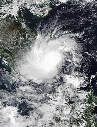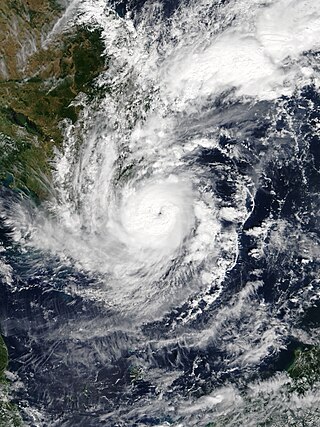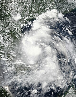
Typhoon Xangsane, known in the Philippines as Typhoon Milenyo, was a typhoon that affected the Philippines, Vietnam, and Thailand during the 2006 Pacific typhoon season. The name Xangsane was submitted by Laos and means elephant.

The 2017 Pacific typhoon season was a below-average season in terms of accumulated cyclone energy and the number of typhoons and super typhoons, and the first since the 1977 season to not produce a Category 5-equivalent typhoon on the Saffir–Simpson scale. The season produced a total of 27 named storms, 11 typhoons, and only two super typhoons, making it an average season in terms of storm numbers. It was an event in the annual cycle of tropical cyclone formation, in which tropical cyclones form in the western Pacific Ocean. The season runs throughout 2017, though most tropical cyclones typically develop between May and October. The season's first named storm, Muifa, developed on April 25, while the season's last named storm, Tembin, dissipated on December 26. This season also featured the latest occurrence of the first typhoon of the year since 1998, with Noru reaching this intensity on July 23.

Typhoon Wutip, known in the Philippines as Tropical Storm Paolo, was a Category 3 major typhoon that affected Vietnam, Laos, and Thailand. The nineteenth named storm and the fifth typhoon of the 2013 Pacific typhoon season. Wutip formed off the coast of Luzon on September 27, 2013. Being inside PAR, PAGASA named the disturbance Paolo which replaced the name Pepeng. JTWC later gave the identifier Tropical Depression 20W. Moving west-southwestward, the system intensified into a tropical storm, assigning the name Wutip. Wutip reached its peak intensity of a Category-3 major typhoon. On September 30, the storm made landfall on the provinces from Ha Tinh to Thua Thien Hue province of Vietnam, including Quang Binh the center of the storm.

Tropical Depression 18W was a tropical depression that impacted Vietnam, Laos and Thailand during mid September 2013. The system was first noted as a tropical depression on September 16, 2013, while it was located within the South China Sea to the south east of Hanoi in Vietnam. Over the next two days the system gradually developed further, before it was reported by the Vietnamese National Centre for Hydro Meteorological Forecasting that the system had developed into their eighth tropical storm of 2013. However, other meteorological agencies did not report that the system had developed into a tropical storm.

Tropical Storm Kujira was a tropical cyclone that prompted the PAGASA to declare the beginning of the rainy season in the Philippines. The ninth tropical depression, 8th named storm, and first storm to make landfall on China in the 2015 Pacific typhoon season, it formed as a tropical depression south of the Paracel Islands on June 19.

Tropical Storm Vamco was a weak tropical cyclone which affected Indochina in mid-September 2015. Formed from a tropical disturbance on September 13, the system developed into a tropical storm and reached its peak intensity on September 14. Vamco made landfall in Vietnam and affected Laos, Thailand and Cambodia. The storm caused flooding in these countries and damages amounted to US$14.1 million. Fifteen people died in the floods.

Tropical Storm Rai was a weak and short-lived tropical cyclone which affected Indochina in September 2016. Formed from a tropical disturbance on September 11, the system developed into a tropical storm and reached its peak intensity on September 12, before making landfall in Vietnam and affecting Laos, Thailand and Cambodia. In Vietnam total damage reached US$73.96 million.

Severe Tropical Storm Aere, known in the Philippines as Tropical Storm Julian, was a long-lived tropical cyclone that struck Central Vietnam in October 2016. The nineteenth named storm of the annual typhoon season, Aere formed on October 4, 2016 as a tropical depression to the east of Luzon, Philippines shortly after the JMA had started tracking Songda. On the next day, the system had become a tropical storm and it moved into South China Sea. During October 7, it intensified into a severe tropical storm and reached peak intensity with 10-minute winds of 110 km/h (70 mph). Shortly thereafter, due to remaining in almost the same area for hours, Aere began to weaken to a tropical storm, and on October 10, it weakened to a tropical depression, before weakening to a low-pressure area late on October 11. On October 13, Aere re-generated into a tropical depression and it made landfall in Huế, Vietnam late that day. The system moved towards Laos and Thailand before it fully dissipated on October 14.

Severe Tropical Storm Talas was a tropical cyclone that affected Vietnam in mid-July 2017. The storm was first identified as a tropical disturbance over the South China Sea on July 13 and was upgraded to a tropical depression the following day. On July 15, the depression intensified into a named storm of the 2017 Pacific typhoon season. Before making landfall in Vietnam, Talas reached its peak intensity as a severe tropical storm on July 16. It weakened to an area of low pressure on July 17 as it moved inland. Throughout Vietnam, the storm resulted in 14 fatalities and damaged approximately 2,700 homes. Rough seas caused about 50 boats to sink. Nearly 50,000 hectares of vegetable fields, around 800 ha of aquaculture, and 47,600 ha of rice and other subsidiary crops were affected. The storm caused an estimated US$8.8 million in damages in Hainan, China, increased rainfall in Myanmar and Thailand, and triggered landslides and flooding in parts of Central and Northern Laos.

Typhoon Doksuri, known in the Philippines as Tropical Storm Maring, was a strong Category 2 typhoon that mostly impacted the Philippines and Vietnam during mid-September 2017. Forming as the nineteenth named storm of the season, Doksuri developed as a weak tropical depression over to the east of Visayas on September 10.

The October 2017 Vietnam tropical depression, also known officially by its designation as Tropical Depression 23W, was a weak but deadly system that brought torrential rainfall and extreme flooding over northern and central Vietnam in October 2017. The depression formed on October 7, located to the northwest of Luzon, Philippines. The system moved in a general westward direction as it steadily intensified. Despite being forecast to strengthen into a tropical storm, 23W failed to reach this intensity, due to lack of organization as it made landfall in Hà Tĩnh Province on October 10.

Typhoon Damrey, known in the Philippines as Severe Tropical Storm Ramil, was a strong tropical cyclone that affected the Philippines and Vietnam during early November 2017. Damrey first originated as a tropical depression over the Philippine archipelago of Visayas on October 31. Emerging into the South China Sea a few days later, the system strengthened into the second deadliest and twenty-third named storm of the 2017 Pacific typhoon season. Rapidly intensifying, Damrey became the season's tenth typhoon on November 3, reaching its peak intensity as a Category 2 on the same day. Damrey made landfall over Khánh Hoà, Vietnam on November 4 and began to rapidly weaken, fully dissipating on November 5.

Tropical Storm Son-Tinh, known in the Philippines as Tropical Storm Henry, was a weak but very deadly tropical cyclone that devastated Vietnam and Laos in July 2018. Son-Tinh originated from an area of low pressure over the Philippine Sea on July 15, 2018. Moving quickly westwards, Son-Tinh strengthened to the ninth tropical storm of the annual typhoon season on July 17. Intensifying only slightly while crossing the South China Sea, Son-Tinh made its first landfall over Hainan Island on July 18. After emerging into the Gulf of Tonkin, Son-Tinh restrengthened before making its second landfall as a tropical storm in Northern Vietnam on July 19. Once inland, Son-Tinh weakened into a low pressure area as it slowed and made a clockwise loop. The remnants of Son-Tinh then emerged back over water and regenerated into a tropical depression late on July 21.

Tropical Storm Toraji was a weak, short-lived system that impacted Vietnam in November 2018. Forming as the twenty-seventh named storm of the 2018 Pacific typhoon season, Toraji developed as a tropical depression to the southeast of Vietnam on November 16. Quickly organising, the system strengthened into a tropical storm the next day. Toraji rapidly weakened thereafter early on November 18, when the storm made landfall over southeastern Vietnam, later dissipating. The storm's remnants moved into the Gulf of Thailand when Toraji re-organised back into a tropical depression on November 20. However Toraji quickly deteriorated on the same day as it moved closer to the Malay Peninsula.

Tropical Storm Sinlaku was a weak tropical cyclone that impacted Vietnam, Thailand and Laos in August 2020. Beginning as a tropical depression on July 31 in the South China Sea, Sinlaku was the fifth storm of the 2020 Pacific typhoon season. It gradually organized as it took a slow west-northwest course, strengthening into a tropical storm the following day despite its monsoonal structure. The storm subsequently made landfall in Vietnam as a broad but weak tropical storm. Persistent land interaction weakened Sinlaku, leading to its dissipation on August 3.

Severe Tropical Storm Usagi, known in the Philippines as Tropical Storm Samuel, was a tropical cyclone that affected the Philippines and Southern Vietnam in late November 2018, causing severe damage around the Visayas region and Ho Chi Minh City. The storm formed from a disturbance in the Central Pacific basin on November 3, but did not develop into a tropical storm until almost three weeks later, on November 13. Usagi underwent rapid intensification and peaked in intensity before making its final landfall on Vũng Tàu, Bà Rịa–Vũng Tàu province as a weakening tropical storm on November 25. While never considered as a typhoon by the Japan Meteorological Agency (JMA), the Joint Typhoon Warning Center (JTWC) assessed its intensity to be equivalent to Category 2 status on the Saffir–Simpson scale. Usagi caused one death and ₱52.2 million (US$992,000) in damages in the Philippines, most of which came from agriculture. Usagi caused 3 deaths and ₫925 billion in damages in Vietnam.

Tropical Storm Linfa was a weak, short-lived but deadly and destructive tropical cyclone that was the twelfth wettest tropical cyclone on record and the second of nine tropical cyclones in a row to strike Vietnam in 2020, a little under a month after the less damaging Tropical Storm Noul. The fifteenth named storm of the 2020 Pacific typhoon season, Linfa originated from a tropical depression which formed just to the west of the Philippines on October 6. After passing through the island nation, the storm emerged into the South China Sea and slowly gained strength, earning the name Linfa on October 10 on approach to Vietnam. On the next day, Linfa had reached peak strength and made landfall in Vietnam, marking the beginning of a devastating series of floods in the country and worsening the already active monsoon season. Linfa quickly dissipated as it moved inland, but associated thunderstorms continued for several days.

Tropical Storm Dianmu was a weak tropical cyclone that caused considerable damage over parts of Mainland Southeast Asia during late-September 2021. The fifteenth named storm of the 2021 Pacific typhoon season, Dianmu originated from an area of low-pressure situated in the South China Sea on September 21. Being first monitored by the Joint Typhoon Warning Center, the system rapidly consolidated to a tropical depression on September 22 as it continued to approach Vietnam before strengthening further to a weak tropical storm, with the Japan Meteorological Agency naming it as "Dianmu". Little intensification occurred before it made landfall on the country with winds of 35 knots. It then rapidly weakened over land and dissipated on September 24 as a tropical cyclone.

Tropical Storm Sonca was a weak but damaging tropical storm that impacted Vietnam in mid-October 2022. The thirtieth tropical depression, and nineteenth tropical storm of the 2022 Pacific typhoon season, Sonca developed from a scattered area of convection within a broad low-level center. As it became slightly organized, the Japan Meteorological Agency (JMA) classified the system as a depression on October 13, while the Joint Typhoon Warning Center (JTWC) followed suit the next day, naming the system 22W. Not long after, the system intensified into a tropical storm, receiving the name Sonca by the JMA. It soon made landfall on Da Nang, Vietnam. Sonca rapidly weakened over land, and the JTWC and JMA both issued their final advisories on Sonca.

Tropical Storm Soulik, known in the Philippines as Tropical Depression Gener, was a weak tropical cyclone that impacted both the Philippines and Vietnam. It formed as the fifteenth named storm of the annual typhoon season in September 2024, Soulik originated from a low-pressure area to the east-northeast of Manila, Philippines on September 14, when it was designated as tropical depression Gener due to its formation within the Philippine Area of Responsibility on September 16. The system gradually shifted westward along the southern edge of a mid-level subtropical high, making landfall in Palanan, Isabela, on September 17. As it traveled further into Luzon, it weakened while encountering the rugged terrain of the Cordillera Central. After emerging over the South China Sea on the next day, the system displayed a broad, disorganized low-level circulation. Although two disturbances in the South China Sea were initially expected to merge closer to Vietnam, the Joint Typhoon Warning Center considered merging these disturbances into one system. Early the next day, the depression strengthened into a tropical storm named Soulik by the Japan Meteorological Agency (JMA). Soulik made landfall near Quang Binh and Quảng Trị, Vietnam, at around 2 p.m. local time. It quickly weakened to a tropical depression due to land interaction, and the JMA continued to monitor the system until it dissipated on September 20.


