Turanga Creek

Last updated

Turanga Creek
New Zealand Whitford.jpg
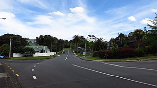
View of the Turanga Creek from Whitford
Turanga Creek
Route of the Turanga Creek
Auckland Council 2019 Wards Outlined Blank.png
Red pog.svg
Mouth of the Turanga Creek
New Zealand relief map.jpg
Disc Plain red.svg
Turanga Creek (New Zealand)
Native nameTūranga (Māori)
Location
Country New Zealand
Region Auckland Region
Physical characteristics
Source 
  coordinates 36°59′09″S174°56′56″E / 36.9859°S 174.949°E / -36.9859; 174.949
Mouth Tamaki Strait
  coordinates
36°53′34″S174°57′33″E / 36.8929°S 174.9592°E / -36.8929; 174.9592
Basin features
ProgressionTuranga CreekTamaki StraitHauraki GulfPacific Ocean
LandmarksWade Island, Whitford
Tributaries 
  left Mangemangeroa Creek

The Turanga Creek, also known as the Turanga River or Turanga Estuary, is a stream and tidal estuary in the Auckland Region of New Zealand's North Island. The township of Whitford was founded at the navigable headlands of the creek.

Contents

Geography

The Turanga Creek is a drowned valley system. [1] The creek begins in Tuscany Estate near the intersection of Michael Bosher Way and Redoubt Road, flowing northwards to Whitford and out to the Hauraki Gulf. [2] Wade Island is located in the estuary at the mouth of the creek, named after the early European settlers Isaac and Eve Wade, who purchased the island in 1852. [3]

History

View of the Whitford Wharf on the Turanga Creek in 1897 Wharf, Whitford, 1897.jpg
View of the Whitford Wharf on the Turanga Creek in 1897

The eastern coast of Auckland was visited by the Tainui migratory waka around the year 1300. The waka landed at Tūranga Creek, tethered to a volcanic rock in the shape of a man. This gave rise to the name of the creek, Tūranga, which means "Anchorage". [4] The anchor can still be found today, and is a 1.5 metre in diameter siliceous sinter found in the mudflats near Clifton Road. [5] Tainui followers of Manawatere, who identified as Ngā Oho, decided to settle the area between the Pōhutukawa Coast and Tūwakamana (Cockle Bay). Ngāi Tai ki Tāmaki, the mana whenua of the area, descend from these early settlers. [6] [7] Ngāi Tai ki Tāmaki traditional stories talk about the land already being occupied by the supernatural Tūrehu people, and many place names in the area reference Tūrehu figures, such as Hinerangi and Manawatere. [6] Tūranga became the name of the hill overlooking the west bank of the estuary, and the name was applied to the and kāinga of the estuary. [8]

The creek area was known as a traditional source for eels (tuna), lampreys (kanakana) and flounder (pātiki). [9] When William Thomas Fairburn visited the area in 1833, it was mostly unoccupied due to the events of the Musket Wars, as most members of Ngāi Tai had fled to temporary refuge in the Waikato. [6] [10] In 1836, Fairburn purchased 40,000 acres between Ōtāhuhu and Umupuia (Duders Beach), including much of the catchment of the Wairoa River. [10] Fairburn's Purchase was investigated by the New Zealand Land Commission in 1841 and 1842 and found to be excessive and reduced in size. The disallowed parts of his purchase were not returned to Ngāi Tai, however in 1854 a reserve was created for Ngāi Tai around Umupuia. [10]

The town of Whitford was established on the creek in the 1840s by European settlers. The creek was the main transport link for the town to the outside world until the 1920s, when road transport became more popular. [11] In the late 1870s, John Granger established a brickworks along the shores of the creek. [12] During World War II, home guard soldiers dug trenches along the creek. [13]

Amenities

Wades Walkway, also known as the Whitford Path, starts in Whitford, and follows the western banks of the Turanga Creek. [14] [15]

Related Research Articles

<span class="mw-page-title-main">Tāmaki Strait</span>

The Tāmaki Strait is an area of the Hauraki Gulf in the Auckland Region of New Zealand's North Island. The strait is east of the Waitematā Harbour, and is located between Waiheke Island, East Auckland and the Pōhutukawa Coast.

<span class="mw-page-title-main">Pakuranga</span> Suburb in Auckland, New Zealand

Pakuranga is an eastern suburb of Auckland, in northern New Zealand. Pakuranga covers a series of low ridges and previously swampy flats, now drained, that lie between the Pakuranga Creek and Tamaki River, two estuarial arms of the Hauraki Gulf. It is located to the north of Manukau and 15 kilometres southeast of the Auckland CBD.

<span class="mw-page-title-main">Beachlands, New Zealand</span> Suburb in Auckland, New Zealand

Beachlands is an outer suburb of Auckland, New Zealand, established in the 1920s, where development increased in the 1950s due to its popularity as a beach holiday destination. It is located on the Pōhutukawa Coast and in close proximity to Maraetai.

Botany Downs is an eastern suburb of the city of Auckland, New Zealand. This residential area previously formed part of the East Tāmaki area. In terms of local-body administration, the suburb lies in the Howick ward, one of the thirteen administrative divisions of the Auckland Council.

<span class="mw-page-title-main">Shelly Park</span> Suburb in Auckland, New Zealand

Shelly Park is a suburb of East Auckland, in northern New Zealand. The suburb is in the Howick ward, one of thirteen electoral divisions of the Auckland Council. It is named after the beach of the same name.
<span class="mw-page-title-main">Cockle Bay, New Zealand</span> Suburb in Auckland, New Zealand

Cockle Bay is a suburb of East Auckland, New Zealand. The suburb is in the Howick ward, one of the 13 administrative divisions of Auckland city and currently under governance of the Auckland Council.

Highland Park is a suburb of Auckland, New Zealand, located between Howick and Pakuranga. It belongs to the Pakuranga electorate which is currently represented by Simeon Brown.

<span class="mw-page-title-main">Farm Cove, New Zealand</span> Suburb in Auckland, New Zealand

Farm Cove is a suburb located in East Auckland, New Zealand. The suburb is in the Howick ward, one of the thirteen administrative divisions of Auckland. The Rotary Walkway Reserve runs through Farm Cove.

<span class="mw-page-title-main">Whitford, New Zealand</span> Place in Auckland Region, New Zealand

Whitford is a rural town to the south-east of Auckland, New Zealand, located on the Pōhutukawa Coast. The area is a part of the rohe of Ngāi Tai ki Tāmaki, who settled around the Turanga Creek area. Whitford developed into a rural township in the 19th Century, known for its ostriches, thoroughbred horses, and quarry.

Dannemora is a suburb in Auckland, New Zealand. It is located in the east of the city, close to Pakuranga and Botany Downs, and in the Howick ward and local board area of Auckland Council.

<span class="mw-page-title-main">Maraetai</span> Place in Auckland Region, New Zealand

Maraetai is a coastal town to the east of Auckland in New Zealand, on the Pōhutukawa Coast. Part of the traditional rohe of Ngāi Tai Ki Tāmaki, the area developed into a coastal holiday community in the early 20th Century.

<span class="mw-page-title-main">Half Moon Bay, Auckland</span> Suburb in Auckland, New Zealand

Half Moon Bay, is a suburb of East Auckland, New Zealand, lying immediately south of Bucklands Beach. It is home to the Half Moon Bay Marina, where over 500 boats berth. It is located on the Tāmaki River in the Hauraki Gulf.

Highbrook is a suburb located in the city of Auckland, in the North Island of New Zealand. The area is on the eastern side of the Auckland city centre and is a large industrial area developed only in recent years. The area is under governance of the Auckland Council, and is home to a large bulk of New Zealand and international businesses and organisations.

<span class="mw-page-title-main">Sunnyhills</span> Suburb in Auckland, New Zealand

Sunnyhills is a suburb of East Auckland, New Zealand, located on the eastern banks of the Tāmaki River near Pakuranga. Previously farmland within the Pakuranga Town District, suburban housing developed in the area in the mid-1960s.

Burswood is a residential suburb of Auckland which is separated from the rest of the city by the Pakuranga Stream on its west, north and eastern sides, and the major road Ti Rakau Drive on its south. Population density is higher than in most of Auckland, with no quarter acre sections.

<span class="mw-page-title-main">Golflands</span> Suburb in Auckland, New Zealand

Golflands is an eastern suburb of the city of Auckland, New Zealand. The Pakuranga Golf Club is part of the suburb, and many of the streets have names related to golf or notable golf players, such as Bob Charles drive.

<span class="mw-page-title-main">Somerville, New Zealand</span> Suburb in Auckland, New Zealand

Somerville is an eastern suburb of the city of Auckland, New Zealand. Most of the houses were built in the 1990s. Before 1990, the area was rural.

<span class="mw-page-title-main">Pōhutukawa Coast</span> Region of Auckland, New Zealand

The Pōhutukawa Coast is an area of the Auckland Region in New Zealand. The area covers townships south of the Tāmaki Strait: Whitford, Beachlands, Maraetai and Umupuia. The area was traditionally known as Maraetai, and is within the rohe of Ngāi Tai ki Tāmaki. In the 1920s, seasonal holiday communities developed in the area, which became permanent residential towns by the 1950s.

<span class="mw-page-title-main">Waipaparoa / Howick Beach</span>

Waipaparoa / Howick Beach is a beach in the Auckland Region of New Zealand's North Island. It is located in Howick.

<span class="mw-page-title-main">Pakuranga Creek</span> Stream in East Auckland, New Zealand

Pakuranga Creek is a tidal estuary and stream in the Auckland Region of New Zealand's North Island. The creek flows from inlant Pakuranga, meeting the Pakuranga Stream and flows into the Tāmaki River.

References

  1. "Tūranga". LAWA. Auckland Council . Retrieved 19 June 2023.
  2. "Turanga Creek". New Zealand Gazetteer. Land Information New Zealand. Retrieved 21 June 2023.
  3. "Wade Island". New Zealand Gazetteer. Land Information New Zealand. Retrieved 21 June 2023.
  4. Green, Nathew (2011). "From Hawaīki to Howick – A Ngāi Tai History". Grey's Folly: A History of Howick, Pakuranga, Bucklands-Eastern Beaches, East Tamaki, Whitford, Beachlands and Maraetai. By La Roche, Alan. Auckland: Tui Vale Productions. pp. 16–33. ISBN   978-0-473-18547-3. OCLC   1135039710.
  5. La Roche, Alan 2011, p. 322.
  6. 1 2 3 Heritage Department of the Auckland Regional Council. "Duder Regional Park – Our History" (PDF). Auckland Council . Retrieved 30 August 2021.
  7. Green, Nat (2010). Ōtau: a Ngāi Tai Cultural Heritage Assessment of Clevedon Village, Wairoa Valley (PDF) (Report). Auckland Council . Retrieved 21 October 2022.
  8. Ngāi Tai Ki Tāmaki and the Trustees of the Ngāi Tai Ki Tāmaki Trust and the Crown (7 November 2015). "Deed of settlement schedule documents" (PDF). NZ Government. Archived (PDF) from the original on 13 February 2020. Retrieved 31 October 2021.
  9. La Roche, Alan 2011, pp. 175.
  10. 1 2 3 Clough, Tom; Apfel, Aaron; Clough, Rod (June 2020). 109 Beachlands Road, Beachlands, Auckland: Preliminary Archaeological Assessment (PDF) (Report). Environmental Protection Authority . Retrieved 21 October 2022.
  11. "History of Howick, Pakuranga and surrounding areas". Times Newspapers. 11 April 2005. Archived from the original (web) on 25 October 2006. Retrieved 23 January 2008.
  12. "June 1877". Auckland Libraries Heritage Collections. MJ_1103. Retrieved 21 June 2023.
  13. La Roche, Alan 2011, p. 265.
  14. Janssen, Peter 2021, p. 156.
  15. "Whitford Path". Auckland Council . Retrieved 21 June 2023.

Bibliography