
Penobscot County is a county in the U.S. state of Maine, named for the Penobscot people in Wabanakik. As of the 2020 census, the population was 152,199, making it the third-most-populous county in Maine. Its county seat is Bangor. The county was established on February 15, 1816, from part of Hancock County when the area was still part of Massachusetts. Penobscot County is home to the University of Maine.
Drew is a township in Penobscot County, Maine, United States. The population was 26 at the 2020 census. It is part of the Bangor Metropolitan Statistical Area. The Surety of Sinners Orthodox Mission, a Russian Orthodox church, is located in Drew. A former plantation, Drew completed the de-organization process in 2023 to become part of Maine's unorganized territory.

Central Aroostook is an unorganized territory in Aroostook County, Maine, United States. The population was 164 at the 2020 census.

Connor is an unorganized territory (township) in Aroostook County, Maine, United States. The population was 418 at the 2020 census. It is the location of a former Nike missile site and the Blotner Radar Site.

Northwest Aroostook is an unorganized territory in Aroostook County, Maine, United States. The population was 12 at the 2020 census.
South Aroostook is an unorganized territory in Aroostook County, Maine, United States. The population was 579 at the 2020 census.

Square Lake is an unorganized territory in Aroostook County, Maine, United States. The population was 706 at the 2020 census.
Wyman is an unorganized territory in Franklin County, Maine, United States. The population was 82 at the 2020 census. It is designated as Township 4 Range 3 of Bingham's Kennebec Purchase.
Northwest Hancock is an unorganized territory (township) in Hancock County, Maine, United States. The population was 2 at the 2020 census. The territory is designated as Township 32 Middle Division.

South Oxford is an unorganized territory located in Oxford County, Maine, United States. The population was 591 at the 2020 census. The unorganized territory encompasses the areas designated under state law as Albany Township, Mason Township, and Batchelder's Grant. Albany and Mason were formerly incorporated as towns. Albany disincorporated in 1937 while Mason disincorporated in 1935.
Argyle is an unorganized territory (township) in Penobscot County, Maine, United States. The population was 255 at the 2020 census.
East Central Penobscot is an unorganized territory in Penobscot County, Maine, United States. The population was 308 at the 2020 census.
Kingman is an unorganized territory (township) in Penobscot County, Maine, United States. The population was 137 at the 2020 census.
North Penobscot is an unorganized territory in Penobscot County, Maine, United States. The population was 405 at the 2020 census.
Prentiss is an unorganized territory (township) in Penobscot County, Maine, United States. The township was named for Henry Prentiss, an early landowner. The population was 169 at the 2020 census.
Whitney is an unorganized territory in Penobscot County, Maine, United States. It is designated as Township 5 Range 1 of the North of Bingham's Penobscot Purchase. The population was 6 at the 2020 census. T5 R1 NBPP is also known as Pukakon Township.
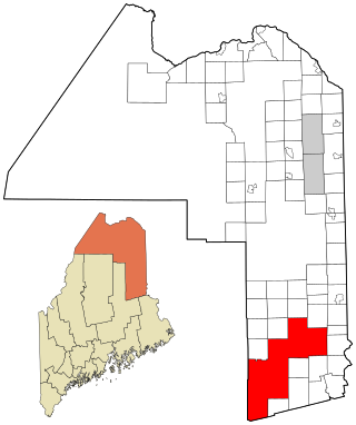
East Central Washington is an unorganized territory in Washington County, Maine, United States. The population was 724 at the 2020 census.
North Washington is an unorganized territory in Washington County, Maine, United States. The population was 505 at the 2020 census.

Muscle Ridge Islands is an archipelago and unorganized territory off the coast of South Thomaston in Knox County, Maine, United States. The population was 9 at the 2020 census.
Marshall Island is an island and unorganized territory in Hancock County, Maine, United States. It lies where Penobscot Bay and Blue Hill Bay meet, between Swan's Island and Isle au Haut. Uninhabited, it is one of the largest undeveloped islands surrounding the contiguous United States.


