 Typhoon Kent on August 29, 1995 | |
| Meteorological history | |
|---|---|
| Formed | August 24,1995 |
| Dissipated | September 1,1995 |
| Very strong typhoon | |
| 10-minute sustained (JMA) | |
| Highest winds | 155 km/h (100 mph) |
| Lowest pressure | 945 hPa (mbar);27.91 inHg |
| Category 4-equivalent super typhoon | |
| 1-minute sustained (SSHWS/JTWC) | |
| Highest winds | 240 km/h (150 mph) |
| Lowest pressure | 910 hPa (mbar);26.87 inHg |
| Overall effects | |
| Fatalities | 52 direct |
| Damage | $419 million (1995 USD) |
| Areas affected | Philippines,Taiwan,Southern China,Hong Kong |
| IBTrACS | |
Part of the 1995 Pacific typhoon season | |
Typhoon Kent,known in the Philippines as Super Typhoon Gening, [1] was a powerful Category 4-equivalent typhoon that formed in late August during the 1995 Pacific typhoon season.
Contents
- Meteorological history
- Preparations
- Impact
- Philippines
- Taiwan
- Hong Kong
- Southern China
- See also
- References
- External links
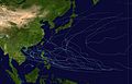
The twelfth tropical cyclone,fourth typhoon and first super typhoon of the 1995 season, [2] Kent formed on August 24 in the western north Pacific and moved westwards where it reached typhoon status on August 26 east of the Philippines. Kent then rapidly strengthened into a super typhoon with winds reaching peak intensity of 150 mph (240 km/h) as it brushed past the northern Philippines and southern Taiwan before making landfall in eastern People's Republic of China on August 31. After making landfall,Kent weakened and dissipated the following day. [3]
A strong and destructive typhoon,Kent left 52 fatalities and $418.9 million (1995 USD,$555 million 2006 USD) in damage in the Philippines,Taiwan and China. [3] [4]
