Typhoon Oscar was a powerful typhoon that brushed Japan before recurving to its east. The seventeenth tropical cyclone and second super typhoon of the moderately active 1995 Pacific typhoon season,Oscar formed as a tropical depression a few hundred miles east-northeast of Guam. The tropical depression then strengthened into a tropical storm,and was given the name Oscar. It then reached typhoon status on September 14,becoming a super typhoon later that same day. Oscar recurved northeastwards two days later,skirted past Honshū on 17 September and became extratropical on 18 September.
Oscar affected Tokyo,where numerous buildings sustained severe damage from high winds and several major highways were shut down. At least 20 people were injured by flying debris in Japan.[1] One person was killed in a landslide and another drowned in a flood. Seven more people were killed by Typhoon Oscar throughout the country.[2] Three other people were also listed as missing due to the storm.[3] Although it never made landfall,losses from the storm throughout Japan still amounted to 612.3million yen (US$6.7million).
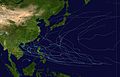
Meteorological history
Map plotting the storm's track and intensity,according to the Saffir–Simpson scale
About almost a month without any tropical cyclones reaching tropical storm strength, with Tropical Storm Nina being the most recent, a new tropical depression, designated Tropical Depression 17W by the Joint Typhoon Warning Center (JTWC), formed over the Pacific about 380kilometers (240miles) east-northeast of Guam on the early morning of September 12. Tracking northwestwards and intensifying over water, Oscar attained typhoon strength on September 14.[4]
Oscar recurved northeastwards two days later, skirted past Honshū on September 17 and started weakening. Oscar was downgraded to a tropical storm, then the system became extratropical on September 18. In Japan, Oscar claimed nine lives and injured at least 13 people. Six people were reported missing and about 600 houses were damaged by high winds and flood water.[4]
Preparations and impact
Typhoon Oscar approaching Japan on September 16
Dozens of domestic flights and sea ferries were canceled. Storm and flood warnings were issued across most of Japan's eastern coastal and central areas.[3]
As the typhoon's center moved north, the most powerful area near its center touched coastal areas southeast of Tokyo. At 6 A.M. on September 17, the typhoon was centered almost directly over Aoga Island, 225miles south of Tokyo, moving north-northeast at 21miles per hour. Forecasters predicted that Tokyo would receive up to 12inches of rain over 36 hours. Seven major train lines and subways in and around Tokyo reduced service.[3] There were no immediate reports of injuries, but wind-carried objects, such as tree branches, hurt at least 20 people and sudden wind gusts knocked people down.[5]
Typhoon Oscar's winds reached 174kilometres per hour (108miles per hour), making it comparable to Typhoon Ida that killed 1,269 people in 1958 and 5,098 from Typhoon Vera in 1959 in the Tokyo-Yokohama area.[3] It was one of the most powerful typhoons to hit Japan since World War II, dealing the east coast a glancing blow before veering out to sea. Two people were killed, and three were missing.[6]
This page is based on this Wikipedia article Text is available under the CC BY-SA 4.0 license; additional terms may apply. Images, videos and audio are available under their respective licenses.


