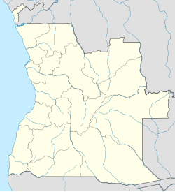
Cuanza Sul Province is a province of Angola. It has an area of 55,660 square kilometres (21,490 sq mi) and a population of 1,881,873. Sumbe is the capital of the province. Dom Francisco Inocêncio de Sousa Coutinho founded the province in 1769 as Novo Redondo.

Caxito is a town, with a population of 55,000 (2014), and a commune in the municipality of Dande, province of Bengo, Angola. It is also the capital of the province.

N'dalatando, formerly Vila Salazar, is a town, with a population of 161,584 (2014), and a commune in the municipality of Cazengo, province of Cuanza Norte, Angola.
Ondjiva, formerly Vila Pereira d'Eça, is a town, with a population of 121,537 (2014), and a commune in the municipality of Cuanhama, province of Cunene, Angola. It is also the administrative capital of Cunene Province and is located at the extreme south of the country, about 42 kilometres (26 mi) from the border with Namibia. It was traditionally the seat of the Ovambo king of the Oukwanyama tribe. Ondjiva was greatly affected by the Angolan Civil War (1975-2002).
Lucapa is a town, with a population of 110,000 and a municipality with a population of 154,305, located in eastern Angola. Lucapa is the former capital of Lunda Norte Province.

Xangongo is a town, with a population of 35,000 (2014), and a commune in the municipality of Ombadja, province of Cunene, Angola.

Bibala is a town, with a population of 10,500 (2014), and a municipality in southern Angola. It lies in Namibe Province. The municipality of Bibala covers 7,700 square kilometres (3,000 sq mi) with a population of 64,504 (2014).
Quibala is a town, with a population of 27,128, and a municipality in Cuanza Sul, Angola. The municipality has a population of 142,057 and comprises an area of 10,300 km2. It is bordered by the city of Calulo in the north, by the town of Waku-Kungo in the east, by the municipality of Ebo in the south, and in the west by the municipality of Gabela and by Porto Amboim.

Dondo is a town, with a population of 64,643 (2014), and a commune in the municipality of Cambambe, province of Cuanza Norte, Angola.
Andulo is a town and municipality in Bié Province in Angola. The municipality covers an area of 10,100 square kilometres (3,900 sq mi), with a Population of 258,161 in 2014. It is bordered to the north by the municipality of Mussende, to the east by the municipalities of Luquembo and Nharea, to the south by the municipalities of Cunhinga, Mungo and Bailundo and west by the municipalities of Cela and Quibala.
Calai is a town and municipality in Cuando Cubango Province in Angola.
Cambundi-Catembo is a town and municipality, with a population of 46,312, in Malanje Province in Angola. The municipality consists of four communes Cambundi-Catembo (commune), Dumba Cambango, Quitapa and Tala Mungongo.
Cela is a município (municipality) in the province of Cuanza Sul in Angola. It covers an area of 4,610 square kilometres (1,780 sq mi) and its population is 225,520 in 2014.
Waku Kungo Airport is an airport serving Waku-Kungo in Cuanza Sul Province, Angola. The runway is 6.5 kilometres (4.0 mi) south of Waku-Kungo, near the village of Cela.
Calulo is a town, with a population of 44,000 (2014), and a commune in the municipality of Libolo, province of Cuanza Sul, Angola and the seat of the municipality. The town stands at an altitude of 990 m (3,250 ft) above sea level.
Calussinga is a town, with a population of 15,000 (2014), and a commune of Angola, located in the province of Bié.
Sanga is a commune of Angola, located in the province of Cuanza Sul.
Kissanga Kungo is a commune of Angola, located in the province of Cuanza Sul.
Alto Hama is a town, with a population of 17,000 (2014), and a commune of Angola, located in the province of Huambo.


