
Angola, officially the Republic of Angola, is a country on the west-central coast of Southern Africa. It is the second-largest Lusophone (Portuguese-speaking) country in both total area and population, and is the seventh-largest country in Africa. It is bordered by Namibia to the south, the Democratic Republic of the Congo to the north, Zambia to the east, and the Atlantic Ocean to the west. Angola has an exclave province, the province of Cabinda, that borders the Republic of the Congo and the Democratic Republic of the Congo. The capital and most populous city is Luanda.

Zaire is one of the 18 provinces of Angola. It occupies 40,130 square kilometres (15,490 sq mi) in the north west of the country and had a population of 594,428 inhabitants in 2014. It is bordered on the west by the Atlantic Ocean, on the north by the Democratic Republic of Congo, on the east by the Uíge Province, and on the south by the Bengo Province.

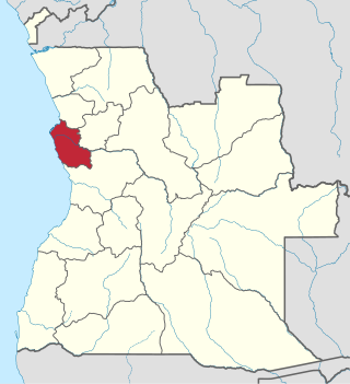
Benguela is a province of Angola, situated in the west of the country. It lies on the Atlantic Ocean, and borders the provinces of Cuanza Sul, Namibe, Huila, and Huambo. The province has an area of 39,826 square kilometres (15,377 sq mi) and its capital is Benguela. According to the 2014 census, there were 2,231,385 inhabitants in the province. The current governor of Benguela is Isaac dos Anjos.
Luanda is a province of Angola. It covers an area of 18,835 km2, and had a population of 6,945,386 at the Census of 16 May 2014. The latest official estimate is 8,247,688.

Moxico or Moshiko is the largest province of Angola. It has an area of 223,023 square kilometres (86,110 sq mi), and covers 18% of the landmass of Angola. The province has a population of 758,568 and a population density of approximately 3.4 residents per km², making it one of the most sparsely populated areas of Angola. The population of the province is in flux; displaced residents have slowly returned to Moxico since the end of the Angolan Civil War in 2002. The war left Moxico as one of the most landmine-contaminated places in the world. The governor of the province is Gonçalves Manuel Muandumba.

Lubango, formerly known as Sá da Bandeira, is a municipality in Angola, capital of the Huíla Province, with a population of 914,456 in 2022. The city center had a population of 600,751 in 2014 making it the second-most populous city in Angola after the capital city Luanda.
Caconda is a town and a municipality in the province of Huíla, Angola. The municipality had a population of 167,820 in 2014.

Viana is a city and one of the nine municipalities that make up the province of Luanda in Angola. Viana lies 15 to 30 kilometers east as a suburb of the capital Luanda and has a population of 2,092,439 (2022), including about 6,000 long-term refugees primarily from Katanga Province in the Democratic Republic of the Congo.
Jamba is a town and a municipality, with a population of 105,090, in the province of Huíla, Angola.

Railway stations in Angola include:

Ícolo e Bengo is a city council in the province of Luanda in Angola. It had a population of 81,144 in 2014.

Barra do Dande is a town, with a population of 75,000 (2014), and a commune in the municipality of Dande, province of Bengo, Angola.

Quiçama, Quissama or Kisama is one of the nine municípios that make up the province of Luanda, as per the new administrative division of the province . It covers an area of 13,900 square kilometres (5,400 sq mi) and its population as of 2014 is 26,546. The municipal seat is the village of Muxima.

Rangel is one of the six urban districts that make up the municipality of Luanda, in the province of Luanda, the capital of Angola. The Rangel District is one of the older and more urbanized in Metropolitan Luanda. The district has an area of 6.2 square kilometers. The district is best known as the home of Americo Boavida University Hospital as well as several large sporting facilities including Pavilhão da Cidadela, Pavilhão Anexo and Pavilhão Anexo II.

Belas is a city and one of the nine municipalities that make up the province of Luanda, as per the new administrative division of the province.
The Municipality of Luanda is one of the nine municipalities that make up the province of Luanda, Angola. It covers roughly 116 km2 and includes Ilha de Luanda. The population was 2,194,747 at the 2014 census and is projected to be 2,571,861 in 2019 per Instituto Nacional de Estatística, República de Angola.
The following is a timeline of the history of the city of Luanda, Angola.


