Cuando Cubango is a province of Angola and it has an area of 199,049km2 and a population of 534,002 in 2014. Menongue is the capital of the province. The governor of the province is José Martins, who was appointed governor in November 2021.

Moxico or Moshiko is the largest province of Angola. It has an area of 223,023 square kilometres (86,110 sq mi), and covers 18% of the landmass of Angola. The province has a population of 758,568 and a population density of approximately 3.4 residents per km², making it one of the most sparsely populated areas of Angola. The population of the province is in flux; displaced residents have slowly returned to Moxico since the end of the Angolan Civil War in 2002. The war left Moxico as one of the most landmine-contaminated places in the world. The governor of the province is Gonçalves Manuel Muandumba.
Nancova is a municipality of the province of Cuando Cubango, in Angola. The population is 2,796 in 2014 in an area of 10,310 km2. The municipality consists of the communes Nancova and Rito.
Menongue, formerly Serpa Pinto, is a town, a municipality, and the capital of Cuando Cubango Province in Angola. The municipality had a population of 320,914 in 2014. It is one of the four municipalities in Angola whose inhabitants are predominantly Mbunda.

Cuito Cuanavale, occasionally spelt Kuito Kuanavale or Kwito Kwanavale, is a town and municipality in Cuando Cubango (Kuando-Kubango) province in Angola.
Cuchi is a town and municipality in Cuando Cubango Province in Angola. The population of the municipality was 42,974 in 2014.
Jamba is a town and a municipality, with a population of 105,090, in the province of Huíla, Angola.
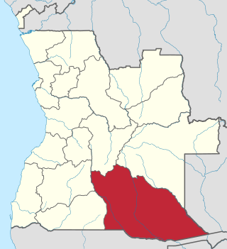
Luengue-Luiana National Park is a national park in Angola.
Calai is a town and municipality in Cuando Cubango Province in Angola.
Cuangar is a town and municipality in Cuando Cubango Province in Angola. The town lies on the Okavango River, opposite the town of Nkurenkuru, Namibia. The municipality had a population of 28,459 in 2014. It is situated close to a fort.
Dirico is a town and municipality in Cuando Cubango Province in Angola. The municipality was estimated to have had a population of 19,191 in 2020.
Longa is a town and commune in the municipality of Cuito Cuanavale, province of Cuando Cubango, Angola. As of 2014, the commune had a population of 15,104 people over an area of 14,000 square kilometres (5,400 sq mi).
Rivungo is a town and municipality in Cuando Cubango Province in Angola. It is situated on the Cuando River. The municipality had a population of 33,053 inhabitants in 2014.
The Luengué Hunting Reserve is located in Luengué, Mavinga, Cuando Cubango, Angola. Established on July 15, 1959, it is 16,700 km2 (6,400 sq mi).
The following is a complete list of rulers of the Mbunda Kingdom, established in the southeast of present-day Angola, covering Moxico and Cuando Cubango Provinces.

The Mbunda Kingdom, sometimes called the Kingdom of Angola or Mbundaland, was an African kingdom located in western central Africa, in what is now southeast Angola. At its greatest extent, it reached from Mithimoyi in central Moxico to the Cuando Cubango Province in the southeast, bordering Namibia.
Missombo is a city and commune of Angola, located in the province of Cuando Cubango. As of 2014, the commune had a population of 9,469 over an area of 3,030 square kilometres (1,170 sq mi).
Cunjamba Dima is a city and commune of Angola in Cuando Cubango Province. As of 2014, the commune had a population of 1,064 people over an area of 6,220 square kilometres (2,400 sq mi).
Cutuile is a city and commune of Angola, located in the province of Cuando Cubango. As of 2014, the commune had a population of 2,334 people over an area of 6,470 square kilometres (2,500 sq mi).
Luengue is a city and commune of Angola, located in the province of Cuando Cubango. As of 2014, the city had a population of 3,457 people over an area of 18,900 square kilometres (7,300 sq mi).
