The Great Barrier Reef is the world's largest coral reef system, composed of over 2,900 individual reefs and 900 islands stretching for over 2,300 kilometres (1,400 mi) over an area of approximately 344,400 square kilometres (133,000 sq mi). The reef is located in the Coral Sea, off the coast of Queensland, Australia, separated from the coast by a channel 160 kilometres (100 mi) wide in places and over 61 metres (200 ft) deep. The Great Barrier Reef can be seen from outer space and is the world's biggest single structure made by living organisms. This reef structure is composed of and built by billions of tiny organisms, known as coral polyps. It supports a wide diversity of life and was selected as a World Heritage Site in 1981. CNN labelled it one of the Seven Natural Wonders of the World in 1997. Australian World Heritage places included it in its list in 2007. The Queensland National Trust named it a state icon of Queensland in 2006.

Lord Howe Island Marine Park is the site of Australia's and the world's most southern coral reef ecosystem. The island is 10 km in length, 2 km wide and consists of a large lagoonal reef system along its leeward side, with 28 small islets along its coast. In 1999, the waters within three nautical miles of Lord Howe Island (465.45 km2) were declared a marine park under the NSW Marine Park Act 1997 to protect its unique marine biodiversity, with the park currently being managed by the New South Wales Marine Parks Authority. Both Lord Howe Island and Balls Pyramid are incorporated within the three nautical miles protected by the state marine park. Both marine parks complement the island's status as a World Heritage Site.

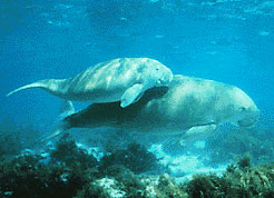
Southeast Asian coral reefs have the highest levels of biodiversity for the world's marine ecosystems. They serve many functions, such as forming the livelihood for subsistence fishermen and even function as jewelry and construction materials. Corals inhabit coastal waters off of every continent except Antarctica, with an abundance of reefs residing along Southeast Asian coastline in several countries including Indonesia, the Philippines, and Thailand. Coral reefs are developed by the carbonate-based skeletons of a variety of animals and algae. Slowly and over time, the reefs build up to the surface in oceans. Coral reefs are found in shallow, warm salt water. The sunlight filters through clear water and allows microscopic organisms to live and reproduce. Coral reefs are actually composed of tiny, fragile animals known as coral polyps. Coral reefs are significantly important because of the biodiversity. Although the number of fish are decreasing, the remaining coral reefs contain more unique sea creatures. The variety of species living on a coral reef is greater than anywhere else in the world. An estimation of 70-90% of fish caught are dependent on coral reefs in Southeast Asia and reefs support over 25% of all known marine species.

Blast fishing, fish bombing, dynamite fishing or grenade fishing is a destructive fishing practice using explosives to stun or kill schools of fish for easy collection. This often illegal practice is extremely destructive to the surrounding ecosystem, as the explosion often destroys the underlying habitat that supports the fish. The frequently improvised nature of the explosives used, and undetonated charges, means danger for fishermen and divers as well, with accidents and injuries.
The Gulf of Mannar Marine National Park is a protected area of India consisting of 21 small islands (islets) and adjacent coral reefs in the Gulf of Mannar in the Indian Ocean. It lies 1 to 10 km away from the east coast of Tamil Nadu, India for 160 km between Thoothukudi (Tuticorin) and Dhanushkodi. It is the core area of the Gulf of Mannar Biosphere Reserve which includes a 10 km buffer zone around the park, including the populated coastal area. The park has a high diversity of plants and animals in its marine, intertidal and near shore habitats. Public access inside the park is limited to glass-bottom boat rides. It was established as a National Park in 1986.

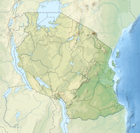
Chumbe Island is a private island in the Mjini Magharibi Region, Tanzania, off the coast of Mjini District. It is situated in the Zanzibar Channel. The island is known for its ecological innovation and exceptional coral reefs. The Chumbe Lighthouse is also located on the island.

The Mnazi Bay-Ruvuma Estuary Marine Park(MBREMP) was established on 1 July 2000 under Act No. 29 of 1994 of Marine Parks and Reserves of Tanzania.
The Dar es Salaam Marine Reserve System or DMRS is a group of marine reserves in Tanzania, with the IUCN category II located within Dar es Salaam Region of Tanzania. The reserve system consists of nine uninhabited islands, four located north of Dar es Salaam's Kinondoni District; and four south of the city Makatumbi Islands, Kimbubu Island, Sinda Island and Kendwa Island in Kigamboni District. It provides protection for several important tropical ecosystems; coral reefs, mangroves and seagrass beds.

The Coral Triangle (CT) is a roughly triangular area in the tropical waters around Indonesia, Malaysia, Papua New Guinea, the Philippines, Solomon Islands, and Timor-Leste. This area contains at least 500 species of reef-building corals in each ecoregion. The Coral Triangle is located between the Pacific and Indian oceans and encompasses portions of two biogeographic regions: the Indonesian-Philippines Region, and the Far Southwestern Pacific Region. As one of eight major coral reef zones in the world, the Coral Triangle is recognized as a global centre of marine biodiversity and a global priority for conservation. Its biological resources make it a global hotspot of marine biodiversity. Known as the "Amazon of the seas", it covers 5.7 million square kilometres (2,200,000 sq mi) of ocean waters. It contains more than 76% of the world's shallow-water reef-building coral species, 37% of its reef fish species, 50% of its razor clam species, six out of seven of the world's sea turtle species, and the world's largest mangrove forest. The epicenter of that coral diversity is found in the Bird’s Head Seascape of Indonesian Papua, which hosts 574 species. In 2014, the Asian Development Bank (ADB) reported that the gross domestic product of the marine ecosystem in the Coral Triangle is roughly $1.2 trillion per year and provides food to over 120 million people. According to the Coral Triangle Knowledge Network, the region annually brings in about $3 billion in foreign exchange income from fisheries exports, and another $3 billion from coastal tourism revenues.
Fumba is a village on the Tanzanian island of Unguja, part of Zanzibar. It is located in the southwest of the island, at the end of the Fumba Peninsula, and overlooks Menai Bay in Mjini Mgaharibi Region.

The Menai Bay Conservation Area (MBCA) is located in Menai Bay, Zanzibar Tanzania. At 470 square kilometres (180 sq mi), it is Zanzibar's largest marine protected area. It was officially established as a conservation area in August 1997 in the traditional fishing area, known as Unguja Island, covering the tropical marine environment comprising extensive coral reefs, tropical fish, sea grasses, and mangrove forests. In addition to controlling illegal fishing, MBCA's alternative initiatives have included bee keeping, mangrove replanting, tree nurseries and tourism. The management of the MBCA falls upon the Fisheries Department and the bay's local villages. It is rated by the IUCN as Category VI Managed Resource Protected Area.
The East African coral coast is a marine ecoregion along the eastern coast of Africa. It extends along the coasts of Kenya, Tanzania, and northern Mozambique, from Lamu in Kenya to Angoche in Mozambique. It adjoins the Northern Monsoon Current Coast ecoregion to the north, and the Bight of Sofala/Swamp Coast ecoregion to the south.
The Tanga Marine Reserves System (TMRS) is a group of marine reserves in the Tanga Region of Tanzania. All TMRs, though, serve as significant sea bird breeding areas. The Tanga Marine Reserves are: Kirui Island, Maziwe Island, Ulenge Island, Kwale Island and Mwewe Island.
Chapwani Island is a private island located in Malindi ward of Mjini District in Mjini Magharibi Region, Tanzania. A British naval cemetery located in Chapwani serves as the last resting place for servicemen who died while serving in Zanzibar. These are the graves of those who perished in the attack by the German cruiser SMS Königsberg on the British protected cruiser HMS Pegasus during World War One. Interms of marine protection, Changuu and Chapwani reefs were seen as less protected, whereas Chumbe reefs and Kizimkazi reefs were thought to be well protected.
Kwale Island is a protected island located in Fumba ward of Mjini District in Mjini Magharibi Region, Tanzania. The island is included in the marine conservation area of Menai Bay.
Pamunda Island or Komunda Island is a protected island located in Fumba ward of Mjini District in Mjini Magharibi Region, Tanzania. One of the Menai Bay islands, the island is part of the Menai Bay Marine Conservation Area. The native Eucheuma denticulatum grows abundantly around Pamunda Island.

Sume Island is a protected island located in Fumba ward of Mjini District in Mjini Magharibi Region, Tanzania. The island is included in the Menai Bay Marine Conservation Area. Sume reef protects on the biodiverse island. Field observations of Acropora spp. reefs on Sume Island in southern Zanzibar indicate that native Eucheuma denticulatum is flourishing there.
Miwi Island is a protected island located in Fumba ward of Mjini District in Mjini Magharibi Region, Tanzania. One of the Menai Bay islands, made of limestone, the island is a part of the Menai Bay Marine Conservation Area.
Niamembe Island is a protected island located in Fumba ward of Mjini District in Mjini Magharibi Region, Tanzania. One of the Menai Bay islands, the island is a part of the Menai Bay Marine Conservation Area and is composed of limestone.
Pungume Island is a protected island located in Fumba ward of Mjini District in Mjini Magharibi Region, Tanzania. The largest of the Menai Bay islands, the island is composed of limestone and is a part of the Menai Bay Marine Conservation Area. The island was close to the location of the 2012 capsized ship MV Sagit.