{{lang|sv|Vammala stad}}"},"settlement_type":{"wt":"Former town and municipality"},"image_shield":{"wt":"Vammala.vaakuna.svg"},"image_map":{"wt":"Vammala.sijainti.suomi.2008.svg"},"mapsize":{"wt":"150px"},"map_caption":{"wt":"Location of Vammala in [[Finland]]"},"pushpin_mapsize":{"wt":"150px"},"subdivision_type":{"wt":"Country"},"subdivision_name":{"wt":"[[Finland]]"},"subdivision_type1":{"wt":"[[Regions of Finland|Region]]"},"subdivision_name1":{"wt":"[[Pirkanmaa]]"},"subdivision_type2":{"wt":"[[Sub-regions of Finland|Sub-region]]"},"subdivision_name2":{"wt":"South Western Pirkanmaa sub-region"},"established_title":{"wt":"[[Charter]]"},"established_date":{"wt":"1907"},"extinct_title":{"wt":"Consolidated"},"extinct_date":{"wt":"2009"},"area_footnotes":{"wt":"{{Cite web |url= http://www.maanmittauslaitos.fi/Pintaalat_kunnittain_1.1.2008.pdf |title= Area by municipality as of {{#time: j F Y|2008-01-01}} |access-date= {{#time: j F Y|2010-04-13}} |publisher= Land Survey of Finland |format= PDF |language= fi, sv |url-status= dead |archive-url= https://web.archive.org/web/20110807140011/http://www.maanmittauslaitos.fi/Pintaalat_kunnittain_1.1.2008.pdf |archive-date= 2011-08-07 }}"},"area_total_km2":{"wt":"876"},"area_land_km2":{"wt":"803.87"},"area_water_km2":{"wt":"72.13"},"population_as_of":{"wt":"2008-12-31"},"population_footnotes":{"wt":"{{Cite web |url= http://www.vrk.fi/vrk/files.nsf/files/029EEED89C84611BC22575350052CE3A/$file/081231.html |title= Population by municipality as of {{#time: j F Y|2008-12-31}} |access-date= {{#time: j F Y|2010-04-13}} |work= Population Information System |publisher= Population Register Center of Finland |language= fi, sv |url-status= dead |archive-url= https://web.archive.org/web/20101202145510/http://vrk.fi/vrk/files.nsf/files/029EEED89C84611BC22575350052CE3A/%24file/081231.html |archive-date= 2010-12-02 }}"},"population_total":{"wt":"16635"},"population_density_km2":{"wt":"auto"},"demographics1_info1":{"wt":"% (official)"},"demographics1_info2":{"wt":"%"},"demographics1_info3":{"wt":"%"},"demographics1_info4":{"wt":"%"},"demographics_type2":{"wt":"[[Demographics|Population by age]]"},"demographics2_title1":{"wt":"0 to 14"},"demographics2_info1":{"wt":"16.8%"},"demographics2_title2":{"wt":"15 to 64"},"demographics2_info2":{"wt":"61.6%"},"demographics2_title3":{"wt":"65 or older"},"demographics2_info3":{"wt":"21.6%"},"timezone":{"wt":"[[Eastern European Time|EET]]"},"utc_offset":{"wt":"+2"},"timezone_DST":{"wt":"[[Eastern European Summer Time|EEST]]"},"utc_offset_DST":{"wt":"+3"},"coordinates":{"wt":"{{coord|61|20.5|N|022|54.5|E|region:FI|display=inline,title}}"},"postal_code_type":{"wt":"Postal code"}},"i":0}}]}" id="mwAg">Former town and municipality in Pirkanmaa, Finland
Vammala | |
---|---|
Former town and municipality | |
Vammalan kaupunki Vammala stad | |
![]() Location of Vammala in Finland | |
Coordinates: 61°20.5′N022°54.5′E / 61.3417°N 22.9083°E Coordinates: 61°20.5′N022°54.5′E / 61.3417°N 22.9083°E | |
Country | Finland |
Region | Pirkanmaa |
Sub-region | South Western Pirkanmaa sub-region |
Charter | 1907 |
Consolidated | 2009 |
Area | |
• Total | 876 km2 (338 sq mi) |
• Land | 803.87 km2 (310.38 sq mi) |
• Water | 72.13 km2 (27.85 sq mi) |
Population (2008-12-31) [2] | |
• Total | 16,635 |
• Density | 19/km2 (49/sq mi) |
Population by age | |
• 0 to 14 | 16.8% |
• 15 to 64 | 61.6% |
• 65 or older | 21.6% |
Time zone | UTC+2 (EET) |
• Summer (DST) | UTC+3 (EEST) |
Vammala is a former town and municipality of southwestern Finland, chartered in 1907. On 1 January 2009, Vammala was consolidated with the municipalities of Mouhijärvi and Äetsä, to form a new city named Sastamala .
Vammala was located in the southwest Pirkanmaa region, and was part of the former (1997 to 2010) province of Western Finland.
The municipality had a population of 16,635 (31 December 2008) [2] and covered a land area of 803.87 square kilometres (310.38 sq mi). [1] The population density was 20.29 inhabitants per square kilometre (52.6/sq mi).
The municipality was unilingually Finnish.
Artjärvi is a former municipality of Finland. It was consolidated with the town of Orimattila on January 1, 2011.
Hauho is a former municipality of Finland. It was situated in the province of Southern Finland and is today a part of the region of Tavastia Proper.
Houtskär is an island group and former municipality of Finland. On 1 January 2009, it was consolidated with Iniö, Korpo, Nagu and Pargas to form the municipality of Pargas.
Karis is a town and former municipality in Finland. On January 1, 2009, it was consolidated with Ekenäs and Pohja to form the new municipality of Raseborg; Finnish: Raasepori.
Karttula is a former municipality of Finland. It was consolidated with the city of Kuopio on 1 January 2011.
Kortesjärvi is a former municipality of Finland. It was consolidated, together with Alahärmä and Ylihärmä, to Kauhava on 1 January 2009.
Kuhmalahti is a former municipality of Finland. It was consolidated with the municipality of Kangasala on January 1, 2011.
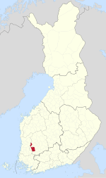
Kylmäkoski is a former municipality of Finland. It was consolidated with the town of Akaa on 1 January 2011. It was located in the Pirkanmaa region. The municipality had a population of 2,610 and covered a land area of 190.96 square kilometres (73.73 sq mi). At the end of 2011, the urban area of Kylmäkoski had 674 inhabitants. The population density was 13.67 inhabitants per square kilometre (35.4/sq mi). The municipality was unilingually Finnish.
Lapinlahti is a municipality of Finland. It is part of the Northern Savonia region, located 59 kilometres (37 mi) north of the city of Kuopio. The municipality has a population of 9,331 and covers an area of 1,245.16 square kilometres (480.76 sq mi) of which 148.58 km2 (57.37 sq mi) is water. The population density is 8.51 inhabitants per square kilometre (22.0/sq mi).
Liljendal is a former municipality of Finland.
Noormarkku is a former municipality of Finland.
Närpes is a town and municipality of Finland. It is located in the former province of Western Finland and is part of the Ostrobothnia region. The town has a population of 9,583 and covers an area of 2,334.14 square kilometres (901.22 sq mi) of which 1,357 km2 (524 sq mi) is water. The population density is 9.81 inhabitants per square kilometre (25.4/sq mi). Economically, the municipality is known for extensive greenhouse farming of tomatoes and manufacture of trailers for trucks.
Pargas is a former town and municipality in south-western Finland. On 1 January 2009, it was consolidated with Houtskär, Iniö, Korpo and Nagu to form the new municipality of Väståboland.
Pernå is a former municipality of Finland.
Pohja is a former municipality of Finland. It was consolidated with Ekenäs and Karis to form the new town of Raseborg in 2009.
Ruotsinpyhtää is a former municipality of Finland. Ruotsinpyhtää, Pernå and Liljendal were consolidated to Loviisa on January 1, 2010.
Vampula is a former municipality of Finland. It was consolidated with Huittinen on 1 January 2009.
Varpaisjärvi is a former municipality of Finland. It was consolidated with the municipality of Lapinlahti on January 1, 2011.
Ylikiiminki is a former municipality of Finland. It was consolidated with the city of Oulu on 1 January 2009.
Sastamala is a town and municipality of Finland. It is located in the Pirkanmaa region. The town has a population of 24,068 and covers an area of 1,531.75 square kilometres (591.41 sq mi) of which 96.14 km2 (37.12 sq mi) is water, making it the largest municipality in the Pirkanmaa region in terms of area. The population density is 18.64 inhabitants per square kilometre (48.3/sq mi). The municipality is unilingually Finnish.
![]() | Wikimedia Commons has media related to Vammala . |